Thursday, August 16, 2012

North County News- Moonlight Makeover


Moonlight Beach is arguably the epicenter of Encinitas. Some may say Swami's, some may say the old downtown, or even the new Walmart (that's a joke- a poor one at that). My vote is Moonlight Beach- just look at the amount of families and tourists it draws on the weekend either at the beach, playground, park, scenic overlooks, ocean, or volleyball courts. There's been some rejuvenation over the past few years down there- with the playground getting new equipment, landscaping of the park, and Cottonwood Creek getting restored. Next up is the concession stand and lifeguard towers getting a remodel starting in September.
There's even some shuffling of the beach layout. The lifeguard tower is getting a garage that will be built into the small C Street embankment below the lower parking lot. And the concession stand is being combined with the restrooms (no jokes please) and being moved to the side of the hill under the large parking lot (see the diagram above to help clear up my confusing message). The city's website says "The proposed 2-story lifeguard tower will total approximately 1,900 square feet, be in the same location as the existing facility and consolidate the area currently used for storage containers and rescue equipment. The proposed detached garage will total approximately 950 square feet, be located approximately 50 feet from the tower and be tucked into the slope of the site, providing for recreational space above, serving as an overlook. The restroom building and concession stand and associated storage will be combined into a single building of approximately 3,600 SF and will be recessed into the toe of the slope below the existing parking lot and just south of the existing playground. The area of the existing restroom building and concession stand will be restored to beach area, resulting in a net increase of usable public recreational area. All new structures will be designed in response to the ocean environment and contain roof and wall forms that reference ocean and beach forms. Proposed materials were chosen for durability and include colored concrete, masonry, metal roofing, stainless steel railings and aluminum framed glazing. Colors were chosen from the environment to match the surrounding site and are muted earth tones. The new facilities will also incorporate “green” building elements such as natural ventilation and day lighting, photovoltaic panels and water saving fixtures."
Considering Moonlight Beach is one of the reasons we live in North County, the upgrade to the buildings will be much appreciated. Of course the changes will be a big draw to everyone living in the area, so the proposed new parking spaces on B Street will be necessary. The upgrades should be done by spring. Make sure to keep checking back on the North County Surf blog this winter for updates!

Wednesday, August 15, 2012

Clip of the Day: Real Surfing

CJ Hobgood from FCS on Vimeo.

Remember when pros used to mix carves and off the lips with airs? Seems like nowadays (i.e. the US Open) everyone throws a few reverse airs down and that's the heat. Boring. Someone who hasn't forgotten how to surf is CJ Hobgood. Remember him? 2001 World Champ? Florida ripper? Has a twin? If you don't, check out today's Clip of the Day and see him lay it on a rail- a lost art form.

Tuesday, August 14, 2012

Surf Check 8/14/12


Had some fun surf today. The low clouds broke up early this morning and didn't come back until after sunset, the water was warm again (74), the wind wasn't too bad- W at 8 most of the day, and we had some due S swell for chest high surf around town and a few shoulder high waves the closer you got to the OC. There was even some small NW swell to break up the S lines.
For tomorrow the S swell will drop slightly but still give us inconsistent chest high sets. Look for the low clouds to be a little more persistent in the morning but should break up around 10am.
Tides are about 3' at sunrise, 4.5' mid-morning, down to 2' mid-afternoon, and up to 6' at sunset.
We have a weak front moving through northern California tomorrow which may kick up our low clouds in the morning a little bit more and drop our beach temps to under 80 finally, but it still should be a nice day. By late in the week, high pressure nudges it's way from Nevada (again) and we get a surge of 'tropical' monsoon moisture (again) for warmer temps and muggy conditions. If you liked last weekend, you'll love this weekend.
For the upcoming weekend, we had a storm about 7 days ago form directly under us that sent us a due S swell our way. We should see some shoulder high sets towards Thursday evening in far north county SD and overhead sets in the OC. That should last through the weekend. What's odd about this swell is that it formed in the same spot as last weekend's S swell- which was more focused on the OC- as usual for a SSE. And the weather was great last weekend too- which it should be this weekend. I swear this Surf Check is sponsored by Xerox. For the north Pacific and the tropics- they're pretty quiet so don't expect any surf from them in the next 3-5 days. No worries though- good weather and good surf from the S is on tap this weekend (again). Further out, looks like there's some more activity in the southern hemisphere directly S of us. Guess when that swell should show? Next weekend of course...


Friday, August 10, 2012

THE Surf Report 8/10/12

Hurricanes and heat waves and thunderstorms oh my!

SURF:
Amazing weather this week. August is right on schedule. We had temps in the mid-80's at the beaches, a lack of low clouds in the nights and mornings, and water temps hit a high of 74 at Torrey Pines yesterday. The surf was even kind of fun the closer you got to the OC.
Today we have leftover S swell and tiny NW swell for chest high sets in far north county SD and shoulder high sets in the OC. We actually get a boost from a S swell later today as well as some hurricane surf from Gilma. Of course S facing beaches will pick it up the best (i.e. the OC) so they'll get some head high+ waves this weekend. SD will have chest high sets- the bigger of course the closer you get to Camp Pendleton. The OC should be darn fun this weekend considering the good surf, great weather, and warm water. I bet no one will be at Lowers. Shhhh.
Tides the next few days are about 3' at sunrise, 5' before dinner, and maybe down to 4' at sunset. Not much change. Make sure to keep up to date on the waves and weather at Twitter/North County Surf.  

FORECAST:
We've got a good storm forming due S of us today that should send some surf towards next weekend. It's sizeable but almost in the shadow of Central America at it's peak- so expect some fun surf in SD and head high+ sets in the OC next weekend- kind of like this weekend. Does that make sense?
For the tropics, former Hurricane Ernesto in the Caribbean moved over the Yucatan Peninsula, started to fall apart, and has since re-emerged off mainland Mexico in the Pacific. What does all this mean? Ernesto looks to be reforming into a hurricane again which should give us surf maybe 5-7 days out again (just like Gilma this weekend- odd pattern with these hurricanes and southern hemisphere storms). For the north Pacific, we've had some background NW windswell earlier in the week and it's looking pretty quiet in the coming week. No worries as we have more than enough S swells headed our way- but they may be a little lined up due to the lack of combo swell from the NW. 

WEATHER:
The heat wave is easing- sort of. Today look for temps around 80 at the beaches again and high 70's this weekend. The deserts will go from 118 to 113! What a relief. Look for low clouds to slightly make an increase towards the end of next week- nothing major but a little more than what we've seen lately. And of course a slight chance of thunderstorms in the mountains and deserts the next few days.

BEST BET:
Saturday looks to be the call- new S swells from the southern hemisphere and tropics, great weather, and water temps in the low- to gasp!- mid 70's.

NEWS OF THE WEEK:
By now you've probably heard the news that the July heat wave that wilted crops, shriveled rivers and fueled wildfires officially went into the books last week as the hottest single month on record for the continental United States. CNN reported this week that the average temperature across the Lower 48 was 77.6 degrees Fahrenheit, 3.3 degrees above the 20th-century average. The National Oceanic and Atmospheric Administration said that edged out the previous high mark, set in 1936, by two-tenths of a degree. In addition, the seven months of 2012 to date are the warmest of any year on record and were drier than average as well, NOAA said. U.S. forecasters started keeping records in 1895. And the past 12 months have been the warmest of any such period on record, topping a mark set between July 2011 and this past June. Every U.S. state except Washington experienced warmer-than-average temperatures, NOAA reported. The high temperatures have contributed to a "rapid expansion" of drought across the central United States, NOAA found. Dozens of cities and towns already have seen the mercury hit record levels this summer, and three states -- Nebraska, Kansas and Arkansas -- saw record dry conditions between May and July. That's battered American farmers' corn and soybean crops, driven farmers to sell or slaughter cattle they can't feed and spurred the U.S. Department of Agriculture to designate more than half of all U.S. counties as disaster zones. Hopefully this winter's pending El Nino will help cool things off- at least in the southern half of the U.S....

BEST OF THE BLOG:
Airs are starting to get a bad name with every kid on the block having a reverse in their repertoire. Even I can do a flip. Not really but everyone else can. So Kustom has come up with the 'Airstrike': 1 boat, 5 surfers, 4 webisodes, and $50k for the best air. Winner takes all. Check out John John, Albee, Chippa, etc. going for broke over shallow reef. Cool. And of course a mid-week Surf Check and an in depth THE Surf Report. All of that and more in the blog below!

PIC OF THE WEEK:
Time for a classic shot this week. Sure it's cold, crowded, and on the opposite side of the world, but it's still one of the world's best waves. Don't believe me? Gotta watch Curren vs. Occy then in Billabong's Surf Into Summer. Solid. For more great shots, check out Australia's Surfing Life.

Keep Surfing,

Michael W. Glenn
Off The Charts
Hoping Curiosity Finds Surf on Mars
Taking Online Surf School Classes

Thursday, August 9, 2012

Clip of the Day: Airs Airs And More Airs

Airs are starting to get a bad name since every kid in the book it seems can do a reverse air now. Judges on the ASP are even starting to fall asleep watching guys like Jadson, Miguel, Gabriel, etc. Or maybe it's just the Brazillians. Regardless, if you're constantly throwing reverse airs on every wave and not burying the rail, it's pretty stagnant. On the other hand, if you have a contest that's JUST airs, then guys go big, over shallow reef might I add, and crazy airs are dreamed up. Like the Kustom Airstike- 1 boat, 5 surfers, 4 webisodes, and $50k for the best air. Winner takes all. But you need a solid crew to pull it off. So take multiple Innersection winner Albee Layer, throw in the flavor of the month John John Florence, wunderkid Matt Meola, Australia's next big air guy Ryan Callinan, and current big thing Chippa Wilson, and you get some huge rotations- some made, some not. Let's just hope no one gets hurt.

Tuesday, August 7, 2012

Surf Check 8/7/12


We've got amazing conditions today and great surf (in the OC). Surf around town has chest high sets from a S/NW combo towards far north county SD and the OC has head high sets. Sun came out early today and the winds have been calm for the most part. As of 11am this morning, winds are still only 8mph from the SW and air temps are already mid-70's before lunch going to a high of 80 later in the afternoon.
Speaking of the weather, high pressure is setting up over the 4 Corners area this week and we'll be warm at the beach (maybe 85 by Friday) and the deserts downright deadly with Death Valley potentially hitting a high of 126 late in the week. Nuts. At least the fog at the beaches will be kept to a minimum. Back to the surf though- we've got some extreme angled S swell today that's mainly passing SD county with the OC looking like your best bet- typical summer.
We do though have a small SW swell coming towards Friday/Saturday with some knee-waist high NW windswell filling in too. With the beaches hitting the mid-80's on Friday/Saturday and the small chest high combo swell, it could be a fun start to the weekend. Water temps are also holding at 70 in SD and 67 in the OC.
Tides the next few days are pretty mellow- about 2' at sunrise, up to 5' after lunch, and down to 2' again at sunset.
As far as the tropics go, we have Tropical Storm Gilma on the radar. Unfortunately Gilma is forecasted to MAYBE make it as a minimal category 1 hurricane (and briefly at that) and also move WNW away from us. If anything, the OC may see some waist high waves towards the weekend but it will be overrun anyway from the new chest high SW. 
We've got a sizeable storm forming due S of us tomorrow in the southern hemisphere but it's so far S (almost under Peru at that point) that the swell angle may not make it to us. If anything, it would be similar to today's swell- coming in at 170 degrees- and mainly hitting the OC mid-month. So in the meantime, enjoy the fun little swells this weekend and great weather.

Friday, August 3, 2012

THE Surf Report 8/3/12


Will I ever ride my step-up again?!

SURF:
Beautiful weather this week but not much surf. We had some small SW swell but not enough to break out the shortboard.
Today we have a slight increase in SW swell for chest high sets in far north county SD and some inconsistent shoulder high sets in the OC. Looks fun but a little lined up due to the low tide early this morning and lack of real NW swell. The SW swell should hang around this weekend- beware the walled conditions though at the beachbreaks. Overall it will be rideable this weekend with the best sets in the OC. Water temps are a pleasant 70 degrees in SD and 67 in the OC.
Tides the next few days are -1' 6am, 5' at 11am, 1' at 5pm, and 3' at 8pm. Make sure to keep up to date on the waves and weather at Twitter/North County Surf.

FORECAST:
After a little surf this weekend, we get a boost from the SW on Monday for chest high+ waves in north county SD and head high+ waves in the OC. That holds 'til Wednesday.
NW windswell also increases slightly towards Thursday for waist high sets in south county SD.
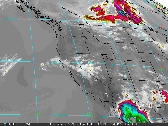
We've got a little more activity in the southern hemisphere on the charts but nothing real big (again). Hoping for some more SW towards the middle of the month. As far as the tropics go- it's quiet down there! Surprising since we're moving towards El Nino conditions- the water is slightly warmer than normal down there and hence should be producing more storms...

WEATHER:

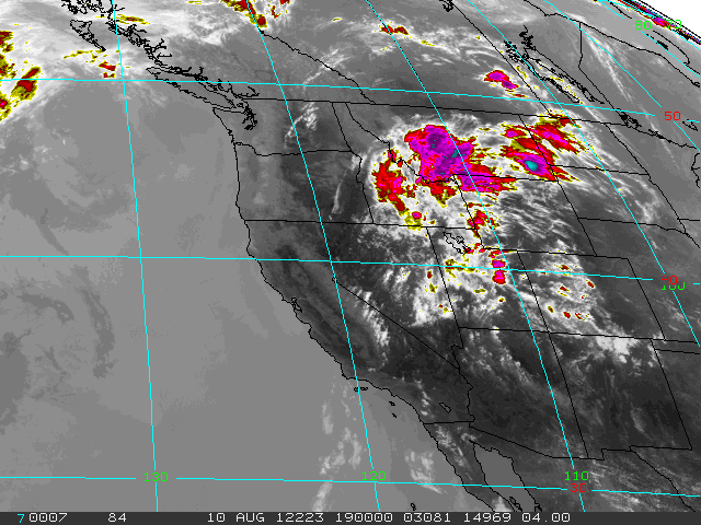
Typical summer weather on tap this weekend- we've got a weak low pressure system setting up shop this weekend so our low clouds will take a little longer to burn off in the nights/mornings but by lunch time we'll have sunny skies and temps in the mid-70's. By early in the week, high pressure sets up in the Four Corners and we get some monsoonal moisture in our mountains and deserts again with maybe some tropical-like clouds for us late in the week. Pretty much what you've seen the past month around here...

BEST BET:
Best SW swell we've seen in a few weeks is supposed to arrive on Monday- so I'm making it a 3 day weekend!

NEWS OF THE WEEK:

I know we're right in the middle of summer but all indications are that we're headed towards a moderate El Nino this fall and I'm looking forward to it quite frankly. After a couple years of La Nina conditions (i.e. cold water, foggy conditions around here, and no out of control surf), it's nice to have some warm water temps this summer, the potential to fill our reservoirs this winter, and a shot of ripping off the end of the Huntington Beach Pier. Early reports are that it's going to be a moderate El Nino but I'm betting on statistics- we've had strong El Nino's in '69/'70, '82/'83, and '97/'98- so we're due for '12/'13. The latest report from the National Weather Service last week is forecasting the following:
-High confidence of El Nino conditions (sea surface temperatures above normal) in the equatorial Pacific Ocean which would bring a moderate El Nino episode for winter 2012/2013.
-These conditions can begin to impact the atmosphere (storm track as early as the fall of 2012), with the primary impact November to May.
-El Nino conditions can produce more weather events with an elongated extended Pacific Jet Stream (storm track) which can bring more frequent storms to southern California (more precipitation events but not necessarily flooding)
-Slight increase in changes for an above normal precipitation year in Southern California
Long story short- look for our water to stay a little warmer longer this summer and into fall, a chance of increased precipitation this fall and then turning it up a notch again this winter, bigger messier surf, and of course some storms taking aim at southern California vs. northern California like a normal year. For more details on the forecast, check out the report at NOAA.

BEST OF THE BLOG:

Considering it's been small around here lately, I thought I'd stoke you out with some tiny tubes at Sandspit. Can't wait for winter! Bring on El Nino! And of course a mid-week Surf Check and an in depth THE Surf Report. All of that and more in the blog below!

PIC OF THE WEEK:

Beauty is in the eye of the beholder. Take for instance the Pic of the Week- amid all that noise and congestion is some solitary A-frames calling your name. Mind you the water is 50 degrees, it's 12', and right smack dab in the middle of the Red Triangle. No wonder there's no takers. For more empty shots, check out Mark Mcinnis' work here. 

Keep Surfing,

Michael W. Glenn
Not My Real Name
Triple Threat
Bomboras Or Bust