Friday, August 3, 2012
THE Surf Report 8/3/12
Will I ever ride my step-up again?!
SURF:
Beautiful weather this week but not much surf. We had some small SW swell but not enough to break out the shortboard.
Today we have a slight increase in SW swell for chest high sets in far north county SD and some inconsistent shoulder high sets in the OC. Looks fun but a little lined up due to the low tide early this morning and lack of real NW swell. The SW swell should hang around this weekend- beware the walled conditions though at the beachbreaks. Overall it will be rideable this weekend with the best sets in the OC. Water temps are a pleasant 70 degrees in SD and 67 in the OC.
Tides the next few days are -1' 6am, 5' at 11am, 1' at 5pm, and 3' at 8pm. Make sure to keep up to date on the waves and weather at Twitter/North County Surf.
FORECAST:
After a little surf this weekend, we get a boost from the SW on Monday for chest high+ waves in north county SD and head high+ waves in the OC. That holds 'til Wednesday.
NW windswell also increases slightly towards Thursday for waist high sets in south county SD.
We've got a little more activity in the southern hemisphere on the charts but nothing real big (again). Hoping for some more SW towards the middle of the month. As far as the tropics go- it's quiet down there! Surprising since we're moving towards El Nino conditions- the water is slightly warmer than normal down there and hence should be producing more storms...
WEATHER:
Typical summer weather on tap this weekend- we've got a weak low pressure system setting up shop this weekend so our low clouds will take a little longer to burn off in the nights/mornings but by lunch time we'll have sunny skies and temps in the mid-70's. By early in the week, high pressure sets up in the Four Corners and we get some monsoonal moisture in our mountains and deserts again with maybe some tropical-like clouds for us late in the week. Pretty much what you've seen the past month around here...
BEST BET:
Best SW swell we've seen in a few weeks is supposed to arrive on Monday- so I'm making it a 3 day weekend!
NEWS OF THE WEEK:
I know we're right in the middle of summer but all indications are that we're headed towards a moderate El Nino this fall and I'm looking forward to it quite frankly. After a couple years of La Nina conditions (i.e. cold water, foggy conditions around here, and no out of control surf), it's nice to have some warm water temps this summer, the potential to fill our reservoirs this winter, and a shot of ripping off the end of the Huntington Beach Pier. Early reports are that it's going to be a moderate El Nino but I'm betting on statistics- we've had strong El Nino's in '69/'70, '82/'83, and '97/'98- so we're due for '12/'13. The latest report from the National Weather Service last week is forecasting the following:
-High confidence of El Nino conditions (sea surface temperatures above normal) in the equatorial Pacific Ocean which would bring a moderate El Nino episode for winter 2012/2013.
-These conditions can begin to impact the atmosphere (storm track as early as the fall of 2012), with the primary impact November to May.
-El Nino conditions can produce more weather events with an elongated extended Pacific Jet Stream (storm track) which can bring more frequent storms to southern California (more precipitation events but not necessarily flooding)
-Slight increase in changes for an above normal precipitation year in Southern California
Long story short- look for our water to stay a little warmer longer this summer and into fall, a chance of increased precipitation this fall and then turning it up a notch again this winter, bigger messier surf, and of course some storms taking aim at southern California vs. northern California like a normal year. For more details on the forecast, check out the report at NOAA.
BEST OF THE BLOG:
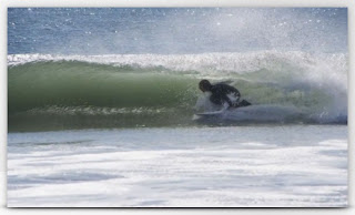
Considering it's been small around here lately, I thought I'd stoke you out with some tiny tubes at Sandspit. Can't wait for winter! Bring on El Nino! And of course a mid-week Surf Check and an in depth THE Surf Report. All of that and more in the blog below!
PIC OF THE WEEK:
Beauty is in the eye of the beholder. Take for instance the Pic of the Week- amid all that noise and congestion is some solitary A-frames calling your name. Mind you the water is 50 degrees, it's 12', and right smack dab in the middle of the Red Triangle. No wonder there's no takers. For more empty shots, check out Mark Mcinnis' work here.
Keep Surfing,
Michael W. Glenn
Not My Real Name
Triple Threat
Bomboras Or Bust


