Thursday, April 28, 2016

THE Surf Report- Early Edition


Spring has sprung.

SURF:
Since we didn't get the typical El Nino around here (i.e. big rains and big surf), this spring seems like it's going according to plan. Cold fronts generating a few showers, windy days, NW windswell, and the southern hemisphere sending us surf.


This past week had off and on weather conditions along with lots of NW windswell and smaller SW swell underneath.  For tomorrow we have a continuation of the NW windswell/groundswell and leftover SW for shoulder high waves.


On Saturday things kick up a notch as a new S swell moves in from a storm last week off Antarctica. Look for shoulder high waves in the AM then overhead sets by sundown. Best S swell spots (towards the OC) will run a couple feet overhead. Those swells hold into Sunday. Good news is that the S swell will have some NW windswell to break it up, bad news is that the NW windswell will be generated by another cold front moving down the coast Saturday night. Sunday may be a little bumpy unfortunately. Make sure to plan your session accordingly.


Water temps are a pleasant 63 degrees and tides the next few days are 3' at sunrise, 0' before lunch, and up to 4' in the evening.

FORECAST:
We have some leftover S swell on Monday for head high sets and a continuation of the NW windswell. Conditions will clean up fortunately. After that the NW looks to be on hiatus with no real groundswells in sight- maybe just some NW windswell again late in the week.

The southern hemisphere though continues to work overtime with models showing more SW swell due on our shores next weekend. Look for head high waves again- hopefully through Monday the 9th.

WEATHER:


Another weak front is forecasted to roll through Saturday afternoon and Sunday morning. Maybe a stray shower or two and breezy conditions, but nothing to change your weekend plans for. Weather cleans up for the first half of next week then models show yet ANOTHER cold front coming through Thursday. This whole April Showers Bring May Flowers thing is overplayed. Please make it stop. Then nice weather will make an appearance next weekend. Keep up to date on the conditions at Twitter/North County Surf. 

BEST BET:
It's been hard to predict when the good weather will coincide with the peak of the swells. This weekend the swells peak on Sunday BUT that's when another weak cold front rolls through. Monday looks clean but the swells will be on their way down! Maybe next weekend when we have new SW swell again and no cold fronts in sight...

NEWS OF THE WEEK:


More random facts (that probably only interest me):

Of the more than 500 or so shark species, about 80% grow to less than 5 feet and are unable to hurt people or rarely encounter people. Only 32 species have been documented in biting humans, and an additional 36 species are considered potentially dangerous.

An estimated 50-80% of all life on earth is found under the ocean surface and the oceans contain 99% of the living space on the planet. Less than 10% of that space has been explored by humans. 85% of the area and 90% of the volume constitute the dark, cold environment we call the deep sea. The average depth of the ocean is 12,450 feet. For comparison's sake, the average height of the land is 2,755 feet.

Currently, scientists have named and successfully classified around 1.5 million species (land, ocean, and air). It is estimated that there are as little as 2 million to as many as 50 million more species that have not yet been found and/or have been incorrectly classified. In regards to the ocean, there are at least 226,408 marine species but there are most likely at least 750,000 marine species (50% of  the worldwide 1.5 million species) and possibly as many as 25 million marine species (50% of 50 million species worldwide).

The speed of sound in water is 4,708 feet/sec - nearly five times faster than the speed of sound in air.


Earth's longest mountain range is the Mid-Ocean Ridge more than 31,068 miles in length, which winds around the globe from the Arctic Ocean to the Atlantic, skirting Africa, Asia and Australia, and crossing the Pacific to the west coast of North America. It is four times longer than the Andes, Rockies, and Himalayas combined.

The pressure at the deepest point in the ocean is more than 11,318 tons/sq m, or the equivalent of one person trying to support 50 jumbo jets.

The top ten feet of the ocean holds as much heat as the entire atmosphere.

The lowest known point on Earth, called the Challenger Deep, is 6.8 miles deep, in the Marianas Trench in the western Pacific. To get an idea of how deep that is, if you could take Mt. Everest and place it at the bottom of the trench there would still be over a mile of ocean above it. The Dead Sea is the Earth's lowest land point with an elevation of ¼ mile below sea level.

Undersea earthquakes, volcanoes and landslides can cause tsunamis (Japanese word meaning "harbor wave"), or seismic sea waves. The largest recorded tsunami measured 196 feet above sea level caused by an 8.9 magnitude earthquake in the gulf of Alaska in 1899.

The Pacific Ocean, the world's largest water body, occupies a third of the Earth's surface. The Pacific contains about 25,000 islands (more than the total number in the rest of the world's oceans combined), almost all of which are found south of the equator. The Pacific covers an area of 111 million square miles.

BEST OF THE BLOG:

Thanks to everyone that is playing at the 2nd Annual North County Board Meeting Golf Tournament on Friday, May 6th. This year's event benefits Outdoor Outreach; connecting youth to the transformative power of the outdoors. If you're looking to get involved in your community, give to a great charity, and spend some time away from the office, here's your chance. There's only a couple spots left, so please contact me ASAP at northcountysurf@cox.net for more information or check out the NCBM website here. Thanks again for your support!

PIC OF THE WEEK:

It's amazing how many empty spots are still left in the world. Even under the watchful eye of the most famous person ever, there's still unridden waves to be had.

Keep Surfing,

Michael W. Glenn
I'm Terrific. Thanks For Asking.
Guess I'm Not Cruz's Running Mate
Only Surfer To Win At Least 1 Contest In The IPS/ASP/WSL/PSAA/WQS/ESA/NSSA/WSA/Bud Tour

Friday, April 22, 2016

THE Surf Report


You name it next week. Except clean conditions.

SURF:

Pretty amazing week. Not the biggest surf but head high sets, amazing weather, and mellow crowds for the most part. Water temps even hit 70 degrees in La Jolla on 4/20! (No jokes please, I'm serious).


Today we have leftover SW/NW for chest high sets as new NW swell starts to fill in this afternoon. Unfortunately, it's accompanied by a weak cold front and it will be breezy on Saturday.


We also have new fun SW swell too but it may be junky due to that cold front. Sunday morning should clean up slightly... before another weak cold front moves through Sunday evening. Going to be a tricky weekend as we'll have good surf but off and on weather conditions. Make sure to be nimble!

Water temps are in the mid-60's again and tides the next few days are 1' at sunrise, up to 3.5' before lunch, down to 1.5' late afternoon, and up to 4' at sunset.

FORECAST:
The cold front mentioned above should clear out by Monday afternoon and in it's wake will be short period overhead NW windswell through Tuesday.

Things calm down Wednesday and we'll have background SW/NW swells for head high sets.

But then... another cold front comes through Thursday and we have head high waves from the NW again.

Charts show a good southern hemisphere S swell headed our way for next weekend but the cold front late in the week may leave behind some NW winds. Hopefully everything cleans up by Saturday and we're left with overhead S swell and clean conditions finally!

WEATHER:

EL NINO'S NOT OVER! WE GOT STORMS! Not actually storms per say, more like a chance of showers and wind. I'm pretty excited nonetheless. The tail end of a storm up N will make it's way through tonight and give us a slight chance of showers and some breezy weather at best. Things clear up Sunday morning then another weak cold front moves through Sunday evening for a chance of light showers again and breezy conditions (at most). We get a slight break on Tuesday then models show MAYBE another weak system and showers again late Wednesday into Thursday. And breezy conditions. Again. All in all some April showers making May flowers. That's all. Make sure to keep up to date on the conditions at Twitter/North County Surf. 

BEST BET:
Hard to say with all these off and on weak cold fronts messing things up all week. Plenty of swell from the SW and NW the next 7-10 days- just messy conditions when all these new swells hit each day...

NEWS OF THE WEEK:


Sure we didn’t get the rain we were ‘promised’ down here in southern California nor did we get the bombing La Jolla Cove swells I prayed to God for every night, but the rest of the world seemed to do alright from El Nino this past year. From record warm ocean temperatures to above average rain and snow in the northwest, it wasn’t a total bust. Take for example the worldwide hurricanes recently. In the past six months, the Earth has witnessed several of the freakiest, most intense storms in recorded history. The USA today last week gave us a quick recap:

Spurred by the highest ocean temperatures observed to date, record-breaking tropical cyclones — the class of storms that includes hurricanes and typhoons — have explosively developed in three regions: the northeast Pacific Ocean, the south Pacific Ocean and the Indian Ocean. These storms may be a harbinger of increasingly severe tropical cyclones in future decades as the Earth continues warming.


The most recent vicious storm, Tropical Cyclone Fantala, attained peak winds of 173 mph north of Madagascar this past weekend. According to meteorologist Bob Henson at Weather Underground, it became the most intense tropical cyclone on record in the Indian Ocean. Fantala has since lost steam and has weakened to a tropical storm over the southern Indian Ocean .  Fortunately, it has avoided any land areas.


Just two months before Fantala, Tropical Cyclone Winston became the fiercest storm on record in the South Pacific, with peak winds of 185 mph. This storm devastated parts of Fiji. (And left Tavarua mostly unscathed thank goodness).


And four months before Winston, Hurricane Patricia became the strongest storm measured to date by the National Hurricane Center in the Northeast Pacific. Its peak winds reached 215 mph before it slammed into Mexico’s west coast. Patricia was just one of 25 Category 4 or 5 tropical cyclones in 2015 in the Northern Hemisphere, the most on record by far.

This is not to mention November 2013’s Super Typhoon Haiyan, which became the strongest tropical cyclone in the northwest Pacific (and the Eastern Hemisphere) based on wind speed.  Its 195 mph maximum sustained winds devastated parts of the Philippines.

To be sure, because the intensity of these storms was not observed by aircraft, except for Patricia, there is some uncertainty in their exact measurements. And, the period of record in the Indian Ocean, where Fantala developed, only dates to 1990. But all of these storms formed in areas where ocean temperatures were much warmer than normal and during an era in which ocean temperatures are warming.

The recent ocean heating provided by El Niño, particularly in the Pacific, has certainly played a role in this flare-up of intense storms. But the longer-term ocean warming trend, related to growing concentrations of greenhouse gases in the atmosphere, is very likely to be playing an important role as well.

Published studies have documented an increase in the intensity of the strongest storms in several ocean basins in recent decades, although an unambiguous global warming signal in tropical cyclone activity hasn’t emerged. Such a signal is expected to become clearer in the future.

A NOAA-led study published in September projects increases in “the number and occurrence days of very intense category 4 and 5 storms” by the end of the century, and, more generally, NOAA projects an increase in the average intensity of tropical cyclones.

Fantala, Winston, Patricia and Haiyan may portend more frequent and intense severe tropical cyclones, especially during El Niño episodes in the Pacific (in the Atlantic, more intense storms would occur during La Niñas).

So what does that mean for us? With or without El Nino, look for increased hurricane activity in the coming years…

PIC OF THE WEEK:

The Monster From New Zealand Swell, 1975, Morro Bay. Or maybe this actually is New Zealand. Man I can't remember. That was a long time ago and I was in a haze for most of the 70's anyway.

Keep Surfing,

Michael W. Glenn
Exalted
Guest Star On The Love Boat
Bumped Jaws At Jaws And Broke Our Jaws

Thursday, April 14, 2016

THE Surf Report- Early Edition


Waiting. Wishing. Windy.

SURF:

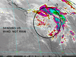
Nothing exciting this past week but it was fun. Had some background NW and SW for chest high waves and nice weather. Today the NW windswell picked up a notch as the SW held. We've got a storm moving through the Rockies tonight and as it does, it will whip our our N winds down here tomorrow. Wind gusts in our local mountains may even reach 70 MPH. Down here at the coast though, we'll have gusts to 30 MPH and those should turn NE (offshore) on Saturday.


With all the N wind, the windswell is increasing and we'll have head high sets Friday and overhead in SD. That holds into Saturday morning.


We also have a small fun SW filling in but with all the windswell, you may not notice it. As the wind continues to blow offshore on Sunday, the NW swell will decrease quickly. We'll still have background SW/NW for chest high sets Sunday morning so don't despair.


Tides the next few days are 4' at sunrise, down to 0' at noon, and up to 4' at sunset. Pretty straightforward. And water temps have warmed up to 64 but will most likely drop to the high 50's in a few days from the NNE winds.

FORECAST:
After the mixed bag over the weekend, the weather stays nice and the surf stays small. Just background NW/SW for chest high sets at the best combo spots.
By Wednesday though, we start to see a new S fill in from a storm that got it's second wind from the previous weekend's SW. Look for chest high sets in north county SD and shoulder high sets in the OC. We'll also have a little bit of waist high NW swell to help peak things up.


Further out, the southern hemisphere starts to get it's act together and we may see good head high SW towards the 24th.

WEATHER:

As mentioned above, winds will be a problem tomorrow as a storm moves into the Great Basin and sends us N wind instead of rain. Winds turn NE Saturday afternoon and stay offshore on Sunday. Beach temps will be in the high 70's late this weekend. Early in the work week temps stay in the high 70's/low 80's. Models then show a trough of low pressure trying to force it's way in late next week and we should see clouds increase and temps finally drop. Make sure to keep up to date on the conditions at Twitter/North County Surf. 

BEST BET:
Saturday with winds turning offshore and dropping NW/holding SW. Or next Wednesday with new fun SW and the last of the good weather.

NEWS OF THE WEEK:


Ever surf for a few hours and would just die for a glass of water while you're sitting in the line up? Especially in the tropics with the searing heat and humidity melting your skin; wouldn’t it be great to just lean over your board and take a big gulp of pure clear ocean water? You can’t of course- seawater contains salt. What the heck? Gatorade contains salt- isn’t that supposed to ‘re-hydrate’ you?! While humans can safely ingest small amounts of salt, the salt content in seawater is much higher than what can be processed by the human body (and what’s in sport drinks for that matter). Additionally, when we consume salt as part of our daily diets, we also drink liquids, which help to dilute the salt and keep it at a healthy level. Living cells do depend on sodium chloride (salt) to maintain the body’s chemical balances and reactions; however, too much sodium can be deadly.

Human kidneys can only make urine that is less salty than salt water. Therefore, to get rid of all the excess salt taken in by drinking seawater, you have to urinate more water than you drank. Eventually, you die of dehydration even as you become thirstier. Awesome. Not.

So with all the rain and rivers that dump freshwater into ocean every day (and eons for that matter) how come sea water is so salty? Blame it on terra firma- salt in the ocean comes from the rocks on land: The rain that falls on the land contains some dissolved carbon dioxide from the surrounding air. This causes the rainwater to be slightly acidic due to carbonic acid (which forms from carbon dioxide and water).

As the rain erodes the rock, acids in the rainwater break down the rock. This process creates ions, or electrically charged atomic particles. These ions are carried away in runoff to streams and rivers and, ultimately, to the ocean. Many of the dissolved ions are used by organisms in the ocean and are removed from the water. Others are not used up and are left for long periods of time where their concentrations increase over time.

Two of the most prevalant ions in seawater are chloride and sodium. Together, they make up over 90 percent of all dissolved ions in the ocean. Sodium and Chloride are 'salty.'

The concentration of salt in seawater (salinity) is about 35 parts per thousand. Stated in another way, about 3.5 percent of the weight of seawater comes from the dissolved salts; in a cubic mile of seawater, the weight of the salt (in the form of sodium chloride) would be about 120 million tons.

By some estimates, if the salt in the ocean could be removed and spread evenly over the Earth’s land surface it would form a layer more than 500 feet thick, about the height of a 40-story office building.

So there you have it. If you’ve been surfing Restaurants in Tavi for 4 hours and are dying for a drink, better to mosey on up to the bar in the real restaurant and have yourself a cold one.

PIC OF THE WEEK:


It's like Disneyland for surfers. Even has Mickey Mouse surfers in long sleeve rashguards and aqua socks!

Keep Surfing,

Michael W. Glenn
Taking Care Of Business
My Music Video Debuts on MTV Tonight
Won the 1st Man On Man Heat, Stubbies Pro 1977

Thursday, April 7, 2016

THE Surf Report- Early Edition


Working for the weekend.

SURF:


Love working all week just to get to the weekend and see it flat. And rainy. So that's your report! No need to read further! But for those of you looking to kill some time, we've got small conditions tomorrow from the NW and SW for waist high sets. Not much better on Saturday and Sunday- in fact worse- as a good storm bares down on us.

The surf will pick up late on Saturday but that's just due to the stormy conditions. Amazingly, this is the flattest it's been since, I dunno, December? Regardless, you know it was due to end sometime. So enjoy your weekend- maybe get a fire going and crack open that puzzle you've been saving.


Tides the next few days are 0' at sunrise, up to 5' before lunch, down to 0' again late afternoon and up to 3' at sunset. And water temps are in the low 60's.

FORECAST:
So how do I put this nicely? We have surf coming next week! But there's more rain coming next week! Rad for winter to show up a week after Spring Break.


Look for small but rideable waves Monday (along with rain again), and if you're desperate for surf (and sinus infections), look for the waves to start picking up Tuesday afternoon and peak on Wednesday with head high+ surf. Conditions should be fairly clean.


On Thursday, models show more rain headed our way and the surf picking up too- pretty big actually. If the forecast holds up, we could have 10' surf and messy conditions next weekend. As far as the southern hemisphere goes, we've had some storms down there but nothing big or too organized, so all eyes are on the storms in the north Pacific next week.

WEATHER:


As mentioned above, we have rain finally in the next 7 days. Hopefully we'll get back on track to make up for that dry February and March. In case you're wondering, preliminary rainfall totals for today are around 1/3". Tomorrow we're in-between storms, then a more potent  weather maker arrives Saturday afternoon bringing a little more wind and rainfall totals around 3/4". Sunday starts to clean up then a smaller storm arrives Monday for an additional 1/4" of rain. If I haven't lost you yet, Tuesday/Wednesday is ANOTHER transition day then ANOTHER rain maker is forecasted for Thursday. I can't complain- we need it. Make sure to keep up to date on the conditions at Twitter/North County Surf. 

BEST BET:
Wednesday as we'll have peaking NW and clean conditions.

NEWS OF THE WEEK:


Even though the San Diego hasn’t received the amount of rain hoped for with this season’s very strong El Niño event, numerous Pacific storms have generated plenty of big surf. And with the big surf, the waves have whipped up an abundance of sea foam. Besides sea foam being generated on every breaking wave, you especially notice it during large wave events and periods of plankton blooms. But just what is sea foam? The most obvious answer is the combination of water and oxygen to make bubbles. San Luis Obispo on the central coast saw their fair amount of foam this winter and the local paper Tribune gives their explanation:

Irving Berlin wrote the lyric, “to the oceans white with foam,” in the patriotic song “God Bless America,” made famous by Kate Smith. Depending on the type of organic matter in the seawater, the foam can also take on a yellow-brownish hue.

Sea foam is formed by the agitation of seawater caused by crashing waves, especially when it contains large amounts of dissolved organic matter. Along California, plankton blooms combined with decaying bits and pieces of red, green and brown algae can put a lot of dissolved organic material in the water column in the form of proteins and fats.


Like fluffy whipped egg whites, the proteins in the seawater become denatured — changed from their natural state — as they are churned by breaking waves in the surf zone.

As the large denatured protein molecules unfold in the churning seawater like origami flowers, the air-loving part of the proteins stick to the air bubbles. The air bubbles in the foam become more persistent through surface tension. This is how sea foam develops.

Because of the persistence and light weight of sea foam, it can easily be blown onshore by winds onto beachfront sidewalks and streets.

Overall, the majority of sea foam is not harmful to humans. In fact, it is often an indication of a healthy and productive ocean ecosystem.

However, when sea foam is made from a harmful algal bloom such as dinoflagellates (red tide), the aerosols from its popping sea foam bubbles can pose a health risk for those with asthma or other respiratory conditions. It can also irritate the eyes of beachgoers.

If sewage, detergents or oils from polluted storm water are present, the resulting sea foam can be more persistent. Sometimes when the conditions are just right, large amounts of sea foam can accumulate along the coast and conceal large rocks and voids, making hiking along the beaches hazardous.

PIC OF THE WEEK:


Came across a really cool concept on Instagram this week. The name is 'Surfreps' and they bill themselves as 'The 500 foot surf report'. Basically they take shots of the surf from an aerial drone and give a quick report. The Pic of the Week is from Swamis this winter. Looks so calm and peaceful from 500 feet, doesn't it? You know better though!

Keep Surfing,

Michael W. Glenn
Your BFF
Was The Doctor In Prince's Band
Just Realized Wilko Is Leading the WSL, Not Wilco

Friday, April 1, 2016

THE Surf Report


Life is good.

SURF:
Not that I didn't mind the El Nino generated surf this past winter, but it was pretty unruly around here for months on end. Most spots weren't handling the size, and if it was, there were 100 screaming people out (isn't Swamis supposed to be about peace, love, and happiness)? These past couple weeks have been fun- SW swells have arrived just in time for spring and there's been more manageable NW.

Today we have both- SW and NW swells- for head high+ sets in the far north part of the county. Most everywhere though has head high waves and sunny skies. Life is good. Tomorrow the SW starts to back off as the NW holds then on Sunday it's chest high most everywhere as both swells fade. Nice weather is on tap regardless.

Water temps are in the low 60's and tides the next few days are 4' at sunrise, down to 0' after lunch, and back up to 4' at sunset.

FORECAST:
Monday looks to be a small day with some leftovers and Tuesday isn't much better as NW windswell moves down the coast for chest high waves in SD. After that things get tricky as the models show just enough activity to get the heart pumping but not too big to get the adrenaline going.

There's a weak storm on the maps today that should give us waist high SW swell in north county SD on Thursday and chest high sets in the OC. The forecast is also calling for a chance of showers, so whatever swell we get, it may be a little messy.

Those same showers are from a cut off low pressure system that could linger just to the SW of us before moving onshore over the weekend. If you'll remember, we sometimes get those cut off lows just to our south once a winter. The result is short period S windswell that comes sideways up the coast like a hurricane. Cool feature. We'll see if it pans out late next weekend.

After that the north Pacific goes dormant and the south Pacific isn't much better as storms are forecasted to go E to W (not aimed at us S to N) so we'll have to patiently wait to see if we get any SW swell mid-month.

WEATHER:

Besides the fun surf today, the only real excitement is the weather the next 7 days. High pressure is in control this weekend and we'll have great beach weather in the low 70's and just your typical night and morning low clouds/fog. Offshore flow looks to make a return Tuesday/Wednesday and beaches could warm up to 80. In regards to that cut off low pressure I mentioned in the forecast above, that could slowly move ashore next Thursday to Saturday and bring showers to the area. Cut off lows are tricky and don't behave the way you want them to (like kids!), so make sure to keep up to date on the conditions at Twitter/North County Surf.  

BEST BET:
Today and tomorrow. If you haven't left work already, get going.

NEWS OF THE WEEK:

Whenever we get this benign weather (i.e. 70 degree beach weather, low clouds/fog in the nights and mornings, doesn't matter if it's January 1st or July 1st here in San Diego), I like to look at what happened this day in San Diego's history in regards to our weather. I guess you could say all the turmoil above is just another day in Des Moines or Anchorage...


2000: Santa Ana winds gusted to 93 mph at Mission Viejo and 67 mph in Anaheim Hills.

1999: A late winter storm that started on this day and ended on 4/2 brought snow to the region. Seven to nine inches fell at Pine Valley and Descanso, two inches at Boulevard, “heavy snow” was reported at Cherry Valley (3000 feet), and one inch at Homeland (1,700 feet). Eight illegal immigrants were found dead near Descanso and two more just over the border. 50 survived wearing only light clothing and tennis shoes and had never experienced snow; they had been on foot for three days. A waterspout was observed six miles off Newport Beach.

1998: A winter like storm brought up to three feet of powdery snow to the ski resorts. 18 inches was reported at Pine Cove. Grape size hail piled up two inches deep at Laguna Niguel. During a period starting on 3/31 and ending on this day, numerous funnel clouds were reported near the Orange and San Diego County coasts, two of which became waterspouts off Orange County. One waterspout briefly hit the coast as a tornado south of the Huntington Beach Pier.

1992: Heavy rain from thunderstorms hit the region. One thunderstorm pounded Escondido with three inches of rainfall less than an hour and produced flash flooding.

1982: 13 inches of snow fell in Big Bear Lake, the greatest April snowfall on record. Strong storm winds considered a tornado hit Leucadia; trees were downed and greenhouses were destroyed.

1965: 1.85 inches of rain fell in Santa Ana, the greatest daily amount on record for April.

1958: A tornado touched down in Laguna Beach. 3.13 inches of rain fell in Palomar Mountain, the greatest daily amount on record for April.

1946: A 7.8 magnitude earthquake hit the Aleutian Islands. Newport Harbor showed a five foot drop in tide. San Pedro showed a 2.5 foot jump in tide.

1903: At least 3.06 inches of rain fell in San Bernardino. Bridges and roads were washed out. A man using a cable car fell into the Santa Ana River and drowned.

PIC OF THE WEEK:

Tom Cozad is an OC photographer who is best know for his aerial shots. Not aerial like Felipe and John John boosting, but aerial meaning shots taken from a helicopter. It gives you a great perspective on how a certain surf spot breaks. You can use Google Earth all you want, but the shots taken from their drone or satellites usually aren't when a set is breaking. So Tom gets my stamp of approval. Check out his work at www.newportsurfshots.com or follow him on Facebook and Twitter.

Keep Surfing,

Michael W. Glenn
Professor Emeritus
Never an April Fool
Therapist Said I'm A Finatic Because I Own 45 Sets of Fins