Friday, March 30, 2012

THE Surf Report- Late Edition


Love/Hate Spring

SURF:
More fun surf this week and the weather co-operated. Had some SW mid-week and a little bit of NW yesterday. Today the NW is backing off but a new SW is filling in. Sets are already shoulder high in north county SD this afternoon.

As you've probably heard by now, that solid SW is peaking on Saturday. North county SD should have some head high+ waves, overhead++ waves in the OC, and south SD chest high+ waves. On it's heels Saturday night is a solid W swell that initially looked to be head high+ but now models are showing some 10' sets by Sunday morning- and double overhead in south SD. I'm hoping late Saturday or early Sunday the combo swells make some epic peaks in southern California. BUT... there' s a weak cold front coming through Saturday evening- typical- so conditions will be junky with 20mph SW winds. That lasts into Sunday. Why can't we get good surf and good weather to coincide?!

Tides the next few days are 2' at sunrise, 0' at 10am, and up to 3' late afternoon. Water is still cold at 56 degrees. Make sure to keep up to date on the waves and weather this weekend at Twitter/North County Surf.

FORECAST:
After the booming surf this weekend, we still have leftover chest high SW on Monday (towards the OC) bigger head high+ WNW and cleaner conditions finally. Tuesday the WNW lingers for some chest high waves in south SD. Wednesday we have some small waist high waves from a little SW swell and Thursday a waist-chest SW shows up. Pretty much uneventful next week.

Charts do though show a new SW forming this weekend so hopefully we’ll be back to head high waves from the SW around the 13th of April.

WEATHER:
Nice day today and tomorrow starts off with low clouds/fog Saturday and increasing winds from that weak front. Look for winds to be in the 20mph+ range late Saturday and light showers Saturday night/Sunday morning. Sunday it starts to clear but the W winds of 20mph hang around. Early next week we get cleaner cool conditions- typical for spring. And then another weak front is forecasted to arrive for the Easter weekend.

BEST BET:
Probably Saturday morning before the winds get on it. Or find someplace protected on Sunday morning and get a sizeable SW/NW combo swell but windy conditions...

NEWS OF THE WEEK:
March 25-31 is Tsunami Preparedness Week. After the devastating March 11, 2011 earthquake in Japan in which roughly 20,000 people lost their lives, California has been busy at work to get it's emergency crews up top speed. Considering we're part of the Ring of Fire (a nearly continuous series of oceanic trenches, volcanic arcs, and volcanic belts and tectonic plate movements. The Ring of Fire actually has 452 volcanoes and is home to over 75% of the world's active and dormant volcanoes), big quakes and tsunamis are part of our life. The California Geological Survey has done an amazing job creating maps showing what coastal cities are at the highest risk if a tsunami were to hit.

Basically if you live in a low lying area without a cliff to protect you (i.e. all of Newport Beach- just look at the map above- anything in red would be swamped), you're in trouble. If most of your town has a 20' or so cliff on the beach (Leucadia, you're spared), then you're in luck. Take a second and visit the website here to see what coastal areas in California are at risk and what you need to do to prepare yourself.

BEST OF THE BLOG:
Surfing now has completely passed me by. Just check out the blog this week to see what I mean. From Ryan Hipwood's antics at absolutely disgusting gurgling doubling-up Shipsterns to the kids of today flipping, tripping, and ripping. I unfortunately am about 25 years behind. Maybe buying a SUP isn't such a bad idea. And of course check out the mid-week Surf Check and a more in-depth THE Surf Report at http://www.northcountysurf.blogspot.com/.

PIC OF THE WEEK:

Just another random lonely warm water wave waiting to be discovered. That's if you had the time and a Mega Millions jackpot in your bank account to fund the expedition. Guess I'm stuck at Swami's this weekend with 200 of my favorite bros. Yippee!

Keep Surfing,

Michael W. Glenn
Haughty
Future Lotto Winner
Heir to MP

Thursday, March 29, 2012

Clips of the Day: Big and Small

Ryan Hipwood 2012 from ryan hipwood on Vimeo.

Doesn't matter if you're into big waves or small waves, it's all surfing. Or is it? Charging 20'+ Shipsterns with straps on isn't my cup of tea. Or surfing small wedges with a reverse air at the end isn't in my bag of tricks. But they're both still fun to watch. Check out the Clips of the Day with Ryan Hipwood going looney on some large slabs. Or check out Kai Neville's next ground breaking film 'Dear Suburbia' (no idea what that means- but it fits the rest of his films 'Lost Atlas' and 'Modern Collective'). While you're watching the clips, I'll be doing some weak turns in weak surf.

Trailer: Dear Suburbia, Prequel I from What Youth on Vimeo.

Tuesday, March 27, 2012

Surf Check 3/27/12


Looking pretty fun today. We've got leftover SW swell and leftover NW windswell from the Sunday/Monday storm. Waves are chest high with best spots in far north county SD/south OC pulling in shoulder high sets. Typical sea breeze today with the wind out of the W at 8.
Tides are pretty mellow too- 3' midday, down to 2' late afternoon, then 3' at sunset. The only real tide swing is 1' at sunrise. Water temps are a chilly 56 degrees.
Weather will be off and on this week. Nothing major- just fluctuations in the clouds and temps. Today will be sunny and mild then tomorrow night a weak front moves by to the north giving us a little more clouds on Thursday. Friday clears out then Saturday afternoon another weak front moves through. Probably no rain but clouds again and cooler temps. Just your average spring.
So what's in store for the next few days? Glad you asked. We've got some NW headed our way for Thursday with chest high sets in north countty SD and head high sets in south SD. That's backed up by a good SW swell showing late Friday and peaking Saturday. North county SD will have head high sets and overhead sets will be had in the OC. Fear not south SD, there is a head high NW headed your way for Sunday. Long story short, all areas will have surf this weekend.
And even further out, there should be some background chest high SW swell for the middle of next week. And take a look at the map above- the southern hemisphere has all kinds of weird stuff going on in the long range- check those 3 storms out- one under Oz, one off New Zealand, and one off Antarctica. I wonder if any of those will merge or at least feed off each other to make a solid storm. Bears watching!

Friday, March 23, 2012

THE Surf Report 3/23/12

Facsimile.

SURF:
Not a bad little week of surf. Had some fun SW/NW combo surf mid-week with clean conditions. I'll take that.
Last night we had a small bump from the NW for waist high+ surf around town with the occassional chest high set in south SD. There was also some small knee high SW filtering in north county SD and waist high waves in the OC. This morning is more of the same as the NW peaked last night and we have slowly dropping small NW through tomorrow.
Then we get solid NW Sunday afternoon- and then we get solid S winds along with a new storm. Bummer. If you liked last weekend then you'll love this weekend. Look for Sunday morning to have S winds and building stormsurf with big junky conditions late in the day. In a nutshell, Saturday will be small and Sunday will be stormy. Not the best weekend lining up unfornuately.

Tides the next few days are 3' at sunrise, 4.5' mid-morning, 0' late afternoon, and back to 3' at sunset. Water is still a chilly 56 degrees. Nothing says spring like a 4/3! Make sure to keep up to date on the waves and weather this weekend at Twitter/North County Surf.

FORECAST:
The storm will still have lingering effects into Monday so look for more overhead jumbled waves to start the day. Things start to clean up Tuesday for waist high+ NW windswell. Wednesday looks pretty small but good conditions. Thursday we get a small waist to chest high bump in SD from the NW with some more similar sized NW lining up for next weekend.

The southern hemisphere has been active and we have a solid storm on the charts today that should send swell to us next weekend. I'm hoping for head high surf in SD and overhead surf in the OC. And maybe the weather will cooperate finally?

WEATHER:

Low clouds and fog this morning will give way to hazy cool sunshine this afternoon. Saturday looks to be the same. Nothing exciting- just a typical spring day. As advertised above, Sunday is going to be stormy with S winds in the 20mph range and rainfall estimates of 1/2" at the coast. Monday the storm starts to exit the region for breezy NW winds and partly cloudy skies. The rest of next week gets back on track with cool conditions and night and morning low clouds.

BEST BET:
Probably next weekend when the weather finally cooperates and that new good SW swell shows up. Or if you're desperate- try some Sunday afternoon stormsurf on for size.

NEWS OF THE WEEK:
With the solid storm last weekend and another one coming Sunday, where do we stand at our rainfall for the season? It's been a wild season with above average rainfall in the fall, then a dry winter, and now a wet start to the spring. Here's the latest totals:
-Newport Beach 4.39" so far. Only 37% of normal to date (11.88"). Total average yearly rainfall should be 12.76"
-Oceanside 6.76" so far. Only 56% of normal to date (11.98"). Total average yearly rainfall should be 12.50"
-San Diego 6.80" so far. Only 76% of normal to date (8.96"). Total average yearly rainfall should be 10.77"
With the storm this weekend, we should add another 0.5". Since we're moving away from the rainy part of our season, I don't see us hitting our average rainfall this year. But the weather sure has been screwed up lately so it wouldn't shock me if we got a couple big dumps and put us right where we should be...

BEST OF THE BLOG:
Hope you've been watching the ASP's 6 Star Prime event at Margaret River this past week. Occy's been killing it! Yes, that Occy. With big burly bumpy surf, place your bets on the guy with the tree trunk legs. Amazingly, he's in the quarterfinals of the event. And on the other side of the draw is John John- 26 years the junior of Occy. How solid of a final would that be?! Also on the blog this week- spring break specials! Deals on boardies, sunnies, and sandals for your trip to Cancun next week. And of course the mid-week Surf Check and a more in-depth THE Surf Report. Check it out in the blog below!

PIC OF THE WEEK:

I swear I don't know how I come across these pics. I'm dumbfounded by this set up. There's at least 4 legitimate line-ups in this shot. And a couple more if the swell gets big of the northern point and inside cove. Throw in some tropical weather, warm water, and lack of crowds, and I might just find a way to retire there. Today. If you want to go, check out the travel brochures at The Perfect Wave.

Keep Surfing,

Michael W. Glenn
Smooth Operator
Finalist. Again.
Phil Edwards The Sequel

Thursday, March 22, 2012

Deal Alert! Spring Break Specials!

All winter long I've been touting deals on fullsuits but now that spring is here, Cancun is calling, and southern hemi swells are finally marching up the Pacific, it's time I dug up some warm water deals. And what better place to start then a good pair of boardies. Like Rip Curl's top of the line Mirage series (check them out starting at $44.99 at Seshday.com.) The Mirage will make you rip like Mick with:
• 
ES4 - ElastoStretch 4
• 
21 inch outseam
• 
Engineered Sublimation Print
• 
STL Technoilogies
• 
Multi Reflective Prints
Lightweight Hydrophobic Fabric
Water repelling and super-fast drying technology make the Mirage the ultimate boardshort.
STL: Stitchless Seam Technology
Ultra Sonic and heat-welding technology reduces excess fabric and weight, while increasing comfort and performance.
Ergo Fit Design
Body-mapped panelling & shaping reduces the need for seams in critical areas - meaning less chafing.
Lock Cord
The silicone-printed drawcord grips on itself & prevents slipping to secure your shorts in even the heaviest of wipeouts
Or get some color on your legs and impress the ladies on the beach. For just $24.99, the Speedball boardshorts from Analog have a 22" inseam, zip fly, anti-slip draw cord with anti-rash lycra at front fly and rise. And 100% Polyster peached microfiber! Did you get all that?

Of course protecting your eyes is just as important as covering your bum. If you want to see past the age of 90, then strap on the Electric BSG Polarized shades. Normally $180, today they're just $79.99 at Seshday.com. The BSG has:
- Polarized lenses
-100% UV Protection
-6 Base Mold Injected Grilamid Frame
-6 Base Polycarbonate Lens
-5 Barrel Stainless Steel Optical Hinge
-3 Piece Domed Volt Logo
And last but not least, don't forget ya' feet! Grab some of the best sandals on the market- the Reef Forte. At just $12.99 you can basically find some loose change in the couch for these. The Forte has:
• new super soft and grippy footbed
• soft reef polyester woven strap with ticking color detailing
• contoured footbed with anatomical arch support
• grippy molded reef rubber outsole
Get on it asap though as Seshday's stuff sells out quick!

Tuesday, March 20, 2012

Surf Check 3/20/12


Happy 1st Day of Spring! Sure feels like it finally. Sunny skies, cool temps, little combo chest high+ SW/NW. Looks fun. 

The tide is high this morning and there's little wedges up and down the beach. Minimal crowds too.Tides today are 5' at 8am, almost -1' at 2pm, and back up to 4' at sunset. Water temps are a chilly 56 degrees. It may be the 1st day of spring but it's still time to wear the 4/3.

The rest of the week is kind of mellow. We have the current SW holding through tomorrow but the NW will be gone. There's some activity in the north Pacific but nothing really aimed our way. Models show a bump for Thursday and again late Saturday but both swells may only have chest high sets.
Weather should be good through the week too with weak high pressure in control, sunny skies, and temps in the low to mid-60's. Further out there's a weak front coming through late Sunday for a chance of showers but nothing like we had last weekend.
The southern hemisphere has come to life now that it's spring and we have a good storm on the charts towards next Saturday (take a gander at the map above). If everything holds, we should have a solid SW swell towards the 1st of April for head high+ surf around town and overhead sets in the OC. Looks like the north Pacific is slumbering and the south Pacific is waking up.

Monday, March 19, 2012

Don't Call It A Comeback!

In one of the most eclectic group of competitors ever assmembled, the Telstra Drug Aware Pro in Margaret River this week has something for everyone. In additon to big burly cold surf (how come the O'Neill Coldwater Classic doesn't have this kind of luck?), there's old school power battling new school tricks- and everyone in between. Just check out the list of characters this event dragged in:

Old School (15 world titles in this list):
-Occy
-Damo
-Slater
-Taj
-Bede
-Raoni
-Freddy
-Reyes
-Cory
-Fanning
-CJ
(I swear the list above could have been round 3 of the Marui Pro in Japan circa 1995)
And in this corner- New School:
-Owen
-Simpo
-Gudang x 2
-Wilko
-Jadson
-Kerr
-Luke
-Coleburn
-Lacomare
-John John
-Nat
-Freestone
-Parkes
-Kolohe
-Evan
-Ho (Mason that is, not Michael- but that would be rad if Michael were there too- battling Occy)
-Caio
It's a 6 Star Prime event on the ASP World Tour meaning there's $250k in prize money and the points actually mean something to the competitors. And the best part is- the surf is big and wobbly and the boys with the tree trunk legs (i.e. Occy) are making heats! Looks like there's some more surf on the horizon too, so it should be a good contest from start to finish. So put the kids to bed, turn on the iPad, and watch some good ol' fashion ripping this week!

Friday, March 16, 2012

THE Surf Report 3/16/12


40 days and 40 nights.

SURF:
Had our first real SW swell of the season this week with a touch of NW. Lots of fun shoulder high+ surf around town and head high+ in the OC. Weather was a little funky but good surf will put a smile on anyone's face.
Today we have leftover SW swell for more chest to shoulder high surf and head high sets in the OC. The NW has backed off but more of that this weekend (kind of- more on that below). Wind is currently variable at 3 and will blow around 10mph from the SW this afternoon and the clouds may stick around at the coast all day. Water temp is 57. As far as the weekend is concerned, the heavens are going to open up if you didn't hear already. Should be our first real storm of the year and it's only fitting we had to wait until the end of winter to get it. Saturday morning starts off slow with just leftover chest high SW swell and winds out of the S at 15mph. Then the SW windswell kicks into gear in the afternoon with overhead sets and wind in the 30mph range. Lots of rain too. By Sunday morning it's a real mess with big stormsurf in control and winds out of the W at 25+ mph. If you're desperate to surf (like me) it's going to be a real battle to not get swept down the beach- or out to sea. Time for some spring cleaning around the house this weekend.
Tides the next few days are 4' at sunrise, almost -1' at lunch, and back to 4' at sunset. Make sure to keep up to date on the conditions at Twitter/North County Surf. 

FORECAST:
After a wild weekend of waves and weather, things don't get much better early in the week as there will still be residual hangover from the lingering storm. Hopefully by late Tuesday/Wednesday morning things are back to normal but there isn't much surf to speak of.
By Thursday though we should be in the swing of things again wtih chest high+ NW for north county SD/OC and shoulder high+ in south SD.
The southern hemisphere has been active lately too with some small background SW lined up for late in the week and better SW towards the end of the month. Long story short- skip the early part of the work week and wait for the 2nd half.

WEATHER:
Not much to tell you that you don't already know- the weather is going to be brutal this weekend. Just check out that monster in the pic above. Today we have some overcast conditions and cool temps and then the rain should start after midnight. Winds tomorrow morning will be 25mph+ from the S and then SW late in the day. Sunday has more strong 25mph winds but turning to the W and with showers. Rainfall totals should be over an inch and up to 2' of snow in the local mountains. Monday the storm backs off but we'll still have junky NW winds around 20mph and an odd shower. Tuesday looks to be a transition day and by Thursday we should have nice cool sunny weather. Models show another trough of low pressure setting up shop offshore late in the week so we're at least due for some clouds next weekend and cool temps again.

BEST BET:
Even though today isn't that exciting, you may want to get some of that leftover SW swell before the storm hits. Or wait until next Thursday when that new fun NW shows and the weather finally cooperates!

NEWS OF THE WEEK:
So what’s the latest on the weather around the globe lately? NOAA put out their latest monthly/quarterly report on Mother Earth and here are the hightlights (or lowlights depending on how you look at it). The globe experienced its 22nd warmest February since record keeping began in 1880. Arctic sea ice extent was the fifth lowest extent on record for February at 6.9 percent below average. Additionally, La Niña conditions continued to weaken during February. According to NOAA's Climate Prediction Center, La Niña is expected to dissipate by the end of April. February 2012 was the coolest February on record since 2008. However, February 2012 also marks the 324th consecutive month with a global temperature above the 20th century average. The last month with below average temperatures was February 1985.
Global temperature highlights: February
• The combined average temperature over global land and ocean surfaces for February 2012 was the 22nd warmest in the 133-year period of record and coolest since 2008, at 54.57°F, which is 0.67°F above the 20th century average of 53.9°F.
• Looking only at land, the global land surface temperature was 0.68°F above the 20th century average of 37.8°F making this the 37th warmest February on record and coolest February since 1994. It was also the coolest month on record since January 2008.
• For the ocean, the February global sea surface temperature was 0.65°F above the 20th century average of 60.6°F making it the 12th warmest February on record.
Global temperature highlights: December – February
• The combined global land and ocean average surface temperature for the December–February period was 0.74°F above the 20th century average of 53.8°F making it the 17th warmest such period since records began in 1880 and coolest December–February since 2008.
• The December–February worldwide land surface temperature was 1.06°F above the 20th century average, the 20th warmest such period on record. The global ocean surface temperature for the same period was 0.59°F above the 20th century average and 15th warmest such period on record.
Global temperature highlights: Year to date
• The combined global land and ocean average surface temperature for the January–February period was 0.67°F above the 20th century average of 53.8°F making it the 20th warmest such period in the 133-year period of record.
• The January–February worldwide land surface temperature was 0.77°F above the 20th century average, the 33rd warmest such period on record. The global ocean surface temperature for the year to date was 0.61°F above the 20th century average and was the 14th warmest such period on record.
• La Niña continued to weaken during February. According to NOAA's Climate Prediction Center, La Niña is expected to dissipate by the end of April.
Polar sea ice and precipitation highlights
• The average Arctic sea ice extent during February was 6.9 percent below average, ranking as the fifth lowest February extent since satellite records began in 1979. The five lowest February Arctic ice extents have occurred in the last seven years. February 2012 is the 14th consecutive February and the 129th consecutive month with below-average Arctic sea ice extent.
• On the opposite pole, the Antarctic sea ice extent during February was 20.3 percent above average, the fifth highest on record.
• The Northern Hemisphere snow cover extent for February was the eighth highest monthly extent in the 46-year period of record. The North American snow cover extent was the 16th lowest February extent on record, while the Eurasian snow cover was the third highest February. The Eurasian February snow cover of 12.0 million square miles was also the fifth highest snow cover extent for the continent among all months on record.
• The snow cover extent for the Northern Hemisphere during the winter (December-February) was the 14th highest on record. The North American winter snow cover extent was the fourth lowest, partially driven by low snow totals across the contiguous United States. The Eurasian winter snow cover extent was fourth highest on record, due to the heavy snowfall observed across central and eastern Europe during January and February.
• Precipitation was variable across the globe during February. Dryness prevailed across much of Western Europe, with France reporting its driest February since 1959, Spain since 2000, and England since 1998. Rainfall was much heavier than average in southeastern Australia, with major flooding occurring in Queensland, New South Wales, and Victoria. This rainfall was associated in part with La Niña.

For the complete report (with really cool graphics and stuff) check it out here.

BEST OF THE BLOG:
if you're looking for motivation to get out there this weekend, look no further- I've got new footage from new guys Coleburn and Simpo as well as new footage from old guys Taj and Cory. Let's be honest- no amount of good clips is going to get you to paddle out this weekend. But at least cruising the blog will give you something to do. And of course check out the mid-week Surf Check and an in-depth THE Surf Report. All of that and more in the blog below!
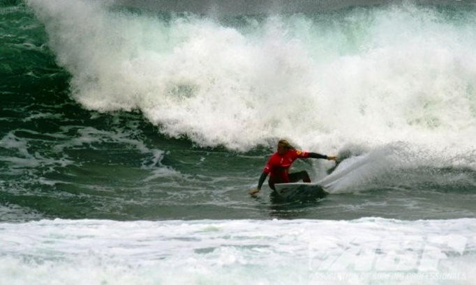
PIC OF THE WEEK:

The total opposite of this weekend. For more shots of what good waves and weather look like, check out  Surf There Now.

Keep Surfing,

Michael W. Glenn
Motivational Speaker
Bracket Buster
More Crazy Than Kerrazy

Tuesday, March 13, 2012

Surf Check 3/13/12

All kinds of stuff going on this week- some good, some bad. Let's start with today though first. We've got some waist high SW with chest high sets in far north county SD and an odd better set in the OC. There's also a touch of NW but it's pretty N and it's having a hard time wrapping into so-Cal.

Winds are currently calm but will blow W at 10mph this afternoon just like yesterday. It's at least looking rideable and the low clouds should clear out by lunch. Tides are pretty mellow today.
Only 0' at sunrise, 3' at 2pm, and down to 2' at sunset.  The NW backs off tomorrow and the SW continues to build and peaks tomorrow with shoulder high sets in north county SD and head high+ sets in the OC. Once that starts to back off towards Thursday, there's not much surf on Friday except small leftover SW and no real NW to speak of. The weather stays cool too with hazy sunshine in the afternoon and temps in the low 60's.
Then the real fun starts. Check out the weather image above. There's a solid storm bearing down on the state. Currently buoys in the Aleutians are running 30+' at 17 seconds and the Sierras are forecasted to get 4'+ of snow above 7,000 feet this weekend. For us, we'll start to get a slight pick up from the NW on Saturday but the storm will already be upon us and the winds will be blowing from the S around 20mph.

By Saturday night/Sunday morning, expect surf to be in the well overhead range with double overhead+ sets from the NW but complete stormsurf conditions with 30mph W winds and heavy rain. Early rainfall estimates are 1-2". Easily the best storm we've had since last winter. The wind, rain, and surf backs off on Monday but the water will be filthy. Next week things should mellow out. All in all a messy big weekend. Get it tomorrow if you can and batten down the hatches!

Monday, March 12, 2012

Clips of the Day: Take Your Pick


It's amazing how quickly pros are shot on video, edited, and posted to the web. Usually in the same day. Like Mitch Coleburn a few days ago in Oz no less ripping some junky warm water ramps. I remember when I was a kid (insert snoring sound here) it would take months to see the latest clips. Heck- I didn't even know who won the '86 world title until Surfer Magazine hit the shelves months after the fact (it was Curren by the way- but I knew he was going to win regardless). Anyway, even if the surf is junk, it's worth posting that night, and why not? It's disposable web video. It's not like you just paid $49.95 for a VHS tape of Beyond Blazing Boards.

And if you don't know what the Beyond Blazing Boards reference is, then I'm proud of you. You've got 80 more years to live and I only have 40. But regardless, every session is now filmed and every wave capture and nothing goes undocumented. Like the clip above of Taj test riding some Mayhem's down the street from Biolos' shaping bay in San Clemente last month.

Or local hero Brett Simpson getting some fun waves on the Gold Coast just after the first event of the year- last week- down at Snapper rocks.

And here's one of my all time favorites- Cory Lopez surfing- well all over the place actually. And a soundtrack by Social Distortion nonetheless (how do those guys at ...Lost get away with it)?

Whether you like new school (Mitch/Simpo) or old school (Taj/Cory- gasp- I can't believe Taj and Cory are considered old school now), it's all ripping no matter how you slice it. And it just happened yesterday.

Friday, March 9, 2012

THE Surf Report 3/9/12


Wait for it…

SURF:
Typical late winter/early spring surf this week. A fast moving storm, lots of wind, not much rain, and short interval N swell. Wednesday morning had some clean conditions to help groom the jumbled surf but that was about it.
Today we’ve got great summer type weather and just a little knee to waist high SW with a touch of even smaller NW. There’s some small waist high SW showing tomorrow in north county SD and some chest high sets in the OC. Then on Sunday there’s some waist high NW showing in north county SD and chest high sets in south SD. Nothing too exciting this weekend but we should have some rideable waves. The low clouds and fog return this weekend too so the little swells will be greeted by overcast conditions. Could be worse I guess.
Tides the next few days are 2' at sunrise, 6' mid-morning, down to 0' lat afternoon, and back to 2' at sunset. Make sure to keep up to date on the waves and weather at Twitter/North County Surf. 

FORECAST:
After the little swells run their course this weekend, we get mainly background waist high+ NW swell through the week with maybe a chest high set in south county SD towards Tuesday morning. And the southern hemisphere is starting to come to life too- looks like some chest high+ SW on Tuesday afternoon for north county SD and head high+ sets for the OC.
After those swells early in the week, we have better NW towards Thursday afternoon for shoulder high waves in north county SD and head high+ surf in south SD.
And charts show another chest high SW swell for next weekend. Should be a fun week of surf next week. Clear your schedule!

WEATHER:
Great weather the past few days and no real surf to greet it. We’ve got a little surf this weekend and the return of low clouds and fog. Typical. Next week we have better surf and more low clouds/fog and some drizzle late Monday. Classic! Can’t we get great surf and great weather to coincide?! Long story short, look for most of next week to have morning low clouds/fog and cooler than average temps in the low to mid-60’s next week. Models show maybe a chance of rain towards next weekend but that’s still a long way off…

BEST BET:
Maybe Tuesday morning if that SW swell shows early and that NW swell from Monday hangs around. Combo swell anyone?

NEWS OF THE WEEK:
Notice how early the sun’s been coming up lately? On a clear morning sans the fog/low clouds, you can paddle out around 5:45 am. And the sun’s been hanging around a little longer ‘til 6pm for those evening sessions. That all changes this weekend as Daylight Saving Time kicks into gear Sunday morning at 2am. So if you enjoyed cracking it before work/school the past few weeks, you can kiss that goodbye. The sun will now come up around 6:45am. BUT… it’s going to be easier to surf after work/school now as the sun will go down around 7pm. Brilliant! Luckily for us, the days are getting longer and we hit a peak of 5.45am for our sunrise on June 21st and a sunset of 8pm. So hang in there a few more months and you can start hitting the dawn patrol again. And if you’re wondering when all of this Daylight Saving Time shenanigans ends, it’s November 4th this year. So get that extra sunshine while you can! 

BEST OF THE BLOG:
What can you get for $100 nowadays? If you’re me, I’m unfortunately spending it on my SDG&E bill. Or maybe a pair of high tech boardshorts that won’t make you surf any better. For reals players? If you’re smart, you’ll head over to the North County Surf blog and pick up a new Electric backpack, Reef sandals, Freestyle watch, Creatures of Leisure tail pad, and a Taylor Knox DVD. All for less than a Benjamin. For reals players. Or if you need some tips on your backside surfing, take a gander at the next goofyfoot world champ Owen Wright in Indo. And of course the mid-week Surf Check and a more in-depth THE Surf Report- all of that and more in the blog below!

PIC OF THE WEEK:
What could be better? You’re living in Oz, got some trunks on, no one’s out, and there’s a fun little right hand point break you’ve got all to yourself. Of course you’re riding a board 3’ too big and you’re not doing any turns but rather squatting- but hey- you’re ripping in your own mind so that’s all that counts. For more shots of the good life, check out Surfing Art. 

Keep Surfing,

Michael W. Glenn
Captivating
Rolling Stone
Shredder