Thursday, March 24, 2016

THE Surf Report- Early Edition


Now what?

SURF:
Now that I have officially declared El Nino dead in the water, what now?

Windy head high NW swell earlier in the week was replaced by waist high+ NW/SW swells. That's what. Should I sell my step-up?

Before I do anything rash, we've got a couple little NW swells this weekend for chest high waves arriving tomorrow and another shot on Saturday. Nothing big but fun with great weather on tap and a little background SW in the water to break things up. Water temps have dropped due to the wind earlier in the week and sits at 60 degrees.


Tides the next few days are 1' at sunrise, up to 4' before lunch, down to 1' again late afternoon, and up slightly to 2' at sunset.

FORECAST:

The good weather goes away on Monday but the surf increases from the NW and SW. So basically we've got a couple good swells headed our way but the weather is going to suck. Awesome.


Look for the NW to increase Monday afternoon from the aforementioned storm as a new good SW swells shows too. We'll have overhead combo surf but crummy weather. Things should clean up by mid-week but the swells will be on their way out.


Next weekend is looking pretty small; maybe that junky combo swell on Tuesday isn't looking so bad after all.

WEATHER:

Great weather on tap this weekend with high pressure in control and just some night/morning low clouds and fog. Temps will be in the low 70's and the beaches full of sun. I'm headed to Mission Beach for Spring Break! As mentioned above, we have a weak storm headed our way Monday afternoon through Wednesday morning. No real measurable rain, just showers, breezy conditions, and cloudy skies. Goodbye Spring Break. Things should clear up the 2nd half of next week for more seasonable weather.  Make sure to keep up to date on the conditions at Twitter/North County Surf. 

BEST BET:
Take your pick: Saturday with chest high NW/SW combo and great weather. Or Tuesday with overhead NW/SW and semi-junky conditions.

NEWS OF THE WEEK:

As you may or may not know, I'm involved with a group called the North County Board Meeting. The purpose of the group is to grow local businesses, support charities, and, um, surf (the most noble cause of them all). Basically we exist 'To Make North County Great Again' (I've heard that somewhere before).

We've had some great events over the past 2 years and one of the most fun was the golf tournament at Goat Hill in Oceanside last spring. Since we're surfers, none of us are really good at golf. Heck, if we were, we'd be rich and on the PGA Tour. The purpose of the tournament is to get together with friends, have a cold one, and heckle each other. Oh- and support a local charity. Well it's time for the 2nd annual tournament and we'd like you to join us Friday, May 6th. Lunch is included and did I mention it was on a Friday?
No excuse to not start your weekend early and help support this year's charity- Outdoor Outreach. They help at-risk kids by getting them outdoors and introducing them to the stoke of surfing, snowboarding, etc. as well as leadership skills and more. If you'd like to make a difference in the community, check out the flier and join us Friday, May 6th at the all new Goat Hill.


And for more information on the North County Board Meeting, check out the group on LinkedIn or our website at ncboardmeeting.org. And Outdoor Outreach can be found at outdooroutreach.org.

PIC OF THE WEEK:

I don't know why I like these types of photos. I guess it's like looking at a scrambled Rubik's Cube. How are you going to solve the riddle of riding this beast? There's the issue of the thick lip you have to paddle in to. Then there's that whole draining off the reef thing. And if you finally make it to riding the face of the wave- there really isn't a 'face'- just a bunch of warbles. So I guess it really isn't rideable. Or is it? I think I need JOB to solve it first.

Keep Surfing,

Michael W. Glenn
Better Looking the Older I Get
Still Believe In the Easter Bunny
Oldest Rookie On Tour

Thursday, March 17, 2016

THE Surf Report- Early Edition


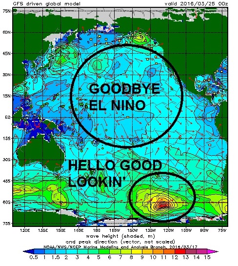
Goodbye and good riddance El Nino (if that even is your real name)...

SURF:
Now that the rain is behind us (or lack thereof) and the big surf has subsided, it's been downright pleasant around here.

Today we had a combo NW/SW for chest high surf. The only damper is the on again/off again fog. Once it burned off, you could find a few fun waves up and down the coast. Tomorrow morning holds then late Friday/early Saturday looks small but still rideable.


By Saturday evening we have a new fun NW showing up for shoulder high sets in SD. We'll also have some smaller background SW swell for the OC. Both those hold into Sunday.


Water temps are also holding in the low 60's and tides this weekend are 5' at sunrise (due to Daylight Saving- about 7 AM), down to -1' after lunch, and up to 4' at sunset (due to Daylight Saving- about 7 PM).

FORECAST:
Still have a couple storms floating around the north Pacific that will send us waves- but no real weather.

New NW will fill in Monday afternoon for shoulder high waves. Then some windy/cloudy conditions on Tuesday will give us a short interval overhead NW. After that the it's looking pretty small the 2nd half of next week. The southern hemisphere is coming to life though as we move towards spring and the models are showing a couple storms flaring up.

First is a storm straight S of us that should give us shoulder high sets around the 28th of March.


On it's heels is a similar sized storm that should build next week and shoot us more straight S swell around the 2nd of April. Is the north Pacific shutting down for the season?

WEATHER:

With El Nino (un)officially gone, we've got great weather on tap this weekend as high pressure is in control. The only fly in the ointment is the night/morning low clouds/fog. A storm N of us early next week will swing a cold front our way late Monday into Tuesday. Look for clouds, breezy conditions, and a stray shower or two. El Nino came in a like a lamb and went out like a... lamb. The 2nd half of next week is shaping up to be beach weather with sunny skies and temps in the mid-70's.  Make sure to keep up to date on the conditions at Twitter/North County Surf. 

BEST BET:
Sunday is the call: Peaking NW swell and nice conditions.

NEWS OF THE WEEK:

Wasn’t that an utter disappointment. Remember in 2014 all the talk (including yours truly) about a strong El Nino? It had a couple hiccups (see my explanation here) and we waited instead for the 'Godzilla El Nino' to arrive this winter. Well, we’re below average on rainfall and spring starts in just 4 days. So what the hell happened (again)?! I want answers dagnabit! Heads are going to roll! The National Oceanic and Atmospheric Administration says El Nino lived up to the hype (i.e. everyone else was on track except for us):

The strong El Niño of 2015/16 is now on the decline, and the CPC/IRI forecast says it’s likely that conditions will transition to neutral by early summer, with about a 50% chance of La Niña by the fall. In this post, we’ll take a look back at this past winter and forward to what may happen next.

Current events:

El Niño has begun to weaken, with sea surface temperature anomalies across most of the equatorial Pacific decreasing over the past month. The large amount of warmer-than-average waters below the surface of the tropical Pacific (the “heat content”) also decreased sharply, despite getting a small boost in January. The heat content is the lowest it’s been in over a year, and since the subsurface heat feeds El Niño’s warm surface waters, this is another sign that the event is tapering off.

That said, there’s still a lot of extra heat in the tropical Pacific, and we expect El Niño’s impacts to continue around the world through the next few months. So far this winter, global rain and snow patterns have mostly been consistent with the expected patterns of El Niño, with some exceptions (that would be us here in sunny So-Cal).

In South America, southern Uruguay, Paraguay, and southern Brazil have received much more rain than their long-term December–February average, and the northern portion of the continent has been dry, as usually occurs this time of year during El Niño. Also consistent (so far) with El Niño’s typical impacts have been Africa’s rainfall patterns (wet in portions of Kenya and Tanzania and dry in southeastern Africa and southern Madagascar), the dryness through Indonesia and northern Australia, and the rains in southeastern China.

The precipitation impacts in North America haven’t been quite as consistent with expectations so far (no s#!+ Sherlock), although the southeast and particularly Florida have received a lot more rain than average. Over the December–February season, the western coast of North America showed a pattern of drier north/wetter south, but the line between the two is shifted somewhat north of where it was during earlier El Niño events. (Years ago you probably read that global warming would shift climate patterns- most likely the heat/desert below us into our region and hence the relatively warmer climates of the Pacific Northwest into the Arctic Circle. Could that be the cause)?


El Niño’s effect on regional temperature is a little less distinct than its effect on precipitation patterns. Since El Niño changes the circulation of the atmosphere all around the world, it essentially changes where we expect rain to fall by steering storms to different locations. Temperature operates differently, especially since global warming is changing the averages. Some of the factors going into the super warm November and December in eastern North America was a good example of how attribution of seasonal temperature patterns is a complicated matter.

Looking forward:

Where does the 50% chance of La Niña come from? Forecasters take into consideration what happened in the past, the predictions of computer models, and current conditions when making their forecast.

La Niña conditions have followed six of the ten moderate and strong El Niños since 1950, including two of the three previous strongest El Niños. However, this small number of cases means that it’s hard to make a very confident forecast based only on the previous events.

Next fall is still many months away, and computer climate models have a difficult time making accurate forecasts through the “spring barrier” period of March–May, which is the time of year when El Niño and La Niña are often weakening and changing into neutral. It’s harder to predict a change in conditions. Nevertheless, most computer models are in agreement that La Niña (strength TBD) will develop by the fall. (What does that mean for our rainfall chances? At this point in time you can say we’ll be below average in rainfall as based on previous La Ninas. But since this El Nino underperformed- maybe La Nina will buck the trend and we’ll get above average rainfall? One can only hope).

There are two models in this graph that are showing a return of El Niño (these models also believe in unicorns, Leprechauns, and a Trump presidency). When a computer model forecast is made, you first have to tell the model what the current conditions are (“initializing” the model). For example, you tell it the current sea surface temperature, so it knows where to start.

The way we get a variety of possible outcomes is to start the models with slightly different initial conditions; the differences grow over time. Modelers can use different observation data sets, or use a few different recent days from a single data set, or use one set of observations and add in the range of uncertainty.

The two models that show a return to El Niño happen to use the exact same data set for the initial conditions. The prediction models are different, so they react to the initial data differently, which leads to different outcomes. However, this particular data set used for the initial conditions has unrealistically cold temperatures in the tropical Atlantic Ocean. This smells fishy so it is currently being investigated. The fact these two models are both predicting El Niño next winter could be related to this issue.


To ENSO researchers, this is pretty interesting, because the relationship between the Atlantic and the Pacific isn’t very clear. But right now, it means we aren’t placing a lot of weight on those forecasts for El Niño next year. The next few months should give us a clearer picture. (Long story short- are we in a historically dry period so no matter what El Nino does- we’re screwed? Or is it impossible to predict the weather and we could actually get average or above average rainfall next winter? At this point in time, the El Nino forecast of 2014 AND 2015 were wrong, so a dry La Nina of 2016 will probably be wrong too)!
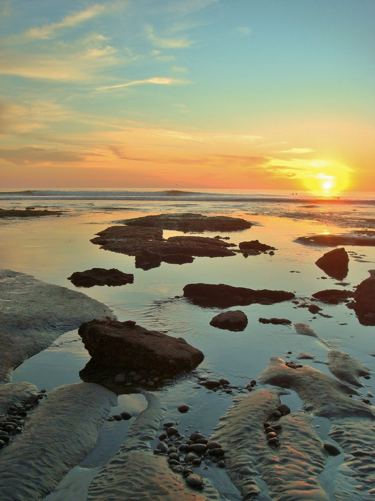
PIC OF THE WEEK:

If you live on the east coast, you can pretend this is a peak all to yourself during a dawn patrol session. Or if you're a west coaster like me, this would be at sunset and a good way to end the day. But what if you lived in a spot that was north or south facing- you'd never see this! Or would you? I'm confused. Maybe I'm overthinking it.

Keep Surfing,

Michael W. Glenn
Eye of the Tiger
Son of a Son of a Leprechaun
Switched My Tuxedo Vest for an Inflatable One At My Wedding

Thursday, March 10, 2016

THE Surf Report- Early Edition


Beware the ides of March.

SURF:

Lots of lump and bump last weekend has turned in to clean fun conditions the past couple days. New SW swell filled in today and met up with leftover NW windswell for peaks up and down the coast. Tomorrow morning should be fun as the NW and SW swells stay steady for shoulder high waves but by the evening we've got a fast moving storm that makes conditions a mess.
Saturday we're back to overhead+ WNW but it's also windy and showery. Sunday the swell backs off but conditions are suspect. Beware the ides of March. Water temps dropped slightly with last weekend's windy storm; we're down to 61 degrees.
And tides the next few days are 0' at sunrise, up to 5' at lunch, and back down to 0' at sunset.

FORECAST:
Low pressure is forecasted to sit on top of us to start the week so we may have some funky clouds/winds Monday/Tuesday.
New NW swell should fill in too but it’s pretty steep so I only expect head high+ surf.
Further out, we had a storm in the southern hemisphere a few days ago and we should see some new chest high SW arrive Tuesday morning.
After that things slow down from the northern and southern hemisphere and we may not see any swell until the first day of spring on the 21st.

WEATHER:

Going to have a little fun tomorrow night with a fast moving storm but we should only get 1/3” of rain which won’t make much of a dent in our drought situation. Low pressure lingers all weekend and we should have cool moist conditions. No real rain makers on tap from Sunday to Tuesday but maybe a stray shower here and there. High pressure sets up shop mid-week and we’ll have temps close to 80 and light offshore winds. Too bad there won’t be any surf. Make sure to keep up to date on the conditions at Twitter/North County Surf. 

BEST BET:
Tomorrow morning is my verdict: Fun NW/SW and fairly good conditions. Or next Tuesday if high pressure sets up early and we have leftover NW and smaller building SW.

NEWS OF THE WEEK:

Now that El Nino has arrived (sort of) 2 weeks before the start of spring, where do we stand with our rain for the season? If we look at our typical 'wet' season from October 1st to today, here's the results so far:

-Newport Beach 4.41". 44% of normal
-Oceanside 5.89". 54% of normal
-San Diego 6.68". 83% or normal

Tomorrow night's rain isn't expected to do much and high pressure next week just makes it worse. What was supposed to be a 'Godzilla' El Nino for rain has turned out to be Barney the dinosaur. I still expect to get April showers but I don't think we'll end up above average. The desalination plant is looking like a good investment right now. Luckily for us, 30% of our water comes from the Sierra snow pack and they happen to be 114% of normal. So that's good news. But it doesn't do much for our dry hillsides down here in so-Cal.

PIC OF THE WEEK:

If I didn't live in north county, I'd live here. Cool little town, warm water, and a pretty good right to keep me satisfied. If they don't have a Dunkin' Donuts though, that's a deal breaker.

Keep Surfing,

Michael W. Glenn
Chairman of the Board
Just Hired A Personal Assistant
Bust My Stick I Shred So Bad

Thursday, March 3, 2016

THE Surf Report- Early Edition


Better late than never.

SURF:

Ever hear the joke: "What job can you be wrong at all the time and NOT get fired?" Answer: "Weatherman!" All the forecast models were showing no rain until at least mid-month and then BAM! Total about face and we have rain coming this weekend. I'm sending my resume to the Weather Channel. But before I get ahead of myself, let's talk about a last ditch effort to get surf this weekend before the winds kick in, the surf gets out of control, and the water is filthy.
WNW is starting to fill in on the outer buoys and we'll have head high+ sets tomorrow. Saturday we're a few feet overhead (again) and 10' sets in SD. The winds should be somewhat manageable in the AM but turning to the SW by Saturday evening. On Sunday it's pretty stormy and we've got 10' surf in town and 12' surf in SD. It will also be windy and rainy- so we're screwed. At least we're getting some rain before the end of winter.
Water temps are a pleasant 63 degrees (for winter) and tides this weekend are over 5' at sunrise, down to -1' after lunch, and up to 3' at sunset.

FORECAST:

If you liked Sunday's waves and weather, you're going to LOVE Monday's. We've got a solid storm hitting our coast in the AM and the swell to go with it. Look for 12'+ storm surf and 15'+ in SD- along with 40 mph winds and dumping rain.  That swell peaks early Tuesday and drops like a rock.
On it's heels though is our first real SW swell of the season showing Tuesday. Water unfortunately will be dirty and the winds may not be calm yet. Hopefully by Wednesday we'll see shoulder high waves here in north county SD and head high waves in the OC. Make sure to wear your hazmat suit under your 3/2. Thursday should be fun with leftover SW/NW and clean conditions.
Models then show another storm for next weekend and big surf again. Nice of El Nino to finally show up to the party.

WEATHER:

As mentioned above, we are finally getting some rain after February was one of the driest on record with less than 0.10" most everywhere in southern California. Tomorrow is a transition day as the storm gathers itself offshore. Look for mostly cloudy skies and manageable winds. Saturday morning starts the same and we should see showers from a weak cold front that night. Sunday is pretty messy with rainy windy conditions. Monday is when the real fun starts and the bulk of the storm moves through. We'll have wind gusts of 40 mph (which isn't that bad considering a few weeks ago it was 60 mph) and moderate to heavy rain. Once it exits the region by Tuesday, we'll have around 1" of rain at the coast and about 1' of snow in the local mountains. Mid-week should be cool and dry as weak high pressure establishes itself. Models then show another storm aimed at us for next weekend but it hasn't even formed yet so make sure to keep up to date on the conditions at Twttier/North County Surf. 

BEST BET:
Between dodging storms, looks like tomorrow afternoon will be a good bet (you were planning to leave work early anyway, weren't you)? Or Wednesday with clean conditions and a combo NW/SW.

NEWS OF THE WEEK:

Every few years I do a refresher course about tides. Since we’ve had some pretty high tides lately due to a variety of factors (check out the story from December here), I thought I’d go into some detail.

The highest tides in the world can be found in Canada at the Bay of Fundy, which separates New Brunswick from Nova Scotia. At some times of the year the difference between high and low tide in the bay is over 53 feet or basically the size of the Eddie contest this year. The highest tides in the United States can be found near Anchorage, Alaska, with tidal ranges up to 40 feet. And what’s the biggest tidal range we have here in north county San Diego? We have it coming up this May and December; over 9 feet. Not exactly 40 feet or even 53 feet; but still amazing to think that if you were standing on the shore at dead low tide, a 6’ person would be 3’ under water at high tide. That’s a lot of water moving.

One interesting place to watch the tides in motion is our own Ponto Beach in Carlsbad.  As the tide comes in, the ocean pushes against the coastline and the water rises. But in the case of Ponto, the tide finds a ‘break’ in the coastline in the form of the lagoon entrance at the jetties. The force of the ocean pushing against the coastline surges into the lagoon. It’s like a mini tsunami. I was surfing out there a few years ago on a low tide going to high. I caught a wave and surfed in-between the jetties. The force was so strong that I couldn’t paddle back out to the ocean and was actually getting sucked under the highway and into the lagoon. I finally gave up, floated into the calm lagoon with the ducks, then ran back across the highway into the ocean. On the flipside, I’ve surfed on a high tide going low in front of the jetties. The current coming out of the lagoon acted like a rip tide and I was sucked out to sea. On a big day of surf, the natural rip tides work in conjunction with the current coming out of the lagoon and the double rip tide is an absolute monster. Makes for some good sandbars though.

Tidal highs and lows depend on a lot of different factors. The shape and geometry of a coastline play a major role, as do the locations of the Sun and Moon. Storm systems at sea and on land also shift large quantities of water around and affect the tides. Detailed forecasts are available for high and low tides in all sea ports, but are specific to local conditions.

That many of the areas of the world with high ranges of tides are in the areas of Alaska, Canada, and northern Europe has created a misconception that the range of tide increases with increasing latitude (as one moves farther from the equator and closer to the poles). This is incorrect. Increased tidal ranges in these areas are created by the positions and configurations of the continents in the northern hemisphere. In the higher latitudes of the northern hemisphere, the continents of North America, Europe, and Asia are pressed closer together. This “constriction” of the oceans creates the effect of a higher range of tides.

In the higher latitudes of the southern hemisphere, in the southern tips of South America, southern Africa, Australia, and Antarctica, tidal ranges are not increased. In these areas the continents are not pressed closely together, there is not a “constriction” of the oceans, and the tidal ranges are not increased.

And if you can't make it to the Bay of Fundy or Alaska to see the extreme tides, just head to the tide pools of Swamis for a mellow afternoon.

PIC OF THE WEEK:

This grainy surf shot is like that photo of the Loch Ness monster from the 1930's. Or better yet- the Zapruder film. No no wait! The film of Bigfoot walking in the woods! Anyway, where was I going with this. Oh- I know; the photo reminds me of a random shot you run across from some seedy character in a back alley who tells you of great treasures just over the hill. Is it real? Does it exist? Will I spend my dying days travelling the world trying to find it? Maybe. Would be kind of nice to put a house up on the hill there and have a few overhead rights and lefts to yourself...

Keep Surfing,

Michael W. Glenn
The Cat's Meow
Was Abducted By Aliens. Really.
World's Only Barefoot Skier AND Barefoot Surfer