Friday, June 29, 2018

THE Surf Report


Fireworks for Fabio.

SURF:


Not a bad week for surf. A little small to start but the last couple days have been fun with combo swell. And the water has been 70 degrees so that’s always a bonus. Today we have combo swell again from the NW/SW for shoulder high sets but low pressure above is stirring up the low clouds and S winds. The low also generated the NW windswell and as high pressure starts to build tomorrow, the NW will back off. Look for the surf to drop slightly tomorrow to the chest high range from the SW with just a touch of NW. 


Sunday morning looks to be waist to chest high before we get another slight boost from the SW in the afternoon for chest high sets. Not exactly big this weekend but fun.  


Tides the next few days are about 0’ at sunrise, up to 3.5’ at lunch, down slightly to 2’ in the evening, and up again to 4’ at sunset.

FORECAST:
Got a tricky one here. I’ll get the easy stuff out of the way first: The SW swell arriving late Sunday will peak for consistent chest high surf on Monday. 


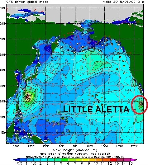
Here’s the hard part now- the models for the past week have been showing a major hurricane forming below Baja towards Monday the 2nd and headed towards us. The tricky part is that it hasn’t formed yet and a million things can happen before it explodes into Hurricane Fabio and sends us surf late Thursday into Saturday. If it does, the OC will see better surf towards Thursday while north SD won’t see much until Friday. Look for the OC to see head high surf Thursday, overhead surf Friday, and well overhead surf on Saturday morning (with the Wedge being 15’)? For north SD, look for maybe a couple fun waves late Thursday, head high waves Friday, and maybe an overhead set in far north San Diego County early Saturday. All of this could change of course- it could be a foot or so smaller/bigger depending how Fabio’s hair blows in the wind. Or at least how the wind blows- so make sure to keep up to date on the latest conditions at Twitter/North County Surf. 


As far as the southern hemisphere goes, forecast charts show a disorganized but large storm forming today which would shoot shoulder high sets our way for Saturday into Sunday next weekend. Looking to be a good summer so far…  

WEATHER:


Got low pressure above us today and tomorrow for breezy S winds and the clouds sticking at the beaches like an unwanted house guest. The low starts to exit the region on Sunday and we’ve got the normal night/morning low clouds/fog and sunny days at the beaches by lunch. No major changes are in the forecast for the next 5-6 days- hopefully high pressure builds slightly next weekend for warmer temps at the beach and less clouds- and maybe a stray cloud from Fabio depending on the size of the storm. 

BEST BET:
We’ve got a little surf the next few days but all eyes are on Fabio (never thought I’d say that in THE Surf Report). Next Friday/Saturday with head high Fabio or next Saturday/Sunday with shoulder high southern hemi swell.

NEWS OF THE WEEK:


Been a busy season for hurricanes already- and we’re just 1 week into summer! If you read THE Surf Report last month (and here too), you came across reports that we were going to have a busier than usual hurricane season. And so far the models have been right. We’ve had 5 named storms and 2 of them have been major hurricanes (Aletta and Bud. Bud if you’ll remember sent us surf but was overrun by that big southern hemi we had a few weeks ago). So where do we actually stand? Well, according to NOAA’s prediction:
  •      We should have an average of 17 tropical storms with a range of 14-20 (So far we’ve had 5 with the bulk of the season still 2 months away and Fabio coming down the road)
  •         An average of 9 hurricanes with a range of 7-12 (2 so far with Fabio coming)
  •         An average of 4 major hurricanes with a range of 3-6  (2 so far with Fabio coming)

In a nutshell, we’re looking pretty good so far. So what’s with all the early hurricane activity? As reported back in February, La Nina was on it’s way out and we were headed towards neutral or even El Nino conditions.  (La Nina being dry and colder water, El Nino being wetter and warmer water). The National Oceanic and Atmospheric Administration (NOAA) earlier this month has now upgraded us to an El Nino ‘watch’ meaning there is a 50% chance of El Niño developing during the late summer or early autumn, and an approximately 65% chance of El Niño conditions in the winter. I’ll let NOAA explain:

Before we get into the potential for El Niño, let’s talk about right now. We are in neutral, and forecasters expect that these conditions will play on through the summer. The surface temperature of the tropical Pacific Ocean is close to the long-term average in most areas, which was smack-dab on the average in the latest weekly measurement.


Another interesting thing is the prominent pattern of warmer-than-average surface temperatures north of the equator (which is fueling our busy hurricane season), and cooler-than-average waters south of the equator. This illustrates the strongly positive phase of the Pacific Meridional Mode… which I’ll get to in a minute.

The atmosphere is also looking pretty neutral; warmer-than-average waters tend to evaporate more water and warm the air above them, creating more rising motion and clouds than average. Cooler waters are the reverse, resulting in less cloud cover than average. During a La Niña event such as this past winter, we saw fewer clouds over the central Pacific.

Most of the models predict sea surface temperatures in the tropical Pacific will be more than 0.5°C warmer than the long-term average by this fall—i.e., above the threshold for El Niño conditions. Several statistical models, which make predictions by applying statistics to historical conditions, are also currently predicting sea surface temperatures in the El Niño realm by late fall. These models are often more conservative than the dynamical models, and the fact that both sets are largely in agreement is lending forecasters some confidence.


But wait, there’s more! The temperature of the water below the surface of the equatorial Pacific has been elevated since March and the May 2018 subsurface heat content is about the 6th highest since 1979.

We care about the subsurface because it can provide a supply of warm water to the surface. Thus, elevated subsurface temperatures are often an early indicator that El Niño is on the way.

The positive phase of the Pacific Meridional Mode (visible in the north-south warm-cool pattern from the sea surface temperature map above) can also be an early indicator that conditions are favorable for El Niño to develop. This pattern can encourage the trade winds (the near-surface east-to-west winds along the equator) in the central Pacific to relax. The trade winds ordinarily serve to cool the surface and keep warmer waters “piled up” in the far western Pacific.

Speaking of relaxing trade winds… as we go to press, the trade winds in the eastern tropical Pacific have weakened as a “westerly wind burst” is taking place. (The effect of the Pacific Meridional Mode is usually farther to the west, and attributing the cause of any particular wind burst can be a difficult chicken-and-egg problem.) This westerly wind burst could work to enhance warming conditions.


With all that said… it’s early yet. The winds along the equator are difficult to predict more than a week in advance, and as much as westerly wind bursts can help El Niño develop, so easterly wind bursts (when the trade winds strengthen) can discourage El Niño. Forecasters feel that current conditions are favorable for El Niño, so an El Niño Watch has been raised. In summary, we have warmer than average water temps where our hurricanes are forming and hopefully all signs will continue to point to an El Nino this fall as we need the rain and big winter surf!

PIC OF THE WEEK:


Reason #237,385 to move to New Zealand.

Keep Surfing,

Michael W. Glenn
Dignitary
NBA Free Agent
Meeting With Kelly and Elon About Building A Surf Ranch On Mars

Thursday, June 21, 2018

THE Surf Report- Early Edition


June Gloom has spited me.

SURF:
Just as soon as I declared June Gloom a distant memory, it reared it’s ugly head on Tuesday. As Death Valley hit 125 today, the beaches sat in a haze of low clouds and struggled to hit 65 degrees. I guess it’s better than a scorching 125 (there’s a reason the word ‘Death’ is part of the region’s name). Regardless, as the sun disappeared the latter part of this week, the surf did too. 


Fun, sunny, chest high+ SW early in the week was replaced by low clouds and waist high+ SW/NW. At least the N winds earlier in the week switched to the S. N winds as you know bring upwelling and cooler water temps; S winds pool the water into the Southern CA bight and warm up the water thankfully. We hit a high of 70 in the water last week, cooled slightly to 67 yesterday, but are on the rebound today and should hit 70 by Sunday again. Now that we have that out of the way, what’s the weekend forecast look like? 


Glad you asked; we had a small storm off Antarctica last week which has sent us a small but fun SW swell filling in tomorrow and peaking Saturday. 


There is also some small NW windswell to cross things up and we’ll have chest high surf for the weekend. Skies should also clear by lunchtime at the beaches for the weekend so it will be a good time to set up an umbrella, bring a couple boards down to the sand, and get groove on. 

Tides for the weekend are around 3.5’ in the mornings, down to 1.5’ at lunch, and up to 5.5’ at sunset.

FORECAST:


The weekend’s SW/NW back off early in the week for waist high surf but we have another slowly building reinforcement out of the SW on Wednesday for chest high sets and more NW on Thursday. The SW continues to build through the weekend for shoulder high sets towards the OC as the NW backs off next weekend. There’s also a small possibility of small tropical swell from Baja but the forecast models haven’t been too favorable with this system. So until then, enjoy the fun sized SW and NW swells.

WEATHER:


As mentioned above, I totally jinxed us by declaring June Gloom was dead. Sure, the beaches had a peak of sun here and there this week, but it wasn’t as nice as it’s been the past 2 months. Thankfully the joke me may be over as high pressure settles over the 4 Corners this weekend and the marine layer will shrink slightly- just enough for the sun to make an appearance by lunch. That looks to be the scenario most of next week too with temps in the low to mid-70’s. Sounds good to me. Make sure to keep up to date on the latest conditions at Twitter/North County Surf. 

BEST BET:
Fun combo swell this weekend, nice weather, and water temps near 70. Or late next week with a slightly bigger SW swell in the shoulder high range.

NEWS OF THE WEEK:


Ever heard of the Great Pacific garbage patch (also described as the Pacific trash vortex)? It’s a gyre of marine debris particles (i.e. trash) in the central North Pacific Ocean discovered in the mid-to-late 80’s. Well, it’s now bigger than it’s ever been, covering an area almost 1 million square miles above Hawaii. That’s up to 16 times larger than previous estimates had suggested, and its growth shows no signs of slowing. The patch, which is littered with tens of thousands of tons of floating garbage, is perhaps the most obvious reminder that mankind has truly messed up this planet. Thank goodness for Elon Musk and his plans for Mars!

The newest survey, which was conducted by The Ocean Cleanup Foundation, was authored by over a dozen international scientists and aided by countless volunteers and researchers attempting to capture the full scope of the crisis. It is now estimated that as many as 1.8 trillion pieces of plastic make up the patch, which is a colossal cleanup task that most nations seem satisfied to ignore.

Back in the 80’s, sailors came across chunks of free-floating chemical sludge, plastics, and other debris congregating in one particular area of the Pacific. Today, scientists know that the patch is the result of a combination of ocean currents that corral tons of manmade trash into a vortex of sorts. It covers an absolutely huge area, comparable to three times the size of France, or twice the size of Texas.


Contrary to what many believe, the patch isn’t a garbage island, but rather a massive area of the Pacific that has an incredibly high plastic density. Plastic trash which has broken up over time turns into smaller chunks that now fill the patch. Discarded fishing nets, bottles, and buckets, and countless unidentifiable plastic chunks have been pushed into this one area, and it’s a death sentence for many marine animals and aquatic birds.

According to the researchers, up to 46% of the trash is the byproduct of the fishing industry, with many nets and crates littering the patch and breaking down into smaller chunks over time. Eventually, all the larger pieces of plastic will become microplastics which are deadly to fish and other marine life. And it’s not just about protecting the ocean ecosystem, as many contaminated fish are often caught and end up on dinner tables. Unless you like your fish sandwich with a side of invisible plastic particles, this is something we all need to be paying attention to.

BEST OF THE BLOG:


If you’re a surfer and love your community, you need to be part of the North County Board Meeting! As I’ve mentioned in THE Surf Report in the past, the goals of the group are:
  •         promote local businesses
  •         grow your network
  •      support charities
  •          and find an excuse to surf!

If you’d like to get involved, our next event is our world famous Surf Meeting, happening tomorrow morning (Friday), June 22nd from 7-9 AM. Come down to Seaside to catch a wave before work, grab some breakfast, network, learn about our community involvement, and just start the weekend right. Look for the green tent and the demo boards from SUPERbrand and INT! For more info on the group, visit our website here, check us out on LinkedIn , or follow us on that Twitter thing. 


And speaking of SUPERbrand (long-time supporters of the North County Board Meeting), they are offering 25% off apparel at their website! Make sure to use promo code NORTHCOUNTYSURF25. Now that the water’s warm, there’s no excuse not to get a pair of new boardies for the summer. Or replace that ratty Van Halen t-shirt of yours. This sale won’t last long- it expires June 30th- so get on it ASAP! Thanks to the crew at SUPERbrand for the killer apparel offer to get our summer kickstarted!  

PIC OF THE WEEK:


Reason #237,384 to move to New Zealand.

Keep Surfing,

Michael W. Glenn
Dapper
Quit My Job To Play Fortnite 24/7
Found A Wave That’s Twice As Good Padang Padang So I Named It Padang Padang Padang Padang

Thursday, June 14, 2018

THE Surf Report- Early Edition


Good as it gets?

SURF:


Our last week of surf may have been as good as it gets around here. Before you scoff and call me an ol’ timer, tell me when (in recent memory- don’t tell me how big ’69 was, or about the epic El Nino of ‘82/’83, or how you charged the Wedge during Hurricane Marie in ‘14) in which we had solid SW swell, a good NW windswell to cross it up, sunny skies, manageable winds, water temps hovering around 70, AND the tourists from Arizona hadn’t clogged the line up yet. Hard to recall, huh? Today the SW/NW swells are all but gone but we still had a couple chest high waves in far north SD and the OC. For tomorrow and Saturday, it’s looking small with just waist high SW/NW but at least the water will be nice.


By late Sunday we start to see a new but smaller SW arrive for chest high sets.


Tides will be -1’ at sunrise, up to 4’ mid-day, and down slightly to 3’ at sunset. 

FORECAST:
The SW swell mentioned above will fill in more on Monday for shoulder high sets towards the OC and peak Tuesday morning.


Charts are also showing a late season W swell arriving about the same time too. Nothing big but SD may see chest high surf from it. If so, combo spots may be fun with the W/SW mixture. After that the Pacific takes a breather and there’s not much on tap the 2nd half of next week.


Models then show a small storm forming in the southeast Pacific (in the corner of Chile and Antarctica) flaring up which could give us a steep angled S swell (not ideal for us) around the 22nd. Look for chest high sets off of that one.


And further out, models show a bigger storm off New Zealand which may give us overhead surf again from the SW towards the 28th. Still a long ways out but it could be similar sized to what we just had. And there may be more activity after that to start July off right.

WEATHER:


We’ve had pretty good weather this spring as May Gray/June Gloom haven’t been a problem (more on that below in the NEWS OF THE WEEK). Sure we’ve had night/morning low clouds/fog- but most days they’ve cleared out by noon and we’ve had great beach weather. We’ve got a low pressure off our coast for the weekend which will make our low clouds/fog linger a little longer down here, but we should see at least a little sun at the beaches by late afternoon. Not ideal- but at least it won’t be socked in with drizzle. This low pressure is also pulling remnant tropical moisture from former hurricanes Aletta and Bud- so if you’re headed to the desert this weekend- you may see a stray weak thunderstorm. Next week high pressure returns for more sun and slightly warmer temperatures. Make sure to keep up to date on the latest conditions at Twitter/North County Surf. 

BEST BET:
Fun combo swell late Monday into Tuesday, nice weather, and water temps near 70!

NEWS OF THE WEEK:


If you’ve read THE Surf Report over the years, you know I’m not a big fan of fog. How many times have you been driving around town, it’s hot as heck, and you think to yourself “What a great day- I’m going to run down the beach for a quick surf”… only to pull up and see the coast is socked in with fog, it’s cold, and drizzly. Not cool. I like it either sunny or stormy- nothing in between. Well, careful what you wish for. The ‘dreaded’ May Gray and June Gloom seem to be disappearing according to multiple reports lately. Here’s what they had to say:

It’s not just climate change that’s intensifying warming in Southern California. As our cities become more populous and denser with buildings, vehicles, and roads, they capture and reflect more of the sun’s heat, and that heat is increasingly dissipating the morning fog and low clouds that shade coastal Southern California in the summer. A scientific study released last week revealed that clouds in coastal areas have “declined significantly” since the 1970s in the most urbanized areas.

“Cloud cover is plummeting in southern coastal California,” said Park Williams, a climatologist and former graduate student and researcher at UC Santa Barbara. “And as the clouds decrease, that increases the chances of bigger and more intense fires.”

Eric Boldt, a meteorologist for the National Weather Service station in Oxnard, said that the findings made a lot of sense, based on his years of experience observing weather in Southern California. “I fully think this is accurate,” he said. “If you heat up the land, you’re going to burn off clouds sooner in the morning.”

Boldt said it was plausible that population growth and development of Southern California since the 1970s led to an intensification of what scientists call the “heat island effect.” “I looked up some numbers on population growth in Southern California,” he said. “Los Angeles County went from about 7 million people in 1970, to about 10 million today. With all those people coming in, and a lot of them moving out towards the ocean, you’re going to have more houses and buildings and freeways reflecting heat.”


The study, which was published last week in the Geophysical Research Letters journal, found that with less cloud cover in summer, plants lost a higher percentage of their moisture to the atmosphere, making them more likely to burn if exposed to fire. Williams stressed that summer cloud cover is a less important factor for fires than Santa Ana winds or the timing of rains in the fall and winter, but he said that about 40 percent of wildfires in the region occur from May through September.

As an example of such a summer fire, Boldt pointed to the Springs Fire in the Camarillo area, which in 2013 burned over 25,000 acres in a little more than a day. “Usually in May we have low clouds and sometimes a little drizzle, but in that case we had a Santa Ana [wind] condition, and a major wildfire that burned all the way from Highway 101 to the ocean,” he said.

Williams and a team of researchers, using cloud measurements taken every fifteen minutes from airports throughout Southern California, found statistically significant decreases in cloud cover at 21 out of 22 airports, with overall decreases of 56 percent in cloud frequency in Burbank and 46 percent at the Santa Monica Airport.

The impact of the heat island effect has not been as marked in Santa Barbara as in Los Angeles and San Diego, Williams said. “Santa Barbara hasn’t been urbanized enough to have as great an impact,” he said. “There is a slight decrease in cloud formation, but the urban heat island effect hasn’t been strong enough to overcome the forces of natural climate variability. By contrast in Los Angeles, somebody going about their lives could have noticed in recent years clouds burning off earlier in the day, such that there is about one extra hour of clear sky conditions.”

So is my wish of great beach weather at the expense of increased wildfires? I sure hope not.

PIC OF THE WEEK:

So there’s been some heated rhetoric between Canada and the US lately which is a shame, because with set ups like this in the Great White North, why can’t we just all get along? Don’t want these points to go to waste…

Keep Surfing,

Michael W. Glenn
Phenomenal
Lover, Not A Fighter
I Guess I’m Some Kind Of Surf Star In Japan

Thursday, June 7, 2018

THE Surf Report- Early Edition


June Gloom? I'll believe it when I see it.

SURF:
Been an odd start to the year. No real surf from January to April, then not much May Gray/June Gloom so far. Not that I'm complaining as fog is my nemesis. I either like it sunny or stormy. Nothing in-between. On that note, we've got sun and surf this weekend! 


Been fun this past week and it's getting better. First up is fun chest high SW/NW the past few days and the water has warmed up to 67 in San Diego. Not exactly El Nino water temps- but we're getting close. As far as the surf this weekend goes, the stars are aligning. You must have been good lately (or lucky). We've got leftover waist to chest high SW on Friday into Saturday and a new NW ground/windswell filling in on Saturday. Best combo spots on Saturday will be shoulder high. Then the fun starts: 


We had a solid storm off Antarctica last week send us SW groundswell for Sunday. Look for overhead surf towards north county San Diego into the OC. 


As luck would have it, we also have a small category 1 hurricane off mainland Mexico this afternoon (Aletta) which will give us more S swell on Sunday. Unfortunately the hurricane swell is a waste as the bigger SW swell will override it. If anything, it will just make our surf more consistent. 


Tides this weekend are 3.5' at sunrise, down to 1' at lunch, and back up to 5.5' at sunset. 

FORECAST:
After the SW swell peaks on Sunday, we still have good head high sets on Monday. For Tuesday, the SW swell won't die and we've got shoulder high sets. By Wednesday it's a shell of it's former self and we're left with chest high surf. Next weekend looks small with just background waist high+ SW/NW. There's been some activity off Antarctica the past few days but nothing solid.


We should get another shot of chest high SW swell around Monday the 18th and shoulder high sets around Wednesday the 22nd. All the while small NW windswell fills in off and on the next week or so. And there's always the possibility of a hurricane flaring up between now and then. 

WEATHER:


Great weather on tap the next week with the only fly in the ointment being Sunday. Basically high pressure is keeping the low clouds/fog to a minimum and we've got great beach weather. Look for temps around 75 and WNW winds about 10 mph+ in the afternoons. There's a weak cold front passing by the N on Sunday that may make the clouds linger at the beaches a little longer but nice weather returns for most of next week. Make sure to keep up to date on the latest conditions at Twitter/North County Surf. 

BEST BET:
Sunday with solid SW or if you don't like weekend crowds, Monday will be good with slightly smaller surf and sunnier skies. 
 
NEWS OF THE WEEK:


We live in a pretty idyllic place here in southern California. While there's always the threat of earthquakes, we tend to spare the wrath of Mother Nature unlike other locations around the US; volcanic eruptions in Hawaii, hurricanes in Florida, and Nor'Easters in, well, you know, the North East. But most everywhere across America has some sort of natural disaster we need to be ready for. In just the last 16 years alone, parts of Louisiana have been struck by six hurricanes, San Diego have been devastated by three particularly vicious wildfire seasons, and a town in eastern Kentucky has been pummeled by at least nine storms severe enough to warrant federal assistance. The New York Times this week did an article detailing the disasters we've gone through recently and it's eye opening. Here's what they had to say:

Louisiana, San Diego, and Kentucky are just a small fraction of the United States that has sustained most of the damage from major natural disasters, forming a pattern of destruction concentrated in particular areas. About 90 percent of the total losses across the United States occurred in ZIP codes that contain less than 20 percent of the population, according to an analysis of data from the Small Business Administration.


The federal government, through disaster relief programs and flood insurance, subsidizes the cost of rebuilding in areas hit repeatedly by storms, floods and fires. Critics say that encourages too much development in those regions, wasting tens of billions of dollars in tax money and endangering lives. Christina DeConcini, the director of government affairs at the World Resources Institute, said that federal programs do not adequately emphasize adapting to the risks posed by climate change. She said that instead of just being responsive, the government should stress building for resilience against disasters.

Some residents continue living in disaster-stricken areas because they cannot afford to leave. Others rebuff appeals to resettle, citing deep family ties or a sense of fatalism. Rather than move the town, “it’s easier to throw your hands up and say, ‘Forget it,’” said Linda Lowe, the president of a historical society in flood-prone Olive Hill, Ky. “Abandoning a location and moving a city makes sense from a scientific, risk point of view, but the fact is that to get to a place culturally and psychologically where that conversation can be tolerated is a difficult thing to imagine,” said Dr. Irwin Redlener, the director of the National Center for Disaster Preparedness at Columbia University. “It’s not all that rational — but I guess a lot of these things are not really rational.”


As hurricane season begins, residents of Slidell, La., near New Orleans, are planning ahead. Susan McClamroch, who works at a museum there, said that locals joke that they “start eating everything in the freezer” this time of year because of the likelihood of a power failure after a hurricane. Brian Smith, who runs a print shop in Slidell, said the business flooded in 1995 and again during Hurricane Katrina in 2005. So when Hurricane Isaac hit in 2012, flooding his shop once more, he moved it away from the vulnerable downtown area. “I’m not going to take that chance again,” Mr. Smith said.

Eastern Kentucky is similarly susceptible to disaster. Almost yearly, it is hit with severe storms. Susan Thomas, who owns a bookstore and coffee shop in Morehead, Ky., said that the store flooded once when her parents owned it. When it flooded again in 2010, she had to throw away 3,000 books. “Honestly, there was a moment where I was, like, can we recover from this?” she said, adding that she returned to check on the store every time it rained. The business moved to a new location in town the next year.

Three Brothers Bakery in Houston has flooded five times since 2001, most recently during Hurricane Harvey. But its owners, Robert and Janice Jucker, the self-proclaimed “king and queen of disaster,” are not moving — and Ms. Jucker, who anticipates more storms, is unafraid. The Juckers received low-interest disaster loans from the Small Business Administration to rebuild their business after Hurricanes Ike and Harvey. Officials verified the damage and estimated the amount of their property loss.


The agency tracks properties nationwide whose owners or renters applied for disaster loans. Data about these loans provide a window into the geographic pattern of destruction that disasters cause each year. The National Oceanic and Atmospheric Administration attempts to calculate the full cost of major disasters, namely those that cause more than a billion dollars in damages. They estimate that 2017 was the costliest year on record, with 16 billion-dollar disasters that together cost the United States more than $300 billion. "While natural disasters are unpredictable, the annual losses from billion-dollar disasters, adjusted for inflation, have increased over the last 40 years. In the first three months of 2018, billion-dollar storms hit the United States three times. In the first three months of an average year, one disaster that causes more than a billion dollars in damages occurs, according to National Oceanic and Atmospheric Administration records dating back to 1980.

Climate change is making some kinds of disasters more frequent. Studies show that large wildfires have become more common in the western United States because global warming has made Western forests drier. But rising damage costs are partly because of demographic shifts and development decisions that make natural disasters more destructive.

Phil Klotzbach, an atmospheric scientist at Colorado State University, said that the rise in population and wealth near the coast was contributing to most of the increase in destruction caused by hurricanes. In the last century, there has been no clear trend in the frequency of hurricanes that made landfall in the continental United States Over the same period, the number of buildings has ballooned in parts of the country susceptible to tropical storms as the population in those places has also increased. In 2016, there were more than 3.6 times as many homes in states that border the Gulf of Mexico and the Atlantic Ocean as in 1940, according to the Census Bureau.


The effects of global warming on individual storms have been difficult to determine, scientists say, because there are only about a dozen observed even in an active season. But scientists also contend that climate change is expected to lead to stronger, wetter hurricanes over all. It has also made them more destructive, Dr. Klotzbach said. Because global sea levels have risen, hurricanes create storm surges that go further inland, flooding homes and businesses. “You can build your house to withstand pretty much any wind, but the surge is what will get you,” he said. Only about 4 percent of all hurricanes that make landfall globally hit the United States, said Robert Mendelsohn, an economist at Yale University who studies the damage caused by hurricanes. Yet 60 percent of worldwide damage from hurricanes happens in the United States. Dr. Mendelsohn attributed this partly to federal government programs that discourage citizens and local governments from building walls to protect housing near the coast. Only in the United States do relief programs and subsidized insurance make it attractive for people to move toward disaster-prone areas, he said.

PIC OF THE WEEK:


As the SW swells move up the Pacific from Antarctica, they hit South America first, then Central America, then points in Mainland Mexico like this one. With the solid SW swell headed our way for Sunday, what do you think this point looked like today? I could only imagine. For more 'imaginary' pics, check out Bryce Lowe-White's work here.

Keep Surfing,

Michael W. Glenn
Intuitive
Under Promise, Over Deliver
First Person To Surf a Chubasco, Typhoon, Willy-willy, Cyclone, and Hurricane In The Same Year