Happy July 4'!
SURF:

Fun SSW in the OC this past week (and not much in SD) is transitioning to SW/NW this weekend for more waves most everywhere.

We had new SW fill in today for 4' sets in northern SD while a touch of NW windswell helped break things up. For Friday, look for the SW to peak in the AM while the NW continues. Most spots are chest high with best combo spots hitting shoulder high. The SW starts to back off Saturday but there's still plenty of small but fun NW for mainly chest high surf. For the 4th, both swells will be on their way out but best spots will still be waist high with chest high surf. And to sweeten the deal, water temps have rebounded to 70! And here's the tides, sun, and water temps for the next few days:
- Sunrise and sunset:
- 5:45 AM sunrise
- 8:00 PM sunset

- Water temps went on a wild ride the past 10 days; from low 70's, to low 60's, and back to low 70's. Shouldn't see any strong NW the next few days so water temps should be nice through at least the holiday weekend.

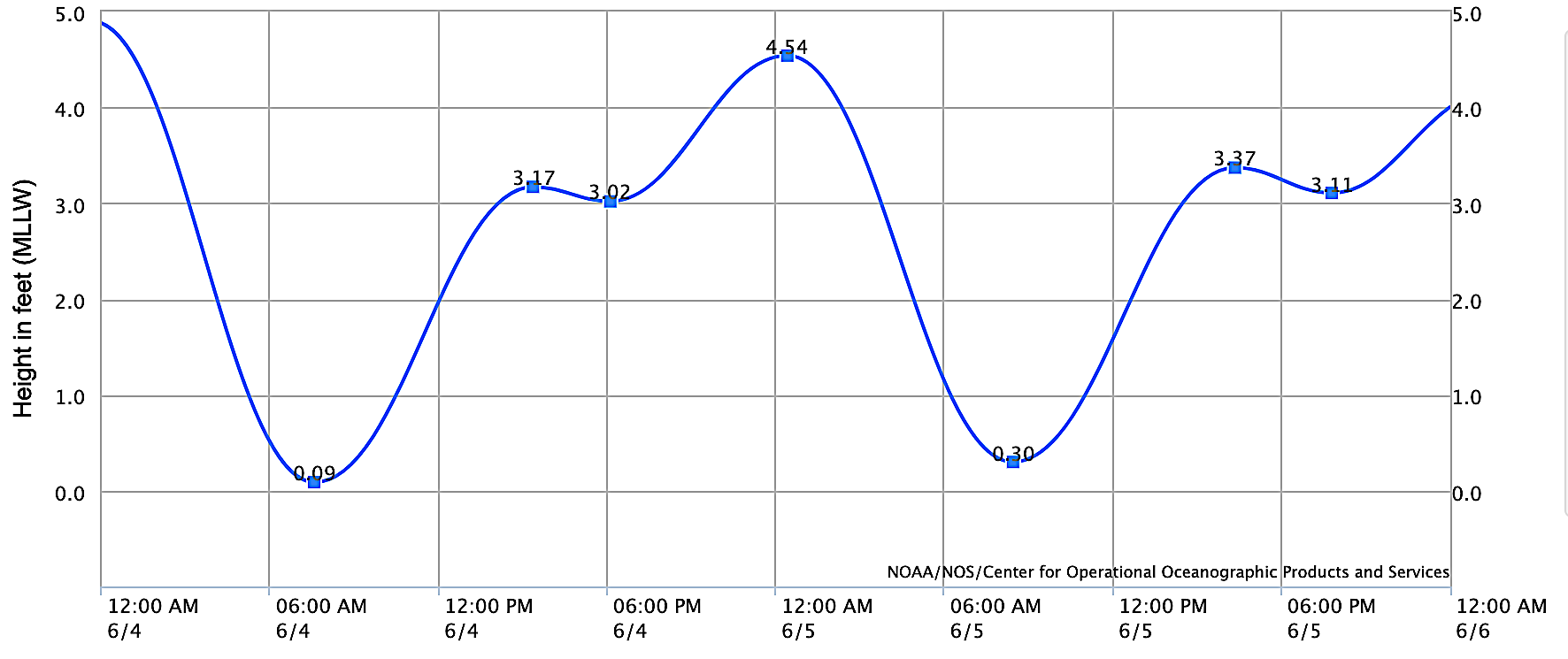
- And tides are nothing unusual this weekend:
- 0' at sunrise
- 3.5' after lunch
- 2.5' at dinner
- and almost 4' at sunset
FORECAST:
After the holiday weekend, things get quiet around here.

No swells of interest in the Pacific will result in waves under waist high through the week.

Models are showing MAYBE a small hurricane forming towards the end of the week which MAYBE could give us a small S swell around the 10th (remember- we're dealing with La Nina here).

Further out, the southern hemisphere should come to life again and we may see chest high surf around 12th and shoulder high waves about the 14th. So until then, please remain calm.
WEATHER:

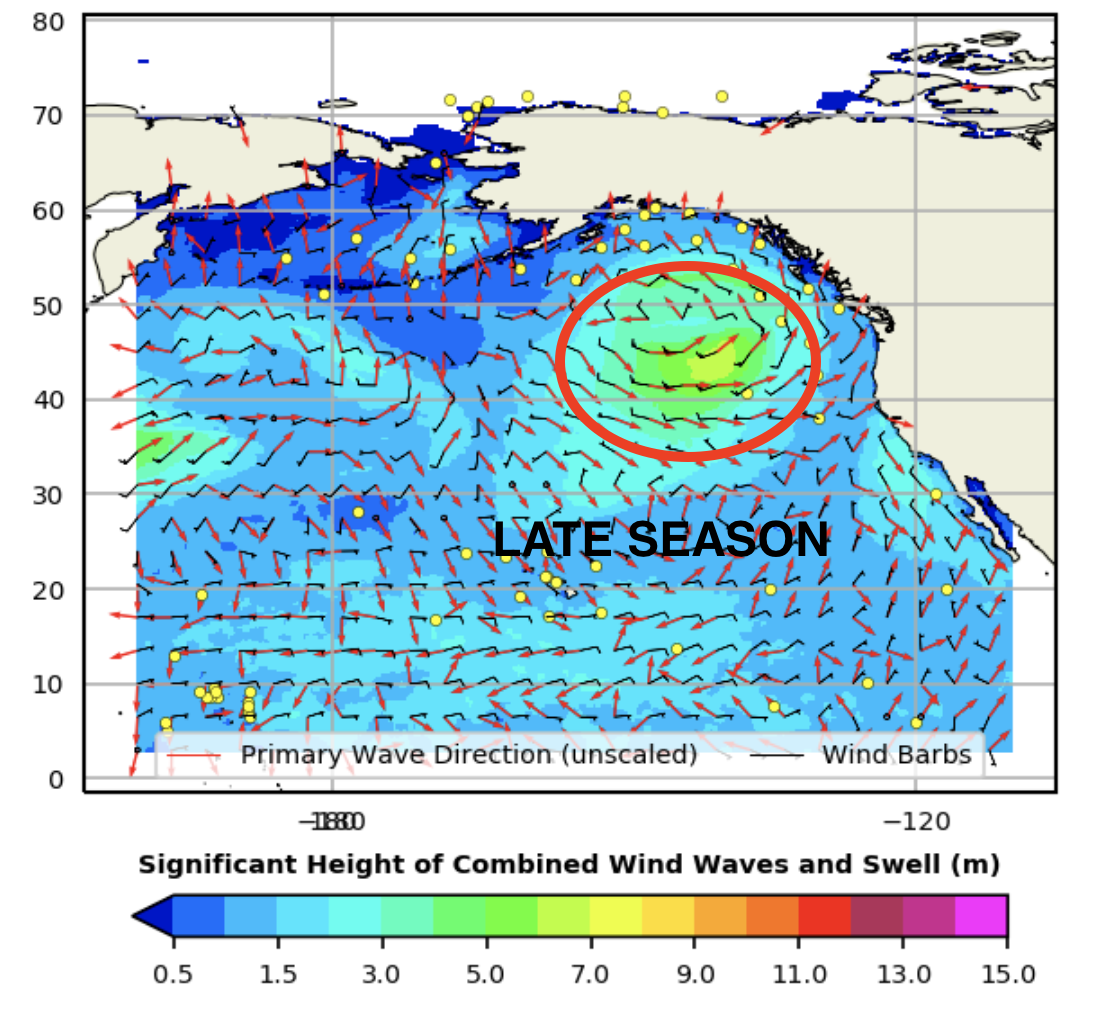
We've got some late season cold fronts moving through the Pacific NW this weekend (sorry Seattle) which will give us a little more low clouds/fog in the nights/mornings. We still should see some sun at the beaches this holiday weekend but it may not be until late afternoon. Look for air temps to be in the mid-70's. High pressure should build back towards the middle of next week for more sun and warmer temps by next weekend- and maybe a return of monsoon moisture towards the mountains/deserts. If anything changes between now and then, make sure to follow North County Surf on Twitter!
BEST BET:
Friday/Saturday with great weather, warm water temps, and fun SW/NW.
NEWS OF THE WEEK:

I can't put my finger on it, but I'm pretty sure something important happened in America this July 4th weekend. OH WAIT- I REMEMBER... THIS WEEKEND IN WEATHER HISTORY!
June 30th through July 3rd:
- 1985: A strong ridge of high pressure settled over the western U.S., bringing summer heat all the way to the coast. The heat wave started on 6/30, ended on 7/3 and broke numerous high temperature records. On this day, the afternoon high in San Diego was 94°, the fifth highest July temperature on record. Santa Ana topped out at 100° (hot, but a noticeable decrease from the prior day’s 110°). Other impressive area temperatures on this day included 113° at El Capitan Dam, 106° at Miramar and 105° in El Cajon.
- 1979: It was 54° in Palm Springs, the lowest temperature on record for July. This also occurred on 7/3/1935.
- 2001: A microburst hit Hesperia, creating a wall of sand and dust and a moaning sound. A radio tower was toppled and other property was damaged, including a roof being blown off.
- 1935: It was 54° in Palm Springs, the lowest temperature on record for July. This also occurred on 7/2/1979.

- 2014: Thunderstorms erupted in the Inland Empire, San Bernardino Mountains, and the High Desert. Flash flooding closed roads in the High Desert along I-15. A swift water rescue occurred in Yucaipa. Thunderstorm wind gusts estimated at 56 mph hit Yucaipa, collapsing one roof and damaging another.
July 2nd through 6th:
- 2007: A major heat wave struck the mountains and deserts from 7/2 to 7/6. A strong persistent marine layer precluded the heat wave from impacting the coasts and valleys. During this time the temperature reached 119° in Ocotillo Wells, 116° in Palm Springs and Indio, 115° in Anza Borrego, 107° in Julian, 103° at Lake Cuyamaca, 100° at Idyllwild, 97° at Palomar Mountain, 94° at Big Bear Lake (tied all time high) and Mt. Laguna. Some heat illnesses occurred.
- 1989: It was hot as a firecracker this 4th of July in Dulzura to the tune of 115°.
- 1957: It was 110° in Escondido, the second highest temperature on record for July.
PIC OF THE WEEK:

So I have this recurring dream where I win the lottery, buy 20 acres in Rancho Santa Fe, build this slabbing wavepool, and I throw a rager with Billy Squier going mental until the wee hours of the morning. I think I need to layoff the Mountain Dews before I go to bed.
Keep Surfing,
Michael W. Glenn
Simple Yet Complicated
Just Signed A Max Deal With The Lakers
Made The 85' Spur Steak Ranch Surfabout Final At 12' Outer Kom
Michael W. Glenn
Simple Yet Complicated
Just Signed A Max Deal With The Lakers
Made The 85' Spur Steak Ranch Surfabout Final At 12' Outer Kom