Tuesday, April 30, 2013

Surf Check

We got surf! Finally. Man was this weekend a bummer. The predicted sun never came out and to make it worse, the surf sucked. Luckily for us the surf is getting better today, even though the 'June Gloom' is still hanging around.
Today we have a building small NW windswell that was generated by a weak cold front yesterday (and hence our ugly cold beach weather today) and also a building S swell generated by a storm off Antarctica last week.
The NW windswell will peak tonight and tomorrow morning should have some waist high sets- with a couple better waves in SD. The S that was generated last week though is still building today and best spots in far north county have head high sets and the OC is overhead.

Water temps are a pleasant 63 degrees and tides the next few days are about 1' at sunrise, dropping to -1' mid-morning, back up to 4' mid-afternoon, and settling at 2' at sunset. The S continues to build tomorrow and most spots around town will have inconsistent overhead sets with the OC a couple feet overhead. Tomorrow should be the day as the combo swells will make for some fun peaks at the beachbreaks.
As advertised above though, the weather stinks as a weak cold front has kicked up the low clouds and the wind this afternoon is blowing SW at 10. The weather cleans up tomorrow and we should have sunny skies and temps in the high 60's finally. High pressure continues to build this week and forecast charts show the beaches hitting the low 80's by Friday.
Unfortunately our small NW windswell will be gone by the weekend and the S will have passed it's peak. Maybe some chest high sets though for the OC but by the Saturday it's pretty small around here.
Next week is looking small too as there just isn't much activity on the models from either the S or the N. Looks like though a storm may flare up again off New Zealand around the 7th of May which would give us surf around mid-May. So until then, enjoy the good surf and weather the next couple days!


Friday, April 26, 2013

THE Surf Report


Spring is soooooo predictable.

SURF:
That was a pretty fun S swell  this week. The weather finally cooperated and far north county SD and the OC had overhead sets. Life is good.
Today we only have leftover S swell for waist high+ sets around town and the OC has some chest high sets. There's no NW in the water unfortunately so it's pretty walled at the beachbreaks. Saturday looks pretty small around here but we do have great beach weather lining up (more on that below). By late Sunday we should see a little bump from the NW windswell (mainly in SD) and we get a new small SW building late Sunday (mainly in the OC). All in all some great weather this weekend but not much surf- unless you want to wait for a little waves late Sunday.
Tides the next few days are 0' at sunrise, up to 4' at 11am, down to 1' at 4pm, and up to 4' again at sunset. Water temps are finally feeling like spring with 62 degree readings around southern California. Make sure to keep up to date on the waves/weather at Twitter/North County Surf.

FORECAST:

After a slow weekend of surf, things start to kick into gear Monday as the NW windswell continues to build and the SW starts to send some good sets our way in the afternoon. By Tuesday it should be pretty darn good as the SW is hitting it's stride and the NW windswell continues to build. Sets most everywhere will be head high+ and best S facing spots will be overhead.
By Wednesday the SW has peaked and the NW windswell will be peaking too. Unfortunately (here it comes) we have a weak cold front coming through on Monday/Tuesday so the low clouds may stick around at the beaches and we'll have some SW wind. Isn't that just Murphy's Law?!
After that, there's another storm trying to form under Australia/NZ that may get into our window. If it holds, we may get more SW towards next Sunday.

WEATHER:

Looks like we have a great weekend setting up (sans the surf of course). High pressure is setting up today and we should have minimal low clouds/fog this weekend and sunny days at the beaches. Air temps should hit 70. There's yet another weak low pressure system moving through northern California early next week and it will deepen our low clouds/fog down here Monday and Tuesday. Should bring a little SW wind with it too. After that, high pressure sets up again and the 2nd half of next week should be sunny with temps in the low 70's. Again. Sounds good.

BEST BET:
Should be good surf late Monday into Wednesday from both the NW and SW directions but Wednesday may be the day with the weather finally clearing up.

NEWS OF THE WEEK:

Had a good S swell earlier this week thanks to a fairly strong storm that set up shop off South America; directly beneath us. The result was a swell that looked like it came from a hurricane off Baja- a unique angle that was almost moving sideways up the beach with really long lefts. The only difference was that the interval was a lot longer due to it’s southern hemisphere origins. So it got me thinking… when are we due for some hurricane surf? And can you believe it- the Eastern Pacific Hurricane season starts in 3 weeks. Yes, hard to believe May 15th is the official start date by the National Hurricane Center. But if you have an El Nino year- like 2012 was shaping up to be- they can start fairly early. Case in point- our water in the Eastern Pacific was fairly warm last year so it was no problem for tropical storms to start forming early.

Tropical Storm Aletta actually formed a day before the official start to the season- May 14th- and peaked with 50mph winds. Right on its heels was a big Category 3 Hurricane named Bud that started May 20th and peaked with 115mph winds. Amazing to think that in just a few weeks we could actually get hurricane surf around here. What the heck happened to winter?! In all honesty though, we’re in a neutral pattern right now (no warm El Nino and no cold La Nina) so there’s not much of a chance of the water warming up abnormally fast down there. I don’t expect a hurricane swell until at least early June. But what about the rest of the season if we’re only expected to have normal water temperatures? Glad you asked.

In a normal year, we usually get 15 named storms of which about ½ turn into hurricanes. BUT… those hurricanes have to be aimed towards us to give us swell (i.e moving N towards California instead of W towards Hawaii). So maybe we’ll get 4 little tropical storms aimed our way to give us surf (namely Orange County) and 4 hurricanes will give San Diego and Orange County some waves. And there’s roughly 3 storms in a normal year which are Category 3 or stronger (115mph+) so San Diego may see 1 of those aimed our way and Orange County may get a couple in a normal year. Long story short, I expect SD to see 3-4 good swells with 1 of those firing and the OC to pick up a couple more little tropical swells. The National Hurricane Center will have their ‘official’ forecast for the upcoming Eastern Pacific Hurricane season towards the end of May so may sure to check back on the North County Surf blog for the latest updates.

BEST OF THE BLOG:

Seems as though I was asleep on the blog, err, job lately. There's been a lot of construction going on recently at the former Ecke property on Saxony Blvd. just north of the YMCA. I thought all was quiet on the western front and they weren't going to build houses on that 100+ acre property. Well was I wrong. 69 new homes are being built on 20 of the acres Check out the full story on the North County Surf Blog as well as a mid-week Surf Check AND an in-depth THE Surf Report. All of that and more in the blog below!  

PIC OF THE WEEK:

I went to Ireland back in the late 90's and the surf industry consisted of 1 shop in Lahinch and more sheep on the beach then surfers. Today Ireland boasts surf clubs, hellmen tackling cold water slabs, and- wait for it- a pro surfer on the ASP's World Championship Tour (Glenn 'Micro' Hall for those of you more interested in the NBA and NFL). Seems hard to believe that with waves like today's Pic of The Week, it took so long for the surf scene to explode over there.

Keep Surfing,

Michael W. Glenn
Auto Pilot
Prior Hamburglar Conviction
President Margo Oberg Fan Club

Thursday, April 25, 2013

North County Business News: Shea Homes On Saxony

Well, well, well. Seems as though I've been asleep at the wheel. Back in August 2011, the North County Surf blog reported that Ecke's development arm, Caltras, was trying to sell off one of their last parcels of land to developers. It was the very visible and desirable 68 acres off Saxony Avenue between Leucadia Blvd. and Encinitas Blvd (i.e. down the street from the YMCA). The last few years the property has been falling apart (see above) and was due for a makeover anyway. Caltras had a deal with the city that if they built the Encinitas Ranch homes and golf course, they wouldn't develop this last parcel of land. Then Caltras had a change of heart a few years ago and tried to pass Prop A to make more homes. That didn't fly with the community of course so then they had a plan to sell off little chunks to developers instead of the entire parcel. That didn't fly either. Then recently the Leichtag Jewish Foundation had a good idea to buy the land and put in a cultural center, turn some of the land into self sustaining agriculture, and even donate some land to Quail Gardens.
What I didn't realize in this feel good story is that Shea Homes somehow got a hold of 20 acres from Caltras and is developing 69 single family homes on the north end of the property (on the corner of Puebla St. and Saxony).
This new development will be called 'Alta'. Shea hasn't publicized these homes yet as they are just now grading the land and no need to get everyone all worked up before the model homes are built. Shea has been quite busy in Encinitas lately with another big development on the north end of Vulcan Ave. in Leucadia and a smaller one tucked away towards the northwest corner of town (walking distance to Ponto) called 'Seaside'.
Now my take is this- since the property was already falling apart, something needed to be done before the vermin take over. Best case scenario: Build a park. It's already too late for that but the Leichtag Foundation will make good use of their parcel- especially with the nice offer to Quail Gardens. So we have that going for us. The other option then is to make some beautiful homes- well landscaped might I add- so it adds value to the community. Hopefully Shea will keep up their end of the bargain. And since Shea has been pumping money into the community lately with their 3 newest developments, I'll give them the benefit of the doubt.
Judging by the speed of which they're working, I'm assuming they'll have a model home by the fall and probably move-in ready by early 2014. And if these turn out to be 10k square foot lots, I'm guessing they'll sell for the low millions/high 900's. Keep up to date on the latest developments with the North County Surf blog as the completion nears.


Tuesday, April 23, 2013

Surf Check


Had some small NW and S over the weekend and today we're starting to see signs of our new S swell show up on our beaches.
We've got clean conditions this morning and the new extreme angled S in the water. Spots around town have chest high sets and as you get towards the OC you'll find some head high sets. There's also a tiny NW in the water but it's not doing much to peak up the surf. Best bet is to hit a pier, jetty, reef or point to find some shape. Looks like the S will peak tomorrow with shoulder high sets in north county SD and overhead sets in the OC. Sorry SD- not much surf for you the next few days.
 
Tides the next few days will be about 3' at sunrise, hitting 4' at 9am, dropping to 0' mid afternoon, then up to 5' at sunset. Water temps are holding at 60.
Not much in the weather department for the upcoming week. We have a weak front coming through tomorrow afternoon that MAY give us a shot at showers or maybe even a little thunderstorm but don't hold your breath. After that moves through, we've got weak high pressure setting up for nice weather and beach temps in the 70's. By Sunday there's another weak little cold front coming through and it will give us more low clouds and fog. Nothing exciting- typical spring around here.
As far as the surf goes the next few days, the S swell mentioned above will die out by Friday and there won't be much surf unfortunately for the weekend. Nice weather though. When that weak cold front comes through on Sunday it should kick up a little chest high NW windswell for SD.
As far as the southern hemisphere goes, we had a good storm start spinning down there a couple days ago and we should see some new shoulder high+ SW swell towards next Monday the 28th and peaking on the 29th. Until then, enjoy the S tomorrow and small clean conditions this weekend!


Friday, April 19, 2013

THE Surf Report


Summer in April.

SURF:
Great weather today but not much surf. We have some little SW groundswell and NW windswell for waist high waves around town. Still worth it to paddle out and get wet on such a fine day. Tomorrow we get a little SW pulse from a storm that formed last week off South America and the OC will see some chest high+ sets.
But fear not SD- we have some NW windswell building again that will peak Sunday for shoulder high sets in far south SD. Here in north county SD we'll have a little sample of both swells for peaky chest high waves at the beachbreaks. Sounds good to me. All in all some little waves to ride this weekend and nice weather once the fog burns off in the mornings- more on that below.
Tides the next few days are 3' at sunrise, 0' at lunch, and up to 4' at sunset. Water temps are holding at 59. Make sure to keep up to date on the waves/weather at Twitter/North County Surf.

FORECAST:

After the little SW this weekend, we'll get a slightly better SW on Tuesday that will make shoulder high sets in far north county SD and the OC. We'll also have some leftover NW windswell. The 2nd half of the week looks to have some background SW swell for chest high sets in far north SD and the OC again.
No NW unfortunately for SD.
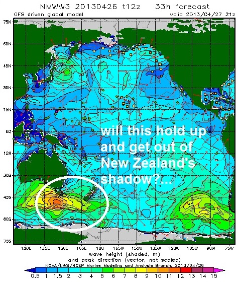
After that, there's a good storm on the charts that should send a solid SW swell towards the 29th of April- make sure to keep up to date on it's progress on the North County Surf blog!

WEATHER:

Of course when the 1st day of summer rolls around, it won't be as nice as today. Gotta love June Gloom! So enjoy the summer like weather today while you can. Looks like we'll peak around 80 today at the beaches and then high pressure starts to break down slightly this weekend. No big deal- just some fog at the beaches tomorrow that will burn off in the afternoons. Saturday should have temps in the mid-70's once the early fog is gone and Sunday will be 70. Early next week looks to be the same- low clouds and fog in the mornings with temps in the mid 60's. Models hint at a low pressure system coming our way towards next weekend but to predict showers that far out would be blasphemy.

BEST BET:
Sunday afternoon should be fun with some little S swell and peaking NW windswell. Just beware the early morning fog! Or wait a little longer for a better SW on Tuesday but not much NW in the water and slightly cooler conditions.

NEWS OF THE WEEK:

Over the years, scientists have been predicting various changes in our climate due to Global Warming; from mid-latitude deserts encroaching to temperate climates, to storms becoming more violent, and sea ice melting which would result in rising sea levels. For scientists studying summer sea ice in the Arctic, it’s not a question of “if” there will be nearly ice-free summers, but “when.” And two scientists say that “when” is sooner than many thought — before 2050 and possibly within the next decade or two. James Overland of NOAA’s Pacific Marine Environmental Laboratory and Muyin Wang of the NOAA Joint Institute for the Study of Atmosphere and Ocean at the University of Washington, looked at three methods of predicting when the Arctic will be nearly ice free in the summer. The work was published recently online in the American Geophysical Union publication Geophysical Research Letters. “Rapid Arctic sea ice loss is probably the most visible indicator of global climate change; it leads to shifts in ecosystems and economic access, and potentially impacts weather throughout the northern hemisphere,” said Overland. “Increased physical understanding of rapid Arctic climate shifts and improved models are needed that give a more detailed picture and timing of what to expect so we can better prepare and adapt to such changes. Early loss of Arctic sea ice gives immediacy to the issue of climate change.” “There is no one perfect way to predict summer sea ice loss in the Arctic,” said Wang. “So we looked at three approaches that result in widely different dates, but all three suggest nearly sea ice-free summers in the Arctic before the middle of this century.” Overland and Wang emphasized that the term “nearly” ice free is important as some sea ice is expected to remain north of the Canadian Archipelago and Greenland.  
        
•The “trendsetters” approach uses observed sea ice trends. These data show that the total amount of sea ice decreased rapidly over the previous decade. Using those trends, this approach extrapolates to a nearly sea ice-free Arctic by 2020.
•The “stochasters” approach is based on assuming future multiple, but random in time, large sea ice loss events such as those that occurred in 2007 and 2012. This method estimates it would take several more events to reach a nearly sea ice-free state in the summer. Using the likelihood of such events, this approach suggests a nearly sea ice-free Arctic by about 2030 but with large uncertainty in timing.
• The “modelers” approach is based on using the large collection of global climate model results to predict atmosphere, ocean, land, and sea ice conditions over time. These models show the earliest possible loss of sea ice to be around 2040 as greenhouse gas concentrations increase and the Arctic warms. But the median timing of sea ice loss in these models is closer to 2060. There are several reasons to consider that this median timing of sea ice loss in these models may be too slow.
“Some people may interpret this to mean that models are not useful. Quite the opposite,” said Overland. “Models are based on chemical and physical climate processes and we need better models for the Arctic as the importance of that region continues to grow.” Taken together, the range among the multiple approaches still suggests that it is very likely that the timing for future sea ice loss will be within the first half of the 21st century, with a possibility of major loss within a decade or two.
That’s mind boggling to think that in the very near future you’d be able to travel to the Arctic in the summer and not see any ice…

BEST OF THE BLOG:

You like barrels? You like bargains? Well the North County Surf blog's got both. From mad food deals to feed the whole family for around $20 bucks to barrels from Slater, Fanning, Owen- and even some vintage Kelly Slater Black and White Footage. It's the morning of the finals. So slip on your star trunks and check it out on the blog as well as a mid-week Surf Check AND an in-depth THE Surf Report; all of that and more in the blog below.

PIC OF THE WEEK:

If Western Oz doesn't have it good enough already with Margaret River, The Box, Desert Point, Gnarlaroo, and countless other bombing waves, you can also add to the list North Point. Taj Burrow made this place famous in his countless videos and there's been a few touring pros tackling this place over the years too (Jamie O'Brien comes to mind). Anyway, it's always good for a triple up and gets real gurgly at the end. Man I could go for a good slab right now.

Keep Surfing,

Michael W. Glenn
Just Peachy
Jedi Master
Going to Hossegor This Fall with Curren and Cole

Thursday, April 18, 2013

Clips of the Day! Barrels, Barrels, and More Barrels!


Today's 'Clips of the Day' is all about barrel riding- the best maneuver known to surfing. Better than reverse airs, better than forehand gouges, and better than the coffin (if you're over 60, then you know what the coffin is). We've got a little bit of everything- big ol' P-Pass, Fanning at the Gold Coast (can't get enough of that), and one of the shortest web clips you'll ever see- but it's of the greatest surfer of all time- so why not. And a bonus clip from Black and White. So first up, is Owen Wright in the clip above, getting absolutely pitted in the south Pacific. Must be nice to be in trunks right now.

Next stop on the Clip of the Day tour is Mick and his mates at Kirra. Looks like that wave is back. Like Jason Buttonshaw back. The boys are getting pitted. Which they should be- it's summer on the Gold Coast. It's good to be the king.


And last but not least is the real king- the 11 time world champ Kelly Slater. Remember the Quiksliver video 110/240 from the 90's? Slater was surfing Little Avalon in northern Sydney and absolutely destroying it. 20 years later he's back and gets a darn fine little tube amongst the crowd.

And speaking of Slater 20 years ago, I've thrown a bonus clip of Kelly at the Body Glove Surfbout at Lowers- his 1st professional win. You remember the footage- from the legendary Black and White video. Kelly a few years ago along with Quiksilver made a film called Evolution that chronicled Kelly's competitive career. In the clip above, Kelly describes what his life was like at the time of winning the Surfbout. Unbelievably, he'd still smoke guys today with his surfing from this clip. It's timeless.

Wednesday, April 17, 2013

Deal Alert! Family Meal Deals!

 
Is the recession over or are we still in the midst of it? Looks like housing prices are inching up, the stock market is hitting highs, unemployment is the best it's been in 5 years- so it's all good, right? Well, no matter how much money you're putting in the bank lately, you still don't want to throw it away. So this week's Deal Alert is to help all you families with groms out there to put some food on the table and at the same time save a little dough.
Speaking of dough, one of the best deals in town is from Leucadia Pizzeria. They have 3 locations in north county but I'm impartial to the downtown Encinitas location; let the kids run around Moonlight Beach all day, you work up an appetite surfing D Street, then get your grub on across the street at Leucadia Pizzeria. Their special should be a coupon only offer, but they serve it all day long on the menu- it's called the Family Meal Deal and it comes with:
-large pizza
-large Caesar salad
-tons of garlic bread
-big bowl of spaghetti and meat balls
Basically feeds a family of 5. And then some. And the best part? Just $24.95.
If you're looking for something a little more healthier than pizza for the family, Souplantation in the Trader Joe's shopping center at Encinitas Blvd. and El Camino Real has got something for everyone. I don't even know where to start with this one; there's just too much good food to list. Maybe I'll start with the price- for just $21.99 you get ALL YOU CAN EAT for a family of 4. No, that's not a typo- that's the real deal. Everything from their world famous salad bar (with lots of veggies for mom), to their dessert bar (for the groms), to chili, corn bread, sourdough bread, to pizza, to soup, and tons more for dad. The catch though is that it's a coupon deal- which usually shows up every other week in your mail- or sign up for their email alerts and get the coupon that way also.
And one of the all time great deals- Little Caesar's $5 large pizzas. But it's more than just the cheap pizza. Here's the scoop: Grab a large cheese pizza for the kids, grab a large pepperoni pizza for the parents, pick up some sodas from the Cardiff, Moonlight, or Leucadia 7-11's, and take your picnic to one of the countless beaches and parks around town. Good quality family time- and you feed the whole family for just $15. Solid.

So there you have it. Just a few of the meal deals around town to keep the family stuffed. And I didn't even touch on all the inexpensive Mexican food joints where you can load up on burritos, tacos, and quesadillas for under $20. But that's a story for another day.

Tuesday, April 16, 2013

Surf Check

Is this a typical spring or what?! Storms coming down the coast- but it's way past winter- so we don't get any rain but rather wind. NW windswell is left in their wake and SW groundswell is lost underneath all the jumbled mess. Can't wait for summer!

Anyway, we had some head high NW windswell in the water today and the wind was blowing W at 15 mph+. There was also some extreme angled SW in the water too for shoulder high sets in far north county SD and overhead sets in the OC- but it was tough to see in all that wind blown slop.

Good news for tomorrow is high pressure sets up for better weather. That should last through the weekend and by Friday we'll have temps in the high 70's. Bad news is that both swells will be on their way down. Should have some fun head high sets though.

Water temps are holding at 59 and the tides next few days are 2' at sunrise, 0' mid morning, and up to 3' right before sunset.
After the NW/SW winds down this week we actually have a few more small swells headed our way. A few days ago we had a little activity flare up in the southern hemisphere and we'll get some S swell from it on Friday for chest high sets. On it's heels is some more NW windswell towards Sunday.
The northern hemisphere takes a breather but the southern hemisphere keeps chugging along. Unfortunately it's nothing big nor long lived AND it's on the edge and end of our swell window. But we should get more chest high SW sets around the 22nd.
After that, we get another little hiccup from the southern hemisphere around the 29th of this month. All in all nothing big but every few days we get reinforcements out of the SW. Can't complain. As long as these stupid cold fronts don't keep coming down here and blowing out our surf, it should make for some fun sessions the next week or so!