Tuesday, October 30, 2012

Surf Check 10/30/12

Had some fun surf this morning from the NW- if you could see it through the fog. Luckily the fog burned off mid-morning and we were left with chest high sets and clean conditions.
This evening we've got just a little NW left and that holds into tomorrow morning. As luck would have it, we've got another similar sized NW showing Thursday into Friday. South SD county should have head high sets.
Looks like the fog will stick around the next few days and the low clouds may increase too for a little drizzle. High pressure builds on Saturday and Sunday looks warm again with temps in the high 70's at the beaches.
Tides the next few days are 4' at sunrise, 6' at 9am, down to 0' at 4pm, and up slightly to 1' at sunset. And water temps are hovering around 66 degrees.
The north Pacific is starting to become consistently active- with our without El Nino. The chart above shows a storm forming this weekend and we should get a shoulder high NW towards next Tuesday and south SD getting some head high+ waves.
And just when I thought the southern hemisphere was shutting down for the season, it started up it's engine again. Looks like a form is trying to form later this week with a chance of SW swell for us next weekend. Hoping to see chest high waves here with bigger sets towards the OC.
And the tropics won't die either. We've got little tropical storm Rosa with 45 mph winds tonight and not much else. Don't expect much surf from her due to the weak wind speeds AND she's moving away from us. There's also a little group of clouds behind Rosa too trying to form but it's still a few days off from amounting to anything.

Long story short- look for fun NW swell the next 7 days and better weather this weekend!


Friday, October 26, 2012

THE Surf Report 10/26/12


Opposites attract.

SURF:
Great weather today and dying surf. Get it while you can! Today we've got some SW that peaked last night and a touch of small NW swell. Surf around town is chest high and conditions are clean.
For tomorrow the surf hits the waist high+ zone and Sunday looks pretty small. All the while the weather is amazing- look for good offshore NE winds in the OC today and light offshore in SD. For the weekend the NE winds back off but the conditions are still great. How come we can't have great surf AND great weather coincide?! Water is starting to drop and is hovering around 67- should get colder with the offshore winds too.
Tides the next few days are around 6' at 8am, dropping quick to around 0' before 3pm, and up slightly to 4' before sunset.  Make sure to keep up to date on the
waves/weather at Twitter/North County Surf.

FORECAST:

After a small clean weekend of surf, there's not much in the short term. We may
get a little bump of NW towards Tuesday for chest high sets in south SD and
possibly a better NW towards next weekend.
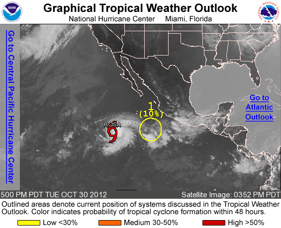
Unfortunately the southern hemisphere is pretty quiet- charts show a little disorganized storm towards Tuesday which would give the OC maybe some chest high sets towards 11/7. Don't hold your breath. And the tropics off Mexico look to be done for the season.

WEATHER:

Fantastic weather this weekend. We should have temps near 80 today at the beaches and close to the mid-80's tomorrow. Sunday looks to be slightly cooler with temps near 80 again but still pretty darn good. High pressure slooooooowly weakens after that and we may see a return of low clouds and fog the 2nd half of next week but for the near term, it's looking good. 

BEST BET:
Some leftover SW swell and great conditions- even offshore in the OC. Everyone head to Huntington today!

NEWS OF THE WEEK:

Normally I don't talk much about East Coast weather since the focus of THE Surf
Report is southern California, but they've got a doozy of a storm setting up
shop on the eastern seaboard today. Currently Hurricane Sandy is a minimal
hurricane with 80mph winds spinning off Florida, but there's a cold front in the
midwest headed to the east coast and it could morph with Sandy. Kind of like a
'Frankenstorm' (perfect for Halloween). CNN layouts out the destruction that's
forecasted for our eastern brethren in the story below:

"No one hopes Hurricane Sandy lives up to its potential.

The storm that has already claimed nearly two dozen lives in the Caribbean
churned Friday near northern Bahamas, and meteorologists warn that it packs the
potential to slam the Northeastern United States as soon as Monday with powerful
winds, pelting rain and cold temperatures. Worst case, Sandy could merge with a
strong cold front from the west. The double threat could morph into a
"superstorm" that could sit over New England for days, making untold trouble for
millions of residents. Weather experts said it's a recipe not unlike 1991's
"Perfect Storm." At 11 a.m. ET Friday, forecasters said Sandy is losing shape
and is a Category 1 hurricane with winds of 80 mph. But it's not to be taken
lightly. "Forget about the category with this," said CNN meteorologist Rob
Marciano. "When you have trees with leaves on them still, this kind of wind and
rain on top of that, you're talking about trees that are going to come down,
power lines are going to be out and the coastal flooding situation is going to
be huge." Sandy's death toll in Haiti, Jamaica and Cuba this week was 21 people.
The U.S. target area is hard to predict at this point. Some landfall computer
models show the storm striking somewhere between Washington and Boston -- some
of the most densely populated areas of the country. U.S. residents in those
areas, forecasters said, should prepare for the possibility of several days
without power.  "There is potential for widespread power outages, not just for a
couple of days but for a couple of weeks or more, if the storm stays on track,"
said meteorologist Kathy Orr of CNN affiliate KYW-TV in Philadelphia. Sandy
could be a storm "of historic proportion," she warns, and the City of Brotherly
Love could take a direct hit. "This could be like the 'Perfect Storm' 21 years
ago," said CNN meteorologist Chad Meyers. A combination of three weather systems
produced the famed "Perfect Storm" in the north Atlantic over Halloween 1991
when moisture flung north by Hurricane Grace combined with a high pressure
system and a cold front, according to the weather service. The current weather
conditions are not exactly the same as what produced the 1991 tempest. Although
Grace contributed significantly to the storm, it did not progress to New England
and did not make landfall, weather records show. On Friday, residents in South
Jersey were already stocking up on batteries and bottled water, and hardware
stores have put up preparedness displays, KYW reported. One location quickly
sold out of electric generators. "This is the worst timing for a storm," Newark
Mayor Cory Booker told CNN's Soledad O'Brien. "You have fall ending, a lot of
loose branches. "The storm itself will be bad, but I worry about the aftermath,
people being caught without power." Along the Jersey shore, storm preparations
included bulldozers shoring up piers with mounds of sand. Worried residents
filled sandbags in case of flooding. "We will be piling up as much sand as
possible along the beachfront," said Frank Ricciotti, Margate, New Jersey,
public works director. "I think the water damage is worse than another type of
damage, and the hardest thing is to stop water, once it starts coming up." With
a national election already under way in many early voting states, Sandy's wrath
also could have a ripple effect on politics. Bad weather in Maryland or
Washington could make it harder for people to get out and cast their ballots at
early voting locations. Early voting kicked off Monday in Washington and will
start Saturday in Maryland. "From Sunday through Wednesday, winds of hurricane
force are expected to lash exposed areas of the Northeast/Mid-Atlantic states,
leading to potentially serious coastal erosion and coastal flooding," the
National Hurricane Center reported. The weather service also warns "the buildup
of tides over multiple tidal cycles should exacerbate the situation."  For more
information on the merging storms, check out the CNN.com story here:

BEST OF THE BLOG:

All kinds of good freesurf clips came out of the pros touring Europe last week. Of course you probably saw Gabriel's 6' air on a 2' wave by now. But Julian and Jordy did some damage of their own too. Check out the Clips of the Day on the North County Surf blog. And what's with the war zone going on at Moonlight Beach lately? Get the details on the blog too. And of course a mid-week Surf Check and an in depth THE Surf Report - all of that and more in the blog below!

PIC OF THE WEEK:

An oldie but a good from January 7th, 2003. When solid surf meets a solid offshore wind event, this is what you get in north county San Diego. Kind of like today- but of course today is much smaller and less offshore wind. So not really like today.

Keep Surfing,

Michael W. Glenn
On Point
Lead Singer of Loverboy Cover Band
Cracking a Bottle of Takayama Teriyaki Tonight

North County Business News: Moonlight Makeover in our Midst

Every beach town has it's hub. Whether it's Main Beach in Laguna, Windansea in La Jolla, or Waikiki in Honolulu, there's a place for the local crew to hang with their families, get a quick surf in, or just meet up with friends. In Encinitas, that place is Moonlight Beach. Sure there's great gathering places like Beacons, Cardiff, and Swami's, but the center of town happens to be Moonlight.
Unfortunately the surf down there only gets good once in a blue moon (sorry, bad pun) but occasionally there's a little wave to be had (like the shot above from January 7th, 2003- wow- has it really been 9 1/2 years since there was surf down there?!). The real appeal is the big sandy beach, concession stands, park for the kids, panoramic views from the various bluffside viewing areas, and laid back atmosphere.
As you've probably heard, there's quite the construction going down on the little beach these past few months. The North County Surf blog reported back in August about the makeover about to take place to update the lifeguard tower, add new concession stands, a bike/surfboard rental area, new garage for the lifeguard vehicles and lookout point above.
Well the work is well under way and the beach is almost unrecognizable. Fortunately we're headed into winter and the beach isn't being used anyway. The kiddie park though is still intact- just need to find a way to get to it with all the construction fences up. Good news is that the new projects should be up and running by summer time.
And with the weather slated to be 80 this weekend, heading to the beach sounds like a good idea. Unless of course you want to go to Moonlight. In the midst of the new buildings being built, there's also a sand replenishment project happening. Check out the North County Surf blog story here. The good news is that all that sand should make for some good sandbars once we get a little surf to stir things up. Just need some surf of course. Don't fret if you don't live in Encinitas- the sand replenishment project is happening all over North County SD. Moonlight's project though should be done next week. All in all, lots of stuff going down at the little beach- just give it a few more months and everything should be back to normal...


Clip of the Day: Euro Battle


By now you've seen the footage of Gabriel Medina launching 6' on a 2' wave in Portugal. Pretty impressive. (And if you haven't, check the video above). But the rest of the tour has been in Europe too (remember guys like Kelly, Jordy, Parko, and Julian)? They've got their own clips too and they're just as impressive.

 
Take Jordy for instance. He was the new hot thing on tour before Dane left and Gabriel showed up. Jordy absolutely destroys some small Portugal beachbreak in the clip above. Funny, 'cause the surf in the clip looks like North County's waves today, but there's no way in hell I'm going to do turns like that at Moonlight. Used to though. I could've been pro you know. And everyones favorite son right now (unless your Brazilian) is North County's own Julian Wilson (ok so his brother lives here- but Julian visits a lot so that counts- heck- we stole Rob Machado from Australia, didn't we? Could happen to Julian too). Julian systematically takes apart some junky French beachbreaks while mysto figure Dane Reynolds makes a short appearance. Good to see Dane get out of California once in awhile.

Tuesday, October 23, 2012

Surf Check 10/23/12

Surf still looks small and gloomy today but help is on the way. More on that below. In the meantime, we've got a tiny NW/SW combo for sets almost waist high around town.
Wind was blowing light from the E at 3 this morning and the sun is trying to break out from the clouds. Even have a few lingering showers this morning. Water temps are holding at 68- pretty darn good for late October- and the tides are almost 5' at sunrise, down to 2' at noon, and up to 5' again at sunset.
 
As advertised, we have a few lingering showers this morning and those should be gone by tomorrow. High pressure starts to set up by Thursday and for the weekend- great weather and warm temps in the 80's at the beaches. Gotta love fall.
In regards to the surf, we've got a new NW filling in tomorrow afternoon for chest high waves in north county SD and head high sets in south SD. And as luck would have it, we've got a fun SW swell filling in tomorrow for chest high sets in north SD county and shoulder high sets in the OC. Should be a fun combo swell late Wednesday/early Thursday once the weather cleans up.
In the long term, there's still some activity forecasted in the Aleutians but no home runs; we may though get a little bump from the NW towards the end of the weekend. And the southern hemisphere looks like it's shutting down for some time. The tropics though still are churning out groups of clouds and there's a small chance of another hurricane. Best bet is another storm by Thursday and maybe some S swell towards Monday. But there's no guarantee considering it's late October already! Best bet: get the NW/SW combo on Thursday morning.

Thursday, October 18, 2012

THE Surf Report 10/18/12

It was fun while it lasted.

SURF:
Fun SW/NW this week and great weather was replaced by the remnants of Hurricane Paul today and weak low pressure. Any small fun surf we had out there was blown to bits early by 15mph S winds today.
For tomorrow and the weekend- we're left with small waist high+ SW/NW and more gloomy conditions as the weak low pressure sets up shop over us for at least the next 5 days. So expect small but rideable swell this weekend and overcast conditions. I guess we can all use a rest and catch up on that yard work.
Water temps are hovering in the high 60's and tides the next few days are 2' at sunrise, 6' at lunch, and down to 1' at sunset. Make sure to keep up to date on the waves and weather at Twitter/North County Surf!

FORECAST:

Nothing really on the radar. Mostly NW windswell is on tap every few days next week (maybe chest high late Sunday in SD and again towards next weekend- in between just waist high leftovers). There's also a weak storm on the chart above trying to take shape mid-week which may give us chest high NW next weekend too.
And the southern hemisphere did a little burp a few days ago which may give us chest high SW swell late Tuesday into Wednesday. All the while the weather is looking kind of gloomy. Nothing too exciting to report. Don't shoot the messenger!

WEATHER:

Looks like our fantastic weather is coming to an end. No real storms on the horizon but weak low pressure is going to set up shop this weekend for overcast conditions and temps in the high 60's. The clouds may not even break up at the coast during the afternoons. Looking kind of ugly. Maybe a little drizzle too. Unfortunately it may stick around most of next week too. Ugh.

BEST BET:
Nothing too exciting on the radar but a little bump in SW towards Tuesday and some NW windswell to cross it up. Wish the weather would cooperate!

NEWS OF THE WEEK:

Seems like our El Nino is camera shy. It was supposed to kick-in late summer, then scientists said by September, and now the latest forecast is looking downright dismal; we may not even get one at all this winter! Ouch. Here's the latest from NOAA today:

The western half of the continental U.S. and central and northern Alaska could be in for a warmer-than-average winter, while most of Florida might be colder-than-normal December through February, according to NOAA’s annual Winter Outlook announced today from the agency’s new Center for Weather and Climate Prediction in College Park, Md. Forecasters with NOAA’s Climate Prediction Center say a wavering El Niño, expected to have developed by now, makes this year’s winter outlook less certain than previous years. “This is one of the most challenging outlooks we’ve produced in recent years because El Niño decided not to show up as expected,” said Mike Halpert, deputy director of NOAA’s Climate Prediction Center. “In fact, it stalled out last month, leaving neutral conditions in place in the tropical Pacific.”When El Niño is present, warmer ocean water in the equatorial Pacific shifts the patterns of tropical rainfall that in turn influence the strength and position of the jetstream and storms over the Pacific Ocean and United States. This climate pattern gives seasonal forecasters confidence in how the U.S. winter will unfold. An El Niño watch remains in effect because there’s still a window for it to emerge. Other climate factors can influence winter weather across the country. Some of these factors, such as the North Atlantic Oscillation, a prominent climate pattern, are difficult to predict more than one to two weeks in advance. The NAO adds uncertainty to the winter outlook in the Northeast and Mid-Atlantic portions of the country. Areas ravaged by extreme drought over the past year are unlikely to see much relief from drought conditions this winter.

In the 2012 U.S. Winter Outlook (December through February) odds favor:
 •Warmer-than-average temperatures in much of Texas, northward through the Central and Northern Plains and westward across the Southwest, the Northern Rockies, and eastern Washington, Oregon and California, as well as the northern two-thirds of Alaska.
•Cooler-than-average temperatures in Hawaii and in most of Florida, excluding the panhandle.
•Drier-than-average conditions in Hawaii, the Pacific Northwest and Northern California, including Idaho, western Montana, and portions of Wyoming, Utah and most of Nevada.
•Drier-than-average conditions in the upper Midwest, including Minnesota, Wisconsin, Iowa and northern Missouri and eastern parts of North and South Dakota, Nebraska, Kansas, and western Illinois.
•Wetter-than-average conditions across the Gulf Coast states from the northern half of Florida to eastern Texas.

The rest of the country falls into the “equal chance” category (which means southern California), meaning these areas have an equal chance for above-, near-, or below-normal temperatures and/or precipitation

PIC OF THE WEEK:

Nothing fancy. Just some lines running down the point. Enjoy.

Keep Surfing,

Michael W. Glenn
Swashbuckling
Pseudo Celebrity
Training Bryce Ellis for his Comeback

Friday, October 12, 2012

THE Surf Report 10/12/12


Can't make up it's mind.

SURF:

Got a little bit of everything in a 7 day period- some NW swell, some SW swell, some cold fall weather, and warm temps this weekend. Place your bets! The current storm is exiting the region today and we've got great conditions on tap this weekend.
Our surf today is some waist high+ NW swell for chest high surf in south county SD with a smaller inconsistent SW towards the OC. Most spots are rideable but not that big. The high tide this morning is killing any surf we do have though. Best to wait for mid-day. Those swells back off slightly through the weekend. All in all nice weather and a little bit of rideable surf. Nothing too exciting but not flat. I'm still waiting for a solid swell. Seems like it's been a long time coming. Winter can't get here fast enough.
Water is still a pleasant 68 degrees and the tides are 5' at sunrise, down to 0' at 2pm, and up to 4' at sunset. Make sure to keep up to date on the waves/weather at Twitter/North County Surf.

FORECAST:

After a fairly safe weekend around here, we've got some background SW the 1st part of the week for chest high surf in the OC and about waist high in north county SD. And the tropics aren't dead yet- we've got another group of clouds trying to organize off mainland Mex. If it can get it's act together, we'd have a storm this weekend and small S swell by the middle of next week.
Our next shot of NW is forecasted to show Wednesday afternoon and last through Friday morning. Nothing big but maybe head high sets in south SD and waist to chest high in north county SD.
And charts from the southern hemisphere show a storm forming once it gets past New Zealand's shadow and into open waters around 10/16. If that's the case, we should get a fun chest high SW swell around 10/24. Lots of stuff going on- keep your fingers crossed they hold up.

WEATHER:

Our first storm of the season has come and gone and it gave us a dusting of snow, high temps in the low 60's, waterspouts, some rain, and the odd thunderstorm. Can't believe a couple weeks ago it was 90 around here. Now that the storm is exiting the region, high pressure builds in behind it and we have nice weather again on tap this weekend and temps in the mid-70's. That lasts for the foreseeable future.

BEST BET:
The only thing in the near future is the leftover NW/SW today and clearing conditions- or next Wednesday with good weather and fun NW. Basically it comes down to this- do you want to call in sick today or next Wednesday?

NEWS OF THE WEEK:

What’s interesting with the advent of global warming is all the unexpected changes in the climate. The most widespread belief was that the climates would migrate- Southern California would feel more like Baja and north of us- like Seattle, would feel like San Diego today. But the unexpected changes are what’s throwing us for a loop. Like changes in summer Arctic wind patterns contributed not only to an unprecedented loss of Arctic sea ice, but is also bringing about shifts in North American and European weather, according to a new NOAA-led study.

A research team led by James Overland, Ph.D., of NOAA’s Pacific Marine Environmental Laboratory in Seattle, Wash., examined the wind patterns in the subarctic in the early summer between 2007 and 2012 as compared to the average for 1981 to 2010. They discovered that the previously normal west-to-east flowing upper-level winds have been replaced by a more north-south undulating, or wave-like pattern. This new wind pattern transports warmer air into the Arctic and pushes Arctic air farther south, and may influence the likelihood of persistent weather conditions in the mid-latitudes.

“Our research reveals a change in the summer Arctic wind pattern over the past six years. This shift demonstrates a physical connection between reduced Arctic sea ice in the summer, loss of Greenland ice, and potentially, weather in North American and Europe,” said Overland, a NOAA research oceanographer. 

The shift provides additional evidence that changes in the Arctic are not only directly because of global warming, as shown by warmer air and sea temperatures, but are also part of an “Arctic amplification” through which multiple Arctic-specific physical processes interact to accelerate temperature change, ice variability, and ecological impacts.
The study, entitled “The Recent Shift in Early Summer Arctic Atmospheric Circulation,” was co-authored by scientists from Rutgers University in New Jersey,  the University of Sheffield in the United Kingdom, and the Joint Institute for the Study of the Atmosphere and Ocean, a partnership of NOAA and the University of Washington. It can be found online.
Before 2007, typical summer winds at the Arctic surface were more variable but tended to flow from the west.  Since then, the summer winds were found to blow more consistently from the south, through the Bering Strait, across the North Pole, and out toward the Atlantic Ocean relative to the mean pattern in previous decades. These winds transfer additional heat from the south toward the North Pole and push sea ice across the Arctic and out into the Atlantic Ocean, contributing to record losses of summer sea ice. The 2012 Arctic summer sea ice minimum far surpassed 2007 as the lowest on record.

“Higher pressure over the North American continent and Greenland is driving these changes in the early summer wind patterns,” said Edward Hanna, Ph.D, of the University of Sheffield.

These shifts in winds not only affect weather patterns throughout the Arctic but are also thought to influence weather in Greenland, the United States, and western Europe. Understanding such links is an ongoing area of research, the scientists said. The effects of Arctic amplification will increase as more summer ice retreats over coming decades. Enhanced warming of the Arctic affects the jet stream by slowing its west-to-east winds and by promoting larger north-south meanders in the flow. Predicting those meanders and where the weather associated with them will be located in any given year, however, remains a challenge.
The researchers say that with more solar energy going into the Arctic Ocean because of lost ice, there is reason to expect more extreme weather events, such as heavy snowfall, heat waves, and flooding in North America and Europe but these will vary in location, intensity, and timescales.

“What we're seeing is stark evidence that the gradual temperature increase is not the important story related to climate change; it's the rapid regional changes and increased frequency of extreme weather that global warming is causing. As the Arctic warms at twice the global rate, we expect an increased probability of extreme weather events across the temperate latitudes of the northern hemisphere, where billions of people live,” said Jennifer Francis, Ph.D, of Rutgers.

BEST OF THE BLOG:

The boys are back in Europe and the world tour is finally heating up. Parko's in 1st (is he going to win his first world title finally?!) and Kelly, John John, Taj, and Mick are nipping at his heels. Check out the Portugal warm up sessions and the epic barrel fest between Kelly and Taj at last year's comp. And of course a mid-week Surf Check and an in depth THE Surf Report - all of that and more in the blog below!

PIC OF THE WEEK:

Man is Tasmania good. Heaps of empty surf, land that looked like California 70 years ago, and with wetsuit technology nowadays, 50 degree water feels like 70. How come this line-up isn't more crowded? Must be the Tasmanian Devils on land. Wouldn't stop me from paddling out.

Keep Surfing,

Michael W. Glenn
Dashing
Whittler
Noll's Wingman at Makaha

Thursday, October 11, 2012

Clip of the Day: Waiting on the Waves


The boys are back in Europe right now (wonder why Lowers has been quiet lately?) and Kelly as you've probably heard won his 584th world tour event. Actually it was 51 but he's still on a roll regardless. Next up is the Rip Curl Pro in Portugal and everyone is gearing up for a solid swell this weekend at Supertubes and possibly a big swell the 2nd half of next week. Sounds good but I hate it when they start the contest, run a few rounds, then everyone sits for a week waiting for the next heat to start. Oh well, better than watching a Brazillian WQS event. Check out the clip from today's layday. Looks pretty good to me but if the expected 2 swells are anything like last year, then it's worth the wait. Here's a quick flashback of the Taj/Kelly heat last year- barrels a plenty to be had.
When the expected swells show, it's going to be solid battle between some the world's best barrel riders: Parko, Kelly, John John, and Fanning- who all happen to be in the top 5 right now fighting for a world title. Make sure to check out the event right here!

Tuesday, October 9, 2012

Surf Check 10/9/12


Actually had some fun background NW/SW today. But as advertised on the North County Surf blog this past Friday, the fall weather has taken hold and we had some cool breezy conditions to mess things up. Nothing major (yet) but it wasn't that classic summer weather we've had the past few weeks.
Good news it that we'll have more NW/SW tomorrow for chest high sets. Bad news is that the weather gets a little uglier (or prettier if you're a weather guy like me).
We've got our first cold weather system moving down the Pacific tonight. It won't be a big one- probably 1/4"+ of rain at the coast Thursday/Friday. But with the relatively warm water we have this time of year (about 70) the cold air above will mix with the warm water below and BOOM! a chance of thunderstorms late tomorrow and Wednesday. Hopefully it will bring a little excitement around here. Air temps are also supposed to hit the mid-60's at most. Definitely not the low 90's like we had at the end of September. Once the low pressure system exits the region on Friday night, high pressure fills in behind it for nice weather this weekend and temps in the mid-70's.
Now if you want to get a little of the SW/NW combo AND dodge some lightening, then the tides the next few days are 4.5' at sunrise, down to 2' at lunch, and back up to 5' at sunset.
Luckily for us, the little storm off our coast will also kick up some WNW swell on Thursday. Look for chest high waves in north county SD and some shoulder high+ sets in south SD. That lasts into Friday.
As far as the SW swells go, we had a good storm form under Australia a few days ago, then get split in half and dissipate when it hit New Zealand and into our swell window. I was hoping for good surf around the 13th/14th but now I'm doubting it.
At least the north Pacific is coming to life. The chart above shows a northerly swell forming around the 16th which would lead to surf around the 18th. And there's also a hurricane on the chart too but that's a long way from forming- and it's mid-October which seems especially late.

Long story short, look for fun NW swell the 2nd half of this week but junky conditions and nice weather this weekend but not much surf.