Thursday, October 29, 2015

THE Surf Report- Early Edition


In the immortal words of Judge Smails, "Well... we're waiting..."

SURF:
No sign of the El Nino winter yet. But I don't care. (In the immortal words of Charlie Brown, "Don't you know sarcasm when you hear it?")
Lots of good waves though this past week if you could figure out the tides. Today we had a cold front move through and it whipped the ocean into a frenzy. If you're reading this at 10 o'clock tonight you're probably cursing the N winds. But if you're reading this at 7 AM on Friday morning, you're probably praising the offshore NE winds as high pressure built in behind the cold front. Friday morning should have leftover SW swell and shorter interval NW for peaky head high+ conditions at the beach breaks, offshore winds, and sunny skies. BEWARE THE WATER TEMPS! Depending on how long the offshores blow, our water temps may drop into the mid to high 60's. The NW drops on Saturday as the SW holds for chest high+ waves and Sunday we're down to waist to chest high surf mainly from the SW.
Tides the next few days are 3' at sunrise (7 AM), up to 6' at lunch, and down to 0' at sunset (6 PM).

FORECAST:

The NW will be gone by Monday but as luck would have it, increases again on Tuesday for overhead surf. But alas it's from another cold front which will bring junky conditions through Wednesday. After that things clean up but the surf goes flat.
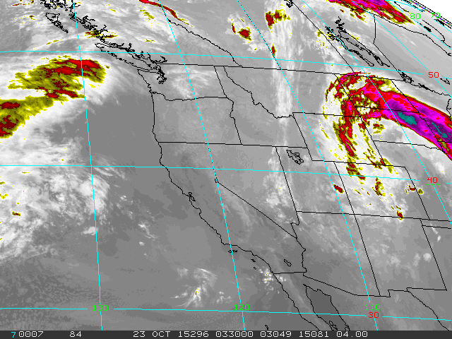
Models show a little storm off New Zealand trying to take shape in a few days which may give us waist high SW (and the OC chest high sets) next weekend but that's about it.
No El Nino in sight unfortunately.

WEATHER:

The forecasted rain this week never materialized but the sunsets sure were nice. We have great weather this weekend for beach temps near 80. Another cold front starts to make it's way down the state early in the week and the clouds increase by Monday. Tuesday the models show another chance of showers appearing and rolling into Wednesday. At this point I'll take anything. High pressure sets up the 2nd half of next week for nice conditions and temps in the low 70's.  Make sure to keep up to date on the waves/weather at Twitter/North County Surf.
 
BEST BET:
Friday morning! Leftover NW and holding SW for good surf. Oh- and offshores! Hopefully you're not reading this mid-day Friday and missed it...

NEWS OF THE WEEK:

Random facts (that may only interest me):

-On this day in history 1974: A tornado touched down in Encinitas. Four inches of snow fell on Palomar Mountain, the greatest daily snowfall on record for October.

-On this day in history 1971: It was 10° in Big Bear Lake, the lowest temperature on record for October. It was 11° in Idyllwild and 18° on Palomar Mountain, each the lowest temperature on record for October.

-On this day in history 1965: A very long heat wave that began on 10/20 ended on this day. A peak temperature of 104° was reached at San Diego on 10/22 and 100° in Los Angeles. LA had ten consecutive days with afternoon highs reaching at least 90°.

-The oceans cover 71% (and rising) of the Earth's surface and contain 97% of the Earth's water. Less than 1% is fresh water, and 2-3% is contained in glaciers and ice caps (and is decreasing).

-The highest tides in the world are at the Bay of Fundy, which separates New Brunswick from Nova Scotia. At some times of the year the difference between high and low tide is over 50', about the size of my first ever wave at Mav's.

-Sharks bite roughly 70 people each year worldwide, with perhaps 6-10 fatalities, according to data compiled in the International Shark Attack File (ISAF). Although shark bites get a lot of attention, this is far less than the number of people injured each year by elephants, bees, crocodiles, lightning or many other natural dangers. On the other side of the ledger, we kill somewhere between 20-100 million sharks every year through fishing activities.

-Almost any shark 6' or longer is a potential danger, but three species have been identified repeatedly in fatal bites: great whites, tigers, and bull sharks. All three are found worldwide, reach large sizes and eat large prey such as marine mammals or sea turtles. More bites on swimmers, free divers, scuba divers, surfers and boats have been reported for the great white shark than for any other species. However, some 80% of all shark bites probably occur in the tropics and subtropics, where other shark species dominate and great white sharks are relatively rare. (On a side note, I'll be surfing in Pacifica, CA next month where a cluster of 20 great whites in lengths of 10-18' were sighted just 100 yards offshore a couple days ago. So I have that going for me).

PIC OF THE WEEK:

Came across this story last week on The Surfer's Journal about this shot photographer Michael Kew took. Long story short, while camping on a bluff above the northern Sonoma County coast in February 2006, Michael woke up to to large unruly surf on the beach below. Seems as though there was a rivermouth that was damned up by a sand berm at the ocean's edge. The surf was huge and because of the high tide and severe drop off along the shoreline, sets were slamming full force into the berm and spilling into the river behind it. As the whitewater surged into the river, it created a rogue wave. This chest high wave peeled flawlessly for dozens of yards in the river while the ocean on the other side of the berm was out of control. Imagine driving down the coast that day, looking for a wave to surf, but being skunked due to the 20' closeouts (along with the deterrent of 50 degree water) only to find this gem in the river with no one out. As long as the berm held to keep the 25' great whites out of the river, I'd paddle out!

Keep Surfing,

Michael W. Glenn
Immortal
I Can't Drive 55
Some Weird Force Is Preventing Me From Strapping My Wave Jet To The Top Of My Woodie

Thursday, October 22, 2015

THE Surf Report- Early Edition


Prepare for landing.

SURF:

Been darn fun around here lately. Good weather, lots of NW/SW swells, and the line ups have been relatively quiet as everyone is surfed out. If you're not tired already, you will be after this weekend. We've got more NW tomorrow that will join our existing SW. Look for shoulder high sets again.
Then we've got new SW swell hitting our shores on Saturday from a storm off Antarctica for more shoulder high surf.
Then on Sunday the much ballyhooed Olaf arrives (not sure what ballyhooed means but it just sounded like a good fit for Olaf) for shoulder high sets from the SW again as well as a small NW to peak things up. All in all a fun weekend of surf and great weather. Water temps are 72 degrees (which will probably last until January. Just kidding. Or maybe not).
And tides the next few days are 5' at sunrise, down to 1' at lunch, and back up to 5' at sunset.

FORECAST:

If you weren't tired last week from the surf or from the upcoming waves this weekend, then you'll definitely be surfed-out next week. On Tuesday Olaf peaks with head high sets from the WSW and more NW arrives. By Thursday Olaf is dead but we've got overhead NW showing from a good storm forming this weekend in the Aleutians with overhead++ sets in SD. The only downfall is that the models are predicting rain and stormy weather. Next weekend things should clean up as more solid NW arrives for Halloween. Trick or treat? All treat.

WEATHER:

Nice weather is in store for the weekend as high pressure is in control. Look for temps in the low 80's at the beaches. Weak low pressure moves in for Monday and the clouds kick up and cool things down. Tuesday is a transition day as a low pressure system moves towards southern California. Could this be the start of our El Nino winter? At least look for a chance of rain towards Wednesday into Thursday- it's still too early to predict how stormy we'll get. Make sure to keep up to date on the waves/weather at Twitter/North County Surf.
 
BEST BET:
Most likely this weekend through early next week as we've got plenty of swell from all directions and great weather. Or the 2nd half of next with bigger surf but potentially stormy weather. So clean weather and crowds or lumpy bumpy solitude? What's your fancy?

NEWS OF THE WEEK:

The North County Surf Blog talks about surfing a lot (ok- all the time), but I never talk about where waves come from. Sure we know where babies come from (stork), where my paycheck comes from (modeling), the Kardashian’s talent (no clue), but the source of waves? Time for me to explain with a little help from my friends at NOAA.

During your early morning surf check, you hope to see corduroy to the horizon; waves transporting water from one place to the next. Though waves do cause the surface water to move, the idea that waves are travelling bodies of water is misleading.

Waves are actually energy passing through the water, causing it to move in a circular motion, much like a buoy or pelican floating on the surface. When a wave encounters an object at the surface, the object appears to jump forward and upward with the wave, but then falls down and back in an orbital motion as the wave continues by, ending up in in it’s original position. If you imagine the water in the wave following this same pattern, it’s easier to understand ocean waves as simply kinetic energy moving through seawater. In reality, the water in waves doesn’t travel much at all. The only thing waves do is transmit across the sea is energy.

The idea of waves being energy movement rather than water movement makes sense in the open ocean, but what about at the beach, where waves break on shore? This phenomenon is a result of the wave’s orbital motion being upset by the seafloor. As a wave passes through water, not only does the surface water follow an orbital motion, but a column of water below it (down to half of the wave’s wavelength) makes the same movement. As a wave approaches shallow water, the lower portion of the wave starts to slow down and compress, forcing the top of the wave to pitch. Eventually this imbalance in the wave reaches a breaking point, and the lip comes crashing down as wave energy is dissipated into the surf.

So where does a wave's energy come from? There are a few types of ocean waves and they are generally classified by the energy source that creates them. Most common are surface waves, caused by wind blowing along the air-water interface (i.e. storms), creating a disturbance that steadily builds as wind continues to blow and the wave crest rises. Surface waves occur constantly all over the globe, and are the waves you see at the beach under normal conditions.

Adverse weather or natural events often produce larger and potentially hazardous waves. Severe storms moving inland often create a storm surge, a long wave caused by high winds and a continued low pressure area. Storm surges are a minor disturbance in deep water, often less than one meter high, but intensify as they move into shallower water. Submarine earthquakes or landslides can displace a large amount of water very quickly, creating tsunamis. Storm surges and tsunamis do not create a typical crashing wave, but rather a massive sea-level rise upon reaching shore and are extremely destructive of course. So for now, enjoy the energy from storm generated waves and head to the hills when the ground shakes!

PIC OF THE WEEK:

There's been a lot of talk recently about wave pools and artificial waves and the such. Surf Snowdonia in England has shown that fun man made waves can make for an entertaining surf contest. But before we get ahead of ourselves, what if we just improve what we already have in the ocean? Like today's Pic of the Week at Scripps Pier. A wave that's walled, weak and flat 365 days a year, I've made into a world class spot with modern technology. Partially using existing science and materials that UCSD engineers already had on the pier, I made minor modifications to their equipment, added in modern wave pool technology, and applied it to the ocean. Not to bore you, but using water flow dynamics of W=3x (7.556/Y)^ squared and a proprietary formula of wave science (56ST) X 3.14(p)i = 23.23.4/8r - 34Y/32@900 (where r = low tide),  I can turn any crummy break into Rincon. I'm currently in the patent process, but when completed, I'm going to open a surf resort at Scripps in La Jolla and charge $50 per wave. You can pre-pay with your credit card here on the North County Surf Blog.

Keep Surfing,

Michael W. Glenn
Been Called Exquisite
The New Wink Martindale
Did A Curren Head Snap And Now I'm Wearing a Neck Brace

Thursday, October 15, 2015

THE Surf Report- Early Edition


I've been waiting patiently.

SURF:
I've you've read THE Surf Report recently, you saw that I predicted the El Nino 'winter' to start mid-October and that we usually get our first good storm around the same time. Well, it's October 15th and no good Aleutian storms are headed our way. No drought busting, landslide causing, roof leaking, wet ones. So we wait. In the meantime, surf has been great! So who am I to complain.
Lots of good SW swell earlier in the week was replaced by WNW the 2nd half of this week.  Tomorrow we have leftover SW/WNW again for chest high waves. The only fly in the ointment is that we have weak low pressure overhead which may give us a little bit of junky W winds again on Friday. The weekend is pretty much on autopilot with the same waves/weather. Water temps are still shockingly warm for October at 72 degrees (which is the same thing I said last week and most likely I'll say again on next week's THE Surf Report).
Tides this weekend will be 3' at sunrise (7 AM), up to 5.5' before lunch, and down to 0' at sunset (6:30 PM).

FORECAST:

If the forecast models hold true, we've got some action next week. First up is a storm in the Aleutians this weekend that will send us waves but alas no weather. Monday we get head high NW with overhead sets in SD. On Tuesday it's followed by some smaller chest high SW.
By Thursday, soon to be Hurricane Olaf from Disney's Frozen makes a guest appearance. Actually, he's a tropical system showing up in the middle of a heat wave late next week so scratch the whole Frozen thing. Olaf is still a long way away from peaking or even hitting the sweet spot in our swell window, but if everything comes together, I'm hoping to see shoulder high sets by Thursday. By Friday charts show some NW too so maybe the combination of swells and great weather will make you want to skip work (which won't take too much prodding).

Further out, the southern hemisphere is showing some life late in the season so we could have some shoulder high+ SW swell around the 24th and chest high SW again on the 27th. And in-between these 2 swells is more fun chest high NW. My hands are tired now from typing. Long story short, make sure to keep up to date on the waves/weather at Twitter/North County Surf. 

WEATHER:

Hopefully the humidity is over. Don't mind dry heat- just keep me out of the humidity. No offense Louisiana. This weekend we have a couple weak low pressure systems above us that are giving the mountains some showers but just low clouds and a breeze down here. Those will clear out by Tuesday. By the middle of the week and into next weekend, models are showing temps 10-15 degrees above normal for another heat wave. No humidity though- just temps in the mid to high 80's again. Just in time for a couple good swells. Nice timing Mother Nature.
 
BEST BET:
Pretty much the 2nd half of next week with great weather, Olaf, SW swell, NW swell, and warm water temps (as usual).

NEWS OF THE WEEK:

As you're well aware by now, water temps in the equatorial eastern Pacific (as well as California) have been way warmer than normal thanks to El Nino. We've also had an unusually warm 'blob' of warm water hanging off the coast of the Pacific Northwest this past year (due to various theories). Well for every reaction there is an opposite and equal reaction. Welcome to the Atlantic 'blob'; a colder than normal pool of water in the northwest Atlantic. Is the ocean out of whack? Sure looks like it. Here's CNN's side of the story:

"At first glance, it stands out like a sore thumb. That blob of blue and purple on the map. One of the only places on the globe that is abnormally cold in a year that will probably shatter records as the warmest globally.

It's being called the Atlantic blob. It's a large area in the North Atlantic that is seeing a pronounced cooling trend. The ocean surface is much cooler than normal and, in fact, record cold in some locations.

Scientists began to notice it developing over the last couple of years, and this cooling in the Atlantic is the complete opposite of the warming over in the Pacific. Much of the warming is attributed to El Nino, a natural process where warm water sloshes over the Central Pacific and extends to South America, but scientists are unable to completely explain what has been dubbed the Pacific blob. This pronounced warming over large areas of the entire Pacific Basin has fueled a well above average season for hurricanes and typhoons over the entire Pacific, and it could have contributed to the California drought, effects on the salmon industry and even tropical sharks seen in waters farther north than ever before.

The Atlantic cold blob is near Greenland. You may not expect to see such a pronounced cooling that far north. After all, we know that most of the documented climate change has affected the poles much more than equatorial regions. Greenland is home to an enormous sheet of ice.

In fact, if you combine the ice sheets of Antarctica and Greenland, you will find 99% of the fresh water ice on Earth. Scientists believe it is the melting of ice in Greenland that is causing the cold anomaly.

A recent study by top climatologists shows that massive ice loss is occurring over Greenland and is disturbing the normal Atlantic Ocean circulation, called the Atlantic meridional overturning circulation, or AMOC. You may be familiar with part of this circulation, the Gulf Stream, which brings warm, tropical surface water northward along the East Coast of the United States and funnels toward the poles. The other main current in the AMOC is a return flow of deep, cold water that runs southward from the poles toward the tropics. This current has dramatic effects on our weather globally. The heat and cold driven by the current transfer to the atmosphere and help drive our weather patterns.

Normally, cold salt water in the North Atlantic sinks, because it is denser, and it is replaced by warm water moving in from the south. A similar process drives the high and low pressure systems and jet stream that drive our weather. In this case, the study suggests that the massive amounts of fresh water melting into the ocean from Greenland can prevent the sinking of the dense, cold, salty water and alter the AMOC circulation.

Believe it or not, this was the very scenario in the popular movie "The Day After Tomorrow." In the movie, the global climate changes in a matter of days, causing tornadoes in Los Angeles, deadly hail in Tokyo and a massive blizzard in New York City.

Fortunately "The Day After Tomorrow" scenario is Hollywood fiction at its best, and not based on sound science. That said, there is cause for concern.

While there is no scientific consensus that the Pacific and Atlantic blobs are related to climate change, there is evidence that they are. The effects of that relationship -- while not like those portrayed in the movie -- could still be severe. The loss of the normal ocean circulation could cause drastic shifts in weather patterns, and continued loss of ice in Greenland will lead to the continued rise in sea level, threatening coastal cities around the globe."

PIC OF THE WEEK:

Absolutely L-O-V-E love this pic (courtesy of Surfer Magazine might I add). I'm a sucker for weird waves. Odd little wedges bouncing off a cliff, low tide double ups on a shallow reef, gurgling sand sucking rip tide waves, the stranger the better. This one may be the oddest of them all. You know the little sand bars in front of our lagoons here in San Diego county? Doesn't matter if it's Tijuana Sloughs, Torrey Pines, or Ponto; all day long the tide fills in the lagoons and when it drains during low tide, the sand bars form. What if you had a lagoon the size of let's say San Francisco Bay? That's a lot of water making a sandbar the size of the Sahara. The end result is a sandbar called the Potato Patch with waves breaking a mile out to see. A sight like no other. Make sure to take a break today and read Doc Renneker's story of his attempt to ride one of the beasts. Even the paddle out was an adventure...

Keep Surfing,

Michael W. Glenn
Local Legend
Mike Glenn Costumes Flying Off The Shelves
Bodysurfed Potato Patch. At Night.

Thursday, October 8, 2015

THE Surf Report- Early Edition


Fall is Fantastic! (In contrast to last week when I said 'Fall is Failing').

SURF:

My how quickly things change. Had a good dousing of rain last week, some small NW swell, and not much to talk about as far as shredding goes. Today on the other hand, the weather was fantastic, we had new SW swell fill in, and things are looking up for the weekend.


First up Hurricane Oho. Huh? Never heard of him? Me neither. This storm formed in the central Pacific off Hawaii so I didn't pay much attention to it as the normal course of action was for the storm to head to Asia. But oh no, Oho had something else in mind. Oho decided to go NW and head towards British Columbia. Now only a tropical storm with 70mph winds, Oho will send head high+ surf our way for late Saturday into Sunday. All the while some fun chest high SW swell will be in the background too. AND the weather is going to be hot all weekend! Hot damn!


Tides the next few days are 5' at sunrise, down to 1' at 2pm, and up to 4' at sunset. Water temps are still shockingly warm for October at 72 degrees. Along with the warm weather this weekend, the lifeguards will be giving out tickets for anyone found wearing rubber in the lineup.

FORECAST:

After fun SW swell from Oho this weekend, Oho will continue to move towards British Columbia and we'll get WNW swell from it on Monday.


We've also got a good SW swell showing up from the southern hemisphere. Not as big as Oho but we'll still see shoulder high sets filling in Monday and lasting into Tuesday. After that, the southern hemisphere still has a lot of activity but most of the storms are oriented E to W and not ideally S to N as to aim swell our way. Most of next week though should have waist to chest high SW.

Models then show another hurricane forming off Hawaii and remarkably it may make a similar path as Oho and head N to British Columbia- sending more SW to NW swell our way late next week. Odd, but who am I to judge? Make sure to keep up to date on the waves/weather at Twitter/North County Surf. 

WEATHER:

Speaking of odd, that's been our weather the past 12 months. From the worst drought on record to the wettest summer we've ever had to a good start to the rainy season this fall with up to an inch of rain last week. Adding to the odd theme, high pressure is in control this weekend and we'll have beach temps in the mid-80's. And remember that low pressure system that gave us rain earlier in the week? It's supposed to make a loop back from the desert SW over the weekend AND HEAD BACK OUR WAY for a 2nd blow. Amazing. If the forecast holds true, we'll get clouds and cooler temps to start the work week then showers towards Wednesday/Thursday. This is supposed to be the normal time of year for weather while El Nino this winter is going to be the the weird one. Can't wait to see how that plays out.
 
BEST BET:
No brainer- Saturday. Good Oho swell, awesome beach weather, and trunks.

NEWS OF THE WEEK:

So we had a lot of rain this summer and we’ve already had a good dose of rain to start the fall- with more on the way next week. So it looks like El Nino is on track for a wild winter. But just how wild? Will this be the Godzilla El Nino as predicted a few months ago? The National Oceanic and Atmospheric Administration reported recently that this El Niño continues to rank among the strongest on record (which started in 1950- caveman hieroglyphics before that don’t count).


The July-September 3-month average sea surface temperature  was 1.5°C above normal, third in line behind July-September 1987 (1.6°C) and 1997 (1.7°C). The atmospheric response to the warmer-than-average sea surface temperatures is keeping pace, too:  the Equatorial Southern Oscillation Index (EQSOI) is -2.2. This is second to 1997’s -2.6, and well ahead of the next two El Niños on the list (1972 and 1982, tied at -1.4). The near-surface winds along the equator in the Pacific, which are important for maintaining the sea surface temperature anomalies, have lagged a bit behind the stronger El Niños so far. These winds, which blow from east to west under normal conditions, weaken during El Niño, allowing the warmer water in the western Pacific to move into the central and eastern regions. In 1997-98, the strongest event on record, the winds in the central Pacific weakened so much they reversed, and blew from west to east during October and November. This September did have consistently weaker-than-average winds, though, and October has started off with a strong westerly wind burst. NOAA will be watching this region closely in the upcoming months to see how it affects this winter's El Nino weather patterns.


So with all that scientific mumbo-jumbo being said, this El Nino looks to be strong- but possibly not breaking the record shattering ’97-’98 beast. More like the ’82-’83 winter- which was a doozy in it’s own right. Regardless, the map above highlights areas of the U.S. that experience temperature or precipitation conditions that may be different from normal when an El Niño is present. Impacts from El Niño are most noticeable during the late fall through early spring months. During late spring and summer, climate patterns may not be affected at all.

In instances when a strong El Niño occurs, there can be large impacts to communities and the U.S. economy. Strong El Niños are often associated with heavy winter rains across California, which could bring much needed moisture to a region devastated by drought. Even if above normal precipitation falls across California, one season of above-normal rain and snow is very unlikely to erase four years of drought.

Meanwhile, heavy rains in the southern half of the U.S. could lead to flooding causing widespread damage to towns and communities, lives and livelihoods. In addition, El Niño could elevate the risk for severe weather across the Southeast during winter. On the other hand, above-average late fall to winter temperatures across the northern tier of the U.S. might mean a milder winter and lower energy costs. It’s important to understand that a strong El Niño only favors these impacts, but doesn’t guarantee they will happen.

The main influence of El Niño in the U.S. summer tends to be on hurricanes:
-More tropical cyclones in the Pacific (and as evident this past summer- more rain too)
-Fewer tropical cyclones in the Atlantic.

Some of the patterns that we may see during a strong El Niño this fall/winter in the U.S. include:
-Above-average temperatures in portions of Alaska, the Pacific Northwest, Intermountain West, Northern Plains and Upper Midwest
-Below-average rainfall in the northern Rockies, and the Ohio and Tennessee Valleys.
-Above-average rainfall in southern California, Arizona, New Mexico, Texas and Florida.

So let the games begin: An increase in above average rainfall to peak around Christmas time due to the 2nd strongest El Nino on record. Just what I asked Santa for.

PIC OF THE WEEK:

Is Indo really better than anything we have in California? My vote is yes.

Keep Surfing,

Michael W. Glenn
Headliner
Found Some Change In My Couch To Finance Charger's Stadium
Only Pro To Ever Combo Kelly And Curren

Thursday, October 1, 2015

The Surf Report- Early Edition


Fall is failing.

SURF:

Not an exciting start to fall. Cool weather and mediocre little SW and NW swells. Wearing trunks in October is killer though. For comparison's sake, I remember dawn patrolling it, wearing just trunks, in early November during the last big El Nino. Water was 68. Will we beat that this year? Guess we'll find out. Back to the surf though. Fall is trying to get kickstarted with cooler weather and NW swells but it's still a pretty weak effort. Tomorrow we have a little boost from the NW for chest high sets towards SD and smaller background SW.
Saturday drops a little then we get another small boost from the NW on Sunday. Nothing firing this weekend but the groms will have fun.
Tides the next few days are 2' at sunrise, up to 5.5' after lunch, and down to 1' at sunset (7 PM for those of you keeping score).

FORECAST:

Summer isn't dead just yet. A couple storms are on the charts that should give us chest high sets around the 8th of October and hopefully head high sets by the 12th of October. We may also get a small NW swell by the 12th too. The tropics have had some rumblings lately but no swell is headed our way. But the water is above average down there and we still have about a month left of hurricane season. So mind your manners and don't jinx it! Make sure to keep up to date on the waves/weather at Twitter/North County Surf. 

WEATHER:

Off and on. That pretty much sums up our weather the next 7 days. We have a weak cold front moving through northern California tomorrow which will kick up our clouds down here and make it a little breezy and cool. No real news other than the fact it will feel more like fall than summer on Friday. Saturday warms up a little bit and it will feel a little more like summer than fall. Models then show a low pressure system setting up in central California Sunday/Monday which may give us a few showers in southern California. Best case would be 1/4". On the Mike Glenn Rain Scale ('MGRS' patent pending)- 1/4" isn't going to do much to our drought situation. (MGRS = 1/4' is weak, 1/2" is a good rain, 1" is a solid soaking, and 2" is El Nino, cars floating down the street stuff). The sun comes back out the 2nd half of next week and we're due for beach weather again. Off and on.
 
BEST BET:
Wait 'til next weekend as new SW fills in.

NEWS OF THE WEEK:

Fall is here, El Nino has been here all year, and I’m impatient. When is it going to start raining cats and dogs?! I normally see our first good rain just before Halloween. I always think it’s going to rain on my groms a week before trick or treating and it always arrives a few days before the big holiday. So what does a normal October supposed to look like? The San Diego National Weather Service can help us out here:

October is the last of the dry months and is usually a transitional period with variable weather... a mixture that includes weather from the previous dry months with a preview of the upcoming wet months.  The normal daily maximum temperature is 72.8 degrees and the normal daily minimum is 60.6 degrees with a mean monthly temperature of 66.7 degrees.  Extremes for the month range from 107 degrees in 1961 to 43 degrees in 1971. There are 2 days of measurable rain on the average... including one day of thundershowers.  These wet days usually occur late in the month as storm systems from the Pacific Northwest move farther south.  The average rainfall is 0.57 inch.  This is 0.42 of inch more than September (a normal September that is- not our end of the world September we just had with 1.24 inches) and 0.44 less than November.  The greatest  monthly total was 4.98 inches in 2004. The minimum is zero which last occurred in 2009. On October 3, 1858... a category one hurricane  struck San Diego...  the only documented hurricane to strike the west  coast of the united states (so we still have some hope for wild weather this month).  October has plenty of sunshine with 68 percent of possible. October averages 14 clear days... 10 partly cloudy and 7 cloudy days.  During the month there are an average of 3 days of heavy fog.  There is an average of one day of clear... dry weather when ‘Santa Ana’ winds push temperatures into the 90s.  Relative humidity averages 75 percent in the early morning... 60 percent near noon and 62 percent in the late afternoon.  Wind speeds average 6.5 mph. The strongest wind for the month occurred on the 20th and was from the south at 39 mph in 2004 (which probably had to do with that 4.98” of rain in October of 2004 also).

So there you have it. October is a transition month and is fairly mild. But with an El Nino winter on the horizon, hopefully things get in to gear soon.

PIC OF THE WEEK:

I remember watching the Katin contest in Huntington back in the 80's where Curren did that legendary off the lip and sprayed the spectators on the pier. I also remember Michael Ho trunking it during his heats. In the middle of February. Which brings up the question: If the surf is firing and you forgot your wetsuit, do you paddle out and risk hypothermia? In the case of Michael Ho, yes. But the surf wasn't firing that day at the Katin contest; it was HB for God's sake! Can't figure that one out.

Keep Surfing,

Michael W. Glenn
Never Wrong
Already Ordered My iPhone 7
Planning a Surf Trip to Mars Now That Water's Been Discovered