Thursday, October 27, 2022

THE Surf Report


Trick AND Treat

SURF:


Fun week around here with combo swell, sunny skies, and somewhat manageable winds. For this weekend, it's more of the same. 


For Friday, we'll just have waist high SW/NW before new SW/NW shows up Saturday. Look for chest high surf which lasts into Sunday. And here's the tides, sun, and water temps for the next few days:
  • Sunrise and sunset:
    • 7:04 AM sunrise  
    • 6:00 PM sunset  
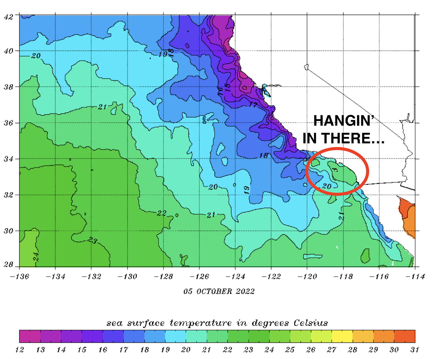
  • Water is still nice for this time a year- a couple degrees warmer than 'normal' at 67 degrees.
  • And tides are starting to get extreme as they do this time of year:
    • 3' at sunrise
    • about 5.5' at lunch
    • and 0' at sunset
FORECAST:

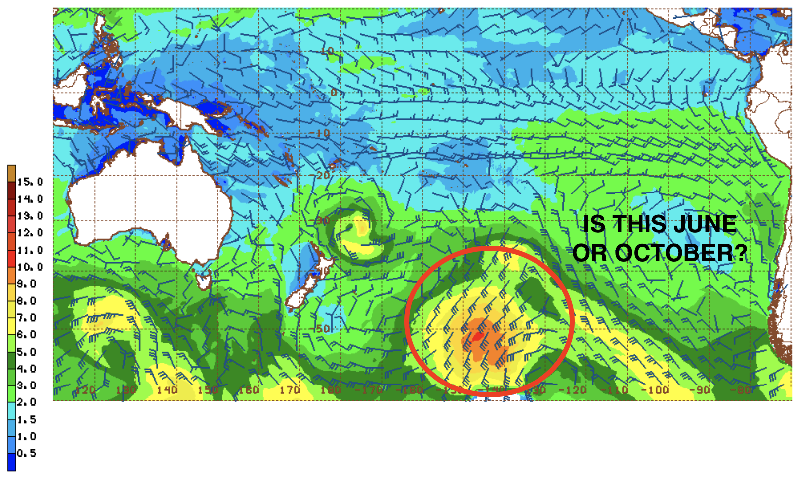
The N Pacific is really coming to life while the S Pacific doesn't realize that summer is over. 


Models show a potent low pressure system forming off the Aleutians this weekend which will give us solid head high+ NW Wednesday BUT.. models also show this storm could get close to California and bring rain/wind. Regardless, we should see swell from it- choppy or not. 


We also had a good storm off Antarctica last week which has sent SW our way the middle of next- which could coincide with the N Pacific swell/storm. So we've got waves coming mid-week BUT... could be messy. Forecast charts also show more storms in the N Pacific so we should see more NW late next weekend.  

WEATHER:


Typical fall, huh? The storm track is starting to lower as it should this time of year and the Pacific NW/Northern Rockies have seen snow while we've seen weak cold fronts down here and light offshores/sunny skies behind them. For the weekend, we'll have cool sunny skies with temps in the low 70's. As mentioned above, the storm track may lower a little more and at best we'll see a cold front come through by Wednesday for showers and at worst (which actually is good as we need the water), a low pressure system on top of us with rain and wind. That also means a chance of snow in the local mountains above 7,000'! If anything changes between now and then, make sure to follow North County Surf on Twitter!

BEST BET:

This weekend with chest high sets from the NW/SW or my personal favorite- storm surf on Wednesday! 

NEWS OF THE WEEK:


Tropical storms are well documented and their formation are fairly well understood. Heck- hurricanes even have their own names! Warm tropical water is the fuel for these storms. Not to oversimplify things, but warm air rises of course, so as the warm moisture rises off the oceans- forming thunderstorms- cool air rushes in to replace it- causing wind. And long story short, you get a hurricane in the most extreme conditions.

But how do storms form in cold weather- i.e. Aleutian storms that create our NW swells in winter? Typically, an 'extratropical' storm forms outside of tropical regions- like the N Pacific, despite the phase tropical in its name. These storms are formed when very cold air masses in the upper-levels interact with warm air masses over the sea (e.g., Pacific or Atlantic). As these bodies of cold air collide with warm air bodies, weather fronts form.


As the fronts mature and strengthen, the denser, drier cold air masses move underneath the more buoyant warm air masses and help force the warm air to rise. As a result of this rising air leaving the surface, a low-pressure system forms into a (rapidly) deepening storm. In the northern hemisphere, the winds of these cyclonic systems deflect to the right as a result of the Coriolis Effect (an effect whereby a mass moving in a rotating system experiences a force- the Coriolis force- acting perpendicular to the direction of motion and to the axis of rotation. On the earth, the effect tends to deflect moving objects to the right in the northern hemisphere and to the left in the southern and is important in the formation of cyclonic weather systems).

A further process of warm air rising in the atmosphere starts cooling it and therefore releases its potential energy. The air becomes more buoyant and consequently fuels the storm’s core with even more intense upward movement of air.

At the final stage, this further lowers the pressure at the surface, intensifying the storm. The most organized storms become a so-called bomb cyclones with explosive strengthening of the wind field and rapidly deepening central pressure.


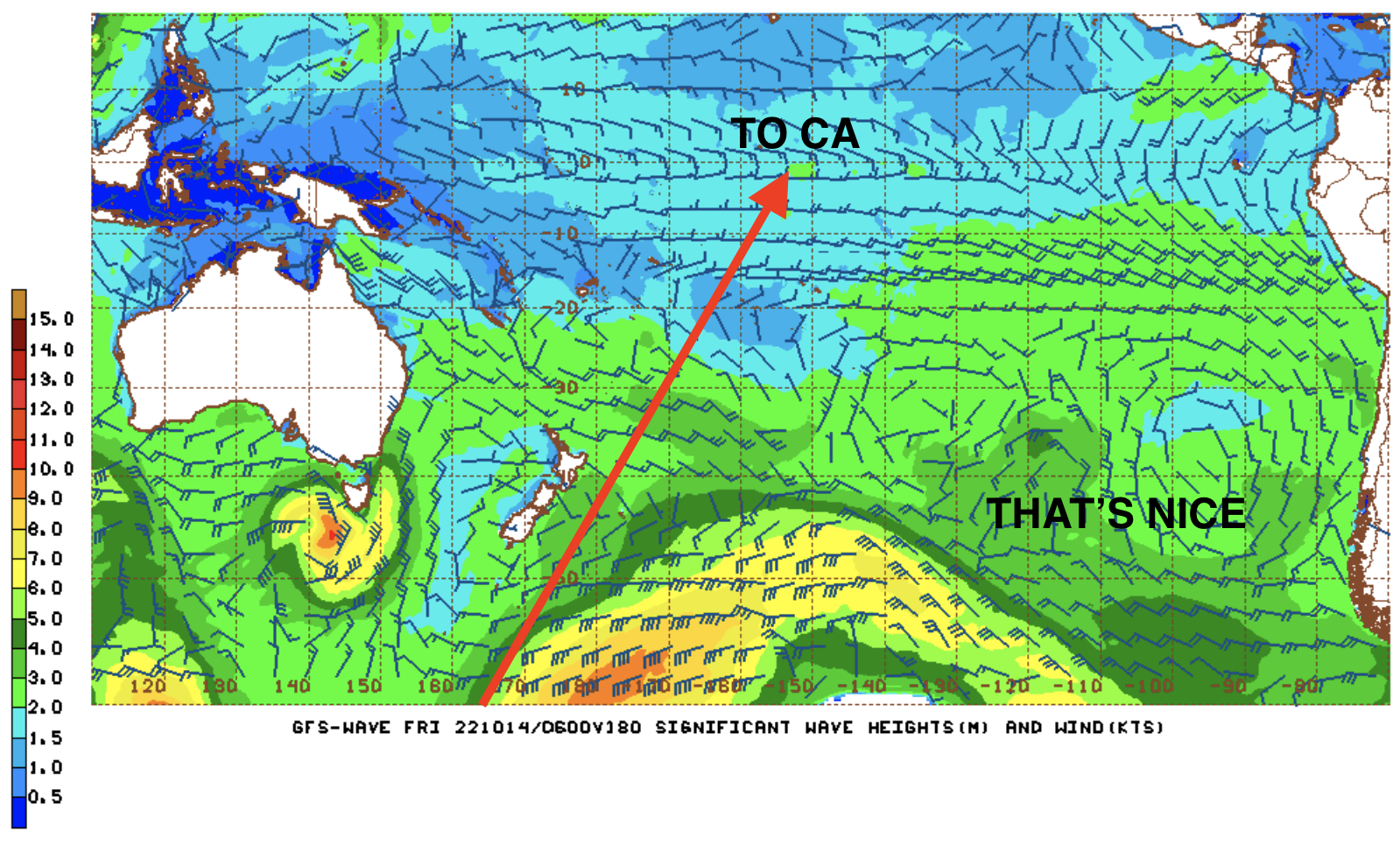
Even though hurricanes get the publicity, extratropical storms from the Aleutians are sometimes more powerful due to their immense size. A storm roared into Alaska last month and an offshore ocean buoy reported waves above 35 feet for 12 hours, peaking at more than 50 feet. Winds gusted over 70 mph for 11 hours- with top speeds of 90 mph. Spots along the Alaska coastline also experienced a storm surge of 11 to 14 feet. Oregon got the wrath of the swell with buoys reporting 40' at 15 seconds, but the storm was aimed towards Alaska, so we only got a glancing blow down here in Southern California last weekend with shoulder high sets.
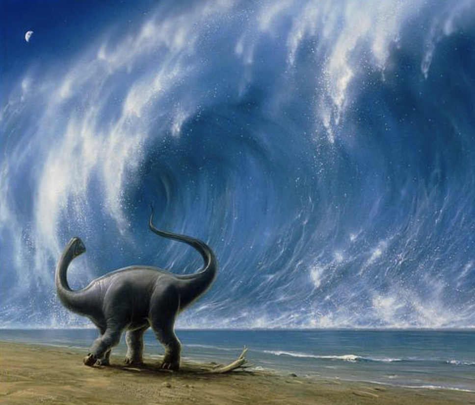
PIC OF THE WEEK:


Scary enough, this spot is actually in the U.S. and breaks on a fairly regular occurrence in the winter thanks to those extratropical storms we just discussed. Un-happy Halloween everybody! 

Keep Surfing, 
Michael W. Glenn
Aficionado
Mentioned In Prince Harry's Memoir
WSL's 'One To Watch' In 2023

Friday, October 21, 2022

THE Surf Report


Opposites Attract

SURF:

Pleasant weather we're having. And a little bit of combo swell to boot. 


Last couple of days have been pretty fun around here. BUT... if you're a fan of the changing seasons and you can't wait for fall to turn into winter, well... we've got some of that in store for you too. 


A solid storm in the Aleutians earlier in the week sent 40' surf at 15 seconds into the Great White North. The storm unfortunately was pushed into the Pacific NW because of the high pressure that gave us such great weather, but... we will see some surf from it over the weekend. For today, look for just background SW/NW for chest high sets- and the return of fog along the coast. 


For Saturday, a weak cold front will move through JUST as a new SW swell fills in from a solid storm last week off Antarctica. If you don't mind breezy SW winds, look for shoulder high+ surf as more NW fills in late. By Sunday, the cold front should be exiting the region and leaving in its wake NW winds, NW windswell, and still solid SW swell for head high surf. And here's the tides, sun, and water temps for the next few days:
  • Sunrise and sunset:
    • 6:58 AM sunrise  
    • 6:07 PM sunset  
  • Water is now mid-60's
  • And tides are on a bit of a roller coaster ride this weekend:
    • rising to 4.5' at breakfast
    • about 1' at 2 PM
    • and back to 4' at sunset
FORECAST:

The weather cleans up on Monday and we still have shoulder high sets from the SW/NW combo. Mid-week is back to nice weather and smaller surf. 


By Wednesday afternoon, another weak cold front could make it's way to Southern CA again, and as it does- the winds and NW windswell will fill in for chest high surf. That lasts into Friday. 


By Sunday, we may see a small SW fill in for waist high surf in SD and chest high sets in the OC. 


And not to be outdone, models show another storm off Antarctica this weekend which could give us more chest high+ SW towards the first couple days of November. Basically we'll have surf- if the weak cold fronts don't mess anything up. 

WEATHER:


The northern Rockies are getting snow this weekend- up to a 2', and we'll feel the tail end of that system down here on Saturday. Look for the SW winds to increase in the 15-20 mph range by nightfall, a chance of light showers, and then switch to mostly sunny cool skies on Sunday- with breezy NW winds. We should see sun and temps in the mid 50's at night and only mid-60's during the day for Monday to Wednesday. Then ANOTHER weak cold front comes through by Thursday. Welcome to fall. If anything changes between now and then, make sure to follow North County Surf on Twitter!

BEST BET:

This weekend if you like solid surf and solid wind. At least it will keep the crowds down! 

NEWS OF THE WEEK:


As you know, the world’s oceans have been warming for generations. How do I know? As a kid, I never felt 80 degree water temps here in So-Cal, and now it's almost commonplace in the summers. It's a trend that seems to be accelerating and threatens to fuel more supercharged storms, devastate marine ecosystems and upend the lives and livelihoods of millions of people, according to a new scientific analysis.

Published this week in the journal Nature Reviews, it finds that the upper reaches of the oceans — roughly the top 2,000 meters, or just over a mile — have been heating up around the planet since at least the 1950s, with the most stark changes observed in the Atlantic and Southern oceans.

The authors of the review, who include scientists from China, France, the United States and Australia, write that data shows the heating has both accelerated over time and increasingly has reached deeper and deeper depths. That warming — which the scientists said probably is irreversible through 2100 — is poised to continue, and to create new hot spots around the globe, especially if humans fail to make significant and rapid cuts to greenhouse gas emissions.

The findings underscore both the key role the oceans have played in helping to offset human emissions — oceans absorb more than 90 percent of the excess heat trapped within the world’s atmosphere — and also the profound implications if the warming continues unabated. If it does, the areas near the surface of the oceans could warm by two to six times their current temperature, the scientists wrote.

“Global warming really does mean ocean warming,” Kevin E. Trenberth, a co-author of the review and a scholar at the National Center for Atmospheric Research, said in an interview from New Zealand. “The best single indicator that the planet is warming is the ocean warming record.”

That record, composed of thousands of temperature measurements across the globe over decades, he said, shows a “relentless” trajectory. “The warming has been accelerating, and the most rapid warming rates have been in the last 10 years or so,” he said.

The consequences of hotter oceans already are on display in numerous ways. Scientists attribute about 40 percent of global sea level rise to the effects of thermal expansion in ocean water. Warmer oceans also speed the melting of ice sheets, adding to rising seas. They disrupt traditional weather patterns and deepen drought in some areas. And they fuel more intense hurricanes, as well as create the conditions for more torrential rainfall and deadly flooding.

The authors cite one example from August 2017, when the Gulf of Mexico reached the warmest summertime temperature on record to that point. That same month, Hurricane Harvey tore through the gulf, exploding from a tropical depression to a major hurricane and dumping catastrophic amounts of rain on Houston and other areas. “All of these things are part of the fact that there’s extra  energy available” in the oceans, Trenberth said.


In addition, the analysis found that future warming could cause precipitous drops in certain fisheries, causing the loss of livelihoods and food sources. The trend also makes it “inevitable” that marine heat waves will become more extensive and longer-lasting — a reality that can trigger toxic algal blooms and fuel massive mortality events among coral reefs, kelp forests and other ocean life

While the authors make clear that oceans around the world are projected to continue warming over the coming decades, even if humanity begins to cut greenhouse gas emissions, that warming will not happen equally across the globe. Largely due to circulation patterns, some regions are projected to warm faster than others and are likely to grapple with more intense impacts.

The paper also underscores that while many uncertainties remain, how that plays out is “critical” to the consequences humans will probably experience, said Joellen Russell, a professor and oceanographer at the University of Arizona. “A small fraction more [mixing] would slow our warming, and a small fraction less mixing would accelerate our warming,” said Russell, who was not involved in this week’s analysis. “That is incredibly important for people to understand.”

The latest findings are largely in line with the growing body of research has documented — that oceans have long stored astounding amounts of energy from the atmosphere and mitigated the impacts of greenhouse gas emissions, but that over time profound impacts are unavoidable on land and at sea. In its most recent assessment on the state of climate science earlier this year, the Intergovernmental Panel on Climate Change said it is “virtually certain” that the upper swath of the oceans have warmed over the past half-century, and that human-caused carbon emissions are the main driver.

“Global mean sea level has risen faster since 1900 than over any preceding century in at least the last 3,000 years,” the IPCC wrote. “The global ocean has warmed faster over the past century than since the end of the last deglacial transition (around 11,000 years ago).” Still, researchers say the amount of future warming depends on what humans do — or don’t do — to rein-in the greenhouse gases that ultimately are heating oceans. And better measuring, understanding and mitigating the problem should be a global priority.

If the world can steer toward a future with the kind of rapidly shrinking emissions envisioned by the Paris climate agreement, the author of this week’s review write, that would probably “lead to a detectable and lasting reduction in [the] ocean warming rate, with noticeable reductions in climate-change impacts.”
Russell said the latest findings emphasize that it “absolutely matters” that humans cut emissions as quickly as possible, to limit warming in the oceans and the ripple effects that ultimately has for humans. “Our oceans are doing us a profound service,” she said. “As a scientist and a mom, I pray about the fact we need to bend that curve in my lifetime. … It is important that we do this.”

BEST OF THE BLOG:


If you haven't already... MARK YOUR CALENDARS! If you're a surfer that wants to grow their business AND help strengthen our community, The North County Board Meeting's next mixer is this Thursday, October 27th, from 5:30 to 7:30 PM. Being hosted by yours truly, this event marks the unofficial opening of The Co Lab, the newest and coolest creative agency in North County. Formed by Bill McCaffray of Alliance MultiMedia, TJ Smith of Printsmith Solutions, and myself of the North County Board Meeting, we'll be hosting at our new headquarters in Del Mar- right next to Viewpoint Brewing Company. So come on down to see the new space at 2195 San Dieguito Dr. #3 in Del Mar, enjoy a drink on our new patio, grab a bite, and finish off the week at Viewpoint ('cause no one works on Fridays anyway). Make sure to bring a friend and carpool as parking is limited. Thanks for the support! 

PIC OF THE WEEK:


My big wave days are behind me. Actually, I never surfed anything over 20' but all I know is, 1/2 that size feels like a lot nowadays. When I retire, I just want to find some fun waves, no one out, and a pair of trunks that still fit. I think this may be the spot. 

Keep Surfing, 
Michael W. Glenn
Centered
Throwing My Hat In The Ring To Be The UK's Next Prime Minister
Already Working On My Summer '23 Tan

Friday, October 14, 2022

THE Surf Report


Purgatory

SURF:

Purgatory in its simplest form is a soul waiting between good and bad. 


In our case, we've been dealing with an ocean that's not exactly flat- and not exactly firing either. For this weekend, we're in purgatory yet again. Just some background SW on Saturday in the waist high range for SD and the occasional chest high set in the OC. Sunday sees a touch of NW fill in for more waist high surf towards SD. There's even a slight chance of showers on Saturday so that will add to the mellow vibe around here. And here's the tides, sun, and water temps for the next few days:
  • Sunrise and sunset:
    • 6:54 AM sunrise  
    • 6:13 PM sunset  
    • we're almost to the point of 7 am sunrise and 6 pm sunset. So long summer!
  • Water is still hangin' around in the high 60's
  • And not much in the tide department this weekend:
    • 3.5' at sunrise
    • 4.5' at lunch
    • 2.5' at sunset
FORECAST:

Looks like we'll get out of purgatory in the near future. Finally! The N Pacific is starting to come to life as we get into the bulk of fall. 


A storm is forming off the Aleutians this weekend and we should get chest high surf on Tuesday from the WNW along with a small SW. 


On its heels is a slightly bigger WNW for shoulder high sets towards next Thursday into Friday. 


And the S Pacific isn't done yet- if the models are correct- we should see a good SW swell around the 23rd. So hang in there folks! The cavalry is coming! 

WEATHER:


Not a lot of sun at the coast this past week but lots of late season monsoon moisture in the mountains and valleys has kept us on our toes. The low pressure responsible for pulling in the tropical moisture will come ashore on Saturday and we could get up to 1/10" of showers along the coast. So I guess that means fall is officially here. The early part of next week will be sunny and mild with temps near 70 along the coast. And then... models show another low pressure system headed our way for the 2nd half of next week. Which means showers again? I thought it never rained in San Diego. Especially this early in the season. If anything changes between now and then, make sure to follow North County Surf on Twitter!

BEST BET:

Most of next week. Looking forward to it. 

NEWS OF THE WEEK:


Ahhhhh, the good ol' days. When we used to have weather more exciting than drizzle. Let's reminisce...

THIS DAY IN WEATHER HISTORY!

2015: Unseasonable high pressure and warm ocean waters led to very warm October days and the warmest October nights on record from 10/10 through 10/15. In San Diego, five out of the six highest October minimum temperatures on record occurred. The highest minimum temperature in any October was 76° on 10/10 and again on 10/13. This is only two degrees off the highest minimum temperature for any time of year! (Only seven nights in history recorded 77 or 78°, all of which occurred during September, meaning these October nights were warmer than any night in July or August in San Diego). On 10/10 the highest minimum temperature in October was also recorded in Chula Vista (73, only three degrees off all-time highest), Oceanside Harbor (74, only two degrees off all-time highest), and El Cajon (tied 69). On 10/13 Santa Ana recorded 78°, the highest October minimum temperature on record. The top six warmest October nights on the Chula Vista record occurred this month, and the top  five in El Cajon occurred this month.

1997: Santa Ana wind gusts measured 87 mph in central Orange County and contributed to a large fire.

1971: It was 97° at Palomar Mountain, the highest temperature on record for October.

1961: Hot Santa Ana winds drove the temperature to 110° in Long Beach, the hottest in the nation, 107° in San Diego (the highest on record for October), 105° in LA, and over 100° in many coastal and inland locations. It was 88° at San Nicolas Island.

1957: An early season storm brought daily record rainfall to Southern California. Over an inch fell at many mountain locations and in parts of central San Diego County. La Mesa recorded 1.08 inch. 

BEST OF THE BLOG:

A couple announcements from the North County Board Meeting:

  • In case you were wondering (and I know you were), it's time for our next meeting! Mark your calendars for a Business Mixer on Thursday, October 27th, from 5:30 to 7:30 PM. Being hosted by yours truly, this event marks the unofficial opening of The Co Lab, the newest and coolest creative agency in North County. Formed by Bill McCaffray of Alliance MultiMedia, TJ Smith of Printsmith, and myself of the North County Board Meeting, we'll be hosting at our new headquarters in Del Mar- right next to Viewpoint Brewing Company. So come on down to see the new space at 2195 San Dieguito Dr. #3 in Del Mar, enjoy a drink on our new patio, and finish it off at Viewpoint. More details to come next week! 

  • And as you know, the North County Board Meeting is more than just networking, supporting local businesses, and surfing with like minded business professionals- it's also about strengthening our community through charitable work. One of the groups we've worked with in the past is the Challenged Athletes Foundation. NCBM member, CAF volunteer, AND Surfhouse owner Nikki Harth will be involved with the Community Challenge next weekend (October 22nd and 23rd). Looking to make a difference and have a good time in the process? Here are the details: 

First, they are looking for volunteers at the CAF Adaptive Surf Clinic on Oct. 22nd in Mission Beach. This is going to be a full day of stoke! There are 3 options for volunteer shifts, either from 7:30am-12pm, 11:30am-4pm, or if you have the energy and time for a full day, 7:30am - 4pm! This year it looks like it will be the biggest surf day that they have ever planned. We will be getting both kids and adults into the water to surf with us! Last time Nikki volunteered, they had over 80 athletes participating, so as you can imagine, they need a lot of help. 

These surf clinics are some of the most fun and fulfilling days you can imagine! Most of these athletes have never surfed before, and CAF gets people from all over the country, so for some it’s even their first time getting in the ocean!  If you, your employees, your friends, or just someone you know from your local line up would be interesting in signing up to volunteer for this, here is the link.

And even if you or someone interested doesn’t surf CAF need all sorts of help throughout the day. Helping people get sized up for wetsuits, helping check in athletes, making sand castles with kids who are waiting their turn to shred, or chatting with parents and learning about the athletes and their stories! 

The second way to help, is to donate to the CAF through Nikki's donation page! Nikki is signed up to swim a mile in the triathlon on Sunday morning, and he's looking to raise $1,000! These donations go towards providing adaptive athletes with the equipment and resources they need to participate in sport. Including helping adaptive surfers work towards their goal of qualify for SURFING in the LA 2028 Paralympic Games! 

Surfhouse has already committed to being sponsors of the CAF Adaptive Surf Programs over the next 4 years, helping surfers get the custom equipment they need, as well as creating additional advanced surf coaching programs for these surfers to have access to in hopes they can qualify for LA 2028! 

So if you are able to donate to his team, please click this link. Every dollar helps! If you have any questions, especially about the volunteering for the surf day on October 21st, please feel free to reach out to Nikki at nikki@surfhouseadventures.com.

PIC OF THE WEEK:


Just a couple lads from across the pond enjoying England's finest.

Keep Surfing, 
Michael W. Glenn
Devilishly Handsome
Jumping On The Padres Bandwagon Today And Today Only
Quarterfinalist 2007 Big Z Memorial Surf Off

Thursday, October 6, 2022

THE Surf Report


Welcome To... Fall?

SURF:

Was in Montana this past weekend and got a taste of fall. Temps in the 40's, a little bit of rain, trees were changing colors. Came back home... not so much. In fact, this past week was more like spring with June Gloom, water temps in the high 60's still, and this upcoming weekend will feel more like July with late season thunderstorms in the mountains and valleys (more on that below). 


So in the meantime as we wait for REAL fall, we're left with partly sunny skies, a new small SW for Saturday (waist high with chest high sets best spots far N county SD and the OC), small background waist high W swell, and manageable water temps for this time of year. And here's the tides, sun, and water temps for the next few days:
  • Sunrise and sunset:
    • 6:48 AM sunrise  
    • 6:23 PM sunset  
  • Water is a pleasant 68 degrees for October (should be 65)
  • And tides are straightforward this weekend:
    • 3' at sunrise
    • 5.5' mid-morning
    • down to 0.5' late afternoon
    • and back to 3' at sunset
FORECAST:


After a small weekend, we get a slightly better SW for Monday. Look for chest high sets for most of N county SD and the OC. 


Behind that, the N Pacific gets in on the act for waist high+ W in N county SD and chest high surf in SD by Tuesday. Further out, models show more activity from the N and S Pacific. 

If the forecast charts hold true, look for more waist to chest high SW around the 18th with a better shoulder high+ SW around the 21st. 


Along with that good SW the 3rd week of October, we may also see waist to chest high W swell. So until then get the groveller out and wait for better surf around the 21st. 

WEATHER:


June Gloom (or May Gray- take your pick) has been dominate this past week with overcast conditions and temps barely approaching 70 along the coast. We have a slight change for Saturday with a bit more sun along our shores and temps in the mid-70's. As mentioned above, the monsoon moisture makes a late season appearance Friday/Saturday and our inland valleys could see a shower or too. By the 2nd half of next week, we're back to more clouds, cooler temps, and maybe a bit of a breeze. Batten down the hatches! If anything changes between now and then, make sure to follow North County Surf on Twitter!

BEST BET:

Monday/Tuesday with fun SW/W or better SW/W around the 21st of October.

NEWS OF THE WEEK:


We all know the story of the asteroid that wiped out the dinosaurs 66 million years ago (not to sound dark- but thank goodness- imagine have T-Rex running around your neighborhood nowadays)? And I reported last year about the mega sand ripples it formed on the ocean floor. But what about the wave itself from the tsunami? Sure the asteroid and the shock wave were devastating, but just how big was that wave? 100'? 1,000'? Bigger? The journal AGU Advances this week thinks the initial 'splash' wave was roughly 15,000' (about 3 miles high) and the corresponding ripples were 5,000' (about 1 mile high). Garrett McNamara was born 66 million years too late. Here's their findings:

The miles-wide asteroid that struck Earth 66 million years ago wiped out nearly all the dinosaurs and roughly three-quarters of the planet's plant and animal species. It also triggered a monstrous tsunami with mile-high waves that scoured the ocean floor thousands of miles from the impact site on Mexico's Yucatan Peninsula, according to a new University of Michigan-led study.

The study presents the first global simulation of the Chicxulub impact tsunami to be published in a peer-reviewed scientific journal. In addition, U-M researchers reviewed the geological record at more than 100 sites worldwide and found evidence that supports their models' predictions about the tsunami's path and power. "This tsunami was strong enough to disturb and erode sediments in ocean basins halfway around the globe, leaving either a gap in the sedimentary records or a jumble of older sediments," said lead author Molly Range.

The review of the geological record focused on "boundary sections," marine sediments deposited just before or just after the asteroid impact and the subsequent K-Pg mass extinction, which closed the Cretaceous Period. "The distribution of the erosion and hiatuses that we observed in the uppermost Cretaceous marine sediments are consistent with our model results, which gives us more confidence in the model predictions," said Range, who started the project as an undergraduate in Arbic's lab in the Department of Earth and Environmental Sciences.

The study authors calculated that the initial energy in the impact tsunami was up to 30,000 times larger than the energy in the December 2004 Indian Ocean earthquake tsunami, which killed more than 230,000 people and is one of the largest tsunamis in the modern record.


The team's simulations show that the impact tsunami radiated mainly to the east and northeast into the North Atlantic Ocean, and to the southwest through the Central American Seaway (which used to separate North America and South America) into the South Pacific Ocean. In those basins and in some adjacent areas, underwater current speeds likely exceeded 20 centimeters per second (0.4 mph), a velocity that is strong enough to erode fine-grained sediments on the seafloor.

In contrast, the South Atlantic, the North Pacific, the Indian Ocean and the region that is today the Mediterranean were largely shielded from the strongest effects of the tsunami, according to the team's simulation. In those places, the modeled current speeds were likely less than the 20 cm/sec threshold.

For the review of the geological record, U-M's Moore analyzed published records of 165 marine boundary sections and was able to obtain usable information from 120 of them. Most of the sediments came from cores collected during scientific ocean-drilling projects. The North Atlantic and South Pacific had the fewest sites with complete, uninterrupted K-Pg boundary sediments. In contrast, the largest number of complete K-Pg boundary sections were found in the South Atlantic, the North Pacific, the Indian Ocean and the Mediterranean.

"We found corroboration in the geological record for the predicted areas of maximal impact in the open ocean," said Arbic, professor of earth and environmental sciences who oversaw the project. "The geological evidence definitely strengthens the paper." Of special significance, according to the authors, are outcrops of the K-Pg boundary on the eastern shores of New Zealand's north and south islands, which are more than 12,000 kilometers (7,500 miles) from the Yucatan impact site.

The heavily disturbed and incomplete New Zealand sediments, called olistostromal deposits, were originally thought to be the result of local tectonic activity. But given the age of the deposits and their location directly in the modeled pathway of the Chicxulub impact tsunami, the U-M-led research team suspects a different origin. "We feel these deposits are recording the effects of the impact tsunami, and this is perhaps the most telling confirmation of the global significance of this event," Range said.

The modeling portion of the study used a two-stage strategy. First, a large computer program called a hydrocode simulated the chaotic first 10 minutes of the event, which included the impact, crater formation and initiation of the tsunami. That work was conducted by co-author Brandon Johnson of Purdue University.

Based on the findings of previous studies, the researchers modeled an asteroid that was 14 kilometers (8.7 miles) in diameter, moving at 12 kilometers per second (27,000 mph). It struck granitic crust overlain by thick sediments and shallow ocean waters, blasting a roughly 100-kilometer-wide (62-mile-wide) crater and ejecting dense clouds of soot and dust into the atmosphere.

Two and a half minutes after the asteroid struck, a curtain of ejected material pushed a wall of water outward from the impact site, briefly forming a 4.5-kilometer-high (2.8-mile-high) wave that subsided as the ejecta fell back to Earth.

Ten minutes after the projectile hit the Yucatan, and 220 kilometers (137 miles) from the point of impact, a 1.5-kilometer-high (0.93-mile-high) tsunami wave -- ring-shaped and outward-propagating -- began sweeping across the ocean in all directions, according to the U-M simulation.

At the 10-minute mark, the results of Johnson's iSALE hydrocode simulations were entered into two tsunami-propagation models, MOM6 and MOST, to track the giant waves across the ocean. MOM6 has been used to model tsunamis in the deep ocean, and NOAA uses the MOST model operationally for tsunami forecasts at its Tsunami Warning Centers.

"The big result here is that two global models with differing formulations gave almost identical results, and the geologic data on complete and incomplete sections are consistent with those results," said Moore, professor emeritus of earth and environmental sciences. "The models and the verification data match nicely."


According to the team's simulation:
  • One hour after impact, the tsunami had spread outside the Gulf of Mexico and into the North Atlantic.
  • Four hours after impact, the waves had passed through the Central American Seaway and into the Pacific.
  • Twenty-four hours after impact, the waves had crossed most of the Pacific from the east and most of the Atlantic from the west and entered the Indian Ocean from both sides.
  • By 48 hours after impact, significant tsunami waves had reached most of the world's coastlines.
For the current study, the researchers did not attempt to estimate the extent of coastal flooding caused by the tsunami. However, their models indicate that open-ocean wave heights in the Gulf of Mexico would have exceeded 100 meters (328 feet), with wave heights of more than 10 meters (32.8 feet) as the tsunami approached North Atlantic coastal regions and parts of South America's Pacific coast.

As the tsunami neared those shorelines and encountered shallow bottom waters, wave heights would have increased dramatically through a process called shoaling. Current speeds would have exceeded the 20 centimeters per second threshold for most coastal areas worldwide.

"Depending on the geometries of the coast and the advancing waves, most coastal regions would be inundated and eroded to some extent," according to the study authors. "Any historically documented tsunamis pale in comparison with such global impact."

And if you're feeling a little spooked about another asteroid hitting us, fear not- NASA is working on a solution.

PIC OF THE WEEK:


Now that the 1st week of October is upon us, it's officially time to start thinking of the holidays. From Halloween costumes, to Xmas presents, and Turkey on Thanksgiving. No, not stuffing your face with a dead bird- Turkey the country. Yes, this really is the Black Sea. Wonder if they celebrate all the holidays over there? I would if Santa brought me this. 

Keep Surfing, 
Michael W. Glenn
Stone Cold
Starring In The Real Husbands Of Encinitas
I Plan To Surf Forever By Being Reincarnated As A Dolphin