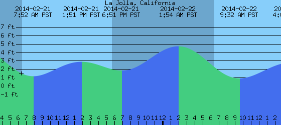
Friday, February 28, 2014

THE Surf Report


The wait is over.

SURF:
Whether you wanted it or not, it's here. 'It' being the biggest storm since 2010. This thing has been brewing for a few days now in the Pacific and it's coming ashore this morning.
First up today is the main front with heavy rain, strong S wind, and building surf. Look for 1-2" of rain today, wind gusts around 40mph+ later and building overhead surf.
Tomorrow the main low moves ashore and we get another inch of rain, sets around 12'+, and a chance of waterspouts. Awesome. All in all a complete mess on the roads, surf, and leaky ceilings (gotta love my 70's tract home). Sunday the sun comes out but the water will be toxic.
Water temps are around 60- but that doesn't matter in the dirty water- and tides are another issue this weekend too- about 5' at sunrise, up to 6'5' mid-morning,, dropping like a rock to -1.5' mid-afternoon, and up slightly to 2' at sunset. Basically the high tides in the mornings- along with the storm surge- AND with the big surf- may create flooding in low lying areas like Cardiff and La Jolla Shores. Stay safe this weekend and make sure to keep up to date on the waves/weather at Twitter/North County Surf. 

FORECAST:
Once the storm exits the region this weekend it will take the surf with it. No big deal as the ocean will be one big toilet anyway with all the dirty run off.
By the time it cleans up though, we'll have a new fun SW arrive late Tuesday for chest high sets in far north county SD and the OC.
We'll also have a shot of NW swell for head high sets arriving on Wednesday.
And models show another storm taking shape for more NW next weekend.

WEATHER:

Where do I start. We're getting walloped right now and it's getting worse. As you've probably heard on the news, we've got a major winter storm rolling through California this weekend. Had a few early showers yesterday and now the main front is moving through with heavy rain, wind, and storm surf. Things will let up this evening slightly then them main core of the system will roll through Saturday. Look for off and on heavy rain tomorrow, wind, and a chance for waterspouts. All in all we may get 2-3" of rain at the coast, 5" in the valleys, and up to 10" along the mountain slopes. Wind gusts may hit 50mph tonight along the coast and 70mph in the mountains. The storm will exit Sunday but the water will be filthy so it's not even worth paddling out even though the sun will finally emerge. We should have more normal weather next week as high pressure sets up shop.

BEST BET:
Considering you'd need a haz mat suit in addition to your 4/3 E Bomb this weekend, might as well wait until the water cleans up mid-week and get some of that new SW/NW combo.
 
NEWS OF THE WEEK:  

From the school that gave us Andrew Luck, Herbert Hoover, Reese Witherspoon, and Tiger Woods (it’s Stanford in case you’re done guessing), computer simulations by Professor Mark Z. Jacobson have shown that offshore wind farms with thousands of wind turbines could have sapped the power of three real-life hurricanes, significantly decreasing their winds and accompanying storm surge, and possibly preventing billions of dollars in damages. In the case of Hurricane Katrina, the computer model revealed that an array of 78,000 wind turbines off the coast of New Orleans would have significantly weakened the hurricane well before it made landfall. For the past 24 years, Professor Jacobson has been developing a complex computer model to study air pollution, energy, weather and climate. A recent application of the model has been to simulate the development of hurricanes. Another has been to determine how much energy wind turbines can extract from global wind currents. In light of these recent model studies and in the aftermath of hurricanes Sandy and Katrina, he said, it was natural to wonder: What would happen if a hurricane encountered a large array of offshore wind turbines? Would the energy extraction due to the storm spinning the turbines' blades slow the winds and diminish the hurricane, or would the hurricane destroy the turbines? So he went about developing the model further and simulating what might happen if a hurricane encountered an enormous wind farm stretching many miles offshore and along the coast. Amazingly, he found that the wind turbines could disrupt a hurricane enough to reduce peak wind speeds by up to 92 mph and decrease storm surge by up to 79 percent. The study, conducted by Jacobson, and Cristina Archer and Willett Kempton of the University of Delaware, was published online in Nature Climate Change. The researchers simulated three hurricanes: Sandy and Isaac, which struck New York and New Orleans, respectively, in 2012; and Katrina, which devastated New Orleans in 2005. "We found that when wind turbines are present, they slow down the outer rotation winds of a hurricane," Jacobson said. "This feeds back to decrease wave height, which reduces movement of air toward the center of the hurricane, increasing the central pressure, which in turn slows the winds of the entire hurricane and dissipates it faster." In the case of Katrina, Jacobson's model revealed that an array of 78,000 wind turbines off the coast of New Orleans would have significantly weakened the hurricane well before it made landfall. In the computer model, by the time Hurricane Katrina reached land, its simulated wind speeds had decreased by 36-44 meters per second (between 80 and 98 mph) and the storm surge had decreased by up to 79 percent. For Hurricane Sandy, the model projected a wind speed reduction by 35-39 meters per second (between 78 and 87 mph) and as much as 34 percent decrease in storm surge. Jacobson acknowledges that, in the United States, there has been political resistance to installing a few hundred offshore wind turbines, let alone tens of thousands. But he thinks there are two financial incentives that could motivate such a change. One is the reduction of hurricane damage cost. Damage from severe hurricanes, caused by high winds and storm surge-related flooding, can run into the billions of dollars. Hurricane Sandy, for instance, caused roughly $82 billion in damage across three states. Second, Jacobson said, the wind turbines would pay for themselves in the long term by generating normal electricity while at the same time reducing air pollution and global warming, and providing energy stability. "The turbines will also reduce damage if a hurricane comes through," Jacobson said. "These factors, each on their own, reduce the cost to society of offshore turbines and should be sufficient to motivate their development." An alternative plan for protecting coastal cities involves building massive seawalls. Jacobson said that while these might stop a storm surge, they wouldn't impact wind speed substantially. The cost for these, too, is significant, with estimates running between $10 billion and $40 billion per installation. Current turbines can withstand wind speeds of up to 112 mph, which is in the range of a category 2 to 3 hurricane, Jacobson said. His study suggests that the presence of massive turbine arrays will likely prevent hurricane winds from reaching those speeds.

PIC OF THE WEEK:

Considering we're almost to the end of winter, I wanted to squeeze in one more cold wave shot before it's all tropical tubes around here.

Keep Surfing,

Michael W. Glenn
Luminary
Project Manager, Area 51
Bought the Op Pro Priority Buoy At A Garage Sale

Tuesday, February 25, 2014

Surf Check

 
Be careful what you wish for...

After complaining of no real rain storms this season, we're about to get WHALLOPED this weekend. Interesting theory about Global Warming I heard a few years ago. One thought is that the weather is going to be more extreme. So instead of a random mix of storms throughout the season (i.e. dry spells, average storms, and strong storms), you just get the dry spells and strong storms. Seems as though that's been the case this winter. No real rain to speak of and then BAM! a big one this weekend. But let's talk about the surf first.
Had some fun NW last week and then a little mysto SW this weekend. I saw the small storm forming in the southern hemisphere last week but it looked like it was going to get lost in all the NW we've been having. Well, the NW swells died off this past weekend and look he was left standing- the little SW! A welcome respite to what should have been a flat weekend.
Water temps have been unbelievably nice- in the low 60's- due to the fact we haven't had any strong storms this winter to bring upwelling to our coast. Almost like an El Nino condition but in a non-El Nino year. Tides the next few days will factor in to our storm scenario this weekend as we may get some minor coastal flooding in our low lying areas. We have a high tide around 6' at sunrise, down to -1' after lunch, and back up to 4' around sunset.
Ok- now for the surf. It's pretty small today as evident by the graphic at the top of the blog. Just small SW and NW today for waist high waves. That will all change though starting later on Thursday. By the afternoon we should have some chest high waves around here as the wind picks up from the SE. By Friday morning the wind will be going strong from the S with gusts around 30 mph and the surf slightly overhead from the S stormsurf. By Friday evening we're in full storm mode with gusts to 40mph, dumping rain, and 8'+ surf. Saturday looks to be the same with wind from the WSW, more 30mph wind, and more rain. Surf should peak in the 10'+ range. Sunday the storm exits with dirty water, dropping surf, and gusty WNW winds. All in all a bad weekend for surf. Don't shoot the messenger.
So let's take a look at that storm. Pretty impressive considering we haven't had any real storms the past couple winters. We'll start to get some showers late tomorrow evening into Thursday. But the real soaker is coming Friday and Saturday with the peak looking like Friday evening/Saturday morning. When it's all done, we may get up to 2" of rain at the coast, up to 6" on the foothills, and 2'+ of snow in the local mountains (but the snow level will be above 6,000'). Sunday things clear out but the water will be dirty, NW winds will be blowing, and it will be a total mess. Models then show high pressure building next week for clear skies and mild conditions. As far as our drought goes, we currently sit at 2" of rain and we should be around 8". Even with a good soaking this weekend, at best we'll be end up with 4" of rain- still short by 50% of normal.
In the long range, we have a storm forming today in the southern hemisphere which should give us a quick shot of shoulder high SW towards the middle of next week. Spring must be right around the corner.
We also have more NW building the 2nd half of next week- and if it meets up with that new SW next week- we may have fun combo peaks at the beachbreaks. Jinx! So until then, batten down the hatches this weekend and stay out of the filthy water.


Friday, February 21, 2014

THE Surf Report


Rain and wave drought this weekend.

SURF:
Had some good weather and good surf the past few days with a couple NW swells hitting our beaches.
Today we have dying NW swell but still waist high waves with chest high sets and slightly better in SD. That dies this weekend unfortunately and by Sunday we only have waist high set waves to ride. Just not much out there after our recent run of swells.
Water temps are around 60- pretty amazing for February- and tides are really mellow this weekend- about 1' in the mornings, up to 3' at 2pm, and only down to 2' at sunset. Make sure to keep up to  date on the waves/weather at Twitter/North County Surf.

FORECAST:

Not much on tap for early in the week and it looks like Sunday-Wednesday will be pretty small. Charts show a storm forming early in the week though in the mid-Pacific which should give us shoulder high waves again on Thursday and head high waves for the weekend- if the rain holds off (more on that below). Models also show the southern hemisphere starting coming to life again (which isn't unusual since March is only 10 days away). So if everything holds up, the OC may get some chest high SW swell towards March 1st.

WEATHER:

Nice summer weather is on tap again for today with only high clouds above and temps in the low 70's at the beaches. High pressure begins to gradually break apart each day with patchy low clouds/fog returning Saturday and a little more extensive on Sunday/Monday. By Tuesday we should have more persistent low clouds at the beaches with temps in the mid-60's. Still pretty darn good for winter. Models are again teasing us by showing some rain developing towards the 2nd half of next week. I'll believe that when I see it- like a wave pool with a real 6' wave to ride.

BEST BET:
Today! Even though the swell is dying- we at least have rideable waves and the good weather is cooperating. Or... if the models hold up- storm surf the 2nd half of next week- if you're in to that sort of thing. 
 
NEWS OF THE WEEK: 

With just 2" of rain around here this winter- normal is around 8"- and now the dry months of summer are in our headlights ahead, CNN is reporting "the worst drought that California has ever seen" has become even worse. It has been a month since Gov. Jerry Brown said the state was facing perhaps "the worst drought that California has ever seen since records (began) about 100 years ago." New numbers released Thursday are painting an even dimmer picture. Currently, the whole state of California is "abnormally dry," according to a weekly report by the U.S. Department of Agriculture. That's a little worse than last week, when 98% of the state had that designation, the report said. Brown has already urged Californians to cut back on water use. He's already called for a voluntary 20% conservation effort statewide. "It's important to wake all Californians to the serious matter of the drought and lack of rain," Brown said in January. "We are in an unprecedented, serious situation that people should pause and reflect on how we're dependent on rain, Mother Nature and each other." President Barack Obama was in California last week announcing a new federal initiative aimed at helping farms and communities. The exact financial impact of the historic drought in California has yet to be calculated. But the financial blow could be in the billions of dollars, especially if the 2012 national drought is any indication. That disaster cost the country $30 billion, according to the National Climatic Data Center. Think I'm going to grab my shovel and hammer and head over to the desalination plant in Carlsbad to give them a hand in finishing it.

BEST OF THE BLOG:

I've written various wave pool articles over the years and now the I can see the light at the end of the tunnel: the real first commercial wave pool- that's not in the Mid East- looks like it's going to be built. Check out the full story as well as the mid-week Surf Check and in-depth THE Surf Report- all of that and more in the blog below! 

PIC OF THE WEEK:

You want slabs?! I got one that's SOOO nasty that it deserved a before and after shot this week. God bless those boogie boarders- they have no idea the pounding they're about to take.

Keep Surfing,

Michael W. Glenn
Dean
Last Laker Standing
Odds on Favorite To Win The 'Walmart Wave Pool Pro' in 2020

Thursday, February 20, 2014

Wavepool Battle! Take 5! Webber Wins!


Seems as though the simmering wave pool talk has finally hit a boiling point in the water. Eastern Surf Mag, the 2nd greatest publication on earth (next to Maxim) wrote an article in the January issue called 'What the Latest East Coast Wave Pool Technology Means For Our Sport' which detailed the possibility of getting a real wave pool built- either here or abroad. If anyone knows the importance of wave pools in our culture, it's the east coast. Wave pools would be a welcome sight to flat spells in the Atlantic that last for months on end. But there are skeptics- and rightfully so- to paraphrase the ESM article: "Some think the technology isn't good enough, while others think it's just financial quicksand. 'It's hard not to be a skeptic' says Florida legend Matt Kechele, a decorated WQS vet and renowned industry rep who has both organized and surfed in big-name contests at East Coast wave pools.
'I competed in the Allentown ASP event in Pennsylvania in the 80's. The ASP said it was 5-6' with barrels. So we show up and I was looking at the pool and I thought it was the kiddie pool. I asked where the real pool was and someone said 'That's it.' I think steel doors created the wave, which ended up being 1-2'. It was hilarious.' But what makes today's wave pool ventures different is that the business model has evolved thanks to such failures and the bubble that is wave pool technology is expanding and becoming more reinforced with time. 'In the past, wave pools haven't made money because the number of waves these pools are able to produce puts one or two surfers on 1 wave at a set interval.' says Matt Reilly, the Director of Marketing and Operations at Surf Park Central, a wave pool promotions media outlet. 'It wasn't sustainable. But by tying the wave pool to some sort of amusement or attraction, the companies have been able to pay their bills.'
For example, the mother lode of all amusements/attractions- Disney World- created Typhoon Lagoon in Orlando, FL. That wave pool has an interval of 90 seconds; that's the time it takes to fill the piston tanks full of pressure to crate a wave. And only allowing one person on a wave every 90 seconds wouldn't be economically feasible without the parks other attractions. But operating a wave pool in conjunction with additional activity offerings- like water slides and a lazy river in the case of Typhoon Lagoon- is a business model that works.


As you've probably read many a times in the North County Surf blog (i.e. articles 'Wavepool Battles 1-4'), there's been many competing technologies out there- like the Wavegarden in Spain, Kelly Slater Wave Company, Dion's Desert Dubai Dredger, and mad scientist/board builder Greg Webber's machine. Well it looks like the first commercial stab at a 'real' wave will be Greg Webber's (and by first, I mean that you're never going to Dubai, Typhoon Lagoon is a mushy bodyboard wave unless you pony up a few grand to rent it for a few hours, and Slater's first attempt went belly-up. So yes, Greg's will be the first open to the public in real waves). Stab Magazine from Australia (my 3rd favorite magazine) reported this week that Australia will be getting the wave pool in September of 2015.
Here's the story: "The three biggest teases in surfing are: Dane Reynolds’ possible return to tour, Alana Blanchard’s Instagram account, and the coming-to-fruition of technology that produces perfect waves of a decent size, aka a barreling, shoulder-high wavepool. There’s been plenty of decent attempts, the most noteworthy of which has been the Wavegarden, but the two chlorine waves to promise the most have been the Kelly Slater Wave Co, and Webber Wave Pools. A year ago, the company that was bank rolling Kelly’s Gold Coast wave pool site went into voluntary administration, following investigation for doing shady s#!t. Which left but one name in the race: Webber Wave Pools. Captained by shaper-turned-manmade wave scientist, Greg Webber, just took another step towards actually producing the waves you used to draw on schoolbooks. The company has just signed a memorandum of understanding with surfer-entrepreneur David Baird for the construction of the first artificial wave pool in Australia. In short, Greg’s wave pool concept will now finally be developed into a commercial project. “We’ve been making this kind of tube in the lab and the river for years,” says Greg. “At last, we will be doing it at full scale. The location is somewhere in Southeast Queensland, but we can’t say exactly where just yet.” It’s been a long road for Greg to get bring his vision to fruition, driven by the fact that, among a great many other things, surfers are motivated to travel around the world and surf no more than 100 waves for three to five grand. So what’ll they spend on that many waves in a day trip to a water park? Then there’s the whole thing of introducing the gift of surfing good vibes into the lives of millions more…
The wave itself breaks continuously and without end. It can accommodate multiple surfers at once. The wave height and shape can be altered within seconds in the oval water park. It breaks into a normal depth of water, exactly like an ocean wave, with a softer surface underneath, so if you do hit the bottom, it’ll be spongy. Greg believes that the gradient has been too gradual on wave pool attempts thus far, meaning development of perfect gradients for different wave stages has been a real area of focus within his project. And so, David Baird will be the first developer of an artificial wave pool in Australia. “David is a surfer-entrepreneur with a great business brain,” says Greg, “but still gets very excited about the thought of getting barreled on a head-high wave in a Webber pool.” Baird owns the site where it’ll be constructed, and the finance is already approved.
So what does that mean for us here in the States? Good news is that Webber's Wave in Australia will be the guinea pig. If this can show a profit (and of all people the surf crazed Aussies will make this work) then some casino mogul here in Vegas will jump all over it and MAYBE we'll see a good wave pool here before 2020...

Tuesday, February 18, 2014

Surf Check

Had some fun NW swells the past few days. Today was the best of the swells with the latest NW peaking this afternoon and a few head high sets to be found around town.
Tomorrow we have leftover NW swell for shoulder high sets but there will be a problem with the wind as a weak cold front moves through. Look for overcast skies tomorrow and breezy conditions.
Good news on Thursday is that as the cold front exits the region it will leave behind a new short interval NW windswell and clean conditions with offshore winds in the morning. We'll have more head high sets and peaky waves.
For the weekend though, high pressure will block any storms from heading our way so we'll have small conditions and sunny skies through early next week. Models are FINALLY hinting at a pattern change the 2nd half of next week and we may get rain. Maybe.
Good news further out is that the models are showing more NW headed our way and we should have more swell towards late Tuesday/Wednesday of next week.
As far as the tides go, we have a 1' tide around sunrise, up to 4' at lunch, and down to 1' again at sunset. Water temps are holding around 60. Enjoy the week and get some surf on Thursday before it goes flat this weekend!


Friday, February 14, 2014

THE Surf Report


More Fog = More Waves

SURF:

Off and on weather this week (i.e. sunny skies or fog- take your pick) and just a little NW windswell made for some pretty meager days around here. But we did have some storms in the Pacific chugging away out there and they'll be sending waves our way for the weekend. First up is a little bump from the NW filling in today which will give us chest high sets into Saturday.
We then get a similar sized NW showing up on Sunday. And then a good storm is sending us head high sets from the NW starting Monday afternoon- with overhead sets in SD. Nothing big this holiday weekend around here but all in all some fun waves- especially towards SD.
Water temps are around 60 and tides the next few days are 4' at sunrise, up to 5.5' mid-morning, down to -0.5' late afternoon and up slightly to 1' at sunset. and up to 5' at sunset. Make sure to keep up to  date on the waves/weather at Twitter/North County Surf. 

FORECAST:
The fun NW on Monday will peak on Monday and we'll get consistent head high+ waves in north county and overhead+ waves in SD.
We then get a slightly bigger boost of NW starting Wednesday afternoon and peaking on Thursday for overhead sets around town and sets in the 8'+ range in SD. Models then show another storm forming which would give us at least head high surf for next weekend. Plenty of waves on tap the next week.

WEATHER:

Our summer like weather will persist through Saturday but high pressure overhead is getting battered by cold fronts passing by to the north. Each successive front will break down the ridge and we'll get a little more fog each day, then low clouds, and maybe by the middle of next week, some persistent low clouds and cool temperatures- but alas no rain on the horizon.

BEST BET:
All week should be fun but as the fog thickens, the surf will be best towards Thursday.
 
NEWS OF THE WEEK:
 
The National Oceanic And Atmospheric Administration's National Centers for Coastal Ocean Science researchers and their partners (man that's a long sentence) have discovered that a chemical commonly used in sunscreen, soaps, cosmetics, and body fragrances is highly toxic to corals. The team's data show that even very low concentrations of benzophenone-2, or BP-2, can quickly kill juvenile corals. BP-2 is an additive used in personal-care products since the 1960s to protect against the damaging effects of ultraviolet light. The team also found that BP-2 causes colorful corals to bleach, and can potentially induce or increase the frequency of mutation in corals by causing damage to their DNA. BP-2 is not removed from most municipal wastewater treatment facilities. This discharge is often directly released in coastal waters of the Caribbean and the Indo-Pacific, threatening near-shore coral reefs. Although pollution is a major cause of coral reef degradation and is the easiest factor to mitigate, BP-2 as a pollutant has largely been ignored, according to C.A. Downs, lead author of the study. "In the case of BP-2 pollution, there are a range of options that can be considered for reducing its impact to reefs—from working with manufacturers and innovating more environmentally sustainable products to educating consumers regarding product selection and product disposal," he said. The study was published in the December 2013 issue of Ecotoxicology.

BEST OF THE BLOG:

Been down to Cardiff's Restaurant Row lately? The old Beach House is no more. What's odd is that they were always busy despite it's outward appearance of cracks in the walls, carpet worn to the bone, and rusted joints. What's even more odd is it's uncertain future. Check out the full story as well as the mid-week Surf Check and in-depth THE Surf Report- all of that and more in the blog below!

PIC OF THE WEEK:

Normally I don't like to expose secret spots, but in the case of this empty barrel... Start spreading the news. I'm leaving today. (Sorry, had to say it).

Keep Surfing,

Michael W. Glenn
Mythical
Part-time Cupid
Surfing Bronze Medalist, 1984 L.A. Olympics

Wednesday, February 12, 2014

Surf Check

 
Have a little NW windswell in the water this morning. Waist high waves can be found with the odd chest high sets at the best spots as well as SD.
That's been pretty much it the past week- just some NW windswell without much size. At least our weather is better today as sunny skies prevail and winds are calm.
Only real excitement out there is the tides. About 6' at sunrise, dropping like a rock to -1' mid-afternoon, and up slightly to 2' at sunset. And with the lack of storms this past month and their subsequent NW winds, there hasn't been much upwelling and the water temps are a pleasant 60 degrees.
As far as our weather is concerned, high pressure is still in control. There are some storms out in the Pacific though and every few days a little pulse of energy will erode the high pressure. For us in southern California, we should have nice weather through Friday as the low clouds and fog try to thicken. By the weekend we'll be a little cooler with a more persistent marine layer. By the middle of next week, high pressure hopefully will have eroded enough to let some storms in and we'll get a shot of showers again.
As far as our surf goes, each one of those little pulses mentioned above will send us shots of surf. After the NW windswell winds down tomorrow, we get another shot of NW groundswell on Friday and another one on Sunday. Nothing big but the weekend should have chest high waves around here and slightly bigger in SD.
As high pressure continues to erode and the storm track lowers to our level, we'll get bigger NW swells. A new groundswell will fill in on Monday for head high sets here and overhead sets in SD.
And charts show more NW swells taking shape next week which would possibly give us fun NW towards the middle of next week as well as next weekend. But they'll also erode the high pressure so these 2 new swells may bring showers and junky conditions with them. Either way, it would be good to see some surf around here again.