Thursday, December 28, 2023

THE Surf Report


SURF:


Heard about the big surf today? If you didn't, it's probably a good thing- you didn't fight the crowds, break a board, or get held under for 10 waves. And if you did hear about, hopefully you scored. 


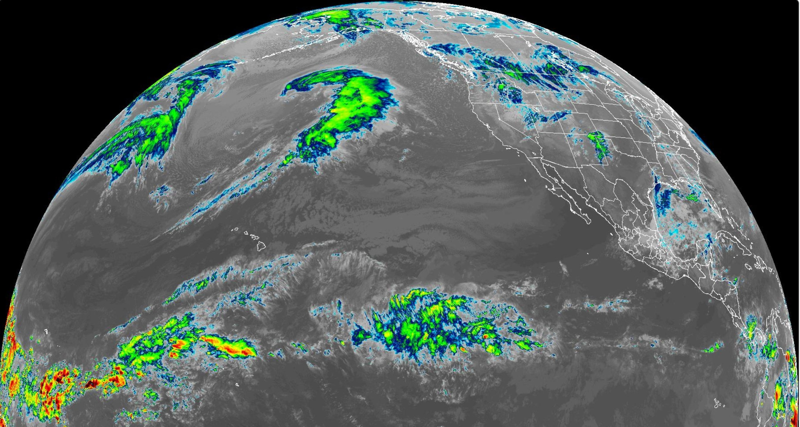
What a day of surf. Not much was showing this morning in Southern CA, but the Central coast sure did. One buoy in particular this morning north of San Fran hit 29' at 20 seconds which translates to 60' Mavericks. And as that swell marched down the coast today, we had our share of bombs from Ventura to SD. The Torrey Pines buoy peaked at 10' at 20 seconds this evening which resulted in 20' bombs at Blacks. For Friday, the W swell will be on it's way down, but there will still be plenty of juice out there- so be careful. 


And for Saturday? Well, it's an El Nino year- so we have more big surf coming- most likely the same size as today. We do though have a cold front coming through on Saturday, so you might catch a clean window early of SE wind but by mid-morning it should be blowing pretty good out of the WNW- so get on it early- if you've got a big enough board. By Sunday, the swell will be rapidly dropping but there will be enough big sets to keep you on your toes. And here’s the sun, tides, and water temps for the upcoming weekend:
  • Sunrise and sunset:
    • 6:51 AM sunrise
    • 4:53 PM sunset
  • Water temps are still low 60's- pleasant for winter.

  • Tides are starting to mellow out:
    • about 4' at sunrise
    • 5' before lunch
    • and down to 0' at sunset
FORECAST:

Looks like the massive surf is on it's way out for the near future BUT... we have plenty of good surf on the charts. 


New shoulder high+ WNW arrives Tuesday the 2nd then more overhead NW may arrive late next week.
We may also get the tail end of storms next week- just showers- but winds may not be ideal. If anything changes between now and then, make sure to follow North County Surf on Twitter!

WEATHER:


So far this El Nino has given us great surf and the rains haven't been problematic. So for our waves & weather this weekend and beyond? Looks like good surf again and just off and on showers. Here's what we have on tap for at least the next 7 days:
  • Friday: Mostly sunny. Temps 65/50
  • Saturday through next week: Showers every other day (and potentially New Years Day). Temps 62/45.
BEST BET:
  • Where do I start? 
  • Friday with solid surf again- hopefully a touch smaller so it's manageable.
  • Saturday: Big again. Know your limits!
  • Sunday/Monday: Good surf and hopefully manageable.
  • New swell Tueday and fun- but showers?
  • Late next week with head high/overhead surf- but showers?

NEWS OF THE WEEK:


AI is all the rage when it comes to the future- including weather forecasting.  But sometimes you can't replace the good ol' fashioned hands on approach, like flying a plane into the eye of the storm. That's why the Scripps Institute is partnering with the Air Force this winter- to go storm chasing in the sky. Here's the Times of San Diego to explain:

San Diego, like the rest of California, was deluged by multiple atmospheric river weather events over the 2022-2023 rainy season, which both considerably eased the state’s drought and created new types of weather hazards. As the climate changes, so too do ways to predict and monitor the weather. To that end, the Scripps Institution of Oceanography’s Center for Western Weather and Water Extremes (W3E) is leading the Atmospheric River Reconnaissance program with “Hurricane Hunter” aircraft from the U.S. Air Force Reserve 53rd Weather Reconnaissance Squadron and NOAA. 

The research will be invaluable for tracking future weather models in a rapidly changing climate, said Dr. Anna Wilson, W3E’s field research manager. “With all this data we can improve our understanding of the physical processes and represent them better.” This has immediate ramifications for the region, Wilson said, which was built for conditions that are either rapidly changing or no longer exist. “Our existing infrastructure was built a long time ago with the setup of the natural reservoir that is the snowpack, and we don’t have that any more to count on,” she said.

This year, California’s snowpack is one of the largest ever, following years of drought — an example of the “climate whiplash” expected in increasingly extreme weather conditions. The joint program aims to collect data on atmospheric rivers, which occur when winds over the Pacific Ocean push moisture-rich warm air toward the West Coast. When it is pushed upward into cooler air, the resulting condensation can cause dramatic amounts of rain or snow to fall – on average, 25 times the flow of the mouth of the Mississippi River.

These rivers of moisture can rapidly turn around drought conditions, but they also carry with them risks of extreme flooding, which is only expected to become more pronounced with more extreme climate change. 
The details collected with this program will help prepare future climate models, said Dr. Marty Ralph, UC San Diego’s Scripps Institution of Oceanography meteorologist and founding director of CW3E.  “If you want to predict where a car is going to be five minutes from now you need to know where it’s starting from and how fast it’s moving,” Ralph said. 

“Similarly, if there is an atmospheric river out near Hawaii, and we want to forecast where it will hit the California coast a few days later and how strong it is, we need to get out there and take direct measurements.” The car analogy works for more dimensions than just location and speed, said Anna Wilson. “Where’s that car now? How big is it, how fast is it driving — that kind of stuff,” she said. 
AR Recon plans to expand further west across the Pacific, running test flight operations from Guam for a two-week period this year.

PIC OF THE WEEK:


On a normal day, I'd do anything to surf this wave. But since it was all-time around here today, this looks just... blah. (Ok, that's an exaggeration, but it has been pretty darn good in So-Cal lately).

Keep Surfing, 
Michael W. Glenn
Opulent
Still Have A Kiss Poster On My Bedroom Wall
My New Year's Resolution Is To Surf 8 Days A Week

Wednesday, December 20, 2023

THE Surf Report- Early Edition


Short Report. Big Storm.

SURF:

Big storm moving our way and I'm headed straight into the middle of it tomorrow- so here's an early edition of THE Surf Report...


Great surf all week with great conditions is being replaced tonight by burly storm out of the N Pacific.


Look for increasing SSW winds tomorrow through Friday and jumbled head high+ storm surf from the W. The weather cleans up this weekend- but the water stays dirty. And here’s the sun, tides, and water temps for the upcoming weekend:
  • Sunrise and sunset:
    • 6:47 AM sunrise
    • 4:47 PM sunset
    • and just like that- our days are getting longer starting tomorrow, Thursday the 21st as the winter solstice is upon us! 
  • Water temps low 60's.
  • Tides are getting extreme again:
    • about 5' at sunrise
    • -0.5' at lunch
    • and 3' at sunset
FORECAST:


Surf starts off in the waist high+ range to start the week- then it ramps up big time the 2nd half of the week- along with potential rain again. Wednesday should be shoulder high and if we're lucky- 10' by next Saturday- but stormy. 


And the waves and weather look to be active into early January. If anything changes between now and then, make sure to follow North County Surf on Twitter!

WEATHER:


Looks like El Nino is finally here. We've got a firehose aimed at Central and Southern CA the next few days. Rain and wind are on tap tonight through Saturday morning with the heaviest rain late Thursday into Friday morning. Rain totals could approach 2". Nothing to sneeze at. It's a warm storm though as it's tapped into tropical moisture- so snow levels may be above 7,000'. But hey- it's a start. Here's what we have on tap for at least the next 7 days:
  • Friday/Saturday: Rain and wind. Temps 65/55.
  • Saturday: Showers early, then clearing. Temps 62/50.
  • Sunday through Wednesday: Sunny and cool. Temps 61/47.
  • Late next week- a return to stormy weather?...

BEST BET:
  • Wednesday with building W swell and clean-ish conditions.
  • Or big sketchy stormy surf next weekend?

NEWS OF THE WEEK:


In the ever evolving story of AI good vs. evil, coral reefs have been dying off recently due to unprecedented ocean warming. But can artificial intelligence help reverse the trend? Here's Bloomberg Businessweek with some insight:

Robots, 3D printers and other machinery fill a building on a pier in San Francisco. It seems an unlikely place to save coral reefs from climate change.

But over the past four years, an Australian coral scientist has been collaborating with technologists at the industrial design software company Autodesk Inc. to develop artificial-intelligence-powered robots that can automate coral restoration. Doing so could speed the rehabilitation of reefs as well as the transplanting of corals to places where they’d have a better chance of surviving in a rapidly warming ocean.

“Where we can really assist is in creating seed banks, because I do think a lot of the tropical corals are going to struggle to survive under climate change,” says coral biologist Taryn Foster, the founder of Coral Maker, who’s working with Autodesk roboticists on the project. Coral Maker, a startup in Geraldton, Australia, aims to eventually restore 100 hectares (250 acres) of reefs a year, compared with the 1 hectare currently rehabilitated annually. Worldwide, coral reefs cover 28.4 million hectares of the ocean.

This summer’s unrelenting climate-change-driven heat cooked coral reefs in Florida, where water temperatures reached 101F (38.3C). In Australia a 2022 marine heat wave affected 91% of the corals surveyed in the Great Barrier Reef. It was the fourth mass bleaching event to devastate the world’s largest reef system since 2016, with water temperatures around the reef hitting a record high last November.

Corals rely on algae to supply food and color. But when ocean temperatures exceed corals’ heat tolerance, the symbiotic algae turn toxic and are expelled. Deprived of nutrition, corals turn white and can die unless waters cool.

Jessica Levy, director of restoration at the Coral Restoration Foundation, says temperatures in the Florida Keys have been so extreme this summer that at one site, corals “didn’t have time to bleach—they just kind of burned and were dead.” So dire was the threat that, in early August, Levy’s colleagues rescued 1,500 corals representing unique genotypes and transported them to water tanks on land to safeguard the reef’s genetic diversity.


As climate change accelerates, it’s leaving almost no reef untouched. Coral restoration has become a contentious issue among marine scientists. Terry Hughes, a prominent coral scientist in Australia, argues that restoration has little impact, is exorbitantly expensive and distracts from reducing carbon emissions, overfishing and pollution, all of which degrade coral reefs. “What would that tiny area look like after it was ‘restored’ and after the next bout of record-breaking temperatures?” Hughes asks of Coral Maker’s 100-hectare goal.

Half of the planet’s reefs—on which 25% of marine species depend—have disappeared over the past 60 years. In 2020 scientists at the University of Hawaii estimated that most of the remaining reefs could be gone within the next two decades, with extinction likely by the turn of the century unless carbon emissions are eliminated. With emissions at record highs, though, and the fate of reefs in the balance, there’s an increasingly pressing need to look for novel solutions to give corals a fighting chance. Projects such as Coral Maker are not designed to replace all the corals lost, but to preserve the genetic diversity of the species.

Foster was a fellow at the California Academy of Sciences in San Francisco in 2019 when she was accepted as a resident at the Autodesk Technology Centers Outsight Network. The program gives entrepreneurs access to design and fabrication tools and to the company’s technology experts.

Efforts to restore reefs have centered on the painstakingly slow and expensive process of hand-transplanting nursery-raised corals in the ocean. Rehabilitation costs vary widely, ranging from $50,000 to $1 million a hectare, according to a paper Hughes co-authored that was published in June in the journal One Earth. “The cost we’re aiming to reduce is the labor cost of doing extremely repetitive and simple tasks that we don’t really need a person to be doing,” Foster says.

That work often involves epoxying individual corals or coral fragments to a degraded reef or gluing the corals into plugs that are inserted into a frame, called a skeleton, that’s then placed in the ocean or attached to an existing reef.

Foster is experimenting with the mass-manufacturing techniques she learned at her family’s stone products business in Western Australia to produce millions of artificial skeletons to hold coral fragments. (The skeletons are made of recycled stone waste.)

Automating the work of placing coral into the skeletons meant training a robot to recognize coral fragments and then pick up the pieces and insert them into a plug. “That’s a big challenge, as you can see that each coral piece is very different from the other, and they’re also very fragile,” says Yotto Koga, a roboticist at the Autodesk AI Lab who volunteered his time for the project.

At Autodesk’s technology center in San Francisco, the team put its AI to the test using a collection of coral that included both real and 3D-printed facsimiles. The AI part of the equation involves training robots to recognize different kinds of coral fragments and adjust their grip accordingly so they don’t damage the organism. Autodesk’s bots resemble pint-size versions of the giant one-armed robots used to weld automotive frames. “Each individual coral is a unique shape, and it’s not something that we could preprogram the robot to handle, so it’s got to be able to deal with that variability on its own,” Foster says.


Her plan is to deploy the robots in two locations. At land-based nurseries, robots would prepare millions of coral plugs for transplantation. Then on a boat at a restoration site, other robots would insert six to eight plugs into each coral skeleton. Divers or remote-operated vehicles would then place the skeletons on a damaged reef or where a new reef was being assembled.

Coral Maker intends to make money in part by selling “biodiversity credits” for reefs it restores or installs. Like carbon credits, biodiversity credits would allow corporations to meet environmental goals by financing ecological preservation. Some experts are concerned, though, that the credits could allow companies to greenwash their role in biodiversity loss unless the offsets are based on sound science, similar to what’s happened with carbon credits.

Foster says only restoration projects that add to biodiversity would generate credits, and rules would be put in place to prevent corporations from “just using them to get the green light to do further damage.”

Although the robots were able to perform restoration tasks in the controlled conditions of the Autodesk laboratory, the next step is to test their ability in the real world with live corals. “If you’re doing computer vision, lighting conditions are really material,” says Heather Kerrick, an Autodesk robotic systems expert. “But we can’t simulate the lighting conditions of a Western Australia beach in here.”

Even the most ambitious restoration effort would be but a drop in an ever-hotter ocean given the extent of coral loss. Hughes and his co-authors analyzed 323 coral reef studies and reports and found that planting 1 billion corals, each 1 square foot in size, would increase coral cover in the Great Barrier Reef by only 1%.
Levy of the Coral Restoration Foundation says that automation and robotics could scale up reef rehabilitation but that the goal of such efforts isn’t necessarily to replace what’s been destroyed. “The point of restoration is population persistence, maintaining these corals from going extinct,” she says. “Not everything we put back in the water is going to survive changing temperatures. But if we do nothing, there will be nothing left.”

PIC OF THE WEEK:


Remote work is all the range. Rumor has it, Santa has set up shop here. Can you blame him?

Keep Surfing, 
Michael W. Glenn
Resourceful
Just 4 More Days Of Being Good. I Got This. 
They Call Me The 'Surfing Fireman' Because Of All The Buckets I Throw

Thursday, December 14, 2023

THE Surf Report


Wet 'n' Wild.

SURF:

For those of you that like to take the guess work out of surfing, I offer you the Palm Springs Surf Club. 3-5’ perfect surf every day starting January 1st. And for those of you that like to take a little risk in your life, I give you… THE Surf Report. I swear Mother Nature is trying to give the Palm Springs Surf Club a run for their money. I would have said from February to October- give me a wave pool in all of it’s chlorinated glory as our surf was awful. But now- I’m not so sure with our recent run of waves. And there’s more coming. A lot more. 


For Friday, we get a new small WNW groundswell for chest high sets (bigger in SD) later in the day and into Saturday. 


Then on Sunday we get more WNW for slightly bigger shoulder high surf (and better in SD again). We also have some storms trying to break down the door by Sunday so expect more high clouds but no real rain or wind to speak of. Yet. And here’s the sun, tides, and water temps for the upcoming weekend:
  • Sunrise and sunset:
    • 6:45 AM sunrise
    • 4:45 PM sunset
  • Water temps low 60's.
  • Tides are getting back to normal:
    • 4' at sunrise
    • about 5.5' before lunch
    • and almost 0' at sunset.
FORECAST:

Here comes the fun part. Models show storms lined up on the horizon like incoming jumbo jets at LAX. The good WNW groundswell on Sunday continues into Tuesday and drops slightly into Wednesday. THEN… the storms could be finally coming ashore by then. 


Surf picks up again late Wednesday to the head high range- but it’s shorter interval WNW swell and may have SW wind on it. For Thursday into Friday, we could have storm surf and wet & wild conditions. The weekend cleans up slightly and long range charts show SOLID surf arriving after Christmas- and maybe more wet & windy weather. Just between you and I… I’m all for it. If anything changes between now and then, make sure to follow North County Surf on Twitter. 

WEATHER:


If you’re a southern California native, you know there’s no such thing as a white Christmas, let alone a wet Christmas. Well, we may be in luck this season. But first- the upcoming weekend. On Friday we’ve got weak offshore winds as storms to the N of us try to break down our high pressure. We’re left with dry conditions and high clouds through Saturday. More storms early next week finally start to saturate the air and we MAY have some showers on Monday- but most likely real rain by Wednesday into Thursday. And on it’s heels could be more storms towards the Christmas holiday. Here's what we have on tap for at least the next 7 days:
  • Friday: Sunny. Temps 67/55.
  • Saturday: Ditto but a touch more high clouds. Temps 67/55.
  • Sunday through Tuesday: Increasing chances of showers. Temps low 60's during the day and high 50's at night.
  • Wednesday/Thursday: A real storm? 
  • Friday and beyond: More storms?...

BEST BET:
  • Late Friday into Saturday: Fun WNW and good conditions. 
  • Late Sunday into Tuesday: Better WNW but deteriorating conditions
  • Bigger surf next weekend and beyond but stormy?...
NEWS OF THE WEEK:


I've been obsessed with wave pools ever since the pro tour held a contest in knee high dribblers back in '85 at the surf capital of the world... Allentown, PA. Fast forward 30 years, and I posted the latest news on the chlorine dream in the North County Surf blog here. Almost 10 years later and countless wave pool blogs later, we finally have our first wave pool in Southern California. Why is this an important milestone? If you've ever spent countless springtime surf sessions in a 4/3 dealing with crowds, lack of surf, S wind, and fog, you know what I'm getting at. You don't think I'm headed over the hill to surf countless shoulder high waves in 80 degree water while my lady sips Pina Coladas and films me? Sign me up. With over 20 million people living within 2 hours of the pool, this is going to be a boon to the wave pool industry and hopefully more will be built soon as the Palm Spring Surf Club will be constantly sold out. So if you haven't heard yet, here's Travel and Leisure Magazine with the scoop:

The long-awaited Palm Springs Surf Club (PSSC) is preparing to officially swing open its doors to the public at the turn of the new year, on Jan. 1, 2024. And with it bring a brand new wave to Southern California. Specifically, to 1500 S Gene Autry Trail in Palm Springs.


“Opening The Palm Springs Surf Club marks the realization of a dream that was once unimaginable — catching waves in the desert. We have assembled a passionate team to create an extraordinary space that will provide world-class entertainment and bring together people from within and beyond the surf community,” Vinny Smith, the general partner of the club, shared in a statement provided to Travel + Leisure. “This team took a dilapidated park that was built in the late 1970s and created what you see today.” 

The idea for the resort started to form in 2018, when Cheyne Magnusson, who helped curate and create the original wave park in Waco, Texas, partnered with pro surf icon Kalani Robb to build a next-generation wave prototype in what was previously the Wet ‘N’ Wild waterpark in Palm Springs. In 2019, they completed the prototype and invited Smith to come test it for himself. So impressed, Smith brought in hotel developers Tim and Colin O’Byrne to help create what is the final club today.  

At the resort, guests can surf an engineered wave that ranges from two to seven feet, depending on just how gnarly each guest feels, which goes on for 400 feet, with the length of each ride going between seven to 11 seconds.  And truly, it can be experienced by everyone from beginner to pro. 


“We're thrilled to bring this unique desert surf experience to life. Whether you're an avid surfer, a beginner, or someone who simply loves to watch this spectacular sport, The Palm Springs Surf Club has something for everyone,” Tim O'Byrne said. “Surfing is a mesmerizing sport to watch, and at PSSC, the experience of observing surfers ride world-class waves against the stunning backdrop of the Palm Springs Mountains is unparalleled.” 

However, even if you don’t want to paddle into the waves, you can still enjoy the 21-acre club thanks to its other water-centric perks like waterslides, ADA-accessible lounge pools, and lazy river, along with its dining venues like Amala restaurant, which will offer sustainable bites. (Guests can also choose to just come to Amala and skip the park entrance fee altogether.)


There are also three full bars on site, where guests can order bespoke cocktails or a draft beer. And anyone choosing to surf can get a low-key bite at Drifter’s just next to the pool. Guests are also more than welcome to lounge about in the private cabanas or day beds lining the river and the wave pool.

And if you’re worried about the water usage in the desert, don’t be. PSSC uses just 1 percent of the water volume required by a typical golf course while generating over 70 percent of its energy resources in-house. 

Surfers are welcome to bring their own boards or rent from the in-house shop. Riding the wave starts at $100 for beginners (for a group of 12), $150 for intermediates (group of 12), and $200 for the advanced (group of 9).

Reservation stations can be booked at palmspringssurfclub.com right now.

See you out there. I'll buy the first round at Mastro's.

PIC OF THE WEEK:


The Golden State has been golden lately. Just ask this A-frame at some undisclosed So-Cal desert. Ok- who's kidding- I'm pretty sure you can guess where this is.

Keep Surfing, 
Michael W. Glenn
NEVER In Doubt
Got 11 More Days To Go Until I Can Be Naughty Again
Gambling Is Illegal At Palm Springs Surf Club, And I Never Slide

Thursday, December 7, 2023

THE Surf Report


Best. Year. EVER.

SURF:


Of course I'm being facetious considering February through October was pretty horrible around here, but 2023 has been bookended by large swells in January and firing surf in November/December. Today was no different as we had more WNW wind/groundswell for head high+ surf most everywhere. For Friday, we get leftovers but still fun head high sets in the AM as well as the start of a Santa Ana wind event. The surf drops further on Saturday for chest high sets- and still offshore conditions. By Sunday, the NE winds back off but the weather will continue to shine and the surf drops to the waist high+ range. And here are the tides, sun, and water temps for this weekend:
  • Sunrise and sunset:
    • 6:40 AM sunrise
    • 4:43 PM sunset
  • Water temps are 63 +/- but should drop next week once the Santa Ana winds kick in this weekend.
  • Tides are starting to expand again this weekend and get real extreme again later next week. In the meantime here's what we have for the upcoming weekend:
    • 5' at sunrise
    • down to 0.5' after lunch
    • and up to 3' at sunset
FORECAST:

Still nothing big on the horizon as high pressure is in control- but we will have surf. 


A small but good storm developing in the north Pacific today will send chest high NW swell for late Monday into Tuesday. 


Not much surf for Wednesday/Thursday but more chest high NW (and bigger towards SD) will arrive for next weekend. If anything changes between now and then, make sure to follow North County Surf on Twitter.

WEATHER:


A cold front moved by the N of us today (good news for you Sierra/Rockies powder hounds) and in its wake is high pressure behind us for Santa Ana winds this weekend. Here's what we have on tap for at least the next 7 days:
  • Friday: Sunny, cool, and breezy offshore winds. Temps 65/50
  • Saturday: Ditto but a touch warmer and a touch stronger winds- temps 70/50.
  • Sunday through at least next weekend? Sunny and temps high 60's/50.
BEST BET:
  • Friday with fun WNW and offshore winds. Get on it early!
  • Tuesday with a new smaller NW and good conditions.
  • Next weekend with more fun NW and good conditions.
NEWS OF THE WEEK:


Great weather around here, eh? So much for that El Nino. Not so fast- as mentioned during last week's THE Surf Report, El Nino is in full swing across the Pacific and if we're to get above average rainfall this winter, we'll most likely see it during the January to March timeframe. So until then, enjoy our great weather. But we do need the rain though- so how are we looking so far? Glad you asked, our rainy 'season' technically runs through October 1st to September 30th, so we've basically just started. Here's our rain totals so far:
  • Los Angeles: 0.13" so far. Only 8% of normal. Last year at this time, L.A. had 2.26"!
  • Newport Beach: 0.53" so far. Only 32% of normal- and last year they had 1.71" at this point. 
  • Oceanside: Has received the lion's shar so far with 1.61" and is at 93% of normal. Last year they had 1.84".
  • San Diego: 0.62" so far and is 40% of normal. Last year at this time they had 1.17".
As you can see, most locations are running about 1/2"-1" behind the pace. All it will take is one average storm later this month to get us to 100% so it's not time to start panicking. And if the El Nino really kicks in- we should see 15" or more this winter if we have any luck. Now's the time to get that leaky roof fixed... 

PIC OF THE WEEK:


The Golden State has been golden lately. Just ask this guy who has the line-up all to himself at some undisclosed Nor-Cal beachbreak. Ok- who's kidding- I'm pretty sure you can guess where this is.

Keep Surfing, 
Michael W. Glenn
Earnest
Cuddly As A Cactus, Charming As An Eel
Banned From The Surf Ranch Pro For Playing Marco Polo During The Finals

Thursday, November 30, 2023

THE Surf Report


No Complaints.

SURF:


If you're a surfer in California, things are looking pretty sweet right now. Lots of surf, great weather, plenty of spots lighting up- it doesn't get much better than this. And hopefully you saw some of those photos coming out of Northern California last weekend- wowza. Tired yet? Still got gas in the tank? Good- there's more coming. 


First up, a storm generated some short period NW swell and is filling in this evening. For Friday, look for shoulder high surf that drops quickly into Saturday. By Sunday we're back to nice weather and waist high+ surf. And here are the tides, sun, and water temps for this weekend:
  • Sunrise and sunset:
    • 6:42 AM sunrise
    • 4:44 PM sunset
  • Water temps are 63 +/-

  • Tides are back to normal this weekend:
    • 3' at sunrise
    • up to 4.5' at lunch
    • and down to 1' at sunset
FORECAST:


The week starts out small but still rideable with a new small NW for chest high sets. Mid week looks small too but clean- and then we have more swell moving in towards Wednesday. 


Charts show a good storm above Hawaii sending more WNW for shoulder high+ surf into Friday. The Aleutians take a breather after that but the N Pacific looks to be active into December so we may have more surf by mid-month. If anything changes between now and then, make sure to follow North County Surf on X.

WEATHER:


The showers have moved through today (about 1/4" along the coast) and we have good weather until at least mid-week. After that, models diverge but showers MAY return next weekend. Until then, here's what we have on tap:
  • Friday and Saturday: Sunny and cool. Temps 65/48
  • Sunday through Wednesday: Slightly warmer and temps 70/55.
  • Late next week: A return of showers?
BEST BET:
  • Friday with shorter period WNW and clean condtiions
  • Wednesday with better WNW

NEWS OF THE WEEK:


Now that El Nino is charging full steam ahead, what should we expect once winter kicks in towards January? The National Oceanic and Atmospheric Administration (NOAA) can shed some light on the subject for us:

After the last three winters of La Niña conditions (weren’t we all ready for a change!), the tropical Pacific is looking much different this year, with a strong El Niño likely this winter. Historically, how has El Niño shaped precipitation (rainfall + snowfall) over the U.S.? Let’s dig in and find out.

What happened during December-February for previous strong El Niños?

For the 7 strongest El Niño events since 1950, wetter-than-normal conditions occurred along the West Coast and southern tier of the U.S., especially in the Southeast. This is expected because El Niño causes the jet stream to shift southward and extend eastward over the southern U.S. However, there are clearly some differences among the events if you look at the details in the maps. For instance, the 2015-16 and 1957-58 strong El Niños were not as wet as expected over the southern U.S. and were even dry in some locations. What is the story there?

The devil is in the details.

When forecasters put together a prediction, one consideration is the forecasts generated by climate models, such as from the North American Multi-Model Ensemble (NMME). You might think that the NMME produces a single forecast map for the upcoming winter, but nope! Each month, the NMME produces hundreds of forecast maps from several different models. Why so many maps? Well, the short version of the story is that the chaos of weather can have big consequences for our seasonal predictions. We cannot possibly say what the weather will be like on January 1st based on model forecasts that were made in early November. So, by running models many times, we are simulating a lot of different possible “weather outcomes” that can occur over a season. 

The easiest way to examine these model predictions is not by staring at hundreds of maps (trust me, we’ve tried), but rather by examining the average of all the maps (this is called an “ensemble mean”). The average isolates the seasonal forecast signal (like El Niño) while removing the noise of chaotic weather. The forecast averages are expecting a strong El Niño this winter; not surprisingly, bears a striking resemblance to the expected winter El Niño precipitation pattern.

However, this is a bit misleading because, as just noted, there are actually hundreds of forecasts, and this is just an average of all of them. We know, because of chaotic weather, that the upcoming reality could more closely mimic any of the hundreds of individual forecasts. And these forecasts can differ considerably from each other. 


For example, one forecast that looks quite similar to the NMME average. On the other hand, another has taken from the same model from the same starting month with basically the same El Niño, has almost the opposite pattern! And we cannot rule out either outcome actually happening for the upcoming winter! 

This, in a nutshell, is the curse of internal variability. Basically, a single model, run forward with slightly different initial states, can lead to very different forecasted outcomes for the upcoming El Niño winter. 

So, what’s the point of a making winter predictions?

If I’m basically saying that anything can happen this winter, then why do we bother to produce seasonal predictions? Well, as we have emphasized on the blog, although almost anything can happen in a given winter, El Niño or La Niña can tilt the odds in favor of a particular outcome, meaning that those hundreds of predictions may lean in a certain direction. Additionally, the stronger the El Niño, the more likely the U.S. winter precipitation pattern will match both the average of the computer model forecasts and the typical El Niño precipitation pattern. Because there are higher chances in certain outcomes (e.g., a wetter winter), the presence of El Niño can help users assess risk and make plans. 

Not convinced yet? We can put my claim to the test by assessing how well the typical or expected El Niño winter precipitation pattern matched up with what actually occurred for past winters. We can do that by examining all previous U.S. precipitation forecasts produced by the NMME, the hundreds of individual forecasts and the multi-model average, for all past winters from 1983-2022. The schematic above breaks down these evaluations.

I have taken every winter precipitation pattern from this period and calculated how well that pattern matched the individual NMME forecasts for that winter, the NMME average forecast, and the expected El Niño precipitation pattern. The values in this evaluation range from -1 to +1, with values closer to +1 indicating a good match with the actual observed pattern, values near 0 indicating no match, and negative values closer to -1 indicating an inverse match (“mirror image”). All these calculations for all 40 winters are presented in a single plot and arranged from left to right according to the strength of the La Niña (strongest farthest left) or El Niño (strongest farthest right), as shown in the bottom left of the schematic.

There’s a lot to take in from these comparisons, but there are three main takeaways:


The first in this sequence reveals two of the main takeaways.

The stronger the El Ni̱o or La Ni̱a, the more likely that the actual winter pattern will match the average model forecast pattern. This is why seasonal predictions work, and why we care so much about ENSO! The tendency is for the average model forecast to perform better at stronger Ni̱o-3.4 index values. In fact, by this metric, the forecasts have performed quite well for most (but not all! Рmore on that below) moderate-to-strong El Ninos.

For a given winter forecast, chaotic weather causes a wide range of performance among individual model forecasts. This second takeaway, which causes the most wailing and gnashing of teeth among forecasters and their users, is the performance from individual model forecasts. In fact, for a given winter, there are usually some forecasts that perform quite well and some that perform quite poorly, even though there are no major differences in the models’ ENSO forecast between the high- and low-performing forecasts. Instead, the main difference is what we saw in those two forecast maps above: unpredictable, chaotic weather. Unfortunately, it’s likely impossible to distinguish those high- and low-performing model forecasts well in advance. Again, that’s the curse of internal variability.

In the second step of this sequence, we now look at how well the observed precipitation pattern matched the expected El Niño or La Niña precipitation pattern.


This addition reveals the third takeaway.

The average model forecast closely resembles the “expected” El Niño/La Niña precipitation pattern for most winters. This point comes out when we consider the average model forecasts, that represent the El Niño or La Niña precipitation patterns for a given Niño-3.4 index value. This is the models’ way of agreeing with what we’ve been claiming at the ENSO Blog for years: ENSO is the major player for predictable seasonal climate patterns over the U.S. If there were another more important source of predictability, we would expect a bigger separation between those colored diamonds and the dark grey dots.

The comparison between the two biggest previous El Niños in this record, the winter of 1997/98 (a forecast success) and 2015/16 (widely regarded as a forecast “bust,” or how forecasters generally describe a bad forecast), are a great illustration of this final point. but the upshot is that the influence of chaotic weather variability could have reduced the 1997/98 forecast performance much more than it did, and it likely was a factor in why the 2015/16 forecast performed so much worse.

Finally, let’s put these comparisons in the context of the forecast for the upcoming winter.

The likelihood of a strong El Niño increases the chance that the precipitation pattern for the upcoming winter will match both the NMME average and the expected El Niño pattern reasonably well, but, as I have been emphasizing, we cannot rule out the possibility that reality will have other plans.

That’s awfully convenient!

At this point, you might be saying, “Hold on, you’re telling me that ENSO is the main driver of the winter precipitation outlook, and if it busts, we can just blame it on the noise of chaotic, unpredictable weather? That sounds like a cop-out (and a little suspicious coming from a writer for the ENSO Blog).” That’s a fair question! As scientists, we need to continuously reevaluate our assumptions, check for blind spots, and tirelessly strive to improve our understanding of our forecast models. I can assure you that these efforts are being made, especially when the seasonal conditions deviate from expectations, and hopefully they will lead to better seasonal predictions with higher probabilities.

The main point I’m trying to make, however, is that when a forecast busts, it isn’t necessarily because there is a clear reason, a model bug, or a misunderstanding of the drivers. It could just be because there is a certain amount of unpredictable chaotic weather that we cannot predict in advance. That means that we must remember that seasonal outlooks are always expressed as probabilities (no guarantees!) and that we need to play the long game when evaluating seasonal outlooks – a single success or bust is not nearly enough.

BEST OF THE BLOG:


Want to give a big THANK YOU to everyone that RSVP'd to this Friday's Hollowday Party, benefiting the Maui Strong Fund!

This year's charity event, presented by our friends at Venture LLP, will be at Master's Kitchen & Cocktail in culinary hotspot Oceanside, CA. An industrial space with classic history, Masters was once a well remembered drag car shop. The revamped restaurant kept its authentic character, and is the perfect spot to get you in the holiday spirit. And with this year's fundraiser, we'll be benefiting our fellow Hawaiian surfers through the Maui Strong Fund, supporting the rebuilding of historic Lahaina town. And it couldn't be possible without YOU and our auction sponsors:
  • Electra Bicycles
  • Surfhouse and Coffee Coffee
  • Solterra wine from payrollHUB
  • Mark K. Ley fine art
  • The Cottage Restaurant
  • Canvas print from the North County Board Meeting
  • Whit Aadland from Whit's Musician Devolpment
  • Captain Fin Co. x Thomas Campbell x Type G
  • Caves Wine Shop
  • Lightning Bolt Surfboards
  • and Alila Marea Resort
And just a reminder that dinner, drinks, live music, and auction gets started at 5:30 PM. Thanks again for the support and we'll see you then! 

PIC OF THE WEEK:


A lone surfer in south county SD having the time of his life. We should all be so lucky. Oh- I guess we have been lately. Never mind.

Keep Surfing, 
Michael W. Glenn
Much Obliged
I Like To (Christmas) Party
Have Logged 3.8 Years Of Accumulated Tube Time To Date