Thursday, April 30, 2015

THE Surf Report- Early Edition


Y'all ready for this?!

SURF:

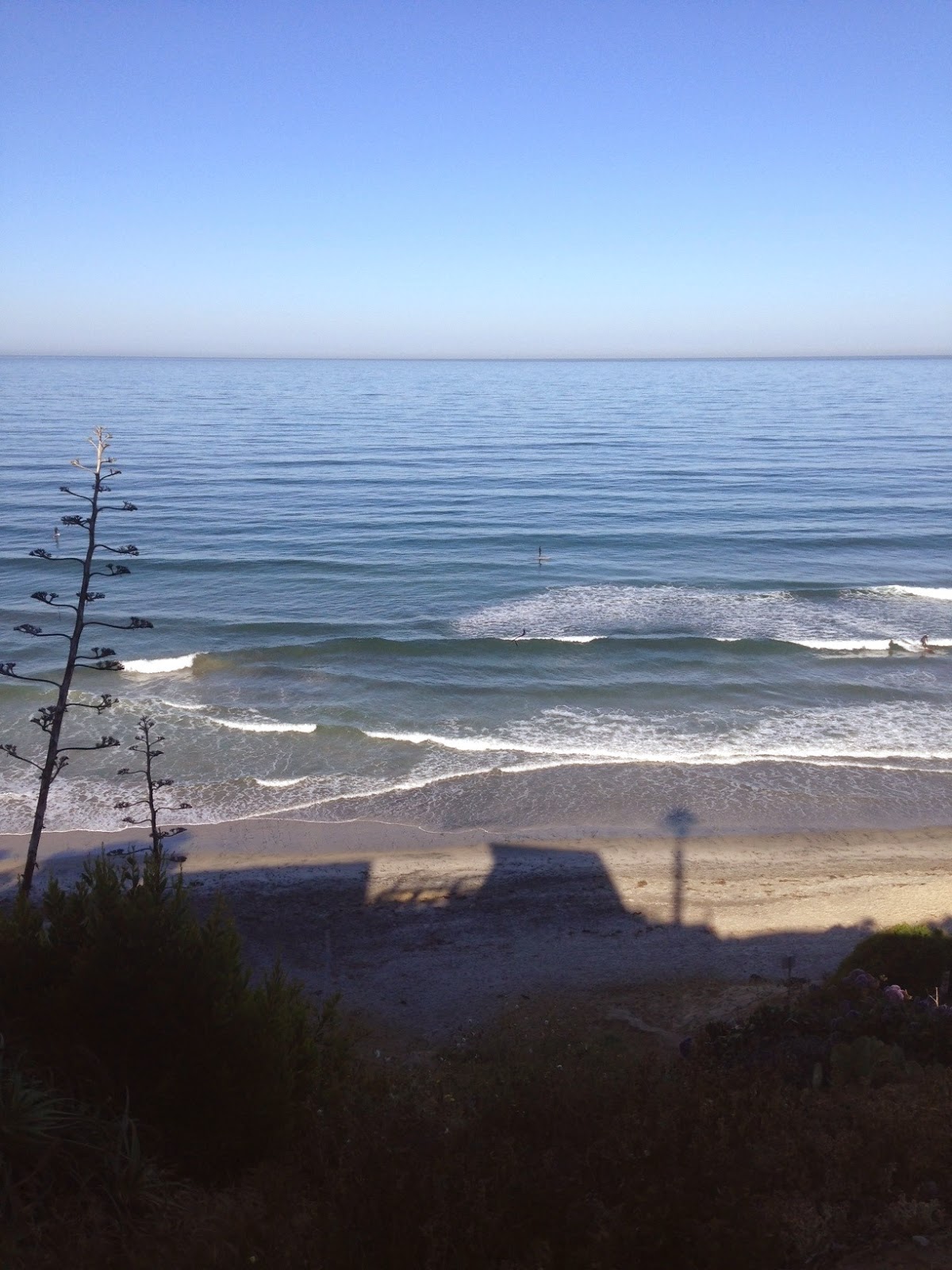
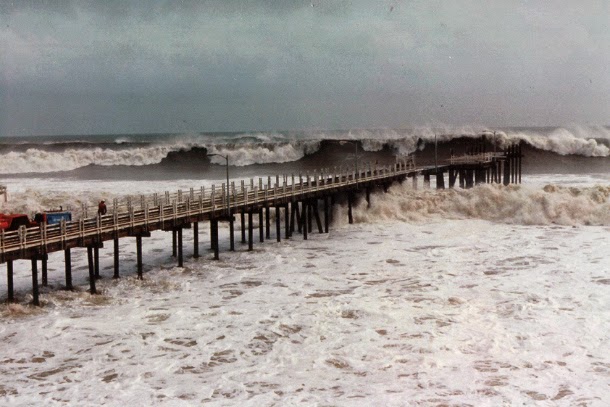
Fun surf this week. Nothing big but mostly fun combo surf all week. We had a good storm a few days ago in the southern hemisphere turn into a monster (more on that below), but at least the first part of the storm sent us fun shoulder high waves this afternoon and tomorrow will be more of the same, along with waist high+ NW windswell.
As the storm grew last week into 50' seas, it unfortunately was due S of us (just on the edge of our swell window), but we'll still get overhead sets by Sunday afternoon, with the OC getting the rogue 10' set. All in all some fun surf this weekend with the best waves Sunday afternoon. Time to ride a real board. Water temps have rebounded nicely and are 64 in Dana Point and 67 in La Jolla.
Tides this weekend are 3' at sunrise, up to 4' mid-morning, down to 1' late afternoon, and up quickly to 5' at sunset.

FORECAST:
The solid S swell will keep turning and burning into Monday as the swell peaks with 8'+ sets in the far north part of SD county and best OC spots hitting 12'. The swell starts to wind down on Tuesday but it still will be solid around here.
Next up on the charts is a waist-chest high NW ground/windswell for SD on Wednesday and on it's heels is a fun SW swell starting late Friday.
Look for shoulder high sets in north county SD and head high waves in the OC by next Saturday.
And then... charts show more storms off Antarctica that will give us fun SW swell the middle of May. Make sure to keep up to date on these developing storms by visiting Twitter/North County Surf.

WEATHER:

Still pretty mild around here. Sure we had some high 70's at the beaches the past few days but at least it's not a full blown 90 degree Santa Ana situation. High pressure starts to break down tomorrow afternoon as a weak low pressure system heads into our area. The result will be more low clouds/fog in the nights/mornings. Temps will be back to 70 at the beaches most of next week. And no rain in sight until maybe monsoon season starts in July.

BEST BET:
Monday. Or if you can't wait that long, Sunday afternoon.

NEWS OF THE WEEK:

Blame it on global warming or just a natural evolution of the earth, but a quarter of the world’s coral reefs have died off in recent decades. Have you always wanted to take a trip to Tavarua? Do it quick. But all may not be lost according to the NY Times (yes- that New York- the one that gave us the epic Slater/Owen battle at the 2011 Quik Pro. Oh- and Balaram Stack. Oh- and can’t forget The Ramones). The NY Times reported recently that man made efforts may be able to re-build the reefs. And I’m not talking about those crappy artificial reefs that produce crappy waves. I’m talking real coral reefs that can help reverse the current destruction due to man-made or natural occurrences. Read on:

SUMMERLAND KEY, Fla. — David Vaughan plunges his right arm down to his elbow into one of nine elevated tanks where thousands of tiny colonies of coral are growing at an astonishing rate in shaded seclusion next to the Mote Tropical Research Laboratory. “Now this is the exciting part. You ready for this?” he asks, straining to be heard over the relentless hiss of filtered saltwater squirting from a maze of pipes and plastic tubing into the shallow fiberglass tank, the size of a dining-room table. Dr. Vaughan, a marine biologist who is executive director of the laboratory, retrieves a flat rock from the bottom. A chocolate-brown colony of brain coral, nearly eight inches wide, has grown on the stony surface, its distinctive fleshy, serpentine folds nearly covering the rock. A year ago the colony began as inch-and-a-half-wide coral fragments cut with a band saw from the same parent colony. As if doused with a growth elixir, these coral “seeds” began to grow 25 times as fast as they would in the wild. And when arranged a few inches apart on the rock, the mini-colonies quickly advanced across the surface and fused to become a single grapefruit-sized organism that continues to grow. Other species grown from tiny coral seeds in the Mote lab have developed even faster — up to 50 times their normal rate. Dr. Vaughan and a staff biologist, Christopher Page, say this quick-grow technique, called microfragmenting, may make it possible to mass-produce reef-building corals for transplanting onto dead or dying reefs that took centuries to develop — perhaps slowing or even reversing the alarming loss of corals in the Florida Keys and elsewhere. “This is real,” Dr. Vaughan said. “This potentially can be a fix.” Other scientists are excited, too. While there are other efforts around the world to grow new coral, “this is easily the most promising restoration project that I am aware of,” said Billy Causey, a coral expert who oversees all federal marine sanctuaries in the Southeastern United States, the Gulf of Mexico and the Caribbean for the National Oceanic and Atmospheric Administration. “Dave and Chris are buying us time,” he added. “This will keep corals out there” until “we can come to understand what is happening to coral on the larger scale.” Still, even Dr. Vaughan’s cheery optimism has its limits. A quarter of the earth’s corals have disappeared in recent decades, and the Mote scientists say no one can predict what will happen if the oceans continue to warm, pollution and acidification increase, overfishing further decimates species beneficial to coral, and land runoff continues to reduce the amount of life-giving sunlight that reaches the bottom. “We do not know if this is a fix-all,” Mr. Page said. “At worst, we’re buying a little time. At best, we could restore the ecosystem.”

To find out more, check out the full article here.

PIC OF THE WEEK:

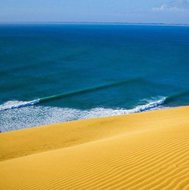
California has so many diverse places to visit it can make your head spin. San Diego, Hollywood, Napa, Disneyland, Lake Tahoe, and now this- the world's longest artificial wave at La Quinta- just outside of Palm Springs. And if you believe that, I have a bridge in San Francisco I'd like to sell you.

Keep Surfing,

Michael W. Glenn
Life Of The Party
I Was Born Ready
Can Get Any Wave I Want At Lowers

Tuesday, April 28, 2015

Surf Check


Beautiful day outside but not much to ride. 
As the NW windswell drops today, the SW starts to fill in- but neither are that big with only waist high waves around town. Did I tell you the weather is fantastic though?! Water temps are hovering around 64 degrees- which is about 5 degrees warmer than normal due to the so-called El Nino. Of note, last year at this time, water temps were also unseasonably warm- 65 degrees- due to the so-called El Nino. What does all this mean? Well, we're only slightly off from last year- and last year was a banner year for water temps and hurricane production. By the end of May we were trunking it in 70 degree water AND we had our first hurricane Amanda. I'm keeping my fingers crossed for the same this summer. 
Tides the next few days are 4' at sunrise, almost 0' after lunch, and back up to 4' at sunset. 

Before we get to the forecast, let's talk about our weather. More 80 degree weather is on tap all week but we may see a return of the low clouds and fog at the coast late Thursday evening. The weekend cools a little more with night/morning low clouds/fog and temps back to the mid to low 70's at the coast. Models then hint at the jet stream taking aim at us towards Monday which may produce a few showers. Since we'll already be into May, don't count on much. 
Now on to the important stuff. We had a little storm last week (that turned into a big storm- more on that below) send us a shot of fun SW that will start to build this afternoon. Look for chest high sets tomorrow in the far N part of the county and into OC. On it's heels is some NW windswell building later tomorrow and into Thursday. Both swells will make for some fun peaks around here by Thursday. 
So that little storm turned into a big, err, gigantic storm and during it's peak had seas over 50'. Unfortunately it peaked SSE of us (not ideal for our swell window) but it was so big, we'll still get overhead S swell from it. Remember that big S swell at the beginning of March? Think that. Look for swell starting to build Sunday and peaking Monday. That will last into Tuesday. By Tuesday we also have a small NW filling in which may help break up the big S lines. 
After that, the southern hemisphere takes a little breather mid-week, then a new slightly shadowed SW swell arrives next Friday into the weekend. Look for shoulder high waves from this one.
AND THEN... the southern hemisphere has another similar sized shoulder high SW on the forecast charts. So in a nutshell: The north Pacific is pretty quiet and the south Pacific is churning out bangers with a beast arriving late this weekend. Enjoy. 

Thursday, April 23, 2015

THE Surf Report- Early Edition


Just cruisin'.

SURF:
Hasn't been the biggest surf lately- nor the best weather- but it's been plenty fun.
This past week saw fun NW/SW swells in the water for shoulder high waves most everywhere. Tomorrow drops slightly but we still have fun chest high+ combo swell. We have a weak cold front moving through on Saturday and as it does, it will kick up the winds in our outer waters.
By late Saturday into early Sunday, models are showing a steep NW windswell in the head high range.
Water temps are cool but still slightly warmer than normal at 63 degrees and the tides are pretty simple the next few days- about 0' in the morning and up to 3.5' late afternoon.

FORECAST:
After the NW windswell rolls through this weekend, we have smaller background NW/SW for most of next week in the waist high+ range.
By Thursday though, charts show some waist high+ NW arriving and the start of some good SW in the chest high+ range.
Then the fun starts. Models tonight are showing a big storm off Antarctica taking shape late this weekend which will balloon into a monster. If the forecast is correct, we'll have a mammoth storm with 50'+ seas. Unfortunately it will peak SE of us near South America- not ideal for our swell window here in the States- but we still should get some well overhead S swell around the 3rd of May. Kind of like that solid S swell at the beginning of March we had.
After that, another storm is forecasted to build at the beginning of May which would give us overhead waves around the 9th of May. I love that we didn't get big El Nino NW swells this past winter but instead the SW swells are paying us back this spring! Make sure to keep up to date on these developing storms by visiting Twitter/North County Surf.

WEATHER:

We're pretty much where we should be this time of year with weak cold fronts moving through our area. No real rain unfortunately but temps are pleasant and it's cool to see cool weather finally. High pressure builds early next week and we get beach temps in the mid-70's again and more sun. Another weak cold front is forecasted for mid-week with more clouds and no rain.

BEST BET:
It's too far out to claim that big swell for early May, so let's just keep it safe and say next weekend with combo NW/SW

NEWS OF THE WEEK:

So we know that last winter was an ‘El Nino’ winter, meaning waters in the eastern tropical Pacific were warmer than average, and that was supposed to lead to big storms, big surf, and big rain. Well, the waters were definitely warmer than usual here in North County (like low 60’s this winter instead of mid-50’s) and I reported last week in the blog below that maybe the reason we didn't get big storms this winter was explained recently by a study in the Nature Geoscience journal that prolonged wind bursts originating in the western Pacific can have a strong effect on whether an El Niño event will occur and how severe it is likely to be. Well… the National Oceanic and Atmospheric Administration (NOAA) has their own theory on why we didn’t get 15+ inches of rain this winter (more like 5-6” or ½ of normal). Blame it on La Nina- the bossy big sis of El Nino. Here’s the scoop from NOAA:

On average, La Niña—the cool phase of a natural climate pattern in the tropical Pacific—leads to somewhat dry winters in California. But a new analysis of historical data from scientists in NOAA’s Climate Program Office suggests that dryness often deepens into drought the following year, even if the tropical Pacific has technically shifted back to “neutral” conditions.  Consistent with that pattern, California’s ongoing drought began in 2011-12, during the second year of a La Niña phase, and it persisted into the “neutral” years of 2012-2014.

The first image at right shows winter (December-February) sea surface temperature and precipitation data for all neutral years in the historical record (1901-2004) that followed a La Niña year. Click tabs below image to see different maps. The second and third images below show the winters of 2012-13 and 2013-14—the second and third winters of the ongoing California drought. Areas that were warmer than average are red; areas that were cooler than average are blue. Areas of unusually high precipitation are green; unusually dry areas are brown.

The conditions during the winter of 2012-13 echo the historical pattern in many ways: cool in the eastern tropical Pacific and warm to the west. In the mid-latitudes, a pocket of cooler water is pinned against the West Coast by a larger blob of unusually warm water in the North Pacific. In the winter of 2013-14, many signs of the pattern remain, but the mid-latitude “blob” of warm water was much warmer than the winter before, and it was located much closer to the West Coast. Meanwhile, the cool anomalies were fading.

The scientists replicated the historical analysis in a climate model that does a good job simulating El Niño/La Nina cycles and found the same pattern: when neutral conditions follow La Niña conditions, ocean surface waters remain cool in the eastern tropical Pacific, warm in the western Pacific, and precipitation in California remains below average. The below-average precipitation is connected to a large ridge of high pressure (not shown) looming offshore, blocking moisture-laden storms from traveling through California.

The simulations suggest that the dryness can linger for multiple years after a La Niña—until the Pacific shifts all the way over to its warm phase, El Niño. And to really help the current drought, not just any El Niño will do. The warming would likely need to be strong and widespread, not just confined to the central Pacific—where the current El Niño is located—but extending across the eastern tropical Pacific, as well.

The location of the warming is key to delivering a wet winter to California because the warm waters become the epicenter for increased tropical rainfall. Tropical rainfall must generally shift all the way into the eastern Pacific in order to influence the jet stream in a way that can reliably steer mid-latitude storms across California and the southern tier of the United States.

The ENSO forecast for April 2015 gives a roughly 70% chance that current El Niño conditions will last through the Northern Hemisphere summer of 2015, but whether it will last through the winter—California’s wet season—is more uncertain.

The lingering influence of La Niña event may explain part of the current California drought, but with an event this complex, multiple factors almost certainly play a role. In addition, research indicates that extended dry spells might be the long-term norm for this part of the world. Research highlighted in The New York Times uses tree rings to reconstruct past climates over centuries. Such studies have found evidence of Western megadroughts that lasted decades.

PIC OF THE WEEK:

Where the heck do these waves exist and how come I'm not on them?

Keep Surfing,

Michael W. Glenn
Victor
Confident Lakers Will Win It All This Year
'Searching for Mike Glenn' Released Exclusively On VHS At Wal-Mart Tomorrow

Friday, April 17, 2015

THE Surf Report- Late Edition


Back on track.

SURF:
After all the heat and bombing SW swell at the beginning of the month, we're starting to look a lot more like April around here.
Just a couple shots of NW windswell this past week for fun shoulder high waves along with smaller background SW swells. Today was the same- along with lots of NW wind. We have NW groundswell filling in tonight and tomorrow should have fun shoulder high surf with a touch of smaller SW again. Sunday backs off slightly but we still have chest high waves.
Water temps have rebounded slightly to 64 degrees and the tides the next few days are 2' at sunrise, up to 5' mid-morning, down to 0' late afternoon and up to 4' at sunset.

FORECAST:

Nothing of significance to start the week except for small NW windswell and background SW swells. We then have a weak cold front coming through the 2nd half of next week and the NW windswell comes along with it.
Thursday we'll have lumpy bumpy windy head high+ surf. That blows through on Friday and the swell goes home with it.
Long range models show a good storm off Antarctica in a few days that may give us overhead SW the start the month of May. Make sure to keep up to date on the waves/weather at https://twitter.com/NorthCountySurf.

WEATHER:

Just when you think summer's getting an early start- the forecast calls for cool conditions this weekend with low clouds in the nights and mornings. Not that big of a deal... but models then hint at showers the 2nd half of next week. Basically what you'd expect from April. By Friday the showers should end and we get cool conditions with NW winds behind the cold front.

BEST BET:
Even though Thursday will be the biggest day in the next week, the weak storm mentioned above will mess things up. Tomorrow is the call with new NW groundswell, nice weather, and background SW.

NEWS OF THE WEEK:

As we all know by now, the long-forecasted El Niño event of 2014/15 did not live up to the hype. Heck- it was non-existent. On March 5, 2015, the National Weather Service finally declared a "weak" event arriving several months later than expected, formally dashing predictions that we would see a major event on par with the monster El Niño of 1997/98 that would bring much-needed rain to California, large surf, and stormy conditions. Now, a team of researchers believes that they know why this year's event, and others like it, didn't live up to the hype.

A new study published online April 13, 2015, in the journal Nature Geoscience finds that prolonged wind bursts originating in the western Pacific can have a strong effect on whether an El Niño event will occur and how severe it is likely to be. In addition, the paper identifies three distinct varieties or "flavors" of El Niño, and explains how these westerly wind bursts (WWBs) can determine which of these flavors will take shape. The findings should help refine future predictions of these global-scale climate events.

"These westerly wind bursts are intra-seasonal; they're not weather, they're not climate, but somewhere in between," said Raghu Murtugudde, a professor of atmospheric and oceanic science at the University of Maryland who is a coauthor on the study. "Our study shows that the wind bursts are definitely having an effect. We better learn to predict them if we are going to have skillful El Niño predictions."

The researchers analyzed 50 years of tropical Pacific sea surface temperature and westerly wind burst data. They found differences, especially when comparing the data from this year's weak El Niño event with the record-breaking event of 1997/98.

"The most notable difference was the existence of strong westerly winds extending from the western to central equatorial Pacific in May 1997, which were not seen in 2014," said Murtugudde, who also has an appointment in the university's Earth System Science Interdisciplinary Center (ESSIC). "The development of strong westerly winds in the central equatorial Pacific in association with the warming to its east appears to be an essential element of large El Niño events."

After adding westerly wind bursts to their intermediate ocean-atmosphere coupled model, the researchers consistently found three "flavors" of El Niño (rather than one, which was the model's output without the winds). The three warm patterns included extremely strong events with the largest warming near the South American coast, a cluster of weak warm events centered near the dateline, or moderate warming in the central-eastern equatorial Pacific. For strong El Niño events, the westerly wind bursts grew strong and extended east of the dateline.

According to the research team, the wind bursts affect ocean dynamics by exciting Kelvin waves that produce surface warming in the eastern equatorial Pacific and by generating strong equatorial surface currents that extend the eastern edge of the warm pool.

"We hope this study helps other climate modeling researchers realize the importance of westerly wind bursts on El Niño severity and diversity, and the importance of extending our weather forecasting capabilities from two to four weeks to capture WWB variability. Fortunately, the latter is now a focus at the National Atmospheric and Oceanic Administration, which develops our weather forecasts," said Murtugudde.

PIC OF THE WEEK:
What's more ominous? That gaping barrel or that massive tower of rock that looks like it's going to fall down on you at any second?! Great- so you avoid the sharks, make the massive drop, pull in under the guillotine lip, handle the warble inside the barrel, and get spat into the channel going Mach 5 as you hang on by your toenails. And if you survive that, the shaky pillar will be looking over your shoulder like Big Brother.

Keep Surfing,

Michael W. Glenn
Anchor
Goat Hill Course Record 32 Under Par
Duke's Great Grandson

Friday, April 10, 2015

THE Surf Report- Late Edition


And we wait.

SURF:

Not too exciting this past week. Just some background SW/NW swells and mild weather. Unfortunately the weekend is more of the same. Tomorrow looks to be knee high again with waist high sets and Sunday morning starts off small again.
By the afternoon though we should see some waist high SW arrive from a storm off Antarctica last week and the OC may get chest high sets, but nothing exciting.
We also had a late season storm in the Aleutians a couple days ago that will send us NW swell Sunday afternoon too- about chest high- so the weekend isn't completely lost- if you can wait that long. Water temps have also taken a dive due to the very weak cold front that came through on Tuesday. No rain from it but it was nice enough to drop our water temps in to the low 60's. Thanks for that.
Tides the next few days are 1' at sunrise, down to 0' mid-morning, and up to 3' late afternoon. Make sure to keep up to date on the waves/weather at Twitter/North County Surf.

FORECAST:

Now that we got the bad news out of the way, let's focus on the good. We had a small storm in the southern hemisphere last week that will send us more chest high SW on Wednesday.
That's met by a late season storm in the north Pacific taking shape on the models, that if everything comes together, will give us head high NW on Wednesday too. After that, a 2nd storm is forecasted to build off the Aleutians mid-week which would give us more head high NW for the weekend.
Models then show the southern hemisphere coming alive again for more SW around the 20th (chest high) and the 28th (overhead). All in all some fun surf lining up again for us in the long term.

WEATHER:

That 'storm' that rolled through earlier in the week gave us a 0.01" drenching. Which is equivalent to thick fog. Seriously. This weekend we had hoped to see another 'storm' roll through here, but it's going to miss us and head to northern Baja instead. We'll just get some high clouds. Monday/Tuesday is a transition day with night/morning low clouds/fog and cool seasonal temperatures. Then the warm up starts. Seriously. More summer-like beach weather with temps around 80 for Wednesday to Sunday. I'm over it. I'm moving to Seattle next month.

BEST BET:
Dominant NW on Wednesday with background SW and beach temps in the 80's.

NEWS OF THE WEEK:

If you had to list all the great things about Hawaii, you would get writer’s cramp. From the good surf, to the warm water, to the tropical breezes, to Matsumoto’s shave ice, it’s no wonder everyone wants to move there. But at the top of the list you have to put gentle sea turtle. Legend has it that accomplished waterman Clyde Aikau won the inaugural Quiksilver Eddie Aikau Big Wave Contest in macking 25’ surf in 1986 with the help of sea turtles. “Those turtles to me were a symbol of Eddie and Jose Angel. It happened twice that day. Everyone was in the regular lineup when these two turtles appeared and I followed them out beyond everyone else and deeper than everyone else. Then this huge wave came and I jumped on it. It happened twice in that heat”.

But it turns out sea turtles, even at a tender 6-18 months of age, aren’t very lazy. They don’t just passively drift in ocean currents as researchers once thought. NOAA and University of Central Florida researchers say it’s an important new clue in the sea turtle “lost years” mystery. Where exactly turtles travel in their first years of life, before returning to coastal areas as adults to forage and reproduce, has puzzled scientists for decades.

“All species of sea turtles are endangered or threatened under the Endangered Species Act; knowing their distribution is an essential part of protecting them. With a better understanding of swimming behavior in these yearlings we can make better predictions about where they go and what risks they might encounter,” said Dr. Nathan Putman, lead author of this new study and sea turtle biologist with NOAA’s Southeast Fisheries Science Center in Miami.

Upon hatching, young sea turtles swim offshore and disperse with the help of ocean currents. The turtles are rarely observed during the next two to ten years or so, but prior studies suggest that at least some reside among mats of seaweed, such as Sargassum, that provide shelter and habitat in the open sea. Not much is known about these juveniles’ movements during this time (researchers dub it the “lost years”), but it has been widely assumed that turtles simply drift with ocean currents.
Putman worked with Dr. Kate Mansfield, director of the University of Central Florida’s Marine Turtle Research Group, to challenge this long-existing hypothesis. Mansfield placed specially designed solar-powered tags on 24 green & 20 Kemp’s ridley wild-caught sea turtle toddlers in the Gulf of Mexico. The tags were tracked by satellite for a short period of time before shedding cleanly from the turtle shells (max. 2-3 months). Next to the turtles, Mansfield deployed small, carefully-weighted/passively-drifting surface buoys that were also tracked by satellite.

When the drifter tracks were compared to the sea turtles’ movements, the researchers found that the turtles’ paths differed significantly from the passive drifters. Using observed and modeled ocean current conditions, they found a difference of distance between the turtles and drifters to be as much as 125 miles in the first few days. In nearly every instance, the toddlers’ swimming behavior appears to help them reach or remain in favorable ocean habitats.

When placed in the water next to two drifting buoys (blue lines), this one turtle was shown to have swam far to the East. "The results of our study have huge implications for better understanding early sea turtle survival and behavior, which may ultimately lead to new and innovative ways to further protect these imperiled animals,” said Mansfield.

She added, “What is exciting is that this is the first study to release drifters with small, wild-caught yearling or neonate sea turtles in order to directly test the ‘passive drifter’ hypothesis in these young turtles. Our data show that one hypothesis doesn’t, and shouldn’t, fit all, and that even a small degree of swimming or active orientation can make a huge difference in the dispersal of these young animals.”

BEST OF THE BLOG:

If you haven't already, make sure to sign up for the 1st Annual North County Board Meeting golf tournament benefiting TERi. Like you really want to work next Friday?! Think of it this way- it's a chance to network and drum up new business, so it REALLY IS working. If you haven't read the story yet on the North County Surf blog, here it is in a nutshell: A golf tournament next Friday, April 17th to benefit TERi, a facility in Oceanside that helps children and adults with special needs. And it's just $60. And lunch is included from Board & Brew. And it's for a good cause, so there's no reason not to come out and support the event. Fore more info, click here.
PIC OF THE WEEK:

Say what you want about Nazare in Portugal. That it's a mushy wave. Or that Garret McNamara really didn't really ride a 100' wave there. Or that it's not a real wave named Maverick's, Waimea, or Cortes. Regardless, I wouldn't paddle out there, nor would you. It's just a beast. Period. Great, now I'm going to have nightmares about this picture tonight. Stoke.

Keep Surfing,

Michael W. Glenn
Master of Ceremonies
Growing A Sweet Burt Reynolds 'Stache
Want To Be Reincarnated As A Sea Turtle