Wednesday, May 30, 2012

Clips of the Day: NY Surf Film Festival Video Overload


The New York Surf Film Festival has taken off the past few years due to the popularity of surf culture infiltrating the daydreams of 9-5 cubicle workers in the big city. Heck there's even a Quiksilver Boardriders' Club in Times Square. In it's 5th year, the New York Surf Film Festival is an event consisting of three days of screenings of independent short and feature films, cult classics, and world premieres from established surf filmmakers. In between screenings this September, they host a surf history lecture series, Q&A Sessions with filmmakers and notable surfers, Panel Discussions, and Meet & Greets. They are also curating a Surf Art Gallery to be open to the public for the duration of the weekend festival. All in all, with a population of 8.7 million people, there's bound to be a few surfers in the bunch. Which brings us to today's 'Clips of the Day'. Seems as though there hasn't been much surf in NY lately and it's still a few months away until the festival, so someone thought it would be a good idea to scour the internet and find every surf movie trailer in existence on the web.
 

Classics such as 'September Sessions'- basically Jack Johnson hanging out and filming Kelly, Luke, Dorian, Rob, and the rest of his friends in Indo living the good life back in the mid-90's.
Or Billabong's epic 'PUMP!' with Munga, Skeletor (Richie Collins where are thou?), Sunny, Occy etc etc etc and great music by the Slaves, Concrete Blonde, Mary's Danish (rad) and countless other bands that aren't around anymore except for the odd summer fair.


And my personal favorite- Beyond Blazing Boards by Chris Bystrom. Who can forget the opening with the Untouchables blaring and Occy blasting a big air complimented by Curren's massive backside hack in 2' contest surf?! Of course I could have done without the hideous no name surfers in Indo but overall it's a classic.

If you've got some time on your hands this weekend (or are really bored at work), then scroll through the 380+ films on the list and lose yourself in nostalgia. Ahhh, I pine for the days of a 6'2"x19"x2.5" shortboard. Oh wait- they're back?!...


Tuesday, May 29, 2012

Surf Check 5/29/12


Great weather. Warm water temps. Not much surf unfortunately. Last few days have had some NW windswell and a touch of tiny SW groundswell for mainly waist high+ surf around town. And if you haven't been in the water the last few days, temps have been hitting 67 in SD. It helps ease the sting of grovelling in the mushy surf. Tomorrow looks to be the same.

Weather this week is going to have low clouds/fog in the nights and morning and sunny afternoons with temps in the low 70's. Just wish there was more surf to match the great weather!

Tides the next few days are almost 4' at sunrise, 1' mid-day, and 5.5' around 6pm.
Good news is that the NW windswell should pick up towards the end of the week and maybe get some chest high sets in south SD on Saturday.  The weather though may get a little cooler this weekend though with more exentsive low clouds (it's catch 22- the winds pick up to create the NW windswell but it also stirs up the clouds down here).
The southern hemipshere has been downright boring the past 2 weeks and unfortunately we've had no solid SW swells recently. There has though been a little activity a few days ago but it only had 2 of 3 main points to create surf (1. Size of the storm. 2. Wind blowing for a long period of time. But no 3. High wind speeds). Due to the lack of high wind speeds, we should only get some shoulder high sets here on Saturday in far north county SD and maybe head high sets in the OC. Combined with the NW windswell, it may be fun surf this weekend (with a little more clouds and cooler air temps unfortunately). Can't complain though- it's a little more surf than what we've had recently!


Friday, May 25, 2012

THE Surf Report 5/25/12


Boring.

SURF:
Usually I'm a big fan of spring. SW swells light up the coast, a touch of NW windswell peaking up the beachbreaks, fog in the morning burning off to afternoon sunshine. But the past couple of weeks have been boring around here- not much surf nor sun.
Today unfortunately is the extreme of that- we have a late season cold front moving through the area (Tahoe is actually getting a dusting of snow at lake level- great Memorial Day for vacationers up there) and we're getting light showers and blustery SW winds. The only good news for us is that the outer water winds have been blowing 30-40mph and we've got some shoulder high NW swell around town. Blown to bits unfortunately, but some source of surf nonetheless. The front will exit the region tomorrow afternoon and we'll have cool conditions and leftover chest high NW. For Sunday/Monday we have nice weather, temps in the mid-60's and waist high+ surf. All in all a pretty bland weekend. Water temps are still in the mid-60's.
Tides the next few days 0' at sunrise, 3.5' mid-afternoon, and down to 2' in the evening. Even the tides aren't that interesting this weekend. Make sure to keep up to date on the waves and weather at Twitter/North County Surf.

FORECAST:
Not much on the horizon unfortunately. Just some off and on waist high+ NW windswell towards Tuesday and again on Thursday.
Charts though do show some late season activity in the Aleutians and hopefully we'll get some chest high NW swell for late next weekend into Monday. The southern hemisphere hasn't been much better either and we don't have any real swells coming our way next week.
Models show some minor activity this weekend which may give us a chest high+ SW towards next Friday. At least it's something.

WEATHER:
Once this late season cold front exits the region on Saturday afternoon, we'll have cool clear conditions on Sunday. Memorial Day is a little better with low clouds in the morning burning off to hazy afternoon sunshine with temps in the high 60's at the beaches. It looks like more of the same for the work week. Charts hint at another weak cold front next weekend- not as cold or blustery as the mess today- but we may have more extensive clouds next weekend and cool temps.

BEST BET:
Hard to say. If you like junk then you'll love today and tomorrow. If you're waiting for cleaner conditions and better NW/SW swells, then hold off 'til next weekend- that's if the models are correct...

NEWS OF THE WEEK:
Last week on THE Surf Report I made my eastern Pacific hurricane prediction: with the mild El Nino building, I predicted we'd have a slightly above average season. The National Oceanic and Atmospheric Administration came out with their prediction yesterday and said it would be average. Due to current climate predictions (i.e. the El Nino won't be in full swing until the fall) signs point to a near-normal hurricane season. The outlook calls for a 50 percent probability of a near-normal season, a 30 percent probability of a below-normal season and a 20 percent probability of an above-normal season. Seasonal hurricane forecasters estimate a 70 percent chance of 12 to 18 named storms, which includes 5 to 9 hurricanes, of which 2 to 5 are expected to become major hurricanes (Category 3, 4 or 5 on the Saffir-Simpson Hurricane Wind Scale). An average Eastern Pacific hurricane season produces 15 named storms, with eight becoming hurricanes and four becoming major hurricanes. The Eastern Pacific hurricane season runs from May 15 through Nov. 30, with peak activity from July through September. This outlook is based on the analysis and prediction of two competing climate signals:
•Ongoing conditions, such as increased wind shear, that have been suppressing eastern Pacific hurricane seasons since 1995, and
•The possible development of El NiƱo later in the season, with warmer waters in the eastern tropical Pacific Ocean, which can decrease the vertical wind shear and increase hurricane activity in the eastern Pacific region.
“The eastern Pacific has gotten off to a busy and early start of the season, with Tropical Storm Aletta last week and Hurricane Bud churning off the Mexican coast this week,” said Gerry Bell, Ph.D., lead seasonal hurricane forecaster at NOAA’s Climate Prediction Center, part of the U.S. National Weather Service. “NOAA’s seasonal hurricane outlook gives people an idea of how the season will likely unfold so they will be prepared and equipped to respond when disaster strikes. Despite our predictions, it only takes one hurricane to cause a lot of damage and loss of life if people aren’t prepared.” The outlook is a general guide to the overall seasonal hurricane activity. It does not predict whether, where, or when any of these storms may hit land. Residents, businesses and government agencies of coastal and near-coastal regions should always prepare prior to each and every hurricane season regardless of the seasonal hurricane outlook. Eastern Pacific tropical storms most often track westward over open waters, sometimes reaching Hawaii and beyond. However, some occasionally head toward the northeast and may bring rainfall to the arid southwestern United States during the summer months. Also, during any given season, two to three tropical storms can affect western Mexico or Central America.
Long story short- we haven't had a good hurricane season in years- so if NOAA says it's going to be 'normal' around here, I'll take it.

BEST OF THE BLOG:
The unsung heroes live on the North County Surf blog. See clips of Australia's Lee Wilson going bonkers on a 5'2" in Indo, WQS chargers surfing a hefty beachbreak in Brazil, and California's own Nick Rozsa surfing some really fun wedges "north of L.A." (shhhhhh). And the latest on the new construction around town. All of that and more in the blog below!

PIC OF THE WEEK:

If you take a quick glance at the photo, you'll see some tropical breezes blowing, lines to the horizon, and no one out. Upon further inspection, you'll notice it's around 20', a lack of channels, and no one's out because it's 20' and the lack of channels. Looks fun, huh?

Keep Surfing,


Michael W. Glenn
Fascinating
Dating Siri
Rhino Chaser

Thursday, May 24, 2012

North County Business News: What's The Latest

Construction is finally starting or almost completed on various projects around town. So what's the latest? Here's some info from the rumor mill:

Almost a year ago to the date we were talking about the old Charlie's restaurant at Cardiff Reef and what was to become of it. Well it looks like Pacific Coast Grill from Solana Beach is finally ready to open it's doors in a few weeks. The architect created a Baja vibe and there are 2 levels of dining with an ocean view from almost every seat. Rumor has it on the bottom level there is a raw bar and a lounge area. There is also a large deck like their neighbors at the Beach House. Along with Barracuda, The Union, and Solace, there are a few new dining choices in town.

Another food joint that's on the heels of Pacific Coast Grill- even though it's definitely on the opposite side of the culinary arts- is Starbucks at Leucadia Blvd. and the I-5 freeway. Back in October the Starbucks steamroller finally got into motion and now 6 months later the framing is up on the drive through location. If they were smart, they'd have it up and running by the end of July to capitalize on the busy summer driving season.
And now back to the other side of the culinary arts scale- this time to the wine bar that's going into Leucadia- next door to Karina's Taco Shop. Don't worry- they're not related in any way, shape, or form. Costa Azul Winery was rumored to be a couple years away but by the looks of their digging, hammering, and general activity the past month, they look to be ahead of schedule. I would assume though with the permits, building, etc., best case is still the end of this year.


And back in March 2011, the North County Surf Blogs reported that the people of Wal Mart were invading north county and were set to suck the brains out of our heads. Looks like that prediction is about to happen as the Wal Mart sign has been put up on the old Home Expo building and the shopping carts are stacked in the parking lot. The word on the street is that the official opening is the weekend of June 16th. Hide the women and children.

Wednesday, May 23, 2012

Clips of the Day: Unsung Heroes


I've seen a ton of clips of Dane, Taj, Medina, etc. etc. etc. lately- and deservedly so. But what about the photo guys making $20k a year. Ok- it's more like $200k- but it's still not Kolohe Nike money. Guys like Australia's Lee Wilson, WQS chargers, and Nick Rosza getting some work done in little wedges around Ventura.

There's a world of diversity out there outside of the John Johns and Kellys of the world. So enjoy the Clips of the Day and remember there's hope for all of us! If you can nail some reverse airs that is.


Tuesday, May 22, 2012

Surf Check 5/22/12


Interesting pattern the next few days. Let's start with today though. We have a little more NW windswell in the water with a touch of tiny SW swell.

Surf is mostly waist high around town with the odd chest high set. Skies are trying to clear up with only partial clearing at some beaches. Water is a comfortable 67 degrees and the wind is SW at 8.

Tides are pretty mellow the next few days with a -1' at sunrise, 3.5' mid-day, down slightly to 2' late afternoon, and back to 4' at sunset.

Now on to the interesting part. We have a late season cold front moving down the coast and will slide into southern California tomorrow. The bulk of the storm is mostly over land as it dives south towards us so no real rain to speak of- just a thick marine layer Wednesday/Thursday and sprinkles Friday and air temps in the low to mid-60's- but long story short, we'll have lots of wind in our outer waters kicking up a solid NW windswell.

The amazing part is that models show the wind blowing up to 50mph for late today into Friday morning- that's 3 days of tropical storm force winds blowing for an extended period of time. Models show a 15-18' windswell building off Point Conception and outside our islands. Now we won't get a bombing swell from it since it's short period windswell and will have a hard time filtering through our islands AND it's coming from due N, but we should have some head high waves by Thursday and overhead sets in south county SD. Once the front moves through we'll having clearing cool skies on Saturday and dropping swell. By Sunday and Monday the swell is gone but we'll have clear skies and temps near 70.
And if that wasn't interesting enough, we've got the 2nd named tropical storm of the season- and we're just 1 week into it! Tropical Storm Bud is pretty meager right now with 40mph winds but will increase to maybe a minimal hurricane by Thursday. Unfortunately Bud is forecasted to head to mainland Mexico so we won't see any surf. Maybe Cabo will get some head high sets this weekend but that's about it.

The funny thing is that the southern hemisphere should be active right now as it's the peak season for storms down there. But it's been quiet while the normally dormant north Pacific and eastern Pacific are ripe with activity. Looks like some storms are due to flaire up down there this weekend and we'll see some resulting swell towards the first weekend of June. Keep your fingers crossed!


Friday, May 18, 2012

THE Surf Report 5/18/12

Hold it now. Again.

SURF:
Had some fun little SW mid-week and the weather cooperated. Nothing major but some chest high+ waves, afternoon sunshine, and minimal crowds. Today we have a weak little front moving through central CA and it's kicked up the low clouds and S wind this morning.
There's some new NW windswell in the water and leftover SW for waist high+ waves with chest high sets in south SD (from the NW) and north OC (from the SW). The S wind though is making it look a little funky. Good news is that there is some more small background SW swell filling in tomorrow  as well as some more NW windswell. Nothing big but we should have chest high sets tomorrow AND the weather should clean up. Should be a fun little surf day tomorrow and hopefully into Sunday morning.

Water is hovering around 64 and tides next few days are 2' at sunrise, 4' mid-morning, 1' mid-afternoon, and almost 6' at 8pm. Make sure to keep up to date on the waves and weather at Twitter/North County Surf!

FORECAST:
Nothing really exciting on tap for next week. Just some background SW swell for chest high sets in the OC towards Tuesday and again next Friday. Models though do show some activity under Australia late next week that I hope holds together and forms into a swell in our window. Best case for us though would be a good SW 2 weeks out. Ouch.
The north Pacific has essentially shut down for the season and all we're left with is NW windswell from central CA; next round looks to be Wednesday.
And if you haven't heard, we had our first named storm off Mexico this week- tropical storm Aletta. Pretty small with only 40mph winds and it's dead now- but it's a good start. There's also some activity behind Aletta but it's slow to develop and I don't expect it to generate surf for us.
 
WEATHER:
Not exactly summer yet and winter doesn't want to go completely away. So we're left with... spring I guess? We've had a weak cold front move through central CA and we were stuck with S winds this morning and some stubborn low clouds today. High pressure though builds in behind it and we've got nice mild weather for the weekend. Late Monday of next week we have another weak cold front moving through central CA and it will deepen our marine layer and give us cool temps again. Then again the clouds clear out mid-week and we have nice cool weather again. AND THEN AGAIN another weak front passes by to the north next weekend and we'll have more low clouds and cooler temps again. When will these weak fronts end?!

BEST BET:
Nothing too exciting but tomorrow may be fun with a small SW and NW and better weather.

NEWS OF THE WEEK:
Considering we just had our 1st named tropical storm of the season in the eastern Pacific (no need to get excited, Tropical Storm Aletta only winds of 40mph and is dead now), I thought it would be interesting to look at some historical data for past storms in the region. Keep in mind, we may have a low grade El Nino forming this summer so that will only enhance the chances of storms forming this summer. As well as warmer water temps for us, less clouds at the beach, and maybe a few more monsoonal type clouds overhead. So that's a good thing. So here's some info you might find useful when anticipating your summer sessions:
-Between 1971 to 2009, the average number of named storms is 15.3. Out of that number, 8.5 usually become hurricanes. And out of the 15.3 total, 3.8 become category 3 or greater hurricanes (winds over 155 mph).
-For a swell to be produced, you need the wind to blow in your direction, the winds to blow over a large area, and the winds to blow for a long time. In regards to the almost 9 hurricanes on average, only about 1/3 head north for any solid surf aimed at us. The other 1/3 head north west and we'll get some little waves- best bet is to head to the OC to see these swells. And the remaining 1/3 head due west away from us for no real surf on our shores
-Tropical Storm Aletta was named May 14th but on average the 1st named storm occurs June 10th. I'm not claiming we're off to an fast start but at least it's an early beginning. The 1st hurricane usually occurs June 26th. And the first big category 3 storm usually occurs July 19th. What's interesting is that the 2nd named category 3 storm usually occurs a month later on August 19th on average, and the 3rd category 3 storm occurs a month after that on average- September 20th. Odd how they seem to space themselves apart exactly 4 weeks after each other. The last named storm of the season (the 15th storm as mentioned above) amazingly occurs on average on November 5th. That's just 3 1/2 weeks from December- not really what I equate to 'summer' hurricane season.
-The eastern Pacific hurricane season starts May 15th on average (yet Aletta started on a day early on May 14th) and usually ends November 30th.
-Since last summer was a La Nina year (i.e. not the warmest water temps/air temps, and the low clouds hung at the beaches a little longer), we only had 11 named storms last year (in comparison to 15.3 on average). And there was only 1 category 3 storm (when the average is 3). With the looming weak El Nino, the El Nino seasonal averages tend to be 16.8 named storms, 9.8 becoming hurricanes, and 5.2 becoming major hurricanes. What does that mean for this summer? Since we have a weak El Nino forming, I'd assume 16 named storms (vs. 15.3 on average and only 11 with last year's La Nina), maybe 7-8 becoming hurricanes (vs. 9 on average and last year's anomaly of 10 becoming hurricanes- meaning that out of the 11 storms that formed last year, 10 became hurricanes- that's a .900 batting average- pretty lucky), and 4 becoming major hurricanes (vs. 3 on average and only 1 last year).
All in all we should have an ok hurricane season. Nothing amazing but a little more storms on average and maybe an extra major hurricane or two. If you spread that out over the months June to October, hopefully every 3 weeks we'll get a hurricane swell and one of those we'll get a major swell monthly. Throw in the usual southern hemisphere swells and the semi-consistent windswell off central CA and our outer waters, and we should have a fun summer...
 
BEST OF THE BLOG:
Got more deals to kick start your summer into high gear with dirt cheap headphones, tail pads, back packs, and shades. Also got a good video on power surfing legend Taylor Knox. And of course the mid-week Surf Check and a more in-depth THE Surf Report. All of that and more in the blog below!
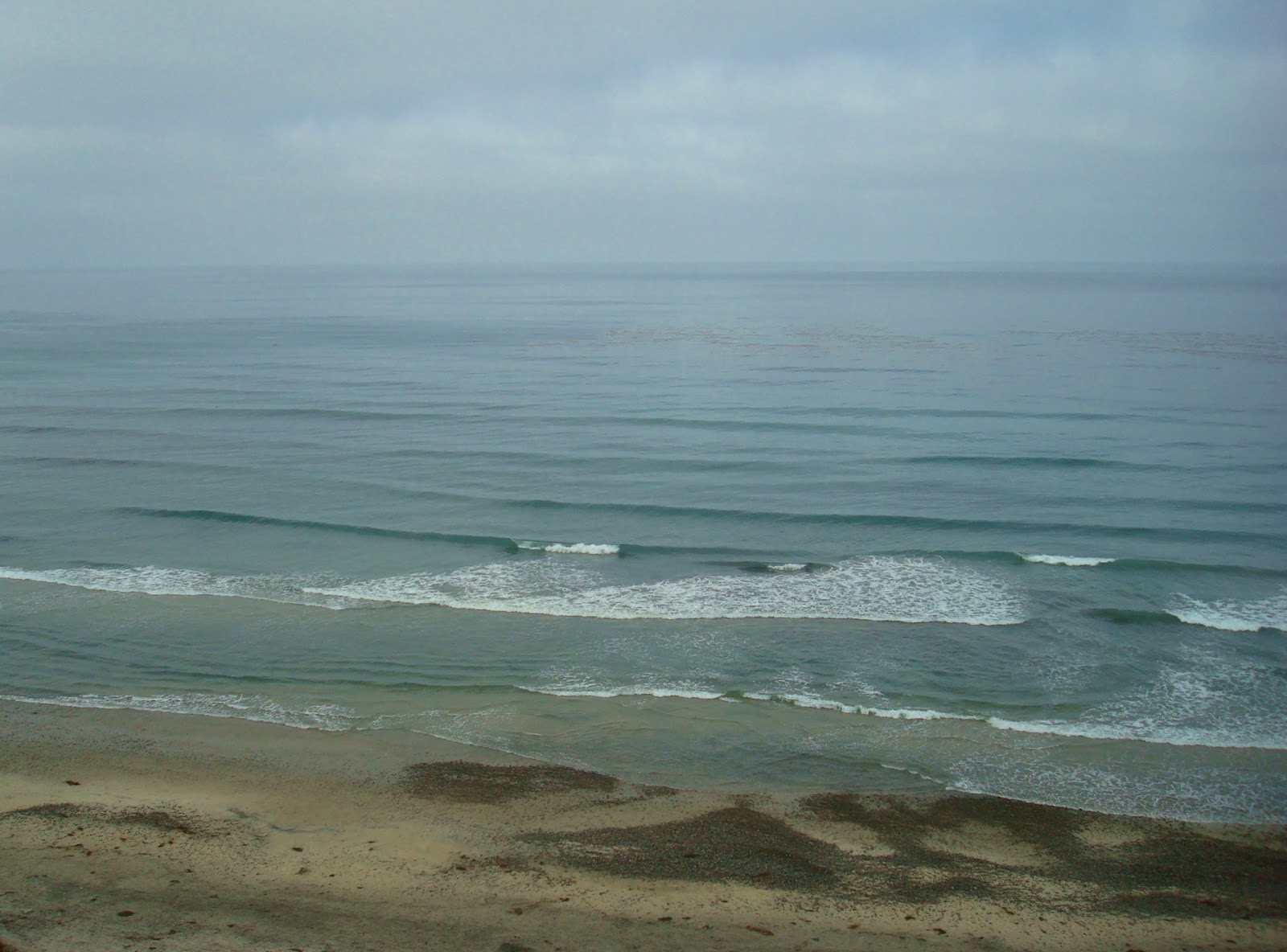
PIC OF THE WEEK:

Nothing special. Just some empty little left point with 1 lucky stiff out. Damn that looks fun right now.

Keep Surfing,

Michael W. Glenn
Life of the Party
NBA's 7th Man Of The Year
Last Surfer On Earth Using a Front Foot Traction Pad

Thursday, May 17, 2012

Deal Alert! More Gear For Summer!


The crew at Seshday this week have got a few good things going on to get you ready for summer. The basic necessities like headphones for your iPod, shades for your peepers, backpacks to hold your swag, and tail pads to freshen up that old beater board.
First up is some thumping headphones from action sports brand Aerial 7. Legend (and all around good guy local Taylor Knox) wears his signature Chopper 2-T.Knox headphones. Timeless retro styling merged with progressive sneaker inspired aesthetics: The CHOPPER2's 44mm driver delivers excellent sound reproduction satisfying even the most critical of listeners. And at $34.95, it's as cheap as it gets. The headphones feature:
  • Engineered to deliver the highest-quality listening experience from your Apple iPod®, iPhone®, BlackBerry®, or other mp3 player, cell phone or music device.
  • Soft, pliable headband for comfortable extended listening.
  • Slim profile in-line microphone for use with iPhone®, BlackBerry® and other cell phones.
  • Includes standard and iPhone® compatible 3.5mm plug and adapters for use with multiple devices.
  • Driver Diameter: 44mm
  • Impedance: 32O
  • Frequency Response: 5-20KHz
  • Sensitivity (S.P.L.): 108±3dB (at 1KHz)
  • Input Plug Diameter: 3.5mm iPhone®      
Once you've blasted your ears off, you should at least protect your eyeballs with Electric's 'Blaster' shades, inspired by air guy Ozzie Wright. They're 54% off this week and are selling quick at $44.95. The Blasters joined forces with Kip Arnette to conceive and handcraft these big bold suckers. Just like Ozzie, Blaster is a head-on collision between bold punk styling and hard rock fashion. If you are explosive and original like the innovative Ozzie Wright these are for you! Ozzie says: "Buy or Die!" You have been warned! Get your Blasters now!

Features
Size Category - 4
100% UV Protection
8 Base Mold Injected Grilamid Frame
8 x 4 Toric Polycarbonate Lens
3 Barrel Stainless Steel Optical Hinge
Ozzie Wright Signature Sunglasses 
All the rage right now is the groms coming up on the world tour (Dane and Jordy are so yesterday). Guys like Medina, Kolohe, and John John are going higher and faster than ever before. Take John John's win yesterday at the Billabong Rio Pro over Parko. A 9.1 on his first wave put Parko on the ropes for the rest of the heat. DaKine happens to sponsor John John and they've got all kinds of acessories on sale at Seshday today.
The John John signature tail pad is a ridiculously low $9.95. Designed by John John, this pro model deck pad is a five piece pad with a 10mm center arch and a 20mm rolled tail kick. As for the construction, it’s all about the compound. Dakine Posi Traction stays grippy in cold water and won’t rub your knees raw in warm water. The specially formulated EVA foam retains its specific density and 100% memory in any water temperature. And DaKine uses the best 3M Pressure Sensitive Adhesive to insure that your pad will never peel off until you want to take it off.    
And to get all your gear to the beach, you'll need a big backpack to transport your junk. DaKine has the 18L Amp pack for $47.95 (normally $100). Trust me- you won't get a better bag for the price. All the bells and whistles you need in an all serious backpack including the new Hydrapak bladder with quick-disconnect hose, a molded back panel for support and ventilation, plus a deployable rain cover (if you're living in Hawaii of course).
Features
  • 100 oz. / 3L Shape-loc hydration reservoir
  • Molded back panel with Air Channel Ventilation
  • Deployable helmet carry
  • Mesh side pockets
  • Fleece sunglass pocket
  • Internal organizer pockets
  • Deployable rain cover
  • Removable waist belt
  • Rescue whistle
  • Volume: 1100 cu. in. [ 18L ]
  • Size: 19 x 10.5 x 8" [ 48 x 27 x 20cm ]
  • Claimed Weight: 490g
  • Reservoir Size: 100 fl oz
  • Material: Nylon                                                        
And like all Seshday sales, it only lasts for a few days or when it sells out- whichever is first. So get on it!
                                                                                 

Wednesday, May 16, 2012

Surf Check 5/16/12


Fun little surf day today. Not exactly firing but there's some SW/NW combo in the water and best spots have chest high sets. Considering the weather is nice and the wind is only 7mph out of the W this afternoon, you can make a day of it.
And did I mention the water is up to 66 degrees already? Is La Nina officially gone? Will we have 70 degree water by the beginning of June? Doh! I just jinxed it! Regardless, there's some fun little waves out there, the sun is out, and the crowds are mellow.
Tides the next few days are 2' at sunrise, up to 4' mid-morning, down to 1' mid afternoon, and 5' at sunset.
The weather should be seasonal the next few days. We've got a weak front moving through Northern California tomorrow and that will increase our low clouds for the early mornings/late nights Thursday/Friday. Weak high pressure then sets up behind the departing front and we've got great beach weather for the weekend with temps near 70.
Winds from the weak front tomorrow will kick up some NW windswell down here on Friday and into Saturday. Nothing big but maybe chest high sets in north county SD and shoulder high sets in south SD.
We even had some weak storms a few days ago in the southern hemisphere and should get a waist high pulse in north county SD on Saturday with chest high sets in the OC. Pretty feeble but with the NW windswell and nice weather, Saturday morning may be fun. In the long range, it's looking pretty bleak. No real storms are happening in the southern hemisphere right now (nor the northern Pacific)and only NW windswell is on the charts for the middle of next week. We're kind of in a holding pattern I guess. I don't think we'll see any real SW swells until at least June.