Friday, September 27, 2013

THE Surf Report


Falling for fall.

SURF:
Man did fall kick in on schedule. NW windswell the past few days, cool temps, and breezy conditions. Heck, they even had snow in the Sierras. And as the weak cold fronts typically blow through in fall, we get high pressure behind them with varying degrees of offshore winds.
This morning we have dying NW windswell with a touch of tiny SW for shoulder high sets in SD and maybe an inconsistent chest high set in north county and the OC.
Look for great conditions this weekend as the NW dies off and the SW fills in slightly for waist high waves in north SD county and the OC. All in all nice weather this weekend and a little bit of surf.
Water temps are 67 and tides the next few days are really mellow- about 3' at sunrise and 4' at sunset. Make sure to keep up to date on the waves/weather at Twitter/North County Surf.

FORECAST:

After the little NW and SW and nice conditions this weekend, more NW swell moves in late Monday. That lasts into Wednesday morning.
We also had a good late season storm in the southern hemisphere yesterday (finally) and we have some SW swell headed our way for late Tuesday into Wednesday. Hopefully the weak cold front forecasted for mid-week (see below) won't be as strong as the models indicate so our surf will stay clean!

WEATHER:

Typical fall- a few days of clouds, breezy weather, and cool temps- then high pressure kicks in for warm weather, offshore winds in the AM, and not a cloud in the sky. Then of course the clouds will return, the wind will kick up, and everything just keeps rotating. That's what we have in store- the clouds/breeze yesterday has been replaced by high pressure and temps near 80 at the beaches later today and tomorrow. That will last into Sunday. Then another weak front moves down from northern California on Tuesday and we get clouds and breezy conditions mid-week. Models then show high pressure building towards next weekend and yes- more sunny skies and warm temps at the beaches.

BEST BET:
Looks like Tuesday with the peaking NW swell and building SW swell. Just keep your fingers crossed the next weak cold front from northern California is just that- weak.

NEWS OF THE WEEK:

There's been a few famous debates about big waves over the years, like how big was Greg Noll's wave at Makaha '69? What caused Mark Foo to drown at Mavericks? Did Garrett McNamara really ride a 100' wave in Portugal? Well now there's a new question to ponder: Scientists have discovered breaking deep sea waves, as high as 800' tall on the ocean bottom. Science Daily broke the story earlier this month:

Waves breaking over sandy beaches are captured in countless tourist photos. But enormous waves breaking deep in the ocean are seldom seen, although they play a crucial role in long-term climate cycles. A University of Washington study for the first time recorded such a wave breaking in a key bottleneck for circulation in the world's largest ocean. The study was published online this month in the journal Geophysical Research Letters. The deep ocean is thought of as dark, cold and still. While this is mostly true, huge waves form between layers of water of different density. These skyscraper-tall waves transport heat, energy, carbon and nutrients around the globe. Where and how they break is important for the planet's climate. "Climate models are really sensitive not only to how much turbulence there is in the deep ocean, but to where it is," said lead author Matthew Alford, an oceanographer in the UW Applied Physics Laboratory. He led the expedition to the Samoan Passage, a narrow channel in the South Pacific Ocean that funnels water flowing from Antarctica. "The primary importance of understanding deep-ocean turbulence is to get the climate models right on long timescales," Alford said. Dense water in Antarctica sinks to the deep Pacific, where it eventually surges through a 25-mile gap in the submarine landscape northeast of Samoa. "Basically the entire South Pacific flow is blocked by this huge submarine ridge," Alford said. "The amount of water that's trying to get northward through this gap is just tremendous -- 6 million cubic meters of water per second, or about 35 Amazon Rivers." In the 1990s a major expedition measured these currents through the Samoan Passage. The scientists inferred that a lot of mixing must also happen there, but couldn't measure it. In the summer of 2012 the UW team embarked on a seven-week cruise to track the 800-foot-high waves that form atop the flow, 3 miles below the ocean's surface. Their measurements show these giant waves do break, producing mixing 1,000 to 10,000 times that of the surrounding slow-moving water. "Oceanographers used to talk about the so-called 'dark mixing' problem, where they knew that there should be a certain amount of turbulence in the deep ocean, and yet every time they made a measurement they observed a tenth of that," Alford said. "We found there's loads and loads of turbulence in the Samoan Passage, and detailed measurements show it's due to breaking waves." It turns out layers of water flowing over two consecutive ridges form a lee wave, like those in air that passes over mountains. These waves become unstable and turbulent, and break. Thus the deepest water, the densest in the world, mixes with upper layers and disappears. This mixing helps explain why dense, cold water doesn't permanently pool at the bottom of the ocean and instead rises as part of a global conveyor-belt circulation pattern. The Samoan Passage is important because it mixes so much water, but similar processes happen in other places, Alford said. Better knowledge of deep-ocean mixing could help simulate global currents and place instruments to track any changes. On a lighter note: Could an intrepid surfer ride these killer deep-sea waves? "It would be really boring," admitted Alford, who is a surfer. "The waves can take an hour to break, and I think most surfers are not going to wait that long for one wave." In fact, even making the measurements was painstaking work. Instruments took 1.5 hours to lower to the seafloor, and the ship traveled at only a half knot, slower than a person walking, during the 30-hour casts. New technology let the scientists measure turbulence directly and make measurements from instruments lowered more than 3 miles off the side of the ship. The researchers left instruments recording long-term measurements. The team will do another 40-day cruise in January to collect those instruments and map currents flowing through various gaps in the intricate channel.

BEST OF THE BLOG:

Seen the new Arnette building in downtown Encinitas? What exactly is it? A retail store? Offices? Party headquarters? Yes, yes, and yes. Check out the full story on the blog. And of course a mid-week Surf Check and an in-depth THE Surf Report. All of that and more in the blog below!
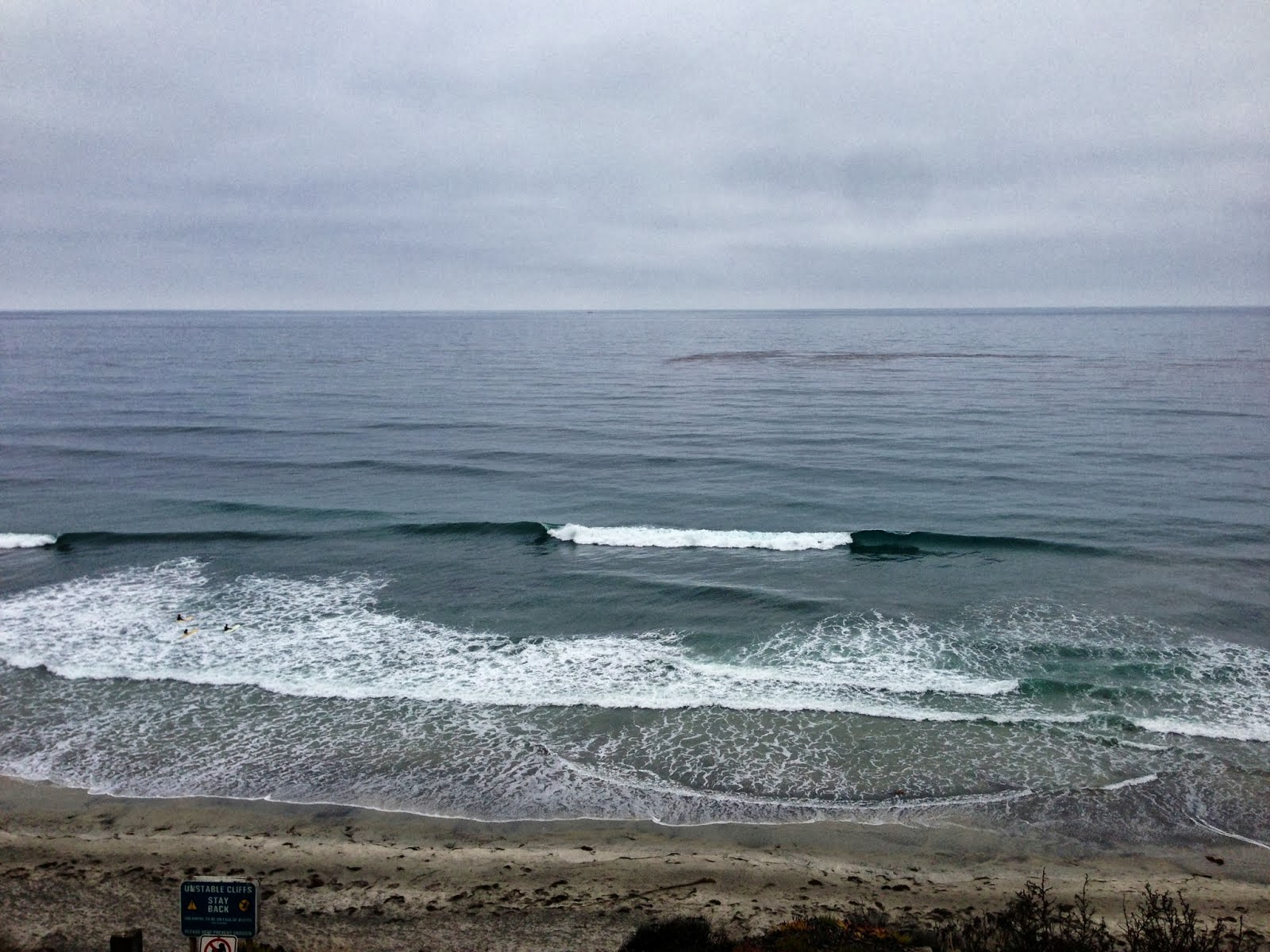
PIC OF THE WEEK:

Secret spot #12873-C. I can sell you a map to this place. Gonna cost you though...

Keep Surfing,

Michael W. Glenn
Global Sensation
In A Wham! Cover Band
Patented The Surfboard

Thursday, September 26, 2013

North County New Business News: Selling Like Hotcakes

Many moons ago when I started surfing, the action sports industry was in it's infancy and new products were shaping the future of the sport. Like Al Merrick's Tri-plane Hull, Rip Curl's Aggrolite wetsuits, and Arnette's Hotcakes sunglasses. Now there's a zillion products on the market from a gazillion so called action sports companies (Hollister are you listening?) and it's hard to decipher what's real and what's not.

Luckily for us, companies like Arnette have persevered over the years and have actually made some smart decisions- like setting up shop in downtown Encinitas. You may have noticed the location pop up last summer, July 2012 to be exact, but didn't know exactly what mad science was going on in there. I got a tour from an old buddy of mine, Fabrice Le Det, the Global Business Director (fancy title for a down to earth guy) and he gave me the scoop. Basically there's been a lot of energy in north county San Diego the past few years- from pros Josh Kerr moving here (as well surfers Jordy Smith and Damien Hobgood to skaters Bob Burnquist and Tony Hawk, to snowboarders Todd Richards and Shaun White, etc. etc. etc.), to Switchfoot having their annual surf contest at Moonlight Beach each summer (13,000 groms at last count), to other companies such as SUPERbrand, Spy, Reef, Nixon, and Fallen to name a few, calling it home. So Arnette wanted to be part of that surge and took up shop in the old Coast Brake and Wheel building- across the street from the La Paloma theatre and next door to Filiberto's. Solid.

Their new location is a 3 headed monster: part retail, part office space, part hang out spot. The retail store (shown above) has their latest styles as well as video games (don't tell your groms). Bret Egertson, Arnette's Marketing Specialist, told me their best seller has been the La Pistola shade in the 'Havana' frame and brown lens (see above). Killer looking pair of shades- and they're polarized. Store hours are 10-6 Tuesday to Saturday.
So what's with the so called 'hang out'? Well if you can't find your groms playing video games in the retail store, then they may be skating the mini-ramp in the offices. Of course the mini ramp isn't open to everyone all the time, but there's been enough events lately where you can sneak a peak. Up next for the Arnette crew is the 'Street Fighter II' tournament happening October 25th. And no, it's not a UFC undercard- they have the old school video game in their retail store. And it's being hosted by none other than skate legend Willy Santos. It's the 2nd time they'll be hosting the event. Check out the first one here:
Like the 1st event, they'll close off the parking lot and have a skate session before the tournament begins. Make sure to check out all the details on Arnette's Facebook page as the event gets closer.

Thanks to Fabrice and Bret for the tour and make sure to stop by the new digs and give them your support!


Tuesday, September 24, 2013

Surf Check

Had some fun surf the past few days. Nothing big but the weather has been nice and there's been waves up and down the coast. Today we have a dropping SW swell and holding NW for chest high sets.
Wind is currently blowing 10 mph from the SW and skies are clear and warm. Gotta love fall.

Water temps are holding around 70 and the tides are pretty mellow the next few days; about 2.5' at dawn, up to almost 5' at 2pm, and down to 2' at sunset.
Our weather is going to be off and on the next few days. We've got a storm up north today which will kick up our low clouds and fog down here tomorrow and Thursday. Look for the clouds to hug the coast both days and a chance of drizzle too. Break out the 5/4/3! Nothing that dramatic but air temps will only be in the low 60's and we'll be a little blown out. For Friday through early next week though, high pressure builds again and we've got great weather on tap with temps in the mid-70's.
And the surf goes as the weather goes: We start to get an increase in NW groundswell tomorrow afternoon- just as the weak cold front moves through. Look for chest high+ waves around town and head high sets in south SD. And when the weather cleans up this weekend... the NW will be gone. We do though have a little SW due to arrive around the same time but the NW will be overriding it. Hopefully when the weather cleans up we'll have some waist high sets from the leftover SW on Friday.
Fear not though, as we have another similar sized chest high+ NW on the charts showing up around next Tuesday. Hopefully the weather will cooperate with this one.
And amazingly, the southern hemisphere isn't dead yet. Charts show a good storm trying to get it's act together later this week. If that happens, we should get shoulder high sets in far north county SD towards the 2nd half of next week with head high sets in the OC. All in all some active weather and waves the next 7 days.


Thursday, September 19, 2013

THE Surf Report- Early Edition


Goodbye Summer and hello Fall!

SURF:
Pretty average week around here. Not that I'm complaining or anything.
Just some chest high+ SW/NW swells, some hazy afternoon sunshine, air temps near 70, and water temps in the high 60's. Look for tomorrow to have leftover waist high NW groundswell with chest high sets in south SD.
Good news is that when summer starts to fade on Saturday afternoon, we get a new chest high NW swell with head high sets in south SD. That rolls into Sunday but the weather is looking to be a little cool and a chance of drizzle in the morning- right on schedule for the 1st day of fall.
Water temps are in the high 60's and  tides the next few days are about 1' at sunrise, up to 6' before lunch, and down to 0' just before sunset.  Make sure to keep up to date on the waves/weather at Twitter/North County Surf.

FORECAST:
The NW peaks on Sunday and we'll have leftover waist high+ surf on Monday with chest high sets still in south SD.
Charts show another stronger NNW taking shape early in the week and we should see shoulder high sets in north county SD Wednesday afternoon and overhead sets in south SD. That lasts into Friday.
Models also show a small storm trying to form this weekend off Antarctica which may send some waist high+ surf to the OC next weekend. Basically things are shutting down in the southern hemisphere and our attention is turning to the northern hemisphere for the next few months...

WEATHER:

We've got pleasant weather on tap for tomorrow and Saturday morning as weak high pressure is in control. Just night and morning low clouds and temps in the low 70's. Then a cold front moves through northern CA late Saturday and our low clouds/fog thicken up on Sunday for a chance of drizzle and temps in the high 60's around here- right on schedule again for the 1st day of fall. We get a quick break early in the week for a little more sunshine then the clouds thicken up again the 2nd half of the week.

BEST BET:
Sunday with the new fun NW swell- but a little more clouds unfortunately. Or Wednesday with a slightly bigger NNW swell- and more clouds again.

NEWS OF THE WEEK:

I don’t think I’ve ever seen autumn ever come so quickly around here. It’s literally like someone turned off the ‘summer’ switch and fall arrived: cooler air temps next week along with low clouds/drizzle and NW swells marching down the coast. To add to my bewilderment, the autumnal equinox arrives this Sunday- right on time to greet the fall weather/waves.  To be precise, it’s at 1:45 PM in north county San Diego. There are of course two equinoxes every year – in September and March – when the sun shines directly on the equator and the length of day and night is nearly equal. Seasons are opposite on either side of the equator, so the equinox in September is also known as the "autumnal (fall) equinox" in the northern hemisphere. However, in the southern hemisphere, it's known as the "spring (vernal) equinox". On the equinox, night and day are nearly exactly the same length – 12 hours – all over the world. And if you’re wondering, the sun comes up at 6:40 AM in north county San Diego and sets at- you guessed it- 6:40 PM. This is the reason it's called an "equinox", derived from Latin, meaning "equal night". However, even if this is widely accepted, it isn't entirely true. In reality equinoxes don't have exactly 12 hours of daylight The September equinox occurs the moment the sun crosses the celestial equator – the imaginary line in the sky above the Earth’s equator – from north to south. This happens either on September 22, 23, or 24 every year. On any other day of the year, the Earth's axis tilts a little away from or towards the Sun. But on the two equinoxes, the Earth's axis tilts neither away from nor towards the Sun, like the illustration shows. After Sunday the 22nd, the days grow shorter as we head towards December 21st and the Winter Solstice- in which we only receive around 10 hours of sunlight.

BEST OF THE BLOG:

Really don't want to wait for Friday's THE Surf Report? Then check out the condensed mid-week 'Surf Check' every Tuesday on the North County Surf Blog. Or if you can wait until Friday, then check out the in-depth 'THE Surf Report' with more maps, tide charts, surf shots, and satellite images than you can shake a stick at. All of that and more in the blog below!

PIC OF THE WEEK:

Dig the 'double point' in this pic- lots of overhead rights rolling through the outside point for the dads and little dribblers on the inside for the groms. Now if there was an Anthropologie on the point for my wife, I'd never have to leave the beach!

Keep Surfing,

Michael W. Glenn
Universally Loved
PG-13
Surfing All-Star if we had Surfing All-Stars

Tuesday, September 17, 2013

Surf Check

Had a small NW windswell/SW groundswell combo today for waist high+ waves. Best spots in the OC and south SD had stomach high+ sets. Considering how flat August was, I'll take it.
Tomorrow we'll have a continuation of the SW groundswell as the NW windswell fills in more. Look for most spots to have chest high waves while the best SW spots have shoulder high sets and the best NW spots have shoulder high sets too. Look for north county SD to be chest high from the combo swells.
Tides the next few days are all over the place. We've got a 2' tide at sunrise, coming up to 6' before 10am, then down to 0' at 4pm, and up to 5' at sunset. And water temps are holding at 70- get it while you can since fall is only 4 days away.
Speaking of fall, it's making an early appearance as we have a weak front moving through central CA and it will thicken our marine layer tomorrow. High pressure builds slightly on Thursday/Friday then another weak front will come through and thicken up the clouds for the weekend. Temps at the beaches will be lucky to hit 70 and lows at night will be 60.
Lucky for us, all that activity up north will send us a NW groundswell for the weekend. Spots around town should have some chest high sets while south SD will hit head high.

Even though summer is almost over, the southern hemisphere won't completely die. Even though it didn't crank out a lot of solid swells the past few months, it has given us some little waves to ride on the groveller. Look for more waist high SW swell around the 24th while the OC gets some chest high sets.
But enough talk of the southern hemisphere, the northern hemisphere is where we need to turn our attention for the next 6 months. Charts show yet another fun NW groundswell lining up for late next week giving us more chest high sets here and head high waves in south SD.

All in all nothing big yet but enough SW and NW swells the next week to keep us in rideable waves.


Friday, September 13, 2013

THE Surf Report


It's like Cheyne Horan finally won a world title.

SURF:
Is it just me or did it seem forever since we had some surf around here.
We finally had some fun surf show up yesterday in the form of chest high sets from the SW with a touch of building NW- while towards the OC there was an odd shoulder high set. We've got peaking SW/NW today for more chest high+ waves in north county SD and head high sets in the OC. Wind this morning is 5 mph from the SW and skies are overcast but clearing.
Sunday the swells drop but there's still waist-chest high waves from the SW with the odd better set in the OC as well as pulses of little NW windswell the next few days. Water temps are starting to head towards the fall season and are running in the low to mid-60's in OC to mid to high 60's in SD.
Tides the next few days are about 4' at sunrise, 2' mid-morning, 5.5' at 5pm, and down to 4' at sunset. Make sure to keep up to date on the waves/weather at Twitter/North County Surf.

FORECAST:

After a fun weekend of surf, we have another smaller reinforcement out of the SW showing on Monday. Waves in north county SD will be waist high with chest high sets while the OC will see a shoulder high set.
There's another little storm that will try to form this weekend in the southern hemisphere that should send us more chest high waves towards the middle of next week.
We also get a boost of good NW windswell at the same time.
The tropics are also trying to make a push again with some clouds organizing off mainland Mexico. If anything comes together, it will be late in the weekend with maybe some S swell towards the middle part of next week.

WEATHER:

High pressure builds this weekend for less low clouds and fog with sunny skies and temps in the mid-70's at the beaches. And not thunderstorms in our mountains/deserts in a long time. Low pressure then brushes by to the north early next week and gives us another shot of cooler temps and low clouds/fog- similar to what we had earlier this week. It will feel more like fall next week than summer.

BEST BET:
A couple options here- today with the peaking SW swell and smaller NW- or Wednesday with the new little SW and better NW windswell. 

NEWS OF THE WEEK:

Came across a really cool website this week. It's called the 'Historical Hurricane Tracks' run by the National Oceanic and Atmospheric Administration. The site, developed by the NOAA Coastal Services Center in partnership with NOAA's National Hurricane Center and National Climatic Data Center, offers data and information on coastal county hurricane strikes through 2012. It also provides links to detailed reports on the life histories and effects of U.S. tropical cyclones since 1958, with additional U.S. storm paths traced as far back as 1851. The site contains global hurricane data from as far back as 1842.

Of note, the online tool now incorporates the path of and details on Hurricane Sandy. Barreling up the U.S. Atlantic coast, the super storm made landfall in New Jersey on October 29, 2012.  It was one of the costliest storms in American history, affecting parts of 24 states, and killing scores of people. Total U.S. damage estimates from the storm exceed $50 billion.

In addition to showing tracks of storms, the site provides insight on the increasing numbers of U.S. citizens and infrastructure at risk from hurricanes, detailing population changes for U.S. coastal counties from 1900 to 2000.

For fun, have a look at the category 5 storms we've had on record in the north east Pacific. You'll notice how close Dora got to us in 2011 and the unbelievable path Guillermo took. Unfortunately have nothing of the sort this year happening off Baja but there's always next year. 

BEST OF THE BLOG:

The circus known as the ASP world tour is back in town and as usual- it's anyone's to win. Who would have thunk Bede could make the final a few years ago?! Is it finally time for someone progressive like Jordy, Julian, and John John to hoist the trophy? Check out clips of each to help you place your bets. All of that and more, plus the mid-week Surf Check and
an in depth THE Surf Report at www.northcountysurf.blogspot.com

PIC OF THE WEEK:

Some of the best vacations are the ones where you stay at home. Seriously- how many good days have you missed at your local break due to that thing called work? Simple way to fix that- just spend your vacation days at home! No costly plane flights or pesky tropical diseases to deal with. Of course Swami's will still have 150 guys in the line-up when the swell shows up. But what do you care? You're on 'staycation'!

Keep Surfing,

Michael W. Glenn
Colonel
Dreamweaver
Zap Spongers with my Laser Zap