Thursday, March 29, 2018

THE Surf Report- Early Edition


Beautiful weather we’re having.

SURF:


Winter seems to be over and we’ve started the slow crawl to summer. The past week had some small NW/SW for waist high sets at best and plenty of NW winds to make our water chilly. This weekend doesn’t offer much except more tiny SW swell for knee high+ waves. The OC will see a couple waist high waves. Our drought (waves and weather) continues! 


Water temps are hovering in the 57 degree range and tides this weekend are 2’ at sunrise, up to 5’ mid-morning, down to 0’ late afternoon and up again slightly to 2’ at sunset. Make sure to keep up to date on the waves and weather at Twitter/North County Surf.

FORECAST:


No big storms on the horizon but we do have a couple little wave makers for Tuesday. A small storm off the Aleutians today will send a waist high+ WNW our way for Tuesday afternoon. There was also solid storm off Antarctica a few days ago (that was aimed more at South America than us) but we’ll get a glancing blow for chest high waves from the S starting on Tuesday and rolling into Wednesday. Add both swells up and we may see a shoulder high set around here. Hooray! The OC should be about a foot bigger due to the extreme S angle. 


After that models show a little waist high NW potentially towards the 7th and another shot of chest high SW around the 12th of April. And if you’re keeping score, it is now week 9 of my brand new step-up sitting in the garage, just waiting for overhead waves. Whimper.

WEATHER:


Pretty mellow weather for the next week or so. We’ll have sunny skies tomorrow with temps in the low 70’s at the beaches. A weak cold front moves by to the N over the weekend which will deepen our marine layer and cool us down to the mid-60’s. After that high pressure returns for temps in the low 70’s next week. And then… another weak front is forecasted to move by to the N again next weekend for more clouds and cooler temps. All in all- typical spring weather and no rain for the foreseeable future. 
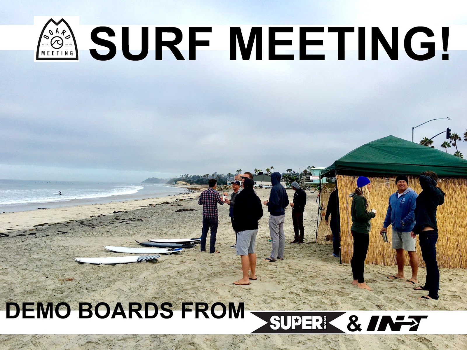
BEST BET:
Tuesday/Wednesday with combo swell and nice weather. If you plan any board meetings that day, make sure it’s in the water.

NEWS OF THE WEEK:


This week is Tsunami Awareness Week. Oddly enough as I write this, a 7.2 quake struck off the coast of Papua New Guinea (NE of Australia). While there is no threat at this time for Hawaii and California, I find the coincidence eerie. (And if you didn’t know, a magnitude 7.5 earthquake hit the country’s highland region on February 26th, triggering powerful aftershocks. The earthquake killed at least 67 people and left 500 others injured. Then one week later, a magnitude 6.7 earthquake struck the country again and killed at least 18 more people. After the second earthquake, the International Red Cross said that as many as 143,000 people could have been affected by the disaster and 17,000 people have been displaced from their homes, Reuters reported). That’s 3 earthquakes all within a month between magnitude 6.7 to 7.2. Yikes. My thoughts go out to the residents of Papua New Guinea.

So now that I have your attention, let’s get back to the task at hand- understanding tsunamis during Tsunami Awareness Week with the help of our friends at the National Oceanic and Atmospheric Administration:


Risks:
Tsunamis are among the most infrequent of Earth's natural hazards. Each year, there are approximately two tsunamis that cause damage near their source. Tsunamis that cause damage or deaths on distant shores (more than 620 miles away) occur about twice per decade. Tsunamis can strike any U.S. coast, but the risk is greatest for states and territories with Pacific and Caribbean coastlines. Low-lying coastal areas such as beaches, bays, lagoons, harbors and river mouths and areas along rivers and streams that lead to the ocean are the most vulnerable. Tsunamis can wrap around headlands, islands and sand spits, so coasts facing away from the tsunami source may also be at risk. Tsunamis are often referred to as local or distant. The type of tsunami depends on the location of the source of the tsunami and where it may strike land. The source of a local tsunami is close to the coast and may arrive in less than one hour. The danger is greatest for local tsunamis because warning time is limited. A distant tsunami is generated far away from a coast, so there is more time to issue and respond to warnings.

Characteristics:
Not all tsunamis act the same. And, an individual tsunami may impact coasts differently. A small tsunami in one place may be very large a few miles away. The speed of a tsunami depends on the depth of the ocean. In the deep ocean, tsunamis are barely noticeable but can move as fast as a jet plane, over 500 mph. As the waves enter shallow water near land, they slow to approximately 20 or 30 mph. That is still faster than a person can run. As the waves slow down, they can grow in height and currents intensify. Most tsunamis are less than 10 feet high, but in extreme cases, can exceed 100 feet. When a tsunami comes ashore, it will not look like a normal wind wave. It may look like a fast-rising flood or a wall of water. Sometimes, before the water rushes on land, it will drain away suddenly, showing the ocean floor, reefs and fish like a very low, low tide. Tsunamis can travel up rivers and streams that lead to the ocean. A large tsunami can flood low-lying coastal areas more than a mile inland. The series of waves that flood, drain away and then re-flood the land may last for hours. The time between waves ranges from five minutes to two hours. The first wave to reach the shore may not be the largest or the most damaging. It is not possible to predict how long a tsunami will last, how many waves there will be, or how much time there will be between waves.

Dangers:
A tsunami can be very dangerous to coastal life and property. It can produce unusually strong currents, rapidly flood land and cause great destruction. The flow and force of the water and the debris it carries can destroy boats, vehicles, and buildings and other structures; cause injuries; and take lives as the tsunami moves across the land. It only takes six inches of fast-moving water to knock over an adult and two feet of fast-moving water to carry away most vehicles. The water can be just as threatening (if not more so) as it returns to the sea, taking debris and people with it. Flooding and dangerous currents can last for days. Even small tsunamis can pose a risk. Strong currents can injure and drown swimmers and damage and destroy boats in harbors. And be aware, a tsunami is not surf-able. Tsunamis are not like wind waves. They do not have a face, do not curl and break like wind waves and are full of hazardous debris.


As far as the most astonishing tsunamis in history, here’s some facts:
  •         1755: 8.5 earthquake. Lisbon, Portugal. 50,000 deaths
  •         1883: Volcanic eruption. Krakatau, Indonesia. 34,417 deaths
  •         1958: 7.8 earthquake. Southeast Alaska. Highest tsunami; maximum height of 1,720 feet
  •         1964: 9.2 earthquake. Alaska. $851 million in damage. Costliest US tsunami on record.
  •         2004: 9.1 earthquake. Sumatra, Indonesia. 227,899 deaths and $13 billion in damage. Deadliest tsunami on record.
  •         2009: 8.1 earthquake. American Samoa Islands. $143 million in damage
  •         2011: 9.1 earthquake. Honshu, Japan. 18,453 deaths and $243 billion in damage. Costliest tsunami on record.

So if you’re at the beach and think you feel an earthquake or see the water receding- get to higher ground!

PIC OF THE WEEK: 


One of the scariest photos I’ve ever seen. Below sea level, big, victory at sea, rocky, and if it didn’t need any more help in making it ominous, it’s in black and white. Sheesh.  

Keep Surfing,

Michael W. Glenn
Heavyweight
Still Have A Perfect Bracket!
The Sultan of Surf Forecasting

Thursday, March 22, 2018

THE Surf Report- Early Early Edition


I’m on Candid Camera, right?

SURF:
I’m starting to believe that Neptune (or Poseidon depending on your religion) is playing a practical joke on us. For the past 2 months, it’s been impossible to find a head high wave around here. And I’m not talking about storm surf either. I’m talking about a good ol’ fashion groundswell from the Aleutians or southern hemisphere. Maybe it’s not their fault. Maybe I’m the one to blame since I bought a step-up at the end of January. Gasp! Maybe I have some power over the universe that I’m not aware of. Like how my good looks are a blessing AND a curse.


Anyway, where were we? Oh- the lack of surf. Not much to report this past week except some waist high+ SW groundswell and a touch of tiny NW.


For today, we have a new chest high W swell filling in with leftover SW but the rain is making things a mess.


We get reinforcement out of the NW on Sunday for shoulder high sets but it may be windy from the W as another smaller system passes by to the north of us. You never thought you’d want to drive to Lemoore right now, did you?


Water temps are high 50’s and tides this weekend are about 2’ at sunrise, down to 0’ before lunch, and up to 3’ at sunset. Make sure to keep up to date on the waves and weather at Twitter/North County Surf. 

FORECAST:


After a bumpy weekend, we get a little push from the NW late on Monday for shoulder high sets in SD and chest high in north county by Tuesday morning. The weather should be clean by then. After that things really slow down with just waist high SW most of the week and a touch of NW.


The southern hemisphere has tried to come alive the past few weeks but most of the energy is aimed at South America- not us. We may get a glancing blow from the S around April 1st (no joke) for chest high waves. But until then, we’re left with crumbs.

WEATHER:


We may be looking at our last real storm of the season today. LA/Santa Barbara is getting the brunt of it with 3+” of rain forecasted through Saturday morning. The OC should see 2+” and SD at most 1” today. Saturday is a transition day at the storm exits the region and Sunday we’ll see a smaller system skirt by to the north with maybe a chance of light showers here. High pressure looks to be in charge next week with sunny skies and temps in the high 60’s.

BEST BET:
Late Monday/early Tuesday with fun, rideable, clean NW.

NEWS OF THE WEEK:


One weather phenomenon that I find fascinating but don’t have much firsthand experience with (thankfully) is lightning. There’s a small chance this weekend from the incoming storm but most of the time you need a stark contrast between two air masses (i.e. hot and cold). In technical terms, lightning is an electrical discharge caused by imbalances between storm clouds and the ground, or within the clouds themselves. I’ll let the pros at National Geographic take it from here:

Most lightning occurs within the clouds. "Sheet lightning" describes a distant bolt that lights up an entire cloud base. Other visible bolts may appear as bead, ribbon, or rocket lightning. During a storm, colliding particles of rain, ice, or snow inside storm clouds increase the imbalance between storm clouds and the ground, and often negatively charge the lower reaches of storm clouds. Objects on the ground, like steeples, trees, and the Earth itself, become positively charged—creating an imbalance that nature seeks to remedy by passing current between the two charges.

Lightning is extremely hot—a flash can heat the air around it to temperatures five times hotter than the sun’s surface. This heat causes surrounding air to rapidly expand and vibrate, which creates the pealing thunder we hear a short time after seeing a lightning flash.

TYPES OF LIGHTNING
Cloud-to-ground lightning bolts are a common phenomenon—about 100 strike Earth’s surface every single second—yet their power is extraordinary. Each bolt can contain up to one billion volts of electricity. A typical cloud-to-ground lightning bolt begins when a step-like series of negative charges, called a stepped leader, races downward from the bottom of a storm cloud toward the Earth along a channel at about 200,000 mph. Each of these segments is about 150 feet long. When the lowermost step comes within 150 feet of a positively charged object, it is met by a climbing surge of positive electricity, called a streamer, which can rise up through a building, a tree, or even a person.

When the two connect, an electrical current flows as negative charges fly down the channel towards earth and a visible flash of lightning streaks upward at some 200,000,000 mph, transferring electricity as lightning in the process. Some types of lightning, including the most common types, never leave the clouds but travel between differently charged areas within or between clouds. Other rare forms can be sparked by extreme forest fires, volcanic eruptions, and snowstorms. Ball lightning, a small, charged sphere that floats, glows, and bounces along oblivious to the laws of gravity or physics, still puzzles scientists. About one to 20 cloud-to-ground lightning bolts is "positive lightning," a type that originates in the positively charged tops of storm clouds. These strikes reverse the charge flow of typical lightning bolts and are far stronger and more destructive. Positive lightning can stretch across the sky and strike "out of the blue" more than 10 miles from the storm cloud where it was born.


THE IMPACT OF A LIGHTNING STRIKE
Lightning is not only spectacular, it’s dangerous. About 2,000 people are killed worldwide by lightning each year. Hundreds more survive strikes but suffer from a variety of lasting symptoms, including memory loss, dizziness, weakness, numbness, and other life-altering ailments. Strikes can cause cardiac arrest and severe burns, but 9 of every 10 people survive. The average American has about a 1 in 5,000 chance of being struck by lightning during a lifetime. Lightning's extreme heat will vaporize the water inside a tree, creating steam that may blow the tree apart. Cars are havens from lightning—but not for the reason that most believe. Tires conduct current, as do metal frames that carry a charge harmlessly to the ground. Many houses are grounded by rods and other protection that conduct a lightning bolt's electricity harmlessly to the ground. Homes may also be inadvertently grounded by plumbing, gutters, or other materials. Grounded buildings offer protection, but occupants who touch running water or use a landline phone may be shocked by conducted electricity.

So even though lightning isn’t too common in the Southern California coastal communities, make sure to head out our local mountains and deserts this summer when the thunderstorms flair up. And watch from a safe distance of course.

PIC OF THE WEEK:
Sure there hasn't been much surf around here lately but that doesn't mean you can't go out and explore for waves does it? Happy hunting.


Keep Surfing,

Michael W. Glenn
Out of Your League
Still Haven’t Been Paid For Ben Affleck’s Tattoo Work
Exclusively Ride Quin Fins

Friday, March 16, 2018

THE Surf Report


Lots of wind, not many waves.

SURF:


Not exactly the greatest week of surf but there were little chest high waves if you timed your session right. Last night we had lots of WNW wind as another cold front exited our region and today were left with chest high waves and cleaner conditions. Late in the day the swells continue to drop with a new cold front moving in. 


Saturday is a mess but the NW windswell starts to pick up again for shoulder high sets. If things can clean up by Sunday, we should have dying chest high waves again from the NW. 


Water temps are holding at 58 and the tides this weekend are 3’ at sunrise, up to 5’ mid-morning, down to 0’ late afternoon, and up to 2’ at sunset. Make sure to keep up to date on the waves and weather at Twitter/North County Surf! 

FORECAST:
The work (or school) week starts off slow with just waist high+ NW/SW groundswell. 


That lasts through Wednesday morning before a new WNW groundswell/windswell fills in. By Thursday we have head high sets- but bumpy conditions from a new cold front. All in all some hit and miss conditions as we head into spring on March 20th. Where the heck did our winter go?! 


For next weekend and beyond forecast charts show some disorganized storms in the Aleutians and off Antarctica but nothing concrete- or impressive.

WEATHER:


Just light showers off and on the past week- and that will continue this weekend. We have a mild start today then a weak cold front comes through later that lasts through Saturday. At most we should receive is ½” of rain. Mild sunny weather returns early in the week then models diverge after that: either a solid storm arrives by Thursday or just a chance of more showers. Since we’ve only had showers the past few weeks- my bet is showers again late next week. 

BEST BET:
In-between storms:  Best to get it early on Friday (before the next cold front knocks on our door) with leftover SW/NW, Sunday morning with dying NW windswell and clearing conditions, or late next Wednesday with new NW before- you guessed it- the next storm arrives Thursday.

NEWS OF THE WEEK:


Know what my kids call sea lions? Dogs of the sea. They bark, like to play, and might bite your foot if you’re not watching. (And for future reference- my kids also call seagulls Rats of the Beach. Noisy, leave droppings all over, and they’ll take your food if you’re not watching). Anyway, looks like our California sea lions have fully rebounded under the protection of the Marine Mammal Protection Act (MMPA), with their population on the West Coast healthy and robust. Their recovery over the past several decades reflects an important success for the MMPA. The landmark 1972 legislation recognized marine mammals as a central element of their ocean ecosystems, setting population goals based on levels that would contribute to the health and stability of those ecosystems.

"The population has basically come into balance with its environment," said co-author Sharon Melin, a research biologist at the Alaska Fisheries Science Center who has tracked sea lion numbers in Southern California's Channel Islands for years. "The marine environment is always changing, and their population is at a point where it responds very quickly to changes in the environment."

Scientists combined the results of sea lion pup counts in the Channel Islands, aerial surveys of sea lion rookeries, survival rates and other information to reconstruct the growth of the sea lion population from 1975 to 2014. They gained enough insight into the dynamics of the population to fill in gaps from a few years with little data.

Market hunting, bounties, pollutants such as DDT and other forces depressed sea lion numbers in the middle of the last century. The new study found that the species then rose from less than 90,000 animals in 1975 to an estimated 281,450 in 2008, which was roughly the carrying capacity for sea lions in the California Current Ecosystem at that time. It then fluctuated around that level, reaching a high of 306,220 in 2012 before declining below the carrying capacity in the years since as ocean conditions changed.

The researchers found sea lion numbers very sensitive to environmental changes, especially changes in ocean temperatures that affect their prey. Their models based on past population shifts predict that an increase of 1 degree C in sea surface temperature off the West Coast will reduce sea lion population growth to zero, while an increase of 2 degrees will lead to a 7 percent decline in the population.

"When the California Current is not productive, they respond pretty fast and dramatically," Melin said. "They're out there in the ocean sampling it all the time. That makes them a very powerful indicator of what's happening in the marine environment."

Marine conditions since 2012 have illustrated that. An unusual marine heat wave off the West Coast known as "the blob" (http://northcountysurf.blogspot.com/2015/05/the-surf-report.html)  combined with an El Niño climate pattern reduced pup production and survival, with thousands of malnourished pups stranding on Southern California beaches. NOAA Fisheries declared the elevated number of deaths an Unusual Mortality Event in 2013. The sea lion population dropped to just over 250,000 in 2013 and 2014.

"This is not just a story about continued growth of the population," DeLong said. "These last several years have brought new environmental stresses to the California Current, and we've seen that reflected by the sea lions."

Understanding the relationship between sea lion numbers and the environment can help scientists detect signals of coming change. Wildlife managers can then use that information to anticipate and prepare for shifts in the ecosystem and its inhabitants. "It helps us to understand the factors driving this population, because we can incorporate them into management decisions," said Chris Yates, Assistant Regional Administrator for Protected Resources in NOAA Fisheries' West Coast Region.

The general recovery of sea lion numbers has had consequences though on the West Coast, including conflicts with people over beach access where sea lions haul out and concern about sea lion predation on threatened and endangered salmon and steelhead in the Northwest. NOAA Fisheries has authorized Oregon, Washington and Idaho to remove individually identifiable sea lions near the Columbia River's Bonneville Dam that have been spotted repeatedly preying on fish protected under the Endangered Species Act.

PIC OF THE WEEK:


Question: What do you get when you add a legendary point break (Malibu) with a legendary storm (Hurricane Marie)? Answer: Legendary swell (with 250 of your best friends). I’m pretty sure this is what Randy Newman had in mind when he wrote ‘I Love L.A.’          

Keep Surfing,

Michael W. Glenn
Inconceivable
Bracket Buster
Duke Kahanamoku’s Cousin’s Brother’s Sister’s Third Grandson

Thursday, March 8, 2018

THE Surf Report- Early Edition


Bring back Winter, no questions asked.

SURF:


As we get closer to March 20th, spring seems right on time. Little SW swells at our beaches, our water temps have bottomed out in the high 50’s, and no big storms rolling through. With that said, old man Winter is going to give it one last shot next week. 


First up though, we have a small boost from the NW that will give SD chest high sets tomorrow. With leftover dying SW, north county SD will also see waist to chest high surf from the combo swells. Saturday the SW is gone and the NW backs off- but it doesn’t matter as we have a weak cold front coming through Saturday afternoon through Sunday morning which will make conditions a little bumpy- so make sure to get a surf in tomorrow. 


Water temps are still high 50’s and tides this weekend are 3’ at sunrise, down to 0’ at lunch, and up to 3’ again at sunset. Make sure to keep up to date on the waves and weather at Twitter/North County Surf.

FORECAST:


Monday starts off slow but a small SW should fill in with a touch more NW by Tuesday. Still small, but best combo spots will be waist to chest high.  Now here’s the fun part: Models the past few days have been advertising a storm building in the Pacific and as it does, tap into sub-tropical moisture early in the week. 


The storm should move ashore Wednesday and as it does, bring overhead messy NW Thursday through Friday.  Things clean up next weekend but the swell dies with it. The north Pacific looks to slow down in the near future but the southern hemisphere is starting to show some life. Nothing concrete yet, but maybe some good SW the first few days of spring (March 21st).

WEATHER:


Got a couple glancing blows the past 7 days from weak cold fronts and that will be the case again this weekend. Tomorrow starts off clean with high clouds overhead then a few showers develop late Saturday. Sunday should be sunny and breezy from the NW once low pressure exits the region. Models again show a weak front moving through again on Tuesday but only some showers at best. The real story is a bigger/colder storm for late Wednesday through Friday. This should be a typical winter storm as cold air, wind, and heavy rain visit the area. The real wildcard is how much tropical moisture it taps and what kind of a boost it will do to our low rain totals. Late next weekend things should return to normal. And as a reminder: SET YOUR CLOCKS AHEAD 1 HOUR when you go to bed on Saturday night! Daylight Saving you know. Sun will rise at 7 AM next week and set at 7 PM. 

BEST BET:
Tomorrow with small clean conditions or late Monday/Tuesday with building fun sized SW/NW and semi-clean conditions before the storm hits.

NEWS OF THE WEEK:


If we do get a solid storm next Thursday the 15th, how will it stack up against other weather events throughout history on March 15th?...

1905: 0.94 inch fell in San Diego in 30 minutes, the greatest 30 minute rainfall on record.

1986: Heavy rain and snow that started on this day and ended on 3/16 caused mud slides along the coast in Orange County. Three feet of snow fell in the San Bernardino Mountains.

1987: Widespread strong storm winds pushed gusts to 40 mph at San Diego with sustained winds 25-35 mph all day. Power outages occurred all over the San Diego metro area. Motor homes toppled in the desert. A light standard fell over onto cars in Coronado. Boats flipped over in harbors. A 22 foot boat turned over at the Mission Beach jetty. Catalina cruise ships were delayed, stranding 1,200 tourists
on the island.

2003: A slow moving cold front dropped three to seven inches of rain across Southern California. Over 1,000 traffic accidents and six deaths were attributed to standing water on roads. Some freeways were covered by water two to three feet deep. In the desert, the Mojave River overflowed its banks, flooding several major roads between Hesperia and Apple Valley. Dense fog along the coastal slopes contributed to two pileups in the Cajon Pass involving a total of 56 cars.

2008: A funnel cloud was observed southwest of Balboa Park.

And on the flipside of March 15th was the year 2015…
Strong high pressure and Santa Ana conditions boosted temperatures into the 90s across the coast and valleys from 3/13 through 3/16, and cooling only into the 60s at night. Numerous daily high maximum and daily high minimum records were set. On 3/13 the warmest reading of 96° in Santa Ana was reached. Highest minimum temperatures were 68° in Santa Ana and San Diego on this day.

BEST OF THE BLOG:


And if you happen to be reading this before 7 AM on Friday, come on down to Seaside Reef as the North County Board Meeting will be having their (semi) monthly Surf Meeting. Try out demo boards from SUPERbrand and INT, grab a little breakfast, network, and find out how you can give back to this amazing community. Look for the Airstream at the parking lot entrance or the green tent on the beach. See you there!

PIC OF THE WEEK:


I bought some property here a few years ago. It’s where I’m going to retire. Maybe tend to the sheep, grow some legumes, and harvest a few barrels. I even plan to put surf racks on my John Deere.

Keep Surfing,

Michael W. Glenn
Mr. Incredible
Already Set My Clock Ahead 1 Hour
I Put The Wild In Wildcard

Friday, March 2, 2018

THE Surf Report


Soothsayer.

SURF:


Don’t you hate it when you can predict the future? Like when I guessed those lottery numbers in 2013 and won 28.7 million. Or that time I said the Giants were going win the Super Bowl against the undefeated Patriots. Or this past fall when I predicted La Nina would shut down our storms and we’d have a lack of rain and surf this winter. Man I wish I was wrong once in a awhile. Our dry spell can’t last forever, right? So let’s make some lemonade out of this weekend’s lemons: We’ve got a cold front moving through this afternoon that will make a mess out of in impending S/NW mix.


The small S arriving on our shores this weekend will get battered by the winds from our storm tonight- so pretty much write that swell off.


We do have NW windswell/groundswell building on Saturday- but the storm mentioned above will make a mess of it too. So pretty much write that off. But SUNDAY on the other hand… should have clean weather and leftover chest high S/NW. Time to put the 5’4” away and break out the 5’10”!


Water temps are high 50’s and tides this weekend are 2’ at sunrise, up to 5’ mid-morning, and down to 0’ at sunset. Make sure to keep up to date on the waves and weather at Twitter/North County Surf.

FORECAST:


I had high hopes for a storm off Antarctica last week but it: A) Never turned into the growling beast I was hoping for and B) It moved in a E/W direction and not N towards us. Regardless, we should have some chest high sets in far N county SD/OC Monday afternoon into Tuesday.


Also arriving on Tuesday is some southern hemi surf from a storm a few days ago. Nothing big- again- but we should have chest high sets in SD on Tuesday. After that we just have background NW/S the rest of the week for waist high+ surf then maybe more NW/SW next weekend. But still no big swells and my brand new step-up waits patiently in the garage…

WEATHER:


Wet weather has returned to California today with San Diego about to receive some drops after lunch. Not a big storm- maybe 1/4” when it’s said and done (a little less than the storm we had earlier this week) and your typical 20 mph+ winds from the SW late Friday then turning NW on Saturday. Sunday things clean up and the rest of the work week looks sunny and mild with temperatures in the mid-60’s. Late next week low clouds and cooling should return.

BEST BET:
Sunday with leftover surf and clean(er) conditions or next Tuesday with small but fun S/NW combo and definitely clean conditions.

NEWS OF THE WEEK:


Seems like we’re in the middle of a wet period right now. Or are we? We all know we’re on the verge of a drought again (thanks for nuthin’ La Nina) and we may have water restrictions this summer if we don’t get a deluge soon. But did the storm earlier this week and the one headed our way this weekend going to make a difference? Let’s look at the facts:
Newport Beach: 1.43” of rain so far this season (14%) and we should be at 10.07”. And the total we’re aiming for this season is 15.71”
Oceanside: 3.02” of rain so far this season (31%) and we should be at 9.74”. And the total we’re aiming for this seasons is 13.66”
San Diego: 2.23” of rain so far this season (30%) and we should be at 10.34”. And the total we’re aiming for this season is 11.62”


We have 3 weeks left of winter and April historically gives us around 1” of rain in a non-La Nina year. So my best guess is that we’ll get just 2 more inches of rain between now and the end of April. When it’s all said and done, that would leave:
Newport around 3.50” (23% of normal)
Oceanside at 5” (37% of normal)
San Diego at 4.5” (39% of normal).
Just looking at San Diego climatological data, the 4.5” of rain would make it the 3rd driest year since at least 1965. Not good.

PIC OF THE WEEK:


Can you name the 3 things wrong with this picture? Give up? Here’s your answers:
1. No one’s out.
2. There’s parking.
3. There’s actually surf! I don’t know when the last time I saw a 6’ wave around here.

Keep Surfing,

Michael W. Glenn
Grandiose
Not Sure What To Wear To The Oscars
More Of A Tube Than A Barrel Guy