Friday, August 31, 2012

THE Surf Report 8/31/12


Yes Virginia, there is a Santa Claus.

SURF:
It was looking pretty bleak there for awhile. The surf has been flat it seems for weeks. Sure we had little bumps here and there in the OC, but when was the last time you rode a 6'2"? (for Slater, I think it was 1997). Anyway, you've probably heard we have surf coming from a variety of sources and first up is the solid southern hemisphere SW swell that started showing on the buoys last night.
Of course with big long period swells, there's lulls between sets, so don't expect any bombs this morning- most likely you'll get good surf this evening when the swell fills in further. Still, far north SD county has some inconsistent chest high sets and the OC has shoulder high sets. There's also small hurricane surf filling in today from Ileana which will help fill in the inconsistency. By tomorrow, look for head high sets in south SD, overhead sets in north SD, and sets a few feet overhead in the OC with the Wedge of course going double overhead+. AND the weather will co-operate with nice conditions by mid-morning. There's also some small NW windswell filling in tomorrow but it will most likely just peak up the lines in SD and not much for the OC- expect walled conditions at the beachbreaks unless you're surfing a jetty, pier, or reef. We'll have good surf through Sunday and Monday will have some leftover shoulder high sets in north SD and head high sets in the OC. Not a bad holiday weekend. And the water is still holding at 70.
And the tides the next few days are 1' at sunrise, 5.5' at 10 AM, down to 1' again at 4pm, and up slightly to 4' at sunset. Make sure to keep up to date on the waves and weather at Twitter/North County Surf. 

FORECAST:

After a good holiday weekend of surf, it goes quiet. Typical. The southern hemisphere had one big burp and now it's napping. Charts show some activity happening in about a week's time, but that means we won't see swell until mid-September.
Luckily the tropics are showing some life after Ileana and we may get some small hurricane surf again mid-week. Bares watching.

WEATHER:

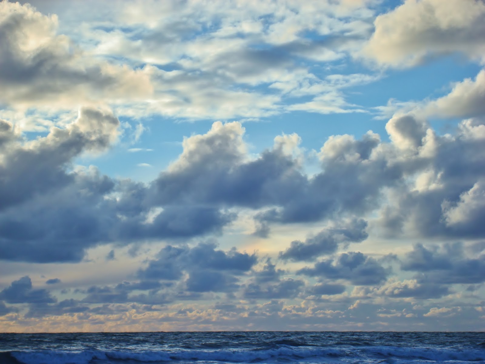
Great weather will continue this weekend. We have a weak cold front moving through northern California but it will only kick up our early morning/late night low clouds and we should have sun by mid-morning and temps in the mid-70's at the coast. Hurricane Ileana may break apart and send clouds our way this weekend but it will be of the tropical kind- warm and humid. So the beach weather shouldn't be affected. Next week looks to be about the same with early morning clouds and nice beach weather in the afternoons. Gotta love this time of year.

BEST BET:
Saturday is the day- peaking solid SW and S swells, great beach weather, and some tropical clouds overhead. Why can't every day be like that?

NEWS OF THE WEEK:
More useless knowledge for when you finally get called up to Jeopardy. ON THIS DAY IN
WEATHER HISTORY!...

1998: Strong thunderstorms developed each day starting on 8/29 and ending on this day. 1.5 inches of rain fell at Apple Valley, 0.77 inch fell in only 45 minutes at Wrightwood, and 0.68 inch fell in only 30 minutes at Forest Falls. Homes and roads were flooded with four to six feet of water in Hesperia and Apple Valley. Rock slides occurred in Mill Creek. Roads were flooded in Sugarloaf and Forest Falls. Flash flooding was also recorded in Hemet. Severe thunderstorm wind gusts of 86 mph hit Sage (south of Hemet). Gusts of 50 mph were recorded at Rialto and gusts of 45 mph hit San Marcos. Trees and power lines were downed. Fires were started by lightning near Barona Ranch. Record heat occurred near the coast as well on these same days. Temperatures hit 112° in Yorba Linda, 110° in Hemet and Riverside, and over 100° in most of Orange County. It was 114° in Dulzura on 8/29.

1977: The wettest August on record in San Diego ended on this day with 2.13 inches.

1972: Hurricane Hyacinth moved as far west as 125 West before recurving to the northeast. The remnants made landfall between Los Angeles and San Diego on 9/3 with winds of 25 mph and rainfall of up to one inch in the mountains from 8/29 to 9/6. This tropical cyclone holds the distinction of traveling the farthest west before recurving and making landfall in Southern California. This occurred during the El NiƱo of 1972-73. Only 0.44 inch was measured in San Diego.

1967: Hurricane Katrina crossed the southern tip of Baja California, then traversed almost the entire length of the Gulf of California before making landfall again and rapidly weakening. More than two inches of rain fell on 8/30 and on this day. Two inches fell at La Quinta and the city was cut off for several hours. 150 homes were damaged by floods in Palm Desert and Indian Wells. Numerous roads were washed out in the Coachella Valley. The Fort Irwin road north of Barstow was flooded, isolating the army base on 8/30.

1955: A prolonged heat wave started on this day and ended on 9/7. It was 110° in LA on 9/1, an all time record for 1955. It was 98° in San Diego and 103° in Santa Ana on this day, both highest temperatures on record for August.

1939: Sea surface temperatures off the coast for the month of August were in the upper 70s, with some reports near San Diego of 80°. This occurred ahead of the tropical storms of the following month of 9/1939.

1928: It was 42° in Escondido, the lowest temperature on record for August.

1889: LA recorded its greatest 24 hour rainfall amount for August at 0.61 inch.

BEST OF THE BLOG:
Ever see Mothra vs. Godzilla? We have our own battle here in San Diego. There's a big sand replenishment project coming to San Diego County beaches and it's going to battle the coming El Nino. Who's going to win? Check the story on the North County Surf blog. And of course a mid-week Surf Check and an in depth THE Surf Report. All of that and more in the blog below!

PIC OF THE WEEK:

So we've got great weather this weekend and warm water- so why am I showing a picture of Iceland? Because I can. Really though, I'm just trying to get you pumped for the upcoming winter and El Nino. So head on over to TransWorld Surf's website and check out the travel tips on Iceland. Or just wait a few months for December to come around here. Your choice. 

Keep Surfing,

Michael W. Glenn
Boundless
Didn't Get the GOP Nomination
Developed the World's First 1 mm Fullsuit. It's Not Warm.

Wednesday, August 29, 2012

Sand vs. El Nino


You may have heard about the sand replenishment program about to begin on San Diego beaches this fall. The North County Times did a good story this week about the logistics of the massive project. Here are the details: "The dredge that will be used to give many North County beaches a massive influx of fresh sand this fall has finally finished its East Coast project and is coming west. "It's supposed to hit the Panama Canal Friday or Saturday," said Shelby Tucker, project manager for the San Diego Association of Governments. After cruising through the canal, the dredge ---- a 315-foot-long vessel named Liberty Island-will work its way north and will probably arrive Sept. 2 in Imperial Beach, Tucker added. The dredge will essentially do the heavy lifting in SANDAG's $22.5 million sand-replenishment project, designed to shore up the county's eroding beaches. Oceanside stands to get nearly 300,000 cubic yards of sand through the project ---- the most of any North County city. Cardiff State Beach, which is proposed to get just under 90,000 cubic yards, will receive the lowest amount. The departure of the Liberty Island ---- a "trailing suction hopper dredge" ---- from the Virginia Beach project has been of keen interest to regional officials and leaders of various cities that will receive beach sand. The equipment's arrival date was postponed several times this summer. That worried some North County city officials, who said the fresh sand from the dredge might not last long if it was placed on the beach just before the start of the winter storm season. On Thursday, Tucker said prospects look good for the dredge to come close to meeting the latest version of its San Diego County work schedule. The schedule calls for the dredge to be in Imperial Beach until early October, when it relocates to Oceanside. After Oceanside, the dredge will be off the coast of Encinitas. In early November, it's expected to move to Solana Beach, and it's scheduled to wrap up work in south Carlsbad at the end of November. The dredge ---- provided by Great Lakes Dredge and Dock company ---- has the ability to suck sand off the ocean floor from a depth of up to 108 feet, the company's web site states. It has the capacity to hold up to 6,540 cubic yards of sand. After filling up with sand, the dredge motors over to a floating pipe system that connects to the coast and pumps the sand onto beaches. Tucker said that this dredge has double the capacity of the one that the region used for its last big sand replenishment project in 2001. That's going to allow work to proceed much more quickly, she said. The 2001 project lasted six to seven months, and this one will be done in three, she told the Encinitas City Council last week. Longtime Encinitas Councilman James Bond said the new project is also breaking other records ---- it only took five years to get all the required permits. Permitting-related work for the 2001 project began in 1993, he said."
What concerns me- which is no fault of anyone- is the coming El Nino this fall and winter. El Nino typically brings consistent storm surf- and large surf at that- which will eat away at the newly deposited sand and dump it offshore- usually in underwater canyons where it can't be dredged at a later date. Regardless of the El Nino coming, we're due for big surf anyway- when was the last time we had a bombing winter where cobblestones were thrown on Highway 101 between Cardiff and Solana Beach or the Huntington Beach Pier was ripped apart? A long time ago. So I think we're due this winter. Anyway, all that money spent on sand will most likely go down the drain (or underwater canyon). So who will win the battle this winter? Mothra or Godzilla? Err, the Sand or El Nino?

Tuesday, August 28, 2012

Surf Check 8/28/12


Bean REALLY small the past few days. Great weather but no surf to enjoy along with it. Like having salsa but no chips. Not cool.

Today is small yet again with just background waist high SW and a touch of NW. That pretty much lasts through Thursday morning unfortunately. Sun was already out at 6am this morning and the water continues to be warm at around 70.
Tides the next few days are 2' at sunrise, almost 5' at 9am, down to 1' at 2pm, and back up to 6' at sunset.

The weather maps the past few days have been all over the place. Looked like we were going to have low clouds at the beaches mid-week and that didn't materialize of course. Then it looked like the low clouds were to return this weekend- but now charts show they should be held to a minimum. Regardless, there's a weak front forecasted to move through central CA this weekend so it should kick up our low clouds a little bit in the mornings- thankfully they won't stick to the coast like last Friday/Saturday and we'll have sunny skies and temps in the low 70's by mid-day. Maybe some tropical clouds overhead too.

Now before I get to the forecast, let me say it kills me that we have 4 areas of the Pacific that generate surf for us: NW windswell off Point Conception, NW or W swells from the Aleutians, S swell from the tropics, and S or SW swells from the southern hemisphere. For the past week, we've had great weather and none of these areas generated surf for us. NOW... 3 out 4 of these areas are currently generating swell that will hit our shores in the coming days. It would have been nice if Mother Nature spread the wealth the last few days instead of having them hit all at once! I guess beggars can't be choosers...

First up on the charts is some building NW windswell tomorrow. Nothing much but SD may have some waist high sets. The real story is the tropics and southern hemisphere.
Tropical Storm Ileana is currently spinning of Mexico and should hit minimal hurricane status by tomorrow with 80 mph winds. Not impressive but it will hit our swell window AND it's moving in our direction. Far north SD county will probably see chest high sets by Saturday and the OC some shoulder high sets.
The real story is a storm in the southern hemisphere that flared up a few days ago and then restrengthened yesterday. Since we haven't had real surf in months, this swell will be a welcome shot in the arm. Look for some shoulder high sets on Friday in SD then head high sets towards Sunday- and a couple overhead sets in far north SD county. The OC will make out slightly better with overhead sets on Friday and surf a few feet overhead on Sunday. There will also be a little boost of NW windswell this weekend too so it may help peak up the lines in SD but not much in the OC. Unfortunately for Ileana, the southern hemisphere swell will override the hurricane swell so it will pretty much go to waste. All in all should be a fun weekend of surf. I may actually break out the 6'2" again!

Friday, August 24, 2012

THE Surf Report 8/24/12


Wasn't that a 180?!

SURF:
A little bit of surf last week and great weather has been replaced with drizzle and a little bit of surf. Small surf looks way more appealing when the sun's out.
Today we have small SW again with waist high waves in SD and chest high sets in the OC. Of course it's overcast and the wind is blowing SW at 8. Nothing too exciting. For the weekend it doesn't look much better- the SW should back off and there's minimal NW showing on Saturday. Sorry for the bad news. Good news is that the water is still holding at 72 degrees.
And the tides are pretty mellow the next few days- about 3' in the morning and up to 5.5' at dinner. Make sure to keep up to date on the waves and weather at Twitter/North County Surf.

FORECAST:
After a dismal weekend of surf (I'm not angry), charts show a little NW windswell towards next Friday. Nothing really, maybe waist high in SD.
As far as the tropics go, there's a little group of clouds off mainland Mex but nothing to get excited about yet.
The real story though is charts showing a solid storm forming today off Antarctica and blowing up this weekend. If that's the case, we could finally have an overhead SW swell late next weekend (Labor Day anybody)? I'm keeping my fingers crossed on this one- we haven't had a big swell in months so we're due, right?...

WEATHER:

A complete 180 around here. Amazing tropical weather last week with temps in the 80's has now been replaced by drizzle, clouds, and temps in the low 70's. Luckily the models show a little better clearing this weekend but we'll still be on the cool side. That lasts until mid-week. Then high pressure is forecasted to return and we should have clear skies and temps in the high 70's next weekend (Labor Day anybody)?

BEST BET:
Nothing in the near term- looks like late next weekend if that forecasted solid SW swell shows up.

NEWS OF THE WEEK:


In the North County Surf blog recently, I reported about the sightings of orcas, great whites, makos, and jellyfish in our waters this summer. And I joked ‘What’s next?!” Well now we know- the Coast News reported two locals are back at Cardiff. Here’s the story:

Two years ago at least two sea creatures moved stealthily into local waters. Tom Stephan was out surfing Cardiff reef when he first encountered them.“ One was big, about three-feet long, and the other was two feet,” he recalled. “They were eating algae on the reef.” Not long after seeing them, Stephan was making a bottom turn on a wave when saw the little one. In a split second, he jumped off his surfboard to avoid injuring it. “It was swimming next to me 100 yards off shore at low tide,” he remembered. “I saw the head of what I thought was a sea otter near a string of kelp, then I noticed reptilian eyes. I thought ‘Cool, the turtles are back.’” Earlier this month, Stephan saw the turtles again. Stephan began spreading the word about the turtles/ He then polled surfers to see if there were other encounters. Vinnie Tessieri, who works at Hansen’s, also had a story. “The first time I saw them was last summer when I was spear fishing at Swami’s and they were about 40 or 45 feet below the surface,” Tessieri said. “I’ve seen them at Pipes at about 35 feet. They were just cruising, and were about two-feet long with a few spots on their shells” Dr. Jeffrey Seminoff is program leader, Marine Turtle Ecology and Assessment Program, Southwest Fisheries Science Center, NOAA. He said that although he was aware of turtles in San Diego Bay, he was surprised to learn two years ago that there were additional sightings north in the San Gabriel River. He described these as a “new phenomenon.” “Just like San Gabriel, I think the Cardiff sightings are relatively new and an indication that the population is starting to recover and reoccupy previous habitats,” he said. “If we were to rewind 200 years, we probably would have seen them like they are now — probably more.” Seminoff said the Cardiff sightings, most likely, are the tip of the iceberg. “In the early 1970s, Michoacan, Mexico was their primary nesting place, and still is,” he explained. “About 15,000 females would come out and lay their eggs each nesting season from November to March. In the late 1980s, the nesting population was down to 200 to 300 turtles per year. The adults were killed for meat and the eggs were thought to be an aphrodisiac.” Today, the population on the nesting beaches of Michoacan, Mexico has increased to about 5,000 East Pacific Green Turtles thanks to their conservation efforts, now in its third decade. Today, he said, the population has increased to about 5,000 turtles thanks to Michoacan’s conservation efforts, now in its third decade. Known as East Pacific Green Turtles, they are genetically distinct from those observed between California and Chile, and the Yucatan where turtles swim with humans. “These are very skittish and do not like people,” Seminoff cautioned. “In the future, those behaviors might change and they might become more accustomed to surfers. They are very savvy, and very cryptic.” He added, “Juvenile turtles ‘pinball’ up the coast at about two to four years of age. Then they ‘set up shop’ and stay in the coastal area for 20 years. Upon sexual maturity, they start nesting. Seminoff says local residents can help protect sea turtles by: refraining from using plastic bags which, when confused with food, can clog a turtle’s intestines resulting in death; eat sustainable seafood that employs turtle-friendly fishing methods and by disposing motor oil and other poisons responsibly, so they don’t end up in the ocean. East Pacific Green Turtles enjoy a rich diet that includes sea grass, algae, sponges, jellyfish, anemones, snails and invertebrates. For this reason, Seminoff speculates they could possibly be living in the San Elijo Lagoon.

For more on Cardiff’s new ‘enforcers of the line-up’ check out the Coast News' article here.

BEST OF THE BLOG:

I've been complaining, err, commenting lately that surfing has been relegated to reverse airs (and I'm not bitter just because I can't do one). It just seems very repetitive and boring lately. Well fear no more- the North County Surf blog has some variety this week with clips of Wilko and Ho mixing things up. And an update on the recent building boom around town. And of course a mid-week Surf Check and an in depth THE Surf Report. All of that and morin the blog below!

PIC OF THE WEEK:

I love coming across random shots like this on the web. Just some no name empty spot that looks darn fun right now. Considering how bad it's been around here lately, this spot looks like J-bay. Without Derek Hynd's weird boards and all the sharks of course.

Keep Surfing,

Michael W. Glenn
W. Stands For Wonderful
Put Up A Valiant Effort Against LL
Stripped Of My Smirnoff Titles


Thursday, August 23, 2012

North County Business News: Wine, Java, and Homesteads

It's almost here! Encinitas' 71st Starbucks! Actually, it's the 9th. Better I guess than the 9th Walmart. Anyway, the new location off the NW corner of Leucadia Blvd. and the 5 Freeway is slated to open at the end of the month. My wife will be the first one there- either as a walk-in or the drive through- or both.
And almost a year ago, the North County Surf blog was complaining, err, commenting on the big vacant piece of land on Vulcan and Ashbury, across the street from the train tracks in north Leucadia. Well it seems there's some activity finally! I haven't been able to corner, err, ask someone on-site what the latest commotion is, but they've put a ton of plywood, 2x4's, etc. on the lot so I'm assuming they'll be building something soon. New houses maybe? As soon as I get the scoop, I'll let you know.
And back in January, the blog was reporting on the new winery going in to the spot just north of Karina's Taco Shop- about 1/2 block north of Leucadia Blvd. at Highway 101- next door to the new Swell Stuff Wetsuit Repair location. Rumor had it, construction would take a couple years and they wouldn't be open until the end of 2013. Well it looks like the Solterra Winery is flying over there and they should have the structure up by the end of this year and I'd assume staffed, with furniture, by next summer. Looks pretty cool- winery, good food, lots of windows- I like to think of it as Union Kitchen and Tap north. Just kidding. Make sure to keep up to date on the latest north county business news at the North County Surf blog!

Tuesday, August 21, 2012

Surf Check 8/21/12


This may be the quickest Surf Check ever! No real surf out there today- only small background S swell and a touch of NW for knee high+ waves around town. Maybe best S swell spots in the OC will have waist high sets once the tide fills in this morning.
Speaking of the tides, we've got a low tide of 0' at sunrise that hurting whatever small surf is out there. Tide then jumps to 5.5' at lunch, then down to 1' before sunset. Water temps are still a warm 72+ degrees (the Dana Point buoy actually hit 75 last night).
The weather is going to be pleasant the next few days too. The low clouds should break up before lunch and return late night. And air temps will be slightly cooler than they have been- 75 degrees. There's also a threat of thunderstorms in the mountains/deserts and some may drift in to the inland valleys- but we won't have to worry about that.
So what's on the surf forecast front? Nothing! No, seriously- it's looking pretty bleak out there. No real storms the past few days means no real surf for us. Best case is some background S swell towards Thursday but that should only give the OC some waist high waves again. For SD, we've got a tiny NW windswell on the chart above for Thursday also- but the angle is pretty N so south SD may only see some waist high sets out of it. And nothing either from the tropics- which is odd since we're right in the middle of hurricane season AND we have a building El Nino.
Good news is that the southern hemisphere chart above shows a storm forming towards the 27th of August. Bad news is that swell wouldn't show until September 4th. Long story short- don't expect any real surf through at least the weekend.

Monday, August 20, 2012

Clips of the Day: The Wilko & Ho Show


Two great Clips of the Day today. Last week I was ranting and raving about how the world tour has lost it's soul with the proliferation of reverse airs on every single wave- multiple times. Seems like guys have forgotten to mix things up and show a little variety in their surfing. Well fear no more- two of the world's great young surfers (and I'm not talking about John John or Gabriel) show how to get creative and lay it on a rail. Australia's Matt Wilkonson headed to Indo recently and does more drop wallet turns than actual airs (hard to believe) while Mason Ho officially puts the stamp on his passport to become the next Buttons Kaluhiokalani. Rest assured, real turns and the fun have been put back into surfing.

Friday, August 17, 2012

THE Surf Report 8/17/12


Get it now! Surf ends soon!

SURF:
Had some fun surf last weekend and then it tapered off during the week. The weather has cooperated all along though with beach temps in the 80's, a lack of low clouds/fog, and tropical clouds overhead.
Today the weather is still great and we've got a new pulse of S swell in the water with a touch of NW windswell. As usual- the farther north you go towards the OC, the bigger it is. Look for waist high waves in south SD with chest high sets in far north county SD- and of course shoulder high+ waves in the OC. That holds into tomorrow and Sunday looks small but rideable around here with the OC still pulling in a couple sets. Water temps are the best they've been in over 2 years- holding at 72 degrees for a couple weeks now.
And tides the next few days are about 1' at sunrise, 5' at 10am, down to 1' at 4pm, and up to 4' at sunset. Make sure to keep up to date on the waves and weather at https://twitter.com/NorthCountySurf.

FORECAST:

After some surf this weekend with great weather, things start to change (for the worse unfortunately). There wasn't any real storms in the southern hemisphere last week so we won't have any real S swells in the near future. And the tropics are unusually quiet right now so no hurricane surf through at least the work week. And the north Pacific is in it's dormant summer phase.
The only hope is some small NW windswell towards next weekend or maybe the tropics will get in gear finally. Long story short- get it today or hold your peace next week!

WEATHER:
If you liked last weekend's weather, your going to love this weekend. And if you hated last weekend's weather, then you're going to hate- oh never mind. Basically it's a carbon copy of last weekend- little if any early morning/late night low clouds at the coast, lots of tropical clouds overhead (and flash flooding in the deserts/mountains) and beach temps in the low 80's. Sounds good to me. Looks like high pressure weakens early next week and we get a cool down and some low clouds returning at the beaches.

BEST BET:
Looks like today- new S swell with a touch of NW windswell, great tropical weather, warm water temps, and it's right there in front of you! Right now! Get on it!

NEWS OF THE WEEK:
Been a good and sort of odd summer we're having. There's been no real big surf but it's been rideable at least. And the weather in June was great, July was a little overcast, and so far August has had a ton of tropical clouds overhead. What's really interesting is the amount of critters in the surf lately. First up was the 15' Great White patrolling the surf at La Jolla Shores in early July. Next was the swarms of jellyfish stinging 130+ people on just 1 Sunday alone in mid-July in Encinitas. And then at the end of the month, Orcas were spotted off San Diego county shores- yes, Orcas. A.k.a. Killer Whales. Well, there's been some certain animals feeling left out lately- seems as though a 10' Mako shark was caught off Oceanside on July 29th. How heavy was it? Well, scales at the harbor don't measure more than 600 pounds- and the shark was off the chart. So it was assumed by the fisherman to be about 700 pounds. Stoke. So what's with all the sea life recently? El Nino's warm waters may be influencing the critters. Who knows really. What I really want to know though is what's next to wash up on our shores- sea snakes maybe? Poisonous Rockfish? The Loch Ness Monster? Now that would be cool.

BEST OF THE BLOG:
When was the last time you saw a real turn by the pros? A long time I assume. Well fear no more, CJ Hobgood still knows how to do them and I have proof on video at the North County Surf blog. And Moonlight Beach is getting a makeover next month- check out what's in store on the blog. And of course a mid-week Surf Check and an in depth THE Surf Report. All of that and more in the blog below!

PIC OF THE WEEK:
Just another empty right on an empty shore filling your empty mind (don't kid yourself, you have Fridayitis and the only cure is some more cowbell). So enjoy the solitude of this empty lineup as your home break this weekend is going to be a zoo.

Keep Surfing,

Michael W. Glenn
Son of Don
With the Band
Experimented in College and Rode Boogie Boards