Friday, April 28, 2017

THE Surf Report- Late Edition


You can't, you won't, and you don't stop.

SURF:


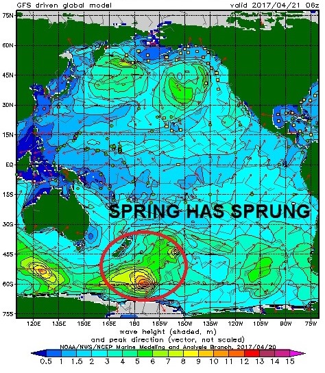
We've been on a roll lately. Again. Fun NW along with fun SW along with somewhat favorable weather resulted in rideable waves all week. Again. (Stop me if this sounds like last week's report).


Looks like things actually get better this weekend as we have a NW windswell/groundswell mix peaking today along with leftover SW. Look for shoulder high waves tomorrow and Santa Ana conditions.


Late in the day Saturday, new SW starts to show for head high waves again on Sunday and great weather. All in all a fun weekend. Again. Water temps are holding in the 63 degree range and beware the tides!


Daybreak has a -1' tide, rising to 4' at lunch, down to 1' late in the day and up to 3' at sunset.

FORECAST:
That new SW on Sunday will roll into Monday as the NW will be a distant memory. Look for shoulder high waves and nice conditions again.


The SW starts to die by Tuesday but we'll still have chest high sets. The rest of the week lacks NW windswell and we'll just have smaller background SW groundswell for waist to chest high surf.


Not much activity in the southern hemisphere the past week so we'll have a little bit of a slow period the 2nd half of next week up here.


Further out, models show storms off Antarctica around the 5th of May which would give us more head high SW mid-month; but that's a long way off. Until then, enjoy the surf early in the work week. Make sure to keep up to date on the storm activity at Twitter/North County Surf. 

WEATHER:


Pleasant weather this past week. Just some on again/off again clouds and mild temps. High pressure is setting up today though the weekend and we'll have great weather and a chance for offshore winds in the AM and breezy NW winds in the afternoon. Look for temps in the high 70's over the weekend and sunny skies. Next week the low clouds/fog return and temps drop to the low 70's. Typical May weather.

BEST BET:
Sunday with smaller NW windswell and building SW for head high sets.

NEWS OF THE WEEK:


As a kid growing up in Southern California, I always believed that if a tsunami we’re headed our way, our offshore islands (Catalina, San Clemente, San Nicholas, and the Channel Islands) would block the ‘tidal wave’ and we’d only get a glancing blow. Made sense at the time- when we get NW swells in the winter, Catalina would block swell from getting into Newport Beach. And when we get SW swells in the summer, Santa Barbara is only a shell of it’s former self due to the Channel Islands. But what if the islands actually amplified the longwave energy of the tsunami and made it bigger? Kind of like how the waves at Seaside Reef bend at high tide and make a bigger than normal wave in the shore break.  Or how the underwater canyon at Newport Point bends S swells into themselves, resulting in large A-frames. Researchers at the University of Southern California recently came to the same conclusion as they challenged the long-held belief that offshore islands protect the mainland from tsunamis- and that it turned out to be the exact opposite of what I thought as a kid...

Common wisdom -- from Southern California to the South Pacific -- for coastal residents and scientists alike has long been that offshore islands would create a buffer that blocked the power of a tsunami. In fact, computer modeling of tsunamis striking a wide variety of different offshore island geometries yielded no situation in which the mainland behind them fared better.

Instead, islands focused the energy of the tsunami, increasing flooding on the mainland by up to 70 percent.

"This is where many fishing villages are located, behind offshore islands, in the belief that they will be protected from wind waves. Even Southern California residents believe that the Channel Islands and Catalina will protect them," said Costas Synolakis of the USC Viterbi School of Engineering, a member of the multinational team that conducted the research.

The research was inspired by a field survey of the impact of the 2010 tsunami on the Mentawai Islands off of Sumatra. The survey data showed that villages located in the shadow of small offshore islets suffered some of the strongest tsunami impacts, worse than villages located along open coasts.


Subsequent computer modeling by Jose Borrero, adjunct assistant research professor at the USC Viterbi Tsunami Research Center, showed that the offshore islands had actually contributed to -- not diminished -- the tsunami's impact.

Synolakis then teamed up with researchers Emile Contal and Nicolas Vayatis of Ecoles Normales de Cachan in Paris; and Themistoklis S. Stefanakis and Frederic Dias, who both have joint appointments at Ecoles Normales de Cachan and University College Dublin to determine whether that was a one-of-a-kind situation, or the norm.

Their study, of which Dias was the corresponding author, was published in Proceedings of the Royal Society A on Nov. 5.

The team designed a computer model that took into consideration various island slopes, beach slopes, water depths, distance between the island and the beach, and wavelength of the incoming tsunami.

"Even a casual analysis of these factors would have required hundreds of thousands of computations, each of which could take up to half a day," Synolakis said. "So instead, we used machine learning."

Machine learning is a mathematical process that makes it easier to identify the maximum values of interdependent processes with multiple parameters by allowing the computer to "learn" from previous results.


The computer starts to understand how various tweaks to the parameters affect the overall outcome and finds the best answer quicker. As such, results that traditionally could have taken hundreds of thousands of models to uncover were found with 200 models.

"This work is applicable to some of our tsunami study sites in New Zealand," said Borrero, who is producing tsunami hazard maps for regions of the New Zealand coast. "The northeast coast of New Zealand has many small islands offshore, similar to those in Indonesia, and our modeling suggests that this results in areas of enhanced tsunami heights."

"Substantial public education efforts are needed to help better explain to coastal residents tsunami hazards, and whenever they need to be extra cautious and responsive with evacuations during actual emergencies," Synolakis said.

PIC OF THE WEEK:


Saw that Damo went south of the border this week for a little R&R and took Jimmicane with him. Here's one of the spots he surfed. I don't think he's missing the tour one bit.

Keep Surfing,

Michael W. Glenn
Stirring
I Really Need A Butler
The Next Great Mike (After Hynson, Difenderfer, Doyle, Tabeling, Purpus, Ho, Snips, Tron, Slambresi, Burness, & Stewart)

Friday, April 21, 2017

THE Surf Report

All signs point to 'YES'.

SURF:

We've been on a roll lately. Fun NW along with fun SW along with somewhat favorable weather has resulted in rideable waves all week.


Looks like things actually get better this weekend as we have a NW windswell/groundswell mix filling in today along with new SW. Look for head high sets and great weather. Saturday will be more of the same as the NW backs off slightly and the SW picks up slightly. Best spots will have head high+ sets.


Sunday morning drops slightly to the shoulder high set range then new W shows up late Sunday for head high sets again. All in all a fun weekend. And water temps are starting to rebound to 63.


Tides the next few days are 4' at sunrise, down to 0' after lunch, and back up to 4' at sunset.

FORECAST:
On Monday the new W peaks for head high sets and we'll still have background SW that lasts through Tuesday to help prop up the surf in the chest high range.


By Wednesday we get a shot of W windswell/groundswell and another NW on Thursday. Along with background SW, we'll have head high waves again.


After that, models show another SW arriving next Saturday for head high sets and yet another smaller SW around the 2nd of May for chest high waves. Lots of good surf on tap and nice weather to boot the next 7+ days. Make sure to keep up to date on the new swells at Twitter/North County Surf. 

WEATHER:


Northern California got the last of the showers/snow this past week and down in So-Cal just some night/morning low clouds/fog. As you noticed yesterday, high pressure started to fill in and we had sunny skies and warm weather. That builds through Saturday and we'll have great weather and temps in the mid to high 70's at the beaches. Low clouds start to return Sunday into Monday for slightly cooler temps, then normal conditions the rest of the week (night/morning low clouds/fog and sunny afternoons with temps around 70). Why would you live anywhere else?! Besides Tavarua of course.

BEST BET:
Saturday with great weather and good NW/SW. Today and Sunday don't look to shabby either though. And while we're at it- next weekend should be good. Again.

NEWS OF THE WEEK:


El Nino, is that you? If you’ll remember, earlier this year I mentioned that forecast models were already giving up on La Nina and, gasp, prophesizing the return of El Nino: So what’s been happening since then? Is our water going to be 70 degrees in May like it was in 2014? Are we going to get tropical rain all summer like 2015? Are we going to get a bazillion hurricanes like 2016?! Calm down, calm down, let’s have the people at the National Oceanic and Atmospheric Administration give us the latest:


The tropical Pacific Ocean has been giving mixed signals recently, making a forecaster’s job even more difficult! In short, many of the computer models we use are predicting the development of El Niño over the next several months, but current conditions in the tropical Pacific aren’t showing many of the elements we’d expect ahead of a developing El Niño.

We’ve had neutral conditions since January, and forecasters predict that continued neutral is the most likely scenario through at least June. By September, chances of El Niño rise to about 50%, a slight edge over neutral (~40% chance) or La Niña (~10% chance).

What are forecasters seeing now?
We rely on prediction models because they provide the most likely evolution of the ENSO system better than we can compute on our own by eyeballing maps and charts and analyzing what has happened in the past under similar conditions.

Right now, many climate forecast models do predict the development of a full-fledged El Niño during this summer or fall. It’s likely that these models are acting on the much warmer-than-average waters near the coast of South America—the “Coastal El Niño” that I’ll get to a little bit later in this post. Predictions for the Niño3.4 region in the east-central Pacific show chances for El Niño ramping up over the next year.

While nearly all of the available dynamical models are predicting an El Niño, only about half of the statistical models are, and those that do are predicting a weaker event than the average of the dynamical models. Statistical models are based on previous events, and right now the tropical Pacific does not look much like it has before past El Niños.

El Niño sets in when the ocean and the atmosphere show coupled behavior—that is, when a stronger link develops between the warming waters in the central and eastern tropical Pacific, and the slowing down of the Walker circulation, in which the westward-blowing trade winds near the surface weaken and the eastward-blowing upper level winds also weaken.


Right now, the tropical Pacific Ocean is split. There is warmth in the eastern Pacific Ocean (the Coastal El Niño—I’ll get to that, I promise). But the western and central Pacific Ocean actually look more reflective of cool, La Niña-like conditions! This is indicated by drier conditions near the Date Line and wetter conditions over Indonesia.

Surface winds over the west-central Pacific have been blowing stronger than average (a stronger Walker circulation, more like La Niña). Meanwhile, the surface temperatures in the central Pacific are cooler than average, also more like La Niña than El Niño. Even the sub-surface ocean temperatures are below average in the central Pacific over the past month. In advance of an El Niño, we would want to see heat content that is above average.

Finally! The coastal El Niño!
During the last two months, strong warming developed in the eastern tropical Pacific Ocean, hugging the western coast of South America.  Back in early February, Peruvians designated this abnormal warmth as a “coastal El Niño” and it has resulted in unusually heavy rainfall along the coast of Ecuador and northern Peru, rivaling the major El Niño events in 1997-98 and 1982-83.

This local event is different from the El Niño-Southern Oscillation (ENSO) we’ve come to know and love, which spans the width of the Pacific Ocean basin. Coastal events tend to arise during the February-April period because sea surface temperatures are typically near the warmest of the year. Heavy rainfall starts when surface temperatures exceed roughly 28˚C (82°F).  between the left and middle panels, showing the SST anomaly, or departure from average, during March 2017 (right panel). Climate.gov map from IGP using UKMet OSTIA data.


Does a coastal El Niño often turn into ENSO events?
Interestingly, it was Peruvian fishermen who first gave “El Niño” its name in the late 1800s, when they noted unusual oceanic warmth near their coast.  Later researchers, most notably Jacob Bjerknes in 1969, realized that the El Niño—the cycle in ocean temperatures—was often connected to the atmosphere above it, the “Southern Oscillation.”  The latter is more far-flung, and reflects the change in the tropical Pacific circulation (winds, convection) that overlies changes in the ocean.  The basin-wide El Niño-Southern Oscillation (ENSO) phenomenon was corroborated in the early 1980s, when detailed information became available with the advent of satellites and advanced monitoring systems like the Tropical Atmosphere Ocean (TAO) buoy array.

Although basin-wide El Niño events were once thought to originate as coastal El Niño events, we’ve since learned that this is not always the case. Coastal warming sometimes precedes strong coupling between the ocean and atmosphere (ENSO events) that span the entire tropical Pacific Ocean, but not always.

In this war of East versus West, which will eventually win out?
Most of the dynamical models favor the eastern pattern “winning” with an expansion of the coastal El Niño into a full-blown El Niño event. Mind you, only once since 1950 have we seen a sequence of El Niño, La Niña, El Niño during three consecutive years—in 1963-66.

While many models have been quite persistent over the last few months in their predictions for El Niño, they carry fairly wide uncertainty envelopes that translate into tempered probabilities for El Niño.  Plus, we are still in a period of less skillful forecasts associated with the spring ENSO predictability barrier.  Given this low model skill in the past at this time of year, and the conflict between the warm eastern Pacific and the relatively cool western Pacific, forecasters find that the odds of development of El Niño in the next six months, while elevated, are not quite at the threshold for an El Niño Watch.

PIC OF THE WEEK:


Random little European town #1276-B. THAT'S where I want to take the family this summer for our summer vacation. I've set up a GoFundMe account if you'd like to donate.

Keep Surfing,

Michael W. Glenn
Phenom
Just Missed Time Magazine's 100 Most Influential at #101
International Bro, Brah, & Bruh

Wednesday, April 12, 2017

THE Surf Report- Early Early Edition


Overdue for the BIG one.

SURF:


More fun surf was on tap this past week. Nothing big but lots of combo swell and nice conditions. No fog yet and no big southern hemi either. We're due! But seriously- who am I kidding. I sold off all my rhino chasers years ago. If the surf got over 10' around here, I wouldn't know what do to with myself. But enough of my crying- we've got some leftover SW and NW tomorrow for chest high waves and breezy conditions as a weak cold front moves by to the N.


As it exits the region on Friday, the NW generated by the storm will give us head high surf and cleaner conditions. Look for overhead sets in SD. There will also be background SW for waist high+ waves but the NW will be the dominant feature through Saturday. Sunday is back to chest high NW/SW combo. And with all the NW wind this spring, water temps have dropped back to the high 50's. Even though it's spring- a springsuit is not the call.


Tides the next few days are 0' at sunrise, up to 3.5' at lunch, down slightly to 1' late afternoon, and up to 3' at sunset. And in case you're wondering, sun comes up at 6:30 AM and sets at 7:30 PM. Plenty of time to surf before and/or after work.

FORECAST:

Monday starts off with small chest high sets from a new SW and Tuesday starts to bump up to the shoulder high range from a better SW swell. We may though have another weak front move through on Tuesday so clouds may be hard to burn off and the wind may be problematic. Wednesday picks up even more from the SW with head high sets.


The good SW continues on Thursday (along with a chest high boost from the NW) and we then get a another reinforcement of head high+ SW for next weekend. All in all some fun surf, again, next week. Make sure to keep up to date on the changing conditions at Twitter/North County Surf. 

WEATHER:


After an unusual winter, it's been a pretty typical spring. The storm track has retreated N and we're left with weak cold fronts swinging through southern California which has resulted in on again off again clouds and cool weather.  Tomorrow another front rolls through for cooler weather, more clouds, and a stronger sea breeze. The weekend is nice and cool then another dying front rolls through late Monday into Tuesday. The rest of the week looks to be cool with clouds off an on. Winter is over and summer isn't here yet- so welcome to spring!

BEST BET:
Thursday through next weekend with good SW and background NW. Clear your schedule.

NEWS OF THE WEEK:


Weren't we just talking about the worst drought on record? And then this winter California had record rains? What gives?! If you've been reading the North County Surf blog over the years, you've probably come across various stories about our weather becoming 'feast or famine' due to global warming. The LA Times this week had a good article explaining that theory:

California’s climate has long been dominated by cycles of intense dry conditions followed by heavy rain and snow. But never before in recorded history has the state seen such an extreme drought-to-deluge swing. Experts and state water officials say California is seeing more of these intense weather swings as temperatures warm, which has profound implications for the droughts and floods the state may face in the generations to come.

A new series of late-season storms this week is expected to vault this winter into the history books, making this year the wettest winter for California’s northern Sierra Nevada in nearly a century of record-keeping. This is significant because the mountain range supplies large amounts of water for the rest of the state. The expected milestone is all the more remarkable given that just two years before, the state was experiencing record dry conditions.

“We went from a driest-on-record scenario to a wettest-on-record scenario,” said David Rizzardo, chief of the snow survey section at the California Department of Water Resources. The extreme cycles of dry and wet weather appear to have been intensifying over the last three decades. “When you look at the other five wettest years other than this one, the earliest of those is 1982,” Rizzardo said. “When you look at the snowpack, the three driest years on record are 2015, 1991, and 1977.”

The shift has coincided with increases in California temperatures that scientists say began about 1980. “The dry periods are drier and the wet periods are wetter,” said Jeffrey Mount, a water expert and senior fellow at the Public Policy Institute of California. “That is consistent with what the climate simulations are suggesting would be a consequence for California under a warming planet.”

Warming global temperatures can have a profound effect on weather patterns across the planet. Changing the distribution of warmth in the ocean drives changes in the atmosphere, which ultimately decides how much precipitation gets to California, Mount said. Warm weather worsened the most recent five-year drought, which included the driest four-year period on record in terms of statewide precipitation. California’s first-, second- and third-hottest years on record, in terms of statewide average temperatures, were 2014, 2015 and 2016. And it’s no coincidence that California’s extreme water supply woes coincided with hot weather.

Warm temperatures in 2015 made the precipitation that did fall drop as rain instead of snow. Some rain that fell in the early part of that winter had to be flushed out to sea to keep space available in reservoirs just in case flooding came later. By spring 2015, the Sierra and Cascades produced a dubious historical record — the smallest snowpack on record, just 5% of average. And this winter’s near disaster at the overflowing Lake Oroville was in part caused by warm storms too. Exceptional water flows into the state’s second-largest reservoir came not only from a constant stream of “atmospheric river” storms that happened to strike California but also because so much precipitation was coming down as warmer rain. Colder snow would not have posed an immediate flood risk.

California water officials have been discussing how warming will affect the state’s water system. Now some officials believe they will have to change the infrastructure — such as building or raising dams and constructing two giant tunnels underneath the confluence of the state’s two largest rivers — to deal with more precipitation falling as rain and snow melting more quickly.

Not everyone is convinced that the evidence is in that climate change is responsible for extreme swings between drought and deluge. After all, humans have only been recording rainfall and the snowpack for a relatively short period of time in California. “I think the evidence is not very conclusive. But this surely bears watching over the coming years,” said Dan Cayan of the Scripps Institution of Oceanography at UC San Diego. “Whether this is occurring because of climate change or because we’re unlucky kind of doesn’t matter, because we have to deal with it either way,” said Jay Lund, director for the Center for Watershed Sciences at UC Davis.


Two years ago, the lack of snow left locals in Soda Springs and many other parts of the Sierra stunned and anxious. The drought hurt ski resorts and changed the landscape of the Sierras. In some areas, trees died at an alarming rate. In others, the typically snow-capped mountains were bare and dry. This winter, however, many residents say they’ve never seen so much snow. As of Tuesday, an astonishing 87.7 inches of precipitation across a zone of eight stations in the northern Sierra has been recorded since October. That’s just shy of the 88.5 inches recorded by the conclusion of the 1982-83 rain year.

The intense winter prompted Gov. Jerry Brown last week to finally declare the drought over in all counties except Fresno, Kings, Tulare and Tuolumne, where diminished groundwater levels still require a need for emergency drinking water. But right now, the above-ground water supply is much improved for most parts of the state. Many of California’s reservoirs are healthy and full. Lake Shasta, California’s largest reservoir, is 93% full. San Luis Reservoir, an important holding area for water that will later be sent to Southern California, is at 98% of capacity.

The Metropolitan Water District of Southern California is hoping to add 1 million acre-feet of water to its so-called dry-year storage. That would get its total storage up to 2.3 million acre-feet, which would almost get the district’s storage up to its high point in 2012, said Demetri Polyzos, senior water resource management engineer for the MWD. That would last a few years if consecutive dry years return to California. The next drought, officials say, could be just around the corner.

PIC OF THE WEEK:


Proof that there's still uncharted surf spots in our world. Ok- this one's not exactly uncharted as there are 100 fishing boats on the beach. But it's definitely not on the radar of the fisherman as every single one of them would be surfing right now! For more uncharted waves, check out John Callahan's work at Surf Explore. 

Keep Surfing,

Michael W. Glenn
Forward Thinker
Don't Know Why I'm A Lakers Fan
Surfing Kirra On Sunday With Rabbit And The Easter Bunny

Thursday, April 6, 2017

THE Surf Report- Early Edition


Not a bad start.

SURF:
Been a pretty good start to spring I would say. Fun combo swell, May Gray isn't here yet, the storms have faded- sign me up!


This past week held true to the forecast as we had good NW groundswell, good SW groundswell, sunny skies, and clean conditions. Today we had building SW and more NW for chest high waves and a little bit of cloud cover. Both swells build slightly tomorrow, so look for shoulder high sets  by afternoon and semi-clean conditions and cloudy skies. We have a weak front moving down the coast late Friday into Saturday that will pick up the NW some more but may bring some bumpy S winds. Nothing major but not as clean as we've had the past few days.


Late Saturday we'll see overhead NW (and some SW underneath it all) and a bit of chop. Sunday the front exits, NW winds will be behind it, and he NW starts to drop as the SW hangs around. All in all some solid surf this weekend but conditions may be iffy. Water temps are warming up slightly (lack of NW winds the past month has helped) and most buoys in SD are 63 degrees.


Tides this weekend are going to be 5' at breakfast, 0' around 3, and up to 4' at sunset.

FORECAST:


As the work week kicks in (unless you're on Spring Break in Daytona Beach like me), we've got more SW on tap Monday for shoulder high sets, that lasts into Tuesday. Wednesday sees a small bump in the NW windswell as the SW serves up some leftovers. We still should see shoulder high sets from the combo- and nice weather.


By Thursday afternoon, we see more SW swell build in for shoulder high surf in far North County and more NW windswell arrives on Friday. BUT... models show another weak front coming through for next weekend. Probably a nuisance like this weekend's weather.


Once that clears out, we should see another SW arrive next Sunday for shoulder high waves. Nothing big with all these swells but definitely keeping us busy. Make sure to keep up to date on the changing conditions at Twitter/North County Surf.

WEATHER:


Models earlier in the week predicted showers Friday/Saturday but have since backed off. Looks like maybe a chance of showers on Saturday, then clear/cool skies and NW winds on Sunday as the weak front moves through. Early in the work week high pressure sets up for sunny skies and warm temps. Then models are predicting again showers for late in the week. Long story short- pretty mild weather. And at least no May Gray. Yet.

BEST BET:
Monday to Friday looks pretty fun with SW/NW combo and no real weather disturbances to mess things up.

NEWS OF THE WEEK:

Now that spring is here, it’s time to look back at the winter that was. As you probably heard, we were expected to be in a La Nina pattern (colder than average water temps, lower than average rainfall). But nothing can be expected as normal around here anymore. Like 2014/2015; full blown El Nino, right? Well, the hurricane season was active, and we received lots of rain over our normally dry summer, but our winter storms were below normal. So 2015/2016’s El Nino was going to be all-time, right? Well, we know how that turned out; only 80% of our normal rainfall totals. So La Nina awoke this past winter, our water temps dropped, and dry conditions were surely on their way. Then the rains came, and they came, and they came. Nothing of Biblical proportions,  but for a season in which we were supposed to get well below our average of 10”, we were 20% over and our reservoirs filled to capacity. So what happened this winter? I’ll let our friends at the National Oceanic and Atmospheric Administration explain:

Often during a La Niña winter, central and southern California receive below-average amounts of precipitation. While this dry pattern does not occur in every La Niña winter—and it’s especially fickle during weak, short-lived La Niñas like we just experienced--nevertheless there is a drier-than-average expectation. Instead, all wet-heck broke lose.


Multiple atmospheric river events in December, January, and February brought copious amounts of rain and snow to the state. Reservoirs were filled to their brims, even exceeding them in some places. At Lake Oroville north of Sacramento, water levels rose past capacity of the Oroville dam leading to the release of water, causing downstream flooding and evacuations. Snow across the Sierra Nevadas was plentiful enough to close ski resorts due to too much snow.  In fact, total precipitation across higher elevations in the state is pacing close to and even above the wettest water year on record. How did this happen?

It’s likely a combination of a dying La Niña, competing climate phenomena, and the random vagaries of the atmosphere. Usually during La Niña, the jet stream above the Pacific Ocean—an area of fast winds 30,000 ft in the atmosphere that serves as a storm highway—is confined to an area just off the Asian continent and doesn’t extend eastward. Also expected during La Niña is a broad high-pressure system over the North Pacific. This high-pressure area blocks Pacific storm systems from easily moving east (2) toward the U.S. Southwest.


This year, even though the jet stream in the Pacific was slightly retracted to the west and the high pressure was present—if slightly displaced northward from what was expected—multiple atmospheric rivers brought heavy rain to California in December.  So, what gives? Well, the Pacific jet stream is not the only jet stream on earth. Jet streams can arise in other locations too.  During the winter, the jet stream over the eastern United States and Atlantic Ocean also strengthens.  This winter, the winds blowing west-to-east across the contiguous United States stretched farther west than usual, helping guide Pacific moisture straight into California.


So even though the Pacific jet roughly acted in La Niña fashion, the US/Atlantic jet stepped into the storm-carrying role instead. That’s just the weather sometimes, as La Niña does not impact the Atlantic jet in a systematic way. Then it happened again somewhat at the beginning of January. Even strong La Niñas don’t mean that California would get NO rain. And this was a pretty pathetic La Niña (one of the shortest and weakest in our historical record). An occasional atmospheric river should be expected during winter, even if the number of them this winter was abnormal.

But what about in late January and February, after La Niña faded away? Well, a Madden Julian Oscillation (MJO) event was the likely culprit for the mid-winter wetness. By late January, our short-lived La Niña was unable to exert its influence strongly across the Pacific. Instead, the MJO helped create the conditions for another round of epic rain and snow.  Put all of those events together and you end up with a ridiculously wet winter for California.

If this winter shows anything, it is that we aren’t kidding when we say that ENSO is not the only game in town. Random weather and other climate factors can often override a La Niña signal, especially when it is weak. And there is always some randomness that is simply not predictable when we make our winter outlooks. That is why we issue our forecasts in terms of probabilities—because we understand what we know, and more importantly, what we don’t know.

So there you have it. Just when you think you know everything, Mother Nature humbles you.

PIC OF THE WEEK:


It amazes me how far people will travel to find new waves and the risks they will take. Like today's Pic of the Week- would you risk disease, crocs (the animals, not the shoes), civil unrest, and the chance of travelling all that way and getting skunked (flat ocean, not the animals). My sense of adventure consists of wondering whether or not the bartender at my swim up pool in Cabo is going to get my drink order right.

Keep Surfing,

Michael W. Glenn
Earth Shattering
Was Mentioned in the Bible
Guinness Record Holder, 12,847 Surf Spots Discovered