Friday, April 26, 2019

THE Surf Report


So close I can smell it.  

SURF:
Beautiful spring time weather and small NW swell earlier in the week was replaced by SW swell on Wednesday. 


The SW peaked last night and today we have waist high waves from the SW. 

That will drop slightly tomorrow with waist high sets then we start to get a slight reinforcement from the SSW on Sunday for more consistent waist high surf. All some small surf this weekend and typical spring weather. 


And tides this weekend are:
  • 3' at sunrise
  • 0.5' around 11 AM
  • 4' at sunset
Daylight hours this weekend are:
  • 6:00 AM sunrise  
  • 7:30 PM sunset  
FORECAST:
The new SW mentioned above starts to fill in more on Monday for inconsistent chest high sets BUT... models show another weak cold front moving through late on Monday that may kick up our winds. Tuesday the swell peaks with chest high surf BUT... it may be windy again as the weak cold front exits the region. Wednesday we're back to inconsistent chest high sets and cleaner surf. 


The 2nd half of the week looks small then a fun shoulder high SW should arrive around the 5th. 


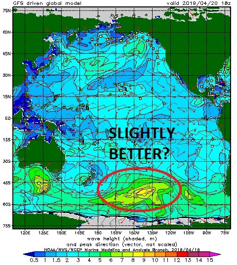
Forecast charts then go into beast mode and we may FINALLY give us our 1st big SW of the season. If everything lines up, we could see well overhead SW swell around the 10th and double overhead at the best spots in the OC (I'm talking to you Wedge). Yes! Make sure to keep track of the waves and weather Twitter/North County Surf. 

WEATHER:


Look for typical low clouds and fog this weekend then we're back to cooler/breezier conditions to start the work week. As is typical this time of year, the storms from the Pacific are starting to wane as we move away from winter so all we're left with is weak cold fronts and windy conditions. That will be the case late Monday into Tuesday (and just like the rest of April). Once that moves through, we should have nice weather for the 2nd half of next week.

BEST BET:
Tuesday/Wednesday if the wind stays away from that peaking SW. Or better SW around the 5th. Or BIGGER SW (I'm hoping) around the 10th!
 
NEWS OF THE WEEK:


As you may or may not know, I'm part of a group called the North County Board Meeting (ncboardmeeting.org). It was formed 5 years ago by local surfers to help strengthen our community. We meet once a month and there are no dues- the only prerequisite is that you have a passion for surfing. We get together at the beach in the mornings for 'Surf Meetings' or have mixers at local surf owned companies like Priority Public House, Agency 73, Surfhouse, Hansen's, etc. to help promote their business. One of my favorite events is annual our golf tournament happening at Goat Hill Park in Oceanside Friday, May 31st. Now you may be wondering why golf for a bunch of surfers. There's a lot of similarities actually. Hitting a good shot is like doing a good turn. You're in a beautiful setting. And you get to heckle your buddies. But the real reason we do it is to raise money a local charity. This year we're benefiting the Challenged Athletes Foundation. The CAF provides physically challenged people with the tools they need to pursue active and healthy lifestyles and we are honored to support them this year. If you'd like to help support your local community too, come join us! This event is open to everyone as the purpose of the event is to assist the Challenged Athletes Foundation. Here's how you can help:
  • Play in the event (lunch included). Cost is $90.
  • Sponsor a hole! It's a great way to connect with others and promote your business. Cost is $250
  • And if you don't play, we're also looking for raffle prize and swag bag donations

Please remember this is a charity event so we can't take IOU's. We're filling up quick, so to secure your spot, please send a check (payable to North County Board Meeting) to Agency 73, 244 N Coast Hwy 101, Encinitas, CA 92024 or contact Rich Clark at rclark@fuzionpayments.com for credit card payments. And last but not least, thank you to Carlsbad attorney Ian McDaniel for being the title sponsor again this year. Any questions, please contact me at northcountyboardmeeting@gmail.com. Thanks for supporting the Challenged Athletes Foundation! 

PIC OF THE WEEK:


Why travel 1/2 way around the world when some of the best waves are just a short drive up the coast?

Keep Surfing,

Michael W. Glenn
Nimble
Dress To Impress
Air Guy On Just The Odd Days Of The Week

Thursday, April 18, 2019

THE Surf Report- Early Edition


Xerox machine + Groundhog Day = The same waves & weather again this week. 

SURF:


Had a slight uptick in the SW yesterday for chest high surf in northern SD and shoulder high sets in the OC. Along with some NW windswell there was some fun waves, minus the strong afternoon sea breeze. For Friday and Saturday, it's a carbon copy. Expect chest high sets from the SW (slightly bigger in the OC) and a touch of NW windswell to cross things up. On late Saturday, another dry cold front will move through to the N of us and kick up gusty winds like we've been having off and on the past two weeks. 


The NW windswell will pick up to the head high range Sunday morning but it will be disorganized. All in all some clean fun small surf Friday/Saturday and larger jumbled surf on Sunday. 

As far as water temps go, if the wind stops blowing, the water temps will be in the low 60's. If the NW wind blows, it drops to the high 50's. So enjoy it today before it drops on Sunday/Monday. 


And tides this weekend are:
  • 0' at sunrise
  • -5' around 11 AM
  • 1' late afternoon
Daylight hours this weekend are:
  • 6:15 AM sunrise  
  • 7:21 PM sunset  
FORECAST:
The NW windswell backs off on Monday for chest high surf along with some background SW. 


Tuesday looks small then another weak SW starts to arrive late in the day on Wednesday for more chest high surf on Thursday in the far N county SD and the OC. 


That's replaced by a better shoulder high SW next weekend. All in all, no big surf on the horizon but fun SW later next week. Make sure to keep track of the waves and weather Twitter/North County Surf

WEATHER:


Been a repeat around here when it comes to waves and weather. Small SW swells being crossed up by small NW windswell- which has been generated by all these spring time dry cold fronts. For the next week- it's Groundhog Day! For Friday we have great beach weather and temps in the mid-70's. On Saturday, the next dry cold front moves down the California coast and we get a return of the low clouds/fog. Late Saturday looks to be breezy (and maybe some sprinkles) and Sunday should be cool as the front exits the region. For Monday through mid-week, high pressure builds again, and take a wild guess... sunny skies and temps in the mid-70's! 

BEST BET:
Tomorrow with nice weather and combo surf or the 2nd half of next week with better SW swells and great weather again. 

NEWS OF THE WEEK:


As you’ve probably read here the past 6 months or so, the big El Nino of ‘17/’18 was to linger in a weakened state into ‘18/’19. While locally we didn’t have above normal water temps this winter nor did we have particularly large surf, we did have above average rainfall. So 1 out of 3 isn’t bad. The good news is that the forecasters at the National Oceanic and Atmospheric Administration are predicting the slight El Nino will last into this summer and maybe beyond. I’ll let NOAA explain:


The Great ‘Puny’ El Niño of 2018–19 continued through March, and forecasters predict it will likely remain through the summer and possibly continue into the fall. The tropical Pacific Ocean shows El Niño’s fingerprint clearly, with warmer-than-average sea surface temperatures stretching across the equator.

The El Niño atmospheric response was also apparent in March, with continued greater-than-average cloudiness and rain near the International Date Line. This is the weakened Walker Circulation pattern, due to more rising air than average over the central Pacific as the warmth of the ocean is transferred to the air above. Both the regular-flavor Southern Oscillation Index and the Equatorial Southern Oscillation Index were negative during March (-0.3 and -1.2, respectively), showing this continued atmospheric response.

We are also interested in the near-surface wind patterns, another critical component of the Walker Circulation, because these winds are how the atmosphere communicates with the ocean. The trade winds normally blow relatively steadily from east to west along the equator, keeping warm water piled up near Indonesia. When they are weaker than average, the ocean surface can warm, and the pile of warm water can begin to slosh to the east. During March, the trades were weakened, but this pattern was confined to a fairly small area of the western Pacific. (Remember this for a bit later when I get into the forecast.)

El Niño’s signature warmer-than-average sea surface temperatures were solidly evident in March, with a monthly average of 0.9°C above average from ERSSTv5, our longest observation dataset. The January–March 3-month average from ERSSTv5, what we call the Oceanic Niño Index, was 0.8, marking the fifth consecutive, overlapping 3-month period above the El Niño threshold (0.5°C above average).


Late fall 2018 was noticeably flat, without the gradual increase, peak, and decline that so many other El Niño events have exhibited. This flatness isn’t unusual behavior for a weak El Niño, however, as other events, including 1977–78, 1978–79, and 2004–05, show.

What is unusual is the model forecast for continued weak El Niño through the summer, with the tropical Pacific sea surface temperature expected to stay a bit above the El Niño threshold. This is a pattern that we haven’t seen in the (admittedly short) 1950–present historical record.

Also, forecasters think there’s about a 50-55% probability that El Niño will continue into the fall. As we’ve discussed before, the spring predictability barrier means it’s difficult for climate models to make successful predictions during March, April, and May, a time of year when ENSO (El Niño/Southern Oscillation, the entire El Niño and La Niña system) events are usually decaying and changing phase. This springtime indecisiveness partially explains the moderate probabilities that forecasters estimate for El Niño continuing into the fall.


The amount of warmer-than-average water between the surface and about 300 meters below the surface was elevated during March, as a downwelling Kelvin wave continued to move eastward under the surface of the equatorial Pacific. As this blob of warm water gradually rises, it will provide a source of warm water to the surface, helping to keep temperatures elevated through the next few months, and helping support the forecast through the spring and summer.

The subsurface temperature in March, as well as the near-surface winds (see above), have some correspondence to ENSO conditions in the subsequent fall/winter, but not a super strong relationship as there has been a pretty wide range of outcomes in the historical record. So while these conditions are factored in to the forecast for the later part of the year, they’re not a huge source of confidence. Plus, the wind anomalies in the western Pacific are pretty darn feeble, which does not elicit comparisons with the evolution leading up to the major 2015-16 El Niño. 

Since El Nino interacts with the Eastern Pacific hurricane season (i.e. the hurricanes between Baja and Hawaii) it will interesting to see how the forecast for a continued weak El Niño affects the Climate Prediction Center’s hurricane outlook, issued later next month. For now, I’m guessing we’ll get a couple extra hurricanes this summer, slightly stronger than normal, and slightly above average water temps. Any complaints?

PIC OF THE WEEK:


Wonder why they call it the impact zone? The definition of impact is "the action of one object coming forcibly into contact with another". In this case the lip of the wave into your head as you try to duck dive this behemoth. Ouch.  

Keep Surfing,

Michael W. Glenn
Bro
Reunited And It Feels So Good
Opening a Tavarua Themed Casino In Vegas Complete With Restaraunts & Cloudbreak Wavepools

Thursday, April 11, 2019

THE Surf Report- Early Edition


Wind, wind, go away...

SURF:
Been a bit of wind lately and not much real swell unfortunately. 


Spring time winds have resulted in colder water temps and short interval NW windswell. We'll have a little more of that tonight- then cleaner conditions by Saturday. First up is another dry cold front moving though tonight which will kick up our winds tomorrow as well as increasing the NW windswell. Look for messy conditions on Friday with head high+ whitecaps. Saturday things clean up and we have leftover chest high NW and Sunday looks small and clean with minimal SW/NW. Best bet is to blow off tomorrow (Get it? Blow? Wind? Never mind.) and just wait for Saturday. 

And thanks to all the good for nuthin' NW wind recently, water temps have dropped to the high 50's again! (Camp Pendleton was actually 55 this morning and Long Beach- get this- had a buoy reading of 53 degrees. Ouch.)


And tides this weekend are:
  • 3.5' at sunrise
  • -0.2' at lunch
  • 4' at sunset
Daylight hours this weekend are:
  • 6:23 AM sunrise (Get in the water by 6 AM!)
  • 7:16 PM sunset (Get out of the water by 7:30 PM!)
FORECAST:


New SW from a medium sized storm starts to fill in late Monday for chest high surf. 


We unfortunately have another windy cold front coming through late Tuesday which will increase the NW windswell again (chest high) but also make a mess of that new SW. Things should clean up by Thursday- but the SW will be on it's way out by then too. 


Next weekend looks to have small SW swell then models show maybe our first real overhead SW swell around the 25th. So until then- look for some fun small SW and winds again around Wednesday. Make sure to keep track of the waves and weather Twitter/North County Surf. 

WEATHER:


As mentioned above, we have another dry windy front coming through tomorrow. The sun and warmer weather returns this weekend for temps in the low 70's and manageable winds. Late Tuesday another dry windy front comes through (I'm getting tired of this- bring on summer already) but high pressure will finally set up shop late next week for temps in the mid-70's and good spring break weather (for those of you who still party during spring break or even get a spring break).  

BEST BET:
Saturday with cleaner conditions and leftover NW windswell OR early Tuesday before that next windy cold front messes up the new SW. 
NEWS OF THE WEEK:


This day in history! (Since these dry windy cold fronts we've been having aren't that exciting to talk about):
  • 1967: 2.18 inches of precipitation fell in Big Bear Lake, the greatest daily amount on record for April. Ten inches of snow fell in Palomar Mountain, the greatest daily snowfall on record for April. This also occurred on 4/17/1963.
  • 1966: Strong winds surfaced in the deserts. The winds disrupted travel along Interstate 10 and Highway 111, and sand blasted cars and homes in Palm Springs and Indio.
  • 1965: A cold late-season storm that started on 4/7 and ended on 4/11 brought heavy rainfall and snowfall to the region. Over the period 7.66 inches of precipitation fell in Lake Arrowhead (with nearly 50 inches of new snow). 5.44 inches fell in Palomar Mountain (with 13 inches of snow), 4.36 inches in Big Bear Lake, 4.25 inches at Cuyamaca, and 3.14 inches in Idyllwild (with 24 inches of snow). 1.5 to 2 inches of rain fell across the coastal basin. Mountain roads were closed.
  • 1953: It was 31° in Santa Ana, the lowest temperature on record for April.
  • 1941: It snowed three inches in Victorville, the greatest daily snowfall on record for April and the latest measurable snowfall of the season.
  • 1922: It was 30° in Escondido, the lowest temperature on record for April.

PIC OF THE WEEK:


What draws your attention to this photo? The tropical clouds on the horizon? The mysterious island just offshore? The purples, the pinks, and the oranges? Or the obvious answer- the long rights and lefts coming off the reef? If you're a true surfer though- the real answer is... all of the above. That's what makes surfing so great. It's more than just riding waves. We're a lucky bunch. (For more amazing surf shots, check out Jackson Bright's work at @jacksonbright on Instragram)

Keep Surfing,

Michael W. Glenn
People Person
Been Asked To Fix The Lakers
Surf Just For Fun. All The Praise And Accolades Are Just Icing On The Cake. 

Thursday, April 4, 2019

THE Surf Report- Early Edition


April showers bring May flowers. No wait- April showers May bring... surf?

SURF:
I'll never be mistaken for a rapper, but I do know waves and weather. And we've had a little bit of everything this past week. 


The southern hemisphere is coming alive, the North Pacific hasn't died yet, we've had great beach weather, and on the opposite side- cool breezy showers. All in the span of 7 days.  Looks to be more of the same for the upcoming week. For tonight, we've got showers moving into the area again along with background SW/NW on Friday for waist high waves. Might be a good day to take a break and fix those dings. 


For Saturday we have better weather in the afternoon and building fun SW swell for chest high surf. 


Then on Sunday we've got new NW meeting up with the old SW for shoulder high sets. And great weather. Should be fun this weekend. And here's some numbers to mull over:

Water temps are low 60's all of a sudden...


And tides this weekend are:
  • 2' at sunrise
  • 4.5 mid-morning
  • 1' late afternoon
  • 2' at sunset
Daylight hours this weekend are:
  • 6:30 AM sunrise
  • 7:10 PM sunset

FORECAST:
Could be good surf next week- if the weather behaves. 


First up is a late season NW that will bring overhead surf on Tuesday- along with a late season cold front. Just showers but breezy W winds unfortunately will mess up the surf. 


We also have some SW arriving at the same time that won't really show until the messy cold front exits on Wednesday. 


Should see shoulder high sets late in the day from the SW with another shot of head high NW on Thursday through Friday. Keeping my fingers crossed that the weather is finally clean by next weekend so we can enjoy all the swells. 


After that, models show the southern hemisphere TRYING to get it's act together again and we may see shoulder high+ SW towards the 15th through 19th. 


And forecast charts show another NW taking shape around the 16th. Could be really fun the next couple weeks IF... the weak cold fronts stop rolling through. Make sure to keep track of the waves and weather at Twitter/North County Surf.

WEATHER:


April showers bring... you know the rest. We've got some showers coming through tonight and possibly Friday evening- typical for April. High pressure starts to take control late Saturday and by Sunday we've got temps in the high 70's at the beaches. Sound like last weekend? Monday is a transition day as another cold front moves into the area by Tuesday. This will be slightly stronger than tonight's cold front with a little more wind and consistent showers. That should be gone by Thursday and great weather again next weekend? Most likely. 

BEST BET:
Sunday with combo swell and great weather. Or next Thursday/Friday with mostly NW swell and possible great weather again. 
 
NEWS OF THE WEEK:


How many high tides are there per day? Easy question right? We 2 high tides and 2 low tides, right?...

It depends. Most coastal locations have two unequal high tides a day. Like us. BUT... if the Earth were a perfect sphere without large continents (which it's not), and if the earth-moon-sun system were in perfect alignment (which they're not), every coastal location would get two equal high and low tides every day (which they don't). HOWEVER... the alignment of the moon and sun relative to Earth, the presence of the continents, regional geography and features on the seafloor, among other factors, make tidal patterns more complex. I'll let the experts at the National Oceanic and Atmospheric Administration explain:

While some places have one high tide and one low tide per day, most coastal locations have two high tides and two low tides a day. These highs and lows typically aren't equal. This is why, in most places, using the phrase "high tide" might be unclear. There's actually high tide and higher high tide (and low and lower low tide).

Tides are one of the most reliable phenomena in the world. As the sun rises in the east and the stars come out at night, we are confident that the ocean waters will regularly rise and fall along our shores.

Tides are very long-period waves that move through the oceans in response to the forces exerted by the moon and sun. Tides originate in the oceans and progress toward the coastlines where they appear as the regular rise and fall of the sea surface.

When the highest part, or crest, of the wave reaches a particular location, high tide occurs; low tide corresponds to the lowest part of the wave, or its trough. The difference in height between the high tide and the low tide is called the tidal range.

Around the world, there are three basic tidal patterns: semidiurnal, mixed, and diurnal. When both high tides are about equal to each other, and the low tides are also roughly equal, the pattern is called a semidiurnal tide. If the two highs and lows differ substantially, the pattern is called a mixed tide. Where there's only one high and one low tide a day, it's called a diurnal tide. One location can experience different tide patterns throughout the month.

The highest tides in the world can be found in Canada at the Bay of Fundy, which separates New Brunswick from Nova Scotia. At some times of the year the difference between high and low tide in the bay is over 53 feet (basically the wave size of an average day for Shane Dorian). The highest tides in the United States can be found near Anchorage, Alaska, with tidal ranges up to 40 feet. And what’s the biggest tidal range we have here in north county San Diego? About 9'. A 7' high tide and a -2' low tide that usually occur towards early January. Not exactly 40 feet or even 53 feet; but still amazing to think that if you were standing on the shore at dead low tide, a 6’ person would be 3’ under water at high tide. Or another way of thinking about it; as the 7' high tide starts to race towards -2', the tide would dropping 1.5' an hour. That's fast. 

PIC OF THE WEEK:


If Baja took a European vacation.

Keep Surfing,

Michael W. Glenn
Spare No Expense
Still Have A Perfect Bracket
Every Year Want To Surf A Wave As Big As My Age. Aiming For A 75' Bomb When I'm 75