Thursday, October 26, 2017

THE Surf Report- Early Edition


September no. October yes.

SURF:
I’m still perplexed on how bad/good the surf has been. September was absolutely dismal around here and then the past few weeks of October have been all-time. Think I’ll get into politics- that’s a lot easier to figure out. I think.
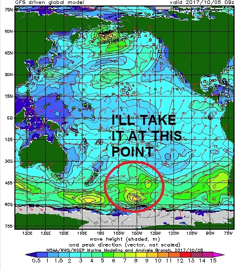

But before I get too far off track, let’s do a quick recap of the past week: Lots of good SW swell, NW swell, 100 degree temps at the beaches, and offshore winds. Pretty close to perfect except for the crowds and cool water temps. But I’ll take it. For tomorrow, the current SW/NW backs off but we still have chest high sets and clean conditions- beware the patchy fog though as our strong high pressure is finally starting to break down.


For Saturday it drops  to the waist high+ range but by Sunday we start to see new NW groundswell fill in. This was from a big storm in the Aleutians a few days ago and hopefully will light up Jaws and Mavericks this weekend. Unfortunately the angle is pretty N and it’s groundswell- which doesn’t filter through our islands all that well- but we still should have shoulder high sets late Sunday into Monday. Down in SD look for overhead sets.


Water temps are in the mid-60’s and tides this weekend are pretty mellow; 4’ at sunrise, down slightly to 3’ at lunch, and up to 4’ again at sunset.

FORECAST:
The NW mentioned above hangs around on Monday for shoulder high sets and then it slowly fades through the week. No real storms on the charts unfortunately for the 2nd half of next week.


Looks like we have some waist high SW headed our way next Thursday

and then maybe some better NW/SW around November 9th. But until then, nothing of significance. If anything changes between now and then, keep up to date on the waves and weather at Twitter/North County Surf. 

WEATHER:


Thankfully the strong Santa Ana winds never reached our coast, so fires were never really an issue this week. But we did have air temps in the 95 to 100 degree range and made it miserable for homeowners without AC (myself included).  High pressure has backed off slightly but we still have temps around 80 at the beaches this weekend and some patchy fog forming. Early next week we should be back to the low 70’s and low clouds/fog. Models are even hinting at showers next weekend. Yeah, right.

BEST BET:
Friday with leftover NW/SW or late Sunday/early Monday with new NW.

NEWS OF THE WEEK:


Rutgers University this month have concluded that explosive volcanic eruptions in the tropics can lead to El Niño events, those notorious warming periods in the Pacific Ocean with dramatic global impacts on the climate, according to a new study. Enormous eruptions trigger El Niño events by pumping millions of tons of sulfur dioxide into the stratosphere, which form a sulfuric acid cloud, reflecting solar radiation and reducing the average global surface temperature, according to the study co-authored by Alan Robock, a distinguished professor in the Department of Environmental Sciences at Rutgers University-New Brunswick. The study, published in Nature Communications, used sophisticated climate model simulations to show that El Niño tends to peak during the year after large volcanic eruptions like the one at Mount Pinatubo in the Philippines in 1991.

"We can't predict volcanic eruptions, but when the next one happens, we'll be able to do a much better job predicting the next several seasons, and before Pinatubo we really had no idea," said Robock, who has a doctorate in meteorology. "All we need is one number -- how much sulfur dioxide goes into the stratosphere -- and you can measure it with satellites the day after an eruption."


The El Niño Southern Oscillation (ENSO) is nature's leading mode of periodic climate variability. It features sea surface temperature anomalies in the central and eastern Pacific. ENSO events (consisting of El Niño or La Niña, a cooling period) unfold every three to seven years and usually peak at the end of the calendar year, causing worldwide impacts on the climate by altering atmospheric circulation, the study notes.

Strong El Niño events and wind shear typically suppress the development of hurricanes in the Atlantic Ocean, the National Oceanic and Atmospheric Administration says. But they can also lead to elevated sea levels and potentially damaging cold season nor'easters along the East Coast, among many other impacts.

Sea surface temperature data since 1882 document large El Niño-like patterns following four out of five big eruptions: Santa María (Guatemala) in October 1902, Mount Agung (Indonesia) in March 1963, El Chichón (Mexico) in April 1982 and Pinatubo in June 1991.

The study focused on the Mount Pinatubo eruption because it's the largest and best-documented tropical one in the modern technology period. It ejected about 20 million tons of sulfur dioxide, Robock said.


Cooling in tropical Africa after volcanic eruptions weakens the West African monsoon, and drives westerly wind anomalies near the equator over the western Pacific, the study says. The anomalies are amplified by air-sea interactions in the Pacific, favoring an El Niño-like response.

Climate model simulations show that Pinatubo-like eruptions tend to shorten La Niñas, lengthen El Niños and lead to unusual warming during neutral periods, the study says.

If there's a big volcanic eruption tomorrow, Robock said he could make predictions for seasonal temperatures, precipitation and the appearance of El Niño next winter.

"If you're a farmer and you're in a part of the world where El Niño or the lack of one determines how much rainfall you will get, you could make plans ahead of time for what crops to grow, based on the prediction for precipitation," he said.

Or in our case… the surf.

PIC OF THE WEEK:


Ever wonder if Lake Tahoe gets surf? Here’s your answer. Granted it’s only 1’, but still, here’s your answer.

Keep Surfing,

Michael W. Glenn
Best In Class
1982 World Jai Alai Champion
My Senior Thesis Was Called “If A Peak Is An A-Frame Then A Closeout Must Be A V-Frame.”

Thursday, October 19, 2017

THE Surf Report- Early Edition


My arms are tired.

SURF:
Lots of paddling the past few days. Which is a good thing. Glad to see some waves around here. All that complaining last month seems like a distant memory.


Today we have good combo swell for head high waves and tomorrow starts off a little smaller in the chest high range.


By afternoon though, a new solid NW groundswell starts to fill in for head high waves.  The NW peaks Saturday for more head high+ surf and overhead waves in SD. On Sunday the NW backs off fairly quickly but we have new smaller SSW to keep us in chest high surf. The only question mark is a cold front moving through on Friday which may give us junky conditions with S winds. Saturday is a transition day and Sunday should have light offshores. Pick your sessions wisely.


Water temps are hovering around 67 and tides this weekend are 3’ at sunrise, up to 5.5’ mid-morning, and 0’ late afternoon.

FORECAST:


Early in the work week the NW/SW fades to the waist to chest high range then a new waist high+ NW arrives Wednesday and is reinforced with another NW for chest high sets next Friday.


Further out, models show a large storm in the Aleutians forming early next week which should give us head high NW again towards Halloween. If anything changes between now and then, keep up to date on the waves and weather at Twitter/North County Surf. 

WEATHER:


Couple items to discuss today. First up is the weak cold front coming through on Friday for a chance of light showers and SW winds. That moves through by Saturday morning then the real story is the building high pressure and dangerous Santa Ana wind conditions. Winds could reach the coast on Sunday for 20 mph+ NE winds that last through Tuesday. Hot days will also be a concern with temps at the beach near 90 Sunday, low 90’s on Monday, and possibly mid-90’s on Tuesday. Crazy. Hopefully by Wednesday the winds back off, temps drop, and late in the week coastal low clouds return. Keep your fingers crossed the winds aren’t as strong as forecasted and the fire weather stays at bay.

BEST BET:
Saturday with nice weather, peaking head high NW, and a touch of SW. Or Sunday with mainly smaller chest high SW and light offshores.

NEWS OF THE WEEK:
A few weeks ago I talked about La Nina conditions taking hold in the Pacific this fall and winter. For us here in southern California, that most likely means less big storms (i.e. smaller surf, less rain, warmer air temps). But what about the rest of the country? Forecasters at NOAA’s Climate Prediction Center released the U.S. Winter Outlook today, with La Nina potentially emerging for the second year in a row as the biggest wildcard in how this year’s winter will shape up. La Nina has a 55- to 65-percent chance of developing before winter sets in.

“If La Nina conditions develop, we predict it will be weak and potentially short-lived, but it could still shape the character of the upcoming winter,” said Mike Halpert, deputy director of NOAA’s Climate Prediction Center. “Typical La Nina patterns during winter include above average precipitation and colder than average temperatures along the Northern Tier of the U.S. and below normal precipitation and drier conditions across the South.”

Other factors that influence winter weather include the Arctic Oscillation, which influences the number of arctic air masses that penetrate into the South and is difficult to predict more than one to two weeks in advance, and the Madden-Julian Oscillation, which can affect the number of heavy rain events along the West Coast.

The 2017 U.S. Winter Outlook (December through February):


Precipitation

•Wetter-than-average conditions are favored across most of the northern United States, extending from the northern Rockies, to the eastern Great Lakes, the Ohio Valley, in Hawaii and in western and northern Alaska.

•Drier-than-normal conditions are most likely across the entire southern U.S.


Temperature

•Warmer-than-normal conditions are most likely across the southern two-thirds of the continental U.S., along the East Coast, across Hawaii and in western and northern Alaska.

•Below-average temperatures are favored along the Northern Tier of the country from Minnesota to the Pacific Northwest and in southeastern Alaska.

•The rest of the country falls into the equal chance category, which means they have an equal chance for above-, near-, or below-normal temperatures and/or precipitation because there is not a strong enough climate signal in these areas to shift the odds.

Drought

•Despite the outlook favoring above-average precipitation this winter, drought is likely to persist in parts of the northern Plains, although improvement is anticipated farther West. 

•Elsewhere, drought could develop across scattered areas of the South, mainly in regions that missed the rainfall associated with the active 2017 hurricane season.

NOAA’s seasonal outlooks give the likelihood that temperature and precipitation will be above-, near, or below-average, and also how drought is expected to change, but do not project seasonal snowfall accumulations. While the last two winters featured above-average temperatures over much of the nation, significant snowstorms still impacted different parts of the country. Snow forecasts are generally not predictable more than a week in advance because they depend upon the strength and track of winter storms. The U.S. Winter Outlook will be updated on November 16.

PIC OF THE WEEK:


My grandfather lives in this old world village. He started surfing that right-hander in 1938. I’m not sure where it is though- always sends me a Xmas card without a return address for some odd reason...

Keep Surfing,

Michael W. Glenn
Primo
Got My Sneaker Deal
Wavepools Are So Yesterday, I'm In To Artificial Reefs Now

Friday, October 13, 2017

THE Surf Report


Doesn’t it feel good to surf again?!

SURF:
No offense to all the shapers out there who make a great groveller board (like the SUPERbrand Fling- shameless plug- sorry) but I was OVER riding tiny waves. It had been like 6 months (exaggeration) since I saw a wave you could do a real turn on. For the true power surfers like Cram, Knox, BK, Sarlo, Kong, Gomes, and Glenn, I’m surprised they didn’t give up surfing altogether.


But Poseidon came through last weekend with a solid SW swell (and a touch of NW) to save humanity.


That surf has since left the building but we do have a little SW that filled in today and some NW filling in tomorrow. Look for chest high sets from the combo swells this weekend and great weather.


Water temps have pretty much peaked for the rest of the season at 70 degrees (get it while you can) and tides the next few days are pretty mellow with 4’ at sunrise, down to 2’ at lunch, and up to 5’ at sunset.

FORECAST:


After a fun weekend of small but rideable waves, we get a better boost of SW on Tuesday for head high sets followed by more chest high NW windswell on Wednesday.

Models then show another NW arriving towards Thursday into Friday.

And then… forecast charts show a couple storms off Antarctica forming late this weekend which should give us shoulder high SW again around the 23rd. Hopefully we won’t be waved starved anymore. If anything changes between now and then, keep up to date on the waves and weather at Twitter/North County Surf. 

WEATHER:


High pressure is great for beach weather but awful for the fires inland. Personally I’m not a big fan of Santa Anas for that reason. On that note, looks like our cool weather today is being replaced by high pressure again this weekend and will increase our fire danger once more. Good news is that if we can sneak by this weekend without any additional damage to Orange County or Napa, there’s a chance of rain up north by Tuesday and maybe some sprinkles down here by Wednesday. Let’s keep our fingers crossed.

BEST BET:
Tuesday-Thursday with fun NW/SW. Need to wax up that shortboard again!

NEWS OF THE WEEK:


This Day In Southern California Weather History! Amaze your friends (with what a nerd you are!)…

2015: Unseasonable high pressure and warm ocean waters led to very warm October days and the warmest October nights on record from 10/10 through 10/15. In San Diego, five out of the six highest October minimum temperatures on record occurred. The highest minimum temperature in any October was 76° on 10/10 and again on 10/13. This is only two degrees off the highest minimum temperature for any time of year! (Only seven nights in history recorded 77 or 78°, all of which occurred during September, meaning these October nights were warmer than any night in July or August in San Diego). On 10/10 the highest minimum temperature in October was also recorded in Chula Vista (73, only three degrees off all-time highest), Oceanside Harbor (74, only two degrees off all-time highest), and El Cajon (tied 69). On 10/13 Santa Ana recorded 78°, the highest October minimum temperature on record. The top six warmest October nights on the Chula Vista record occurred this month, and the top five in El Cajon occurred this month.

1987: A prolonged period of showers from the remnants of Hurricane Ramon started on 10/5 and ended on this day. Rainfall amounts ranged from 0.75 inch at the coast to two inches in the mountains. 2.14 inches fell at Camp Pendleton, 2.08 inches in Fallbrook and 0.69 inch fell at Lindbergh Field. Minor flood damage occurred.

1985: A thunderstorm produced wind gusts close to 80 mph near Encinitas. Tree and power pole damage was widespread, and the roof was ripped off a duplex.

1950: Strong high pressure brought record high temperatures. It was 93° in Idyllwild, the highest temperature on record for October. This also occurred on 10/1/1980.

1924: An early season cold snap gripped Southern California from 10/11 to 10/13. On this day it was 34° in Santa Ana, the lowest temperature on record for October. This also occurred on 10/21/1949 and on 10/31/1935. It was 32° in Escondido, the earliest freezing temperature of the season on record. It is also the lowest temperature on record for October, which also occurred the next day on 10/13.

1889: A monsoon-type thunderstorm brought 7.58 inches of rain to Encinitas in eight hours from 10 pm this day to 6 am on 10/13. 0.44 inch fell in San Diego.

PIC OF THE WEEK:


The beachbreak isn’t much to look at- but who cares when you have a point like that out the back.

Keep Surfing,

Michael W. Glenn
More Than Qualified
Late Night Talk Show Debuts This Fall
2017 WSL Maverick’s Wildcard. Unfortunately

Thursday, October 5, 2017

THE Surf Report- Early Edition


Boy is it going to be crowded this weekend.

SURF:
As you’ve probably heard by now, we have new long period SW swell showing up on our shores. About time.


This past week (make that the past 6 weeks) have been downright awful. Fortunately for us, luck is in our side this weekend.


New SW swell started to hit our buoys this afternoon. Couple spots in far N county saw chest high sets tonight and it will continue to build through tomorrow and peak on Sunday with head high sets and overhead waves in far N county SD and the OC.


We also have small waist to chest high NW filling in late Friday and late Saturday to help peak up the more dominant SW lines. Along with our good weather and warm water, it’s shaping up to be a good weekend for waves. Thank you Neptune, King of the Sea. Water temps are high 60’s and beware the tides this weekend! They’re all over the place.


Look for a 3’ tide at sunrise, up to 6’ mid-morning, down to 0’ late afternoon and up slightly to 1’ at sunset.

FORECAST:


Leftover NW/SW hangs around on Monday for chest hight+ waves then another smaller but still fun SW arrives on our shores Tuesday the 10th. The southern hemisphere takes a breather after that and models show another NW maybe arriving towards next weekend. Models earlier this week showed a solid hurricane forming off Baja but have since backed off that Fake News so we’ll have to take what we can get this weekend. If anything changes between now and then, keep up to date on the waves and weather at Twitter/North County Surf.

WEATHER:


Right on cue- the good surf coincides with a weak Santa Ana condition tomorrow and Saturday. Then a small front moves by to our N for a couple low clouds Sunday/Monday. Once that moves through, stronger high pressure sets up behind it for a slightly stronger Santa Ana event the 2nd half of next week. Look for sunny skies, light offshores, and temps in the 80’s at the beaches. Good time to call in sick.

BEST BET:
Late tomorrow and Saturday with good weather and combo swell. Sunday/Monday should be fun too but the weather won’t be as nice…

NEWS OF THE WEEK:
I was hoping we’d have one last crack at a hurricane swell next week but alas it wasn’t meant to be. Even though the ‘official’ hurricane season doesn’t end until November 30th, without the help of an El Nino this summer/fall, we’re pretty much done. So how’d we do? In May of this year, the National Oceanic and Atmospheric Administration (NOAA) released its annual forecast, predicting a 80% chance of a near- to above-average season in both the Eastern and Central Pacific basins, with a total of 14–20 named storms, 6–11 hurricanes, and 3–7 major hurricanes. How did that stack up?
Well, we had 16 named storms, 9 hurricanes, and 4 major hurricanes. Pretty average- especially when compared to our previous El Nino years of ’16 and ‘15. Heck- we only had 2 storms with winds over 125 mph (Fernanda and Kenneth)- and they both went due W away from us! Thanks for nuthin’! If you read the September 21st THE Surf Report (http://northcountysurf.blogspot.com/2017/09/the-surf-report-early-edition_21.html), you would have seen that El Nino made a hasty exit this summer and the ‘cold’ La Nina had returned, effectively squashing any major hurricane swells for late summer and our upcoming fall.


As mentioned above though, the season doesn’t officially end until late November, but by that time, the water will have cooled off considerably and we’re thinking about Mavericks by then instead of Monuments. So don’t hold your breath for any chubascos giving us surf the rest of the year.

PIC OF THE WEEK:


This is potentially what the surf could look like this weekend. Head high, sunny skies, and light offshores. Minus the 150 people in the line up of course. Hope you have a secret spot to paddle out to!

Keep Surfing,

Michael W. Glenn
Knighted
Snubbed By The Rock & Roll Hall Of Fame
Did An Air Reverse Kick Flip In The Barrel