Thursday, January 28, 2021

THE Surf Report- Early Edition


Y'all ready for this?

SURF:
It took awhile but if you didn't notice, winter is finally here. 


Heaps of surf the past month has finally been met with rain and mountain snow. As you've probably heard by now, we'll have a legitimate storm roll through Southern California tonight. 


As it does, today's swell will be blown to bits and the water this weekend? Dirty as Al Capone. Saturday will be sunny with NW wind, while Sunday should have cleaner conditions and small NW swell- but it won't be worth going out anyway due to the small swell and filthy water. Here's the tide, sun, and water temps anyway:
  • Sunrise and sunset:
    • 6:44 AM sunrise
    • 5:20 PM sunset
  • Water temps are floating around 57 due to the strong NW winds earlier this week. Just be glad you're not surfing San Fran this week where water temps are 51. 
  • And tides have quite a swing this weekend- might be good to check out the tidepools with the kiddos:
    • 4' at sunrise
    • 6.5' at mid-morning
    • -1.1' late afternoon
    • 1' at sunset
FORECAST:
The general rule of thumb is to not surf after it rains until 72 hours have passed. So when Friday's rain exits the region, Saturday/Sunday/Monday would be our 72 hour window and that would mean by Tuesday we could surf again! That's IF... there wasn't another low pressure system rolling through Southern California on Tuesday. 


This one doesn't look to be too wet or windy but just enough to screw up a new shoulder high+ NW swell. 


And as luck would have it, there's an early season waist to chest high SW arriving late Monday that will also get chopped up by the cold front Tuesday. So is there any good news? Looks like high pressure MAY set up late next week and push the storms towards the Pacific Northwest. 


We could see a fun WNW around the 6th of February- and clean conditions as well. 


Charts also show another early season SW taking shape next week which could give us fun chest high surf around the 11th. Make sure to check out Twitter/North County Surf if anything changes between now and then. 

BEST BET: 
Maybe late Monday if that small SW shows (and before the rain on Tuesday). Or next weekend with new WNW and potentially clean conditions. 

WEATHER:


Be glad you're not in Central California today as the atmospheric river is bombarding the coastal slopes. Rain gauges since midnight have recorded 12-14" so far. Not much weather for us down here today- but it's coming. If you don't get woken up tonight from the pounding rain, you'll definitely will by Friday morning. Luckily for us, the bulk of the precipitation will stay to the north but we will see 1-2" along our coasts and valleys while the So-Cal mountains will see close to 2' of snow above 7,000'. Winds won't be particularly strong with this storm (compared to Monday where winds blew 50-60 mph along the coast), but we'll still see gusts from 25-30 mph. Saturday we'll have sunny skies and a NW breeze and Sunday will be sunny and cool. Monday looks to be the same and then our next (weaker) system moves through. After that, we should have sunny cool conditions the 2nd half of next week. As far as our rain total goes, after tomorrow's big storm, we may still only be at 2/3 of where we should be. Hope there's more to come this season. 

NEWS OF THE WEEK: 


You've probably seen the news this week about the 'atmospheric' river taking aim at California today. In simplest terms, think of a low pressure system looking like a wheel. During a normal storm, the wheel would roll right over us. In an atmospheric river, the 'wheel' spins in place and keeps dumping rain. That's what's happening in San Luis Obispo County today as they've received over 1' of rain (not snow I said, rain), and the Sierras could get up to 10' of snow. Sounds awesome if you're visiting- awful if you live in it. Here's an article from the Washington Post this week to shed light on this atmospheric river:

A major West Coast storm continues to dump heavy rains and feet of mountain snow in California, as the low pressure area taps into a corridor of ultra-moist air known as an atmospheric river. The storm has led to mudslides in Monterey County, with continued concerns about the stability of lands in and around burn scars from recent wildfires. Meanwhile, in the Sierra Nevada Mountains, blizzard conditions continue, and several more feet of snow are possible before the storm finally pulls away from the region late Friday. In Monterey County, at least two people were injured and 50 horses rescued after fast-moving mud and debris from the River Fire burn scar smashed into homes. Numerous flash flood watches remain in effect throughout the San Francisco Bay area, with the greatest risk of flooding on Thursday shifting slowly southward with time. According to the National Weather Service forecast office in San Francisco, the heaviest rain has fallen in southern Monterey County — 9.45 inches as of early Thursday — and rain continues to fall.


A strong atmospheric river such as this event can transport an amount of water vapor that’s about equivalent to 7.5 to 15 times the average flow of water at the mouth of the Mississippi River, according to the National Oceanic and Atmospheric Administration. The heaviest rain is expected to focus south of San Francisco throughout the day, closer to Santa Cruz and Santa Clara, as the storm system responsible for the wintry mess digs further to the south. Similar shifts are expected with the areas of heaviest snowfall, as snowfall rates of two to three inches per hour in the Tahoe Basin ease up, and blizzard conditions migrate south during the day. Blizzard warnings are in effect for the central Sierras through early Friday morning, and even if snowfall rates diminish in the Tahoe region, additional accumulations are still expected there. “We also can’t rule out pockets of thundersnow with this storm,” the Weather Service said in an online forecast discussion.

Widespread snow totals of more than five feet were expected from the fire hose of moisture aimed at the tall peaks of the Sierra Nevada Mountains. Mammoth Mountain had already picked up an estimated four to six feet as of early Thursday, according to the National Weather Service in Reno. An additional three to four feet was forecast by Friday afternoon, bringing isolated totals to 10 feet. Images captured at the Mammoth Mountain Ski Area in Mammoth Lakes revealed visibilities down to barely 200 feet. In the highest elevations, the excessive snowfall rates of up to four inches per hour were combining with winds topping 75 mph to produce whiteout conditions. “If you risk travel over the Sierra passes, you could be stuck in your car for many hours,” warned the Weather Service in Reno, stating that wind chills could dip to 20 degrees below zero.

Meanwhile, the increasingly unstable snowpack is prompting avalanche concerns, and the Eastern Sierra Avalanche Center issued a backcountry avalanche warning for parts of the central Sierra Nevada along Highway 395. That highway was shut down overnight Wednesday from near Bishop, Calif., to the Nevada state line, and was expected to reopen on Thursday.

The extreme snowfall is reminiscent of a storm on Dec. 19-20, 2010, which dropped a whopping nine to 13 feet of snow atop Mammoth Mountain. Mammoth Mountain’s main lodge is at roughly 9,000 feet elevation, the summit towering to 11,053 feet. The altitude of the mountains in the Sierra Nevada is instrumental in their prolific snows, since they force the air, which is carrying extremely high levels of moisture, to rise, cool and condense, which results in a dramatic increase in precipitation rates. Such mountain-induced precipitation patterns are known as orographic enhancement. On average, Mammoth Mountain sees about 17 feet of snow per year. Snow in the Sierra is expected to taper down by Friday afternoon.

California has been mired in a deepening drought, with wildfires igniting in Northern and Southern California earlier this month. The whiplash between extremely dry conditions and heavy rains is an example of a weather pattern shift that climate scientists expect to occur more frequently as the region continues to warm.

PIC OF THE WEEK:


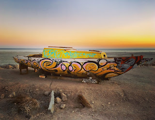
Our water temp? 57. Their water temp? 82. Our conditions tomorrow? Onshore mess. Theirs? Lightly groomed offshore winds. And don't even ask me about crowds. Know of anyone that will let me crash at their pad in the Caribbean for a few months?

Keep Surfing,

Michael W. Glenn
Popular
Cashing Out My Bitcoin And Putting It In Gamestop 
Was Developing An Organic Wax Made Of Beeswax Until My Lab Was Broken Into By Bears

Thursday, January 21, 2021

THE Surf Report- Early Edition


All the flavor and without the calories.

SURF:
Been a great winter so far- heaps of surf and no stormy conditions. You know winter has to arrive sooner or later, don't you? 


I mean, we're 4 weeks into the season and it's been sunny, warm, and a few offshore days thrown in. If the water wasn't 58, I'd say it was September around here. But I'll talk about the big changes in store for us later. Here's what's going on the near term: 


For Friday it looks to be just small waist high SW from an early season storm in the southern Hemisphere. 


That is joined by a much needed cold front late in the day for a chance of showers finally. Look for Saturday to be a bit bumpy as the front exits the region but it will bring short period NW windswell for chest high+ surf. Sunday looks to be clean with more chest high+ NW. All in all, Sunday morning looks best- if the rains from Friday night didn't pollute the ocean. Here's the tide, sun, and water temps to plan your session accordingly:
  • Sunrise and sunset:
    • 6:48 AM sunrise (paddle out by 6:30 AM!)
    • 5:13 PM (paddle in by 5:30 PM!)
  • Water temps are in the high 50's.
  • And nothing exciting in the tide department this weekend:
    • 4' at sunrise
    • 0.5' at lunch
    • 3' at sunset
FORECAST:
This weekend will literally be the calm before the storm. Charts finally show high pressure getting out of the way and storms taking aim at California next week. Which should be the case for January. 


Monday a cold front muscles it's way into Southern California and will unleash rain, wind, and potentially 12' stormsurf. Tuesday the storm should exit but expect breezy NW winds and more out of control surf. 


After that, models are having trouble nailing down the next storm but my guess is that at least Wednesday will be cleaner and manageable (but dirty water) and the next potentially larger storm arrives late next week for more rain and big stormsurf. Make sure to check out Twitter/North County Surf if anything changes between now and then. 

BEST BET: 
Tough call: Friday will be small but clean conditions and water. Sunday will have better surf but suspect water. And next week may have a bigger surf but bumpy conditions and definitely dirty water. 

WEATHER:


As mentioned above, it looks like we'll have rain finally. And not a moment too soon with a couple of brush fires here in SD the past week. Looks like we have a small cold front coming through Friday evening for around 1/4"-1/2" along the coast and 2-4" of snow in the mountains. Saturday afternoon should be cool, mostly sunny, and breezy. Sunday is a nice day before the next cold front arrives late. This one looks like a real winter storm on Monday with potentially 1" of rain, lots of NW wind, and heaps of stormsurf. After that, charts show a robust storm off the Northern CA  coast next Wednesday which could wallop us late next week for more rain, wind, and stormsurf. If you haven't already, get those gutters cleaned, bring in the patio furniture, and patch those holes in the roof! 

NEWS OF THE WEEK: 


Since you're an extreme athlete (does the media even say that anymore about surfers, skaters, snowboarders, BMXers, and MXers?), then you're probably enjoying this extreme winter. Case in point:
  • A unique situation this week had high pressure in the interior West and low pressure below us in Baja. Those two acted like gears and squeezed out:
    • 80-90 mph winds in the San Diego County Mountains yesterday
    • 1" of rain in the San Diego County Mountains too
  • The Sierras had wind gusts over 100 mph on Tuesday 
  • Multiple high temperatures were broken last Friday the 15th in San Diego county:
    • Vista at 94
    • Escondido at 91
    • San Diego at 88
  • And we received no rain for almost 2 months- from early November to late December

But enough of the heat, offshore winds, and dry conditions. We look to be headed towards a wet period for at least the next 7 days. Let's take a look at where we stand today for rainfall:
  • Newport Beach: 1.44" so far but we should be at 6.33". Only 23% of normal! 
  • Oceanside: 1.47" so far but we should be at 5.88". Only 25% of normal!
  • San Diego: 0.98" so far but we should be at 4.40". Only 22% of normal! 
Let's hope Friday's storm drops 1/2", Monday's storm 1" and the potential storm later next week at least another 1". That would add roughly 2-2.5" to our totals. At that point, most rain gauges would be at 3.5"-4"- and still only 65% of normal. Don't look a gift horse in the mouth?...

PIC OF THE WEEK:


Is this Swamis, Bells, or Ribeira? Let's do the math: Swamis in Encinitas and Bells in Victoria, Australia probably saw their first surfers in the 1930's and most likely crowds by the 50's. Ribeira, Portugal on the other hand most likely didn't see surfers until US troops settled after World War II (mid to late 1940's) and the surf industry took hold in Europe in the 80's. So that gives Swamis and Bells a few decades head start in the crowd department. My guess where this empty line up is? Riberia. (Plus, I already know the answer so that's cheating). 

Keep Surfing,

Michael W. Glenn
Adept
On The Cover Of The Tabloids Again
Just Realized I've Been Surfing The Wrong Way This Whole Time

Thursday, January 14, 2021

THE Surf Report- Early Edition


Surf 'em if you got 'em. 

SURF:


Been a crazy few weeks around here. I know I've said this before, but the beach closures in spring, inconsistent summer, and small fall seemed like a bad dream. This winter on the other hand has been legendary. Heaps of surf and Santa Ana conditions are a great way to kick off 2021. And in the near term it's going to continue. So with that being said, I took the Emergency Boardriding System in for an oil change and we're back in business for this weekend. 


Tomorrow starts off slow as we're in between swells but Saturday picks up big time again for overhead surf and 10'+ sets in SD. That lasts into Sunday morning. And the great weather continues. Here's the tide, sun, and water temps to plan your session accordingly:
  • Sunrise and sunset:
    • 6:51 AM sunrise  
    • 5:07 PM
  • Water temps are in the high 50's.
  • And tides have mellowed out:
    • 2.7' at sunrise
    • 5' mid-morning
    • 0' at sunset
FORECAST:
If you haven't broken your step up yet, then Monday's your chance. 


Charts are showing a solid storm taking shape today which will roll in on Monday for more overhead surf and 10' sets at the best spots in North County SD and double overhead in SD. Tuesday is still overhead and Wednesday is back to waist to chest high waves. 


Last weekend a small storm flared off Antarctica which will send us waist high+ SW next Thursday and chest high in the OC. 


Forecast charts also show a small storm forming in the Aleutians this weekend which would give us chest high WNW on Thursday too. Could be smaller but fun combo swell late next week. After that, the North Pacific is still active but down a notch. 


Models show yet another storm off the Aleutians forming next week and we could see more head high WNW around the 25th. Make sure to check out Twitter/North County Surf if anything changes between now and then. 

BEST BET: 
Saturday or Monday if you want to charge. Or if you're tired- tomorrow morning and Wednesday to rest your limbs.

WEATHER:


Surf has sure looked good lately groomed by the Santa Anas- but man do we need some rain around here. Even broke some records in San Diego County today with temps in the mid to high 80's. Great for August- bad for January. For this weekend it's more of the same- sunny skies, low humidities, and warm temps. We have a couple low pressure systems moving inland next week and they've given the weather models a hard time- either we've got cooler temps and offshore winds again or a chance for some light showers. Long story short- don't expect any big storms in the near future. On a side note, we've had around 1" of rain so far this rainy season- and normal is 4". And this time last winter? 7"...

NEWS OF THE WEEK: 


Nothing will replace the joy of surfing in the ocean (except maybe winning tomorrow's $750 million lottery), but wave pools are trying their darndest for your attention. As you've probably heard, there are potentially 4-6 projects in the works for Southern California; 1 in Oceanside and 3 to 5 in the greater Palm Springs area. With wave pools in the past, there weren't enough surfers with deep pockets to support a freestanding pool. Developers have now figured out that tying a wave pool to a resort may be the trick. The wave pool is the 'lost leader' to draw you in while you spend additional dollars at their restaurant, hotel room, drinks at the pool bar, onsite surf shop, etc. And with almost 25 million people living in Southern California, there's more than enough shredders to make it happen. But talk of wave pools in the US have been going on for at least 20 years. Why should we believe it's finally going to happen here in our backyard? This time there's a 'space race' between various developers to be the first to stake their claim to this new type of hospitality endeavor. If you haven't seen the website wavepoolmag.com, make sure to check them out every few weeks as they do a good job of trying to keep track of all of this. Here's what they have to say about the various So-Cal pools in the works...

  • Oceankamp in Oceanside:
    • The wave pool is in the works as construction at the site of the former swap meet and drive-in theatre (off Highway 76, about 5 miles inland from the harbor) moves ahead. OceanKamp, a development by Zephyr, is a 92-acre property billed as a “California Lifestyle Community” focused around activities like yoga, mountain biking and of course, surfing. The project will include a 300-room hotel, as well as 126,000 square feet of space for stores, restaurants and commercial space. The big mystery is the type of wave technology that will be at the center of OceanKamp. The team has committed to a wave-generating system but won’t disclose which one. Best case is to have it open next year or 2023 at the latest. 
  • The Palm Springs Surf Club in... Palm Springs of course:
    • The Palm Springs Surf Club is a rebirth for the old Wet n’ Wild park in Palm Springs. The renovations, lead by the new owners Pono Partners LLC, will focus on a state-of-the-art wave pool capable of producing waves for everyone from beginners to professional surfers. The wave pool at Palm Springs Surf Club is an operational prototype using Surf Loch technology to pump out a variety of wave shapes and sizes. Pono partners is currently using it to raise additional funding for expansion of the pool and additional renovation of the facility. That team is lead by pro Cheyne Magnussen (also the former the wave architect at BSR Surf Resort in Waco) and Kalani Robb, both of whom are part of Pono Partner LLC who bought the park in January 2019. While the final wave pool design will be the center of the Palm Springs Surf Club, the team plans to deliver more than just a wave pool. They are putting $50 million into the 21 acre property and plan to keep the lazy river and other amenities for kids. Their plans also include a restaurant and spa, and bar. Projected opening date is 2022. 
  • Coral Mountain at La Quinta (which will be way cooler than last season's Bachelorette pad):
    • Kelly Slater Wave Company (KSWC) technology announced they will be the centerpiece of this ambitious project in La Quinta. The wave pool will begin construction soon with an estimated completion date sometime in 2022. The $200 million development at Coral Mountain will combine hotel, housing and adventure sports in an area already approved for an 18-hole golf course. Big Sky Wave Developments (founded by avid surfer and son of Charles Schwab) is the financial know-how behind the wave pool and is banking on homeowners and weekenders choosing Kelly’s brand of wave over golf. Will it be open to the public? Probably not- reports are that it's slated as a private development for the wave wealthy buying into the development. FYI- homes in the development will potentially sell for between $1 million and $5 million so pony up if you want some uncrowded perfect waves. Think of it like Hollister Ranch but without gun toting guards, cold water, wind, and sharks. This site will probably host the occasional WSL event since KSWC is involved. Which totally fits into the La Quinta private home/golf course/PGA event lifestyle. 
  • Honokea in Indio
    • Hawaii-based Honokea Surf Villages & Resorts in 2017 announced they were buying land in Indio as part of a $100 million wave pool development using undisclosed artificial wave generation technology. In older reports, the project was due to open in 2019. Honokea was instrumental in getting the NLand wavepool in Austin started in the early days (which is now in purgatory unfortunately). However, the group parted ways with founder Doug Coors before NLand opened its gates. This wave pool has a long road to breaking ground and my guess? May be left behind if the others open first. 
  • DSRTSURF in Coachella (Can't wait to surf my brains out in the AM then see Rage Against The Machine, Travis Scott, and Dua Lipa in the PM!):
    • Local boy Josh Kerr and a crew of heavy hitters including Shane Beschen and the Hobgoods will open DSRTSURF at the Desert Willow Golf Resort. Latest report is that it will open in 2023 with "premium" villas and hotel rooms that surround a wave pool along golf courses, a gym, spa, pickleball and volleyball courts. The facility hosts a surf academy for lessons, camps and retreats. The wave will produce everything from gentle knee-high rollers to head-high slabs via Wavegarden Cove Technology. A big pool of water in the hot desert sounds like these projects are going to use a lot of water, right? Well, let’s take DSRT SURF for example. It’s planning to build a 5.5-acre lagoon that’ll hold about 6 million gallons. Factoring in evaporation and at least one annual draining for maintenance, developer Doug Sheres says they’re looking at using about 20 million gallons per year. Yeah, it’s a lot. "But what sounds like a tremendous amount of water, it’s roughly the amount of water a hole of golf uses,” says Sheres. “So, while providing a recreational activity that arguably will cater to as many if not more people than play golf on the average golf course in a day, we’re only using the amount of water that one hole on that golf course would use.”
  • Thermal Surf Club in Thermal (just above the Salton Sea):
    • Set within a 20-acre Crystal Lagoon, the Southern California desert's next wave pool looks to be powered by American Wave Machines' Perfect Swell technology. Right now it's in the planning stages and also looks to be similar to Kelly's Coral Mountain resort- a private luxury development. Solana Beach's own American Wave Machines Perfect Swell technology will be used to generate both lefts and rights, 30-60 yard rides, semi-hollow to hollow and performance-oriented. 120 -160 waves per hour come in three-wave sets at between 1:10-1:30 apart. Waves are waist to head-high. The website is listing 'residence club' memberships at $175,000 and 'full' memberships at $1 million. Is that all? I guess I'll take 1 each then. 
Based on the available info, I'm guessing Oceankamp in Oceanside, Palm Springs Surf Club, and DSRT SURF will realistically happen and you'll be surfing there in the next 18-24 months. Coral Mountain may happen too, but it's private like Hollister Ranch, so you can count that out unless you win that $750 Mega Millions tomorrow. And finally, nothing will replace surfing in the ocean or vacationing in Hawaii with the fam. But since our summers are overcast and crowded while our winters require a 4/3 (and battling crowds yet again), I wouldn't mind spending a few days in the desert getting guaranteed waves in trunks and enjoying a frosty beverage by the pool with me lady.

PIC OF THE WEEK:


There's been a lot of talk recently about people moving out of California. If it means less people in the line up, don't let the door hit you on the way out!

Keep Surfing,

Michael W. Glenn
Noble
Louis Vuitton Don
Starting A Pro Surfing Wrestling League With The Spartan, Crammy, Hakman, Kong, Bam Bam, and Johnny Boy

Thursday, January 7, 2021

THE Surf Report- Early Edition


Back from sabbatical. 

SURF:
Decided to take some time off last month and find myself. And I found out I was... a surfer. So let's get to it! 


As you probably realized, during the past two weeks I forgot to turn off the Emergency Boardriding System, but I don't think anyone is complaining. Lots of solid surf has left the weak waves of 2020 in our rearview mirror. 


For Friday, we have yet ANOTHER WNW swell filling in for overhead surf and 10' sets at best spots in SD. That holds into Saturday and picks up a notch on Sunday afternoon for well overhead surf here in North County and double overhead sets at good SD spots. So we have that going for us. And here's the tides, sun, and water info:
  • Sunrise and sunset:
    • 6:52 AM sunrise  
    • And the sun finally sets at 5 PM! 
    • AND... in case you're wondering, you probably won't be able to surf after work (if anyone works 9-5 anymore) until probably late February as the sun will be setting around 5:45 PM by then and 6:56 PM due to Daylight Savings Time on March 14th. 
  • And if you haven't surfed since September, you're in for a rude awakening as water temps are 58 at best. 

  • And tides this weekend will make picking your spot a bit tricky with the big surf:
    • 6' at sunrise
    • -1' after lunch
    • 2' at sunset
FORECAST:


Make sure to pace yourself this weekend as Monday is going to wallop you upside the head. As the surf continues to pick up on Sunday, it will peak on Monday with 10' sets in North County San Diego and double overhead+ sets in SD. We finally get to ride those step ups again! Tuesday starts to back off to the overhead range and Wednesday is finally manageable. 


Charts then show a more modest WNW taking shape this weekend which would give us head high to overhead surf again next weekend. We also have some small storms off Antarctica that is sending waist high surf our way (and better in the OC) but it will be steamrolled by the WNW swells. Maybe the OC will have better luck seeing these SW swells later next week. And the icing on the cake this weekend? Slight high pressure is building for weak offshore flow and sunny skies. No more of this pesky fog thank goodness. Make sure to check out Twitter/North County Surf if anything changes between now and then. 

BEST BET: 
This weekend if you like good surf. Or Monday if you like to have your heart race as you dodge a few sets. 

WEATHER:


Good to see some rain and snow between Xmas and New Year. Hope you enjoyed it because La Nina is in full effect and California is bone dry in the middle of our rainy season. But let's stay positive- the high pressure setting up this weekend will give us great weather- temps in the high 60's, light offshore winds, and plenty of sun. Throw in some solid surf and you've got Grade A conditions here in San Diego County. Shhhhh- don't tell your friends up north. Nice conditions and light offshore winds persist into most of next week with no long range models showing rain anytime soon. 

NEWS OF THE WEEK: 


As you may or may not know, I studied Meteorology in college with the goal of becoming a weather forecaster. My hero was Pat Sajak, a weather forecaster in L.A. who eventually became a highly paid game show host (which is the ultimate gig; work a couple hours a day, make people laugh, and pull in $15 million a year. And no, that's not a typo). I also studied Geology because ocean swells are useless unless they have something to break on. 

On that note, one thing that always intrigued me was the geology of California. In particular 3 areas: 
  • The San Francisco Bay and how it flooded the San Joaquin Valley about 66 million years ago during the early Paleocene era. Broad fluctuations in the sea level caused various areas of the valley to be flooded with ocean water for the next 60 million years. About 5 million years ago, the marine outlets began to close due to uplift of the coastal ranges and the deposition of sediment in the valley.
  • How the highest point in the continental United States- Mt. Whitney at 14,505'- affected the weather below it at arguably the hottest place on earth- Death Valley. The answer is the rain shadow effect: When clouds hit a high geographic feature- like a mountain- the rain gets squeezed out the and the land on the opposite side- bone dry. In this case- Death Valley. 
  • And the last question I had; did the waters of the Gulf of California ever creep up towards the Coachella Valley- right behind us here in Southern California? The answer....
A team led by University of Oregon geologist Rebecca Dorsey has published two papers that provide new insights into the origins of the Colorado River, using data from ancient sedimentary deposits located east of the San Andreas fault near the Salton Sea in Southern California. The papers, led by former master's student Brennan O'Connell and doctoral candidate Kevin Gardner, respectively, present evidence that the now desert landscape of the river's lower valley was submerged roughly 5 million to 6 million years ago under shallow seas with strong, fluctuating tidal currents that flowed back and forth along the trajectory of the present-day river.

Layers of sedimentary rocks bearing marine fossils, burrows and diagnostic sedimentary structures, the researchers concluded, record a dramatic rise in sea level that drowned former alluvial fans and caused tidal waters to invade the valley prior to arrival of the Colorado River and its voluminous load of water and sediment. The studies, both funded by the National Science Foundation, were published online ahead of print in the international journal Sedimentology.


The first paper focused on sediments of the late Miocene to early Pliocene Bouse Formation exposed east of the Colorado River, south of Blythe, California. Previously, O'Connell and a team of UO geologists had found evidence that the Gulf of California once reached as far north as Blythe, as detailed in the journal Geology in 2017.

In the new paper, O'Connell and co-authors describe a rich mixture of carbonate mudstones, plant debris and traces of ancient organisms that record brackish water conditions where seawater was diluted by a large influx of fresh water due to high annual rainfall, before waters of the Colorado River flowed into the area. The sediments, they found, formed in wide tidal flats along an ancient, humid-climate marine shoreline. An abrupt transition to low-energy subtidal lime mudstone records widespread marine flooding associated with a long-lived regional rise in sea level, they concluded. Relative sea level rise, they added, resulted from long-term tectonically controlled subsidence. The combined evidence from paleontology, ichnology and process sedimentology "provides a clear record of freshwater input and brackish water conditions due to mixing of freshwater and seawater in a humid climate with high annual precipitation," O'Connell's team wrote.

The second paper, published Dec. 5 and led by Gardner, documents tidal sediments of the same age on the opposite side of the same ancient tidal strait. The sediments accumulated where strong daily reversing currents swept north and south along the axis of the tidal strait, driving migration of large subtidal dunes and depositing large scale cross-bedded carbonate sands.


The authors argue that the migrating dune bedforms could not have formed by tidal like processes in a lake, as some scientists have proposed. The team's results indicate that, after late Miocene to early Pliocene deposition, the sediments were uplifted to elevations up to 330 meters above sea level in the Chocolate Mountains, as a result of long-term crustal strain related to motion on the San Andreas fault. "Taken together, our new papers provide conclusive evidence that the southern Bouse Formation formed in and around the margins of a marine tidal strait that filled the lower Colorado River valley prior to arrival of the modern river system," said Dorsey, a professor in the UO's Department of Earth Sciences.

A map of the southern Bouse tidal seaway, reconstructed with data from both studies, shows that desert communities from Blythe to Palo Verde, California, were submerged under shallow seas with strong fluctuating tidal currents during late Miocene to early Pliocene time.

The Miocene, a geological epoch, lasted from 23 million years ago to 5.3 million years ago; the Pliocene occurred between 5.3 million and 2.6 million years ago. In 2018, another Dorsey-led paper in the journal Sedimentary Geology found that lower stretches of the Colorado River were influenced by tectonic shifts in underlying bedrock and changing sea levels. The river, that study concluded, experienced a series of stops and starts in sediment output during early stages of the river between roughly 6.3 and 4.8 million years ago.

PIC OF THE WEEK:


A good 6/5/4, hood, booties, gloves, and a fire on the beach, I'm there!

Keep Surfing,

Michael W. Glenn
Superior
Can't Wait For 2022!
Getting A 2nd Opinion About Turning Pro