Thursday, May 30, 2019

THE Surf Report- Early Edition


Welcome home June Gloom! 

SURF:
Spring has finally arrived- 3 weeks before summer. But who's complaining?! The cold fronts with their wind and showers seem to have left the building and we had fun S swell this week and clean conditions. 


Look for the S to hold in the shoulder high range tomorrow, back off on Saturday to the chest high range before a new SW starts to slowly creep up on Sunday for chest high sets late in the day. All in all rideable surf this weekend and semi clean conditions. And here's some extra stuff you may be interested in:


Water temps have warmed back up to 63 in SD (and 60 in the OC and 65 at Scripps Pier).

Tides this weekend are:
  • 2' at sunrise
  • 4' at 9 AM
  • 1.5' at 2 PM
  • 6' at sunset
Daylight hours this weekend are:
  • 5:42 AM sunrise  
  • 7:50 PM sunset  

FORECAST:
As mentioned above, a new mid-sized SW swell arrives late Sunday and builds into Monday for chest high surf. That peaks Tuesday morning for shoulder high surf. Wednesday still looks fun and the 2nd half of next week looks to have waist high NW windswell and small SW. 


Further out, forecast charts show a fun S taking shape around the 9th with more shoulder high surf. Good to see waves again- without the wind! Make sure to keep track of the waves and weather at Twitter/North County Surf. 

WEATHER:


Looks like winter is finally gone (jinx!). At least the showers are gone in the near future and we're officially into June Gloom. We've got weak low pressure hanging around Friday/Saturday for low clouds at the beach and sun inland. Temps will be near 70 at the coast with a little more sun towards Sunday. Next week we're right on track for the last few weeks of spring- low clouds/fog in the nights/mornings and sunny skies in the afternoons.

BEST BET:
Friday with fun SW swell or next Tuesday with more SW swell.

NEWS OF THE WEEK:


Been a wild winter. Spring has been almost non-existent as storms from the north kept dropping 1/4" to 1/2" of rain the past month. And the mountains in California- from Tahoe to Julian- continued to see snow. On Memorial Day. The 'unofficial' start to summer. Just how much snow occurred this past winter? The LA Times this week dove deep into the powder (sorry- bad pun). I'll let them explain:

California’s strange spring weather continues to stun the state, now setting a record for the snowiest May at Mammoth Mountain. The resort got a record 29 inches of snow this month, giving those in Southern California a chance to ditch the sandy beach for the powdery mountain this Memorial Day weekend. 

The snowfall has already topped May 2015’s record of 28 inches, further adding to the enormous dump of powder that Mammoth has received. A total of 489 inches have accumulated at the main lodge, and 715 inches have been recorded at the summit (that's almost 60' of snow. Wow). The ski resort’s current base depth is between 90 and 155 inches. In February, residents had to tunnel out from their homes after a record-breaking 24 feet of snow fell during the month.


If that's not odd enough, new research recently linked a series of earthquakes near California’s Long Valley Caldera in the Mammoth Mountain area to heavy snowmelt during a wet winter. Researchers planned to watch for seismic activity as it pertains to snowmelt, which typically begins in late May to early June. The expectation is that there will be a large number of seismic swarms, as there have been in the past, but there’s no guarantee.

Emily Montgomery-Brown, a researcher at the U.S. Geological Survey who published the findings, said there’s been an increase in runoff near Mammoth, but snow is still falling. “We’ll have to keep watching and see when the temperatures really start to warm up,” she said.

Overall, it’s been an exceptionally wet and snowy May in California. The placement of the jet stream — a high-altitude river of air running from the Pacific across the United States — is largely responsible. The jet stream has hit California with a series of storms out of the South Pacific. Mammoth Mountain Ski Area originally pushed its closing date to July 7, but on Friday the resort said it will now be open into August. That’s happened only twice before, making snow a new symbol of a California summer.

Incredible to think you could surf Huntington in trunks at the end of July then run up to Mammoth the next day and get a couple runs in. Awesome.

PIC OF THE WEEK:


With all the bickering between Democrats and Republicans lately, I thought this beautiful picture may bring some peace. May be Photoshopped though so it could be fake. Never mind. For more spots to put on your bucket list, check out Gareth Kolega's work on Instagram.

Keep Surfing,

Michael W. Glenn
Eminent
Kids Always Wanted A Pet So I Trapped A Sasquatch
Did A 360 Air On My SUP By Using My Paddle As A Propeller

Friday, May 24, 2019

THE Surf Report


What's that warm glowing yellow orb in the sky?

SURF:
Been a lot of windy/cloudy conditions lately. Winter won't go away and May Gray is nowhere to be seen. Fortunately for us, there's a break in the action today and we have sunny skies and clean conditions. Get on it! 


We also have new SSW swell in the water along with leftover NW windswell for fun shoulder high surf. For Saturday, nice conditions prevail again, the SSW hangs around, and the NW backs off. Still some fun chest high surf with bigger waves in the OC. For Sunday, this unbelievable pattern of on again/off again cold fronts continues with more clouds, a chance of showers - and yes- wind. The NW windswell will pick up again and make a mess of whatever SSW swell we have left in the water. Long story short, start your Memorial Day Weekend early and get in the water today.  


Tides this weekend are:
  • 2' at sunrise
  • 0.5' mid-morning
  • 3.5' at dinner
Daylight hours this weekend are:
  • 5:45 AM sunrise  
  • 7:50 PM sunset  
(And for those of you surfing in Vancouver, British Columbia, it's 5:18 AM and 9:01 PM. Holy cow.


And water temps have dipped to 60 degrees from all the NW winds- and 57 degrees in northern OC/LA county (which is the same as San Fran). Awesome! By the way, we won't hit our peak water temps until early to mid-August so don't expect to wear trunks anytime soon.

FORECAST:
After the cold front moves through on Sunday, we have a transition day on Monday with a little bit of wind and more sun. 


We start to see new SW swell arrive later on Monday and peak early Tuesday for more shoulder to head high swell. That holds on Wednesday and drops slightly late in the week. 


On it's heels is more similar sized SW arriving at the end of the month into the 1st of June. After that, things take a breather and the N & S Pacific look pretty small. Just in time for June Gloom! Make sure to keep track of the waves and weather Twitter/North County Surf.

WEATHER:


Winter just won't go away (if you haven't noticed I've been saying that the past 3 weeks). Late season (very late season) cold fronts/low pressure systems have been sweeping through our area and have given us breezy, cloudy, showery conditions. That should have ended back in March and at this point in time, true May Gray should be in control (low clouds/fog hugging our coast all day). Luckily for us, we'll have nice weather today and Saturday before ANOTHER weak front moves through on Sunday to kick up our winds again, make a mess of our surf, and drop unexpected showers on our Memorial Day plans. Early in the week we should clear up with cool sunny conditions before ANOTHER weak front shows up on our forecast models for late next week (no showers thankfully, just clouds). At this point in time, I'm guessing we'll continue to have showers on and off through July 4th (I said that last week too).

BEST BET:
Today with combo swell and nice conditions. Or more SW late Monday into Tuesday (with nice conditions on Tuesday).

NEWS OF THE WEEK:


1 more week until the North County Board Meeting's 5th annual golf tournament benefiting the Challenged Athletes Foundation happens on Friday, May 31st! If you haven't signed up yet, hurry as just a few spots are left and we're destined to sell out again. Cost is $90 and lunch from Frazier Farms is included. On that note, wanted to say thanks to Ian McDaniel at Venture, LLP for being the title sponsor this year again and to Goat Hill Park for hosting. And it couldn't happen without our great community of north county San Diego and everyone who donated their time and products. In particular, a big thanks to:
  • Hole sponsors:
    • Agency73
    • Surfhouse
    • C3Bank
    • Lohman & Dehner
    • Volte Wetsuits
    • Wave Soda
    • Ian McDaniel, Venture LLP
    • Challenged Athletes Foundation
    • EPK Collection
    • 19Ten & Elm Street Boardshop
    • VUGA
    • payrollHUB
    • TK Pacific Wealth, Inc.
    • Plan Design Consultants, Inc
    • Suga
    • JR Phillips Group, Inc.
    • Steve Rude at First Choice Loan Services
  • Raffle Prize sponsors:
    • Honma Golf
    • Straye
    • EPK Collection
    • Vuori
    • Gnarlywood
    • Nike
    • VUGA
    • New Wave
    • Vans
    • Volte Wetsuits
    • Vessel/BLVR
    • Priority Public House
    • Go Pro
    • Leus
    • Famous
    • Skrewball
    • Z Customization
    • Evnroll Putters
    • Falkner Winery
    • Mike Hess Brewing
    • Strickly Boarding Company
    • Fichter Silva
    • Adidas
    • Fuzion Payments
    • Bank of California
  • Swag bag sponsor Reverie Hawkins including:
    • D-Fi Packs
    • North County Board Meeting
    • EPK Collection
    • Brixton
    • S&A Publishing
    • Famous
If you'd like to join us or have any questions about the group, make sure to give me a shout at northcountyboardmeeting@gmail.com. Thanks again and I'll see you next week at Goat Hill Park supporting the Challenged Athletes Foundation! 

PIC OF THE WEEK:


Dare you $10 to duck dive that thing. 

Keep Surfing,

Michael W. Glenn
Your Excellency
Been Known To Paint The Town Red
Last Known Winner of the Duke Kahanamoku Invitational Surfing Championship

Friday, May 17, 2019

THE Surf Report


I'm activating the Emergency Boardriding System again. BUT...

SURF:


So good to have real waves again. Lots of SSW swell this past week and semi-clean conditions led to overhead (and well overhead) surf at S facing beaches. As has been typical lately, winds were off and on from passing cold fronts. For the upcoming weekend, it's more of the same story- we'll have leftover background SW that will be met with a couple of cold fronts producing short interval NW swell. 


For today, winds are already blowing from the NW and the fading SW is blown to bits. Saturday morning things clean up to the shoulder high range from the combination of swells. On Sunday morning it's back to chest high sets from the combo swells but we have yet another cold front moving through for more wind and in increase in NW windswell. All in all a windy bookend to the weekend.    


Tides are all over this weekend:
  • 1' at sunrise
  • 4.5' mid-morning
  • 1' mid-afternoon
  • 6' at sunset
Daylight hours this weekend are:
  • 5:50 AM sunrise  
  • 7:40 PM sunset  
  • You pretty much can paddle out at 5:30 AM now and get out of the water around 8 PM. I like that. 
And water temps have dipped to 62 from the NW winds yesterday. Thanks a lot. 

FORECAST:
Lots of SW swells on the horizon, hence the activation of the Emergency Boardriding System again. 


First up is more NW wind/groundswell on Monday that will be met by head high SSW for overhead sets due to the combo swells. That holds into Wednesday before another weak cold front messes things up. 


The NW windswell will pick up more on Wednesday from the cold front but it will be a mess of course. 


Then next weekend we get more shoulder high sets from the SW. 


And if the forecast charts hold true, we've got an overhead SW arriving towards the 28th. Could be fun IF... the cold fronts stop rolling through. Make sure to keep track of the waves and weather at Twitter/North County Surf.
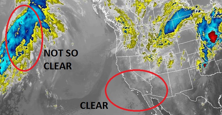
WEATHER:


Winter just won't go away (I said that last week too). We had a weak low pressure system off our coast yesterdy that kicked up our low clouds and squeezed out some showers. That moved through last night and today we're left with breezy NW winds. On Saturday things clear up and we've got sunny cool conditions. Then... another weak front comes through Sunday for more showers and breezy conditions. Monday/Tuesday look mild and calm then... another weak low pressure system arrives on Wednesday for more... showers and breezy conditions. At this point in time, I'm guessing we'll continue to have showers on and off through July 4th. 

BEST BET:
Tuesday with fun head high combo swell and clean conditions. Or next weekend with new shoulder high SW swell (and clean conditions)? Or the 28th with solid SW again (and clean conditions)?

NEWS OF THE WEEK:


As has been reported over the past 20 years or so, one of the downfalls of a warming earth is that storms are becoming more powerful and destructive. Which of course is a bad thing. Unless you're a surfer? Seems as though us amphibians are between a rock and a hard place- As we're amazed at the 80'+ surf at Nazare, Jaws, Cortes Bank, and other big wave breaks, the storms that make these waves pack a wallop when they hit land of course- and upwards of a billion dollars in damage. The Washington Post did a lengthy article recently about the pros and cons of ever increasing surf and wonder kid Kai Lenny's catch 22 dilemma. Here's what they had to say:

A handful of days every year, Jaws bares its teeth. It thunders toward the shoreline, growing to the size of a downtown building. Its power, energy and sheer size have made it one of the most famous big-wave surf breaks in the world, annually luring daredevils, risk-takers and thrill-seekers alike to Maui to tempt fate and tangle with a giant. Kai Lenny lives less than nine miles down the road on the island’s northern shore and spends much of the year just waiting for Jaws to stir to life. He’s part of a small tribe of surfers who eagerly chase the biggest waves on the planet. They monitor weather forecasts and buoys on both sides of the equator, tracking it all closely enough to understand that the ocean is changing around them. Climate change has warmed the ocean and is transforming wave conditions. The coming years and decades could provide big-wave surfers with some of the biggest rides of their lives.

“I feel like our eyes are starting to open up to all these new frontiers of what we can do,” Lenny says. Much of the research is ongoing, but here’s what most scientists agree on: Sea levels are rising, and surf breaks in some areas will change. Storms are projected to get bigger and more frequent, which can create waves that are more powerful and, in many places, bigger. The surfers are on the front lines of these changes, their lives intimately tied to the ocean, humbled by its power and in sync with its rhythms. Surfers such as Lenny live every day in a series of postcards — pristine beaches, sparkling oceans, towering palm trees, majestic rainbows — but can see ominous clouds on the horizon. They don’t pretend to know exactly how the future will unfold in the water, but they’re experiencing the shifts in real time and are plenty conflicted about what lies ahead.

Lenny finds the prospects both exciting and terrifying. The 26-year-old Maui native can tick off the dangers climate change poses to the ocean he loves: “Bleaching of reefs; the damage of the shoreline from stronger storms; the changing of wind patterns so that a particular wave might not be as good anymore; the shifting of currents, which could destroy a particular break along a coastline. … What was once paradise could just be a pool of polluted water.” Then he pauses. “But I got to tell you, if there’s a silver lining, as a big-wave surfer, bigger storms create bigger waves,” he says, “meaning I’ll have the opportunity to ride the biggest waves of my life.”

Lenny was all of 13 years old when he rode Jaws for the first time. Laird Hamilton, the big-wave surfing pioneer, towed him from a Jet Ski onto his first set of giants, and he has been chasing bigger and bigger waves ever since. In November, Lenny was entered in a big-wave contest at Peʻahi, home of the famous Jaws surf break, but the day’s competition was postponed because the waves were too big and too strong. Conditions were dangerous — like tossing a feather into a washing machine — but Lenny went out anyway. With all eyes — and cameras — focused on him, he tamed the menacing monsters, carving his way through walls of water, dropping at one point 20 feet on a wave that appeared to be eight stories high. From afar, he was a mouse tangling with a giant elephant. But up close, he treated the wave as his dance partner, churning through the water with ease, his movements as fluid as the ocean. The ensuing video clips went viral, further cementing Lenny’s standing as one of the sport’s premier daredevil artists. Just a few months later, his only lament is that the waves weren’t even bigger. “It’s not the biggest that I’ll do in my life,” he says of Jaws’s enormity. “I’ll probably do a way bigger one.”


One of the sport’s brightest young stars, Lenny is both laid-back and ambitious, a product of surf culture but also a business-minded entrepreneur — a full-on corporation with sponsors, revenue streams and a dedicated media arm. It’s as if he was born for this sport at this time. His name, Kai, after all, means “ocean” in Hawaiian. And his middle name is Waterman. “People don’t believe that’s his real name,” says his mother, Paula, “but it really is.” He was all of seven days old when his parents put him in the ocean for the first time, a baptism of sorts at Maui’s Lahaina Baby Beach. “Just a very normal thing to do in Hawaii,” explains his father, Martin.

Hawaii has long been a mecca for surfing. Because the islands are isolated in the Pacific Ocean, swells can travel for thousands of miles uninterrupted and descend on them from all sides, offering rideable waves year-round. But for those who grow up here, the water provides more than weekend recreation. “It’s a way for us to reconnect with nature, it’s a way for us to stay healthy, and it’s also a great equalizer,” said Sen. Brian Schatz (D-Hawaii), a recreational surfer himself. “Nobody knows if you’re a doctor or a lawyer or unemployed or a student or even a U.S. senator in the water. There’s something really important about how the ocean humbles everybody.”

Since he got his feet wet as a week-old infant, it’s all Lenny has ever known. He caught his first wave at 4 years old. Surfed in Fiji at 8. Secured his first windsurfing sponsor at 9. Latched on with Red Bull at 13. His popularity now can be traced to the broad range of his skill set. He’s among the top big-wave riders in the world but also an elite wind surfer, kite surfer and foil-board rider. He wants to be at the forefront of anything that involves strong winds and big waves. When he’s in town, Lenny lives with his parents in Pāʻia, along the island’s northern shore. He has a garage there that stores about 80 surfboards, lined up against the walls like library books. He is constantly tweaking the designs and shapes, each wrinkle aimed at optimizing aerodynamics and moving his board one step closer to a high-performance Formula One car.

A wave that crashes on Maui’s northern shore typically originates more than 2,000 miles away in the north Pacific, near the Aleutian Islands. Storms there swirl, and the wind energy is transferred to the ocean surface. A swell ripples across the ocean, often traveling at 30 mph or more and arriving three to five days later at the Hawaiian Islands, where surfers bob in the water waiting for the perfect ride. As it nears the shore, the swell experiences friction along the sea floor, which John Marra, the Honolulu-based regional climate services director for the National Oceanic and Atmospheric Administration, likens to tripping. “They’re hitting the reef or a knob of rocks and just turning over,” he said. Scientists have been studying each of these delicate, interconnected parts to understand the impact climate change will have on waves. The warming ocean affects wind patterns. The wind drives swells. The reef trips the swell and creates the waves that make surfers pop up onto their boards.

The historical data is somewhat limited, and because the ocean is vast, complex and varying, there isn’t a consensus on the changes that are afoot. Nothing will be universal across the globe, and while some areas might see smaller waves, others — particularly those at high latitudes — could see more pronounced effects. A study published this year from University of California Santa Cruz researchers spelled it out simply, saying the warming ocean is “changing the global wave climate, making waves stronger.” The study noted that wave power — the transfer of energy from wind to sea — increased by an average of 0.47 percent per year from 1948 to 2008 and has risen by 2.3 percent annually since 1994. The researchers further estimated that global wave power could increase anywhere from 32 to 122 percent this century, which could produce wave heights that grow 16 to 48 percent. A 2014 study by Canadian scientists projected increases in wave heights for about 50 percent of the Earth’s oceans and found that the one-in-10-year extreme wave heights could double or triple in frequency this century.


“From a big-wave surfer’s perspective, we are entering sort of a golden age,” explained Mark Sponsler, the respected surf forecaster who founded the site stormsurf.com, “in the fact that the warmer the oceans are, the more evaporation there is. The more evaporation there is, the more energy gets sent into the atmosphere. The more energy in the atmosphere — specifically, in the jet stream — the stronger storms are, and storms are what govern the whole big-wave thing.” Australian researchers published a study last month that examined satellite and buoy data from 1985 through 2018 and found increases in wind speed and, to a lesser degree, wave heights across the globe. The changes were more pronounced in the Southern Hemisphere. In the Antarctic Ocean, for example, they found that extreme winds have increased by 8 percent over the past three decades and extreme waves by 5 percent — about a foot — though the study did not attempt to explore a causal relationship with climate change. "Climate modeling does point to some long-term changes in wave conditions, particularly in the [Antarctic] Ocean. However, more work is still required to be certain the changes we observe are caused by climate change,” said Ian Young, a researcher at the University of Melbourne who led the study.

At the same time, oceanographers warn that dying reefs will have an impact on how waves break, and rising sea levels could mean other swells roll right over reliable breaking points without ever “tripping,” leaving the swells flat and surfers without waves. Erosion also could spoil beaches, and shifting wind conditions not only could alter the way water moves toward shores but also could change sediment transport patterns, which could relocate or eliminate sandbars that trip waves. “The ocean feels a little sick right now” is how Hamilton, the surf legend, explains it. “We know there’s change. We know it’s affecting us,” he says. “We know it’ll create bigger surf than we’ve ever had, but it could also create longer periods of no surf, make waves come from weird directions that don’t hit reefs the same way. Overall, I don’t think it’s great — not great for mankind and not great for surfers either.”

By virtue of their chosen pursuit, the world’s best wave chasers are some of the most studied weather watchers. They use a variety of websites and smartphone apps that rely on algorithms, satellite readings and projection models. They’re peering into the future, studying the middle of the ocean to determine what waves will look like three or four days later when they reach the shore. Because they’re all reliant on the wind and the water, surfers notice the most subtle of changes. They know that El Nino years create better surf, that some popular breaks can feel dormant at times and other surf spots are just now coming to life.

The Portuguese city Nazare was just a fishing village a decade ago, but now big-wave surfers flock there in droves to ride the giants rising out of the Atlantic. Last year, Maya Gabeira rode a 68-foot wave there, the largest ever for a female surfer, and fellow Brazilian Rodrigo Koxa set the men’s record, surfing an 80-footer. That record stood for all of seven months before Tom Butler caught a wave at Nazare, estimated at 100 or so feet. It’s not yet verified by the sport’s powers that be, but every year, surfers are challenging the sport’s boundaries. When a storm’s brewing, most people go to great lengths to remain far from danger. The adrenaline-fueled big-wave enthusiasts race toward it. Big storms always have been both celebrated and feared. “There’s going to be parts of the world where people are getting absolutely destroyed — homes lost, people dying,” Lenny says, “and then on the other side, that same storm that just destroyed all of Japan is sending us perfect, big waves. And I love riding big waves.” The best big-wave riders are spontaneous and drop everything when conditions line up. Lenny recalls surfing on Maui’s southern shore in knee-high waves last May. The swell heading toward Fiji kept improving, and within three hours he had packed his bag, loaded up his boards and gotten on an airplane. He missed a connection in Los Angeles, but by the time he landed in Fiji the next day, 40-footers were still rolling in.


For decades, these fearless surfers chased water near the shoreline or were perhaps towed out a bit via Jet Ski. Lenny’s dream looks different. He wants to ride a wave in from the open ocean, getting dropped from a helicopter onto the edge of a storm. “There’s an undiscovered world out there in the middle of the ocean,” he says.

Lenny wants to meet a swell at its infancy, where wind first meets water, and ride it for hundreds of miles back to shore. He likely would use a foil board — a surfboard with a hydrofoil extending from the bottom. The hydrofoil acts similarly to an airplane wing, and the power from the swell creates movement and lift. The surfboard appears to float two or so feet above the water, and as long as the swell moves forward, the surfer flies along, using the wave as a mode of transportation across the sea. “Who knows, maybe you could ride in the eye of the storm,” Lenny says.

The future will be big and burly, and so Lenny spends every day on the water preparing. He often will go out three times a day, alternating between surf board, kite board, foil board, windsurf board and any other watercraft he can get his hands on. In April alone, he surfed in Australia, Hawaii and France, always looking for the taller wave and bigger thrill. Part of what makes Lenny extraordinary is that he aims to ride the giants like the much smaller waves that roll onto the beach not far from his front yard. “The goal of big waves traditionally was a very masculine thing. It was like David and Goliath — like man vs. nature,” he says. “It was to take off on a giant wave, ride it and make it and come in and be celebrated as a warrior. Now with modern advancements and technology, it’s more about performance vs. survival.”

One recent afternoon, Lenny slips between the railing at Ho’okipa Beach and past the sign that reads, “Warning, Strong Current,” walking down the steep rocks with his surfboard under one arm, coolly navigating his way toward Maui’s northern shore. “Hey, Kai-guy, did you see the sea turtles down there?” asks Doug Silva, his affable coach, trailing a few feet behind. Lenny waves a hand and keeps moving toward the water. “I see them every day,” he says.

The break is called Pavilions, and while the waves are only shoulder high, a solid training session awaits. And beyond that a business meeting, an afternoon back on the water, a trip abroad a few days later, then the World Surf League’s Big Wave Awards in California, where he would win the year’s Biggest Wave Award and be honored for the best men’s overall performance, and then another big-wave season starting in the fall. He briefly scans the horizon, getting ready to leap into the water and paddle out. “Dude, looks good out there,” he says.

PIC OF THE WEEK:


Voted 'Worst Wave Ever' by... pretty much everyone. Congrats! For more shots of Puerto you wish you never saw, check out Edwin Morales' work here. 

Keep Surfing,

Michael W. Glenn
Aristocrat
I Pity The Fool
I Hit The Lip So Hard I Need ChapStick After My Sessions

Thursday, May 9, 2019

THE Surf Report- Early Edition


I'm activating the Emergency Boardriding System. 

SURF:
Now before I get ahead of myself, let's have a look at the week that was. 


Had some fun small surf last weekend with clean conditions. That was replaced on Tuesday by bigger SW and... wind from a weak cold front. Today we had another weak low pressure system above us with small surf. 


That will last into tomorrow before new fun SW starts to arrive Saturday morning. Look for chest high sets late in the day and shoulder high sets late on Mother's Day. The only fly in the ointment (again) is a weak low pressure system moving through this weekend. The wind will be spotty so pick and choose your sessions wisely!   


Tides this weekend are:
  • 3' at sunrise
  • -0.5' mid-morning
  • 3.5' late afternoon
Daylight hours this weekend are:
  • 5:55 AM sunrise  
  • 7:35 PM sunset  
And water temps are holding at 63. 

FORECAST:
So here's where the Emergency Boardriding System comes in. The SW over the weekend fills in more on Monday for consistent shoulder high sets. 


On Tuesday we have the odd head high set around here (and bigger in the OC) from a reinforcing SW. That holds into Wednesday. We also have a fun late season NW arriving on Thursday and along with the fading SW, we should have more shoulder high+ surf. The weather is also supposed to cooperate with nice conditions. Should be lots of fun next week. 


After that, the surf takes a breather next weekend and then more chest-shoulder high surf is on the charts around the 21st from the SW. Make sure to keep track of the waves and weather at Twitter/North County Surf.

WEATHER:


Winter just won't go away. We've got a weak low pressure system off our coast that's kicking up our low clouds and squeezing out some showers. That moves through on Saturday and we may see 1/4" of rain at the coast and up to 1/2" inland. The benefit to all of this late season shower activity of course is that it delays our fire weather. Sunday we've got left over clouds and we should see some consistent sunshine by Tuesday/Wednesday. Models though show another weak trough coming through late next week- but that's a long ways off. Until then, enjoy the sun mid-week and worry about the future later! 

BEST BET:
Tuesday with good SW swell and nice weather. Or Thursday with combo swell and nice weather again. 

NEWS OF THE WEEK:


Years ago cities wised up and banned plastic bags at retailers. They were piling up in our landfills, blowing like tumbleweeds on the side of the road, and looking like a poor man’s jellyfish in our oceans. Biodegradable plastic bags aren’t any better as they still are mostly intact after being exposed in the natural environment for three years, a new study shows. Here’s what researchers from the University of Plymouth had to say:

Researchers from the University of Plymouth examined the degradation of five plastic bag materials widely available from high street retailers in the UK. They were then left exposed to air, soil and sea, environments which they could potentially encounter if discarded as litter.

The bags were monitored at regular intervals, and deterioration was considered in terms of visible loss in surface area and disintegration as well as assessments of more subtle changes in tensile strength, surface texture and chemical structure. After nine months in the open air, all the materials had completely disintegrated into fragments. However, the biodegradable, oxo-biodegradable and conventional plastic formulations remained functional as carrier bags after being in the soil or the marine environment for over three years.

The compostable bag completely disappeared from the experimental test rig in the marine environment within three months but, while showing some signs of deterioration, was still present in soil after 27 months. Writing in Environmental Science and Technology, researchers from the University's International Marine Litter Research Unit say the study poses a number of questions.

The most pertinent is whether biodegradable formulations can be relied upon to offer a sufficiently advanced rate of degradation to offer any realistic solution to the problem of plastic litter. Research Fellow Imogen Napper, who led the study as part of her PhD, said: "After three years, I was really amazed that any of the bags could still hold a load of shopping. For a biodegradable bag to be able to do that was the most surprising. When you see something labelled in that way, I think you automatically assume it will degrade more quickly than conventional bags. But, after three years at least, our research shows that might not be the case."

In the research, scientists quote a European Commission report in 2013 which suggested about 100 billion plastic bags were being issued every year, although various Governments (including the UK) have since introduced levies designed to address this. Many of these items are known to have entered the marine environment, with previous studies by the University having explored their impact on coastal sediments and shown they can be broken down into microplastics by marine creatures.

Professor Richard Thompson OBE, Head of the International Marine Litter Research Unit, was involved in those studies and added: "This research raises a number of questions about what the public might expect when they see something labelled as biodegradable. We demonstrate here that the materials tested did not present any consistent, reliable and relevant advantage in the context of marine litter. It concerns me that these novel materials also present challenges in recycling. Our study emphasizes the need for standards relating to degradable materials, clearly outlining the appropriate disposal pathway and rates of degradation that can be expected."

Long story short, if you’re not using recyclable bags when you go to the store, there’s no better time to start than NOW. 

PIC OF THE WEEK:


Nazaré, Portugal is home to some of the largest waves on earth. The name Nazaré itself has a religious background as it is named after the city Nazareth, Israel. I'm sure it's just coincidence that anyone who surfs this spot also prays intently before paddling out...

Keep Surfing,

Michael W. Glenn
Hip
I Love It When A Plan Comes Together
Starred In The Lesser Known 'Four Summer Stories'

Thursday, May 2, 2019

THE Surf Report- Early Edition


I notice a pattern here. 

SURF:


Actually had some fun surf from the SW this week IF... you were able to dodge the wind. Good news is that's typical springtime around here- cold fronts are dying as we move towards summer so we're left with a bit of wind, a chance of showers, and building SW swells. So as the storms finally dissipate this season, the SW swells will finally build. For this weekend though we just have leftovers from the SW with a touch of small NW windswell for waist high surf and the odd inconsistent chest high set at best spots. Weather should cooperate too with just the normal sea breeze and high clouds. All in a all a mellow weekend (I notice a pattern here). 


Tides this weekend are:
  • 1' at sunrise
  • 4' mid-morning
  • 1' late afternoon
  • 4' at sunset
  • (I notice a pattern here).
Daylight hours this weekend are:
  • 6:00 AM sunrise  
  • 7:30 PM sunset 
  • 13.5 hours of surfing time (if you drank a Red Bull every hour) 
And water temps are hovering around 63. Nice to duck dive without an ice cream headache. 

FORECAST:


After a quiet weekend, we finally see new SSW arrive late Monday for chest high+ surf. That peaks on Tuesday with shoulder high waves at best spots in far North County SD and the OC. There is a fly in the ointment though as another weak cold front may move through on Monday which may give us bumpy conditions like we've had (I notice a pattern here). Wednesday/Thursday start to drop to the waist/chest high range, then we finally get a real SW swell to kick off the spring late next Friday. 


By Saturday we should have head high+ surf that holds into Sunday. The perfect present for your mom on Mother's Day! 


The OC will see well overhead sets and we'll get a slight break Monday before a new similar sized SW arrives the afternoon of Tuesday the 14th. It will be good to see real surf again! Make sure to keep track of the waves and weather at Twitter/North County Surf. 

WEATHER:


Nice mild weather this weekend will be replaced by more clouds and a chance of showers late Sunday into Monday. The rest of the week looks a little tricky to forecast as weak low pressure may hang around with small cold fronts moving through the area. Expect a chance of drizzle or even showers off and on most of next week (I notice a pattern here). 

BEST BET:
Could be fun on Tuesday IF... we don't have wind. Looks like better/bigger SW next weekend and beyond though- with better weather? Pattern broken?!
NEWS OF THE WEEK:


Hurricane season is right around the corner. Which is good and bad for various reasons of course. The Eastern Pacific hurricane season ‘officially’ starts May 15th and the Atlantic hurricane season June 1st. Both run through November 30 but there is nothing perfect about these dates as tropical cyclones can appear almost anytime. Case in point- Tropical Storm Adrian in the Eastern Pacific which formed May 9th, 2017, almost a week before the ‘official’ start date. And a tropical depression formed in the Eastern Pacific on New Year’s Eve in 2015- a good way to start off your surf year. 


There have been 24 recorded tropical and subtropical cyclones in the Eastern Pacific basin outside the official Pacific hurricane season. Few off-season tropical cyclones in the east Pacific have affected land, and none of them have made landfall. Only Hurricane Nina (November 29th, 1957) caused both property damage and fatalities. The strongest hurricane between December and May was Hurricane Ekeka in 1992, which reached winds of 115 mph. However, after Tropical Storm Paka (December 2nd, 1997) crossed the International Date Line, it intensified into a typhoon with winds equivalent to a Category 5 hurricane on the Saffir-Simpson hurricane wind scale. 

The beginning of HURDAT, the official Pacific hurricane database maintained by the NHC, is 1949. Since then, thirteen storms have occurred outside the official bounds of hurricane season in the eastern and central north Pacific, respectively. In addition, the Central Pacific Hurricane Center reports nine off-season storms from 1900–1952 with another off-season tropical cyclone occurring in 1832. There have been documents published in the Monthly Weather Review reporting additional off-season storms within 2,000 miles off the Mexican coastline, including one in December.


According to a report this week by the National Oceanic and Atmospheric Administration (NOAA), two years ago this month the nation was in the middle of spring but NOAA’s National Hurricane Center was issuing advisories on Tropical Storm Arlene, the first named storm for that year. This was a rare occurrence and only the second tropical storm on record in the month of April in the Atlantic, joining Ana which formed in 2003. But Ana and Arlene weren't the earliest storms in recent memory. In 2016 Hurricane Alex became the first hurricane to appear in the Atlantic basin in January since 1938.

When the U.S. Weather Bureau, the predecessor to the National Weather Service, organized its new hurricane warning network in 1935, a special telegraph line to connect the various hurricane centers was scheduled to operate for five months from June 15 through November 15. This period was the official season until 1965 when it was expanded to six months beginning June 1 and running to the end of November. Historically these dates encompass about 97% of the tropical activity in the Atlantic basin.

But what about the remaining three percent? Tropical storms have formed in every month outside of the Atlantic hurricane season, and there have been a few hurricanes too. May is the most active month outside the official season, with seven named storms occurring during the past 10 years, including two in 2012 - Alberto and Beryl. And while it’s unusual, all it takes is the right combination of atmospheric conditions and warmer ocean waters for a tropical cyclone to form, regardless of the date.

Coastal locations and the high seas are never completely off the hook when it comes to tropical cyclones. If the potential develops for a tropical depression or tropical storm to form between December and May, the National Hurricane Center will begin issuing Special Tropical Weather Outlooks to notify everyone of that possibility. So the bottom line is don’t 'assume' hurricane season is all about summer- it could be April or even December! 

PIC OF THE WEEK:


Sure boat trips are expensive, but with waves like this, it's worth selling the house for, right sweetheart?

Keep Surfing,

Michael W. Glenn
Daddy-O
Happy Meals Make Me Happy
Jimmy Slade From Baywatch Was Based On My Life