Thursday, May 26, 2016

THE Surf Report- Early Edition


Happy Memorial Gray!

SURF:

May Gray's SW winds and fog have started to subside but the surf went with it. Not much to report on this week except for small SW and cool conditions. Luckily for us things are starting to get better.


We've got small SW ground swell and NW windswell filling in late tomorrow and looking fun late on Saturday.


Sunday should see shoulder high sets in the far N part of the county from the SW and head high sets on Memorial Day. Overall a slow start to the weekend but kicks into gear before we close out the holiday.

Water temps are holding at 66 and tides this weekend are 2' at sunrise, 0' mid-morning, up to 4' late afternoon, and down to 2' again at sunset.

FORECAST:
The SW from the holiday keeps building into Tuesday and far N county sees overhead sets.
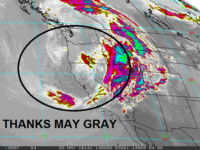

After that things slow down late next week into the weekend.


Models show a late season storm in the N Pacific taking shape which may give us chest high waves towards the 7th of June.


The S Pacific may kick into gear again in a few days- and if it does- more overhead surf around the 10th of June. 2 weeks away unfortunately but better than nothing.

WEATHER:


Nothing major on the horizon. And nothing minor on the horizon either; just night and morning low clouds and fog with a chance of hazy sunshine at the beaches this weekend. Looks to be fine for the holiday weekend- once the clouds burn off. Temps will hang in the high 60's with they typical 10 mph SW winds we've seen the past month. Not as strong thankfully. Models show weak high pressure trying to take hold the middle of next week which means the low clouds may burn off by 10 AM instead of 12 PM at the beaches. Make sure to keep up to date on this exciting weather at Twitter/North County Surf. 

BEST BET:
Monday/Tuesday of next week with good SW swell. After that- hibernation!

NEWS OF THE WEEK:


There’s a big debate going on in the surf world (or ocean enthusiasts for that matter): Are sharks attacking more people or is social media so prevalent that it just happens to capture more on film? Let’s look at the facts. Last year, 98 people in different parts of the world were bitten by sharks. Six of those 98 people died. While 98 may not seem like a large number when you are talking about a global issue, when it comes to shark and human interaction, 98 "unprovoked" attacks means it was a record-setting year. It was a year researchers say warming water temperatures and a population boost could make higher numbers of attacks the norm.

The  International Shark Attack File,  the longest running database on worldwide shark attacks,  said it investigated 164 reports in 2015. The group classifies an "unprovoked attack" as an incident "where an attack on a live human occurs in the shark’s natural habitat with no human provocation of the shark.”A study released by the group blamed warmer waters, and a jump in coastal population for the spike in numbers. The study said, in part:
“As world population continues its upsurge and interest in aquatic recreation concurrently rises, we realistically should expect increases in the number of shark attacks and other aquatic recreation-related injuries …
“Shark populations are actually declining or holding at greatly reduced levels in many areas of the world as a result of over-fishing and habitat loss, theoretically reducing the opportunity for these shark-human interactions.
“However, year-to-year variability in local meteorological, oceanographic, and socioeconomic conditions also significantly influences the local abundance of sharks and humans in the water and, therefore, the odds of encountering one another.”


Let’s ask a few questions before making a decision…

Are there really more attacks happening?

When you talk about shark bites, researchers say you have to look at the ratio, not the numbers. In other words, are more people bitten by sharks because more people (and maybe more sharks) are in the same water? "More people are using the ocean now for recreation than ever before, so there is no doubt that we're putting more people in the water," Chris Lowe, professor in the Department of Biological Studies at California State University Long Beach told Men’s Journal last year. "And while there isn't a lot of good scientific evidence for this yet, I think that some shark populations are increasing due to better fisheries management and improved water quality," he said. "You put more people in the water and add more sharks to coastal areas, you will have more shark-human related interactions."
Professor George Burgess, director of the University of Florida Program for Shark Research, told The Telegraph in a story about last year's spike in shark bites that, “Unlike in the movies, it’s not usually a one cause and effect type of a situation. More often it’s a combination of factors that might have led to there being more sharks or more humans in the water, but this is clearly a situation where there is something going on.”

What are the odds?

How likely is it that you will  be bitten by a shark? Not likely at all. A group of researchers at Stanford University compared records of shark bites with information about how people use the ocean in California.  The found that an ocean swimmer had only one chance in 738 million of being bitten by a great white shark; surfers had a one in 17 million chance; and scuba divers had a one in 136 million chance.

Who do they attack?

Sharks will likely bite the person who acts like a fish or looks like a seal. If you appear to the shark as his normal food choice – by being on a surf board, looking sort of seal-like, or splashing around like a fish  –  he’s more likely to go for it. Humans are generally not on his menu.

Where do they attack?

The United States leads the world in unprovoked shark attacks. Florida leads the United States. While there are more shark bites in the United States, if you are bitten here you are more likely to survive the bite. The fatality rate for shark bites in the U.S. in 2014 was 1.7 percent. For the rest of the world it was 12.8 percent.

Could we see an increase in shark bite incidents again this year?

We could. If current trends continue, the U.S. coastal regions will see population grow from 123 million people to nearly 134 million people by 2020, according to NOAA.  That doesn't include the millions who vacation on the coasts every year.

Who is most likely to get bitten – man or woman?

Sharks don’t seem to prefer the ladies as 90 percent of shark attack victims are men.  It’s the ratio thing in play again – traditionally more men are swimming, snorkeling and surfing – activities that expose you to the greatest risk for shark attacks.

Which sharks are responsible for most human bites?

Three species are most responsible for human bites – the bull shark, the tiger shark and the great white shark.

How many sharks are killed each year by humans?

According to the Florida Museum of Natural History, between 20 and 100 million sharks die each year due to fishing activity.

Feel better now? No? Sorry about that. Don’t let that stop you from going out in the water this weekend and enjoying your Memorial Day!

PIC OF THE WEEK:


Those rights aren't as good as they look. Because if they were, it'd be as crowded as Rincon. It's all a mirage...

Keep Surfing,

Michael W. Glenn
Mr. Know It All
Most Searched Name On Google
1st Place, 2017 Lemoore Open

Friday, May 20, 2016

THE Surf Report


May Gray. La Nina. And no invite to Kelly's wave pool. Yet.

SURF:


Not much excitement around here lately. Had some fun SW swell the past week but May Gray's SW winds early in the AM made a mess of it.


Today they've returned as we have peaking shoulder high sets from the SW and a touch of NW- but the SW winds started early and it's bumpy. Saturday looks to have chest high sets and Sunday is waist to chest high. That's the high point. The low point is another weak front is passing by to the N of us and the clouds will stick around this weekend. You can pretty much write off seeing the sun and expect a little drizzle too. Even with all the clouds though, water temps are creeping up to 66 degrees.


Tides the next few days are 0' at sunrise, up to 3.5' mid-morning, back down to 1' mid-afternoon and back up to 5' at sunset.

FORECAST:


I'll make it quick: Next week is bleak. No real storms in the S Pacific or N Pacific will result in a lack of waves. Most spots will be waist high or under. Forecast models though a show a couple solid storms in the southern hemisphere this weekend which would send good surf for the long Memorial Day weekend.

One looks to give us head high+ waves around Friday the 27th and late in the holiday weekend we could get overhead SW swell.  Make sure to keep up to date on the developing storms at Twitter/North County Surf. 

WEATHER:


As mentioned above, we're stuck in a May Gray holding pattern (which will most likely blend into June Gloom). We have a weak cold front passing by the N today which will thicken up our clouds and keep the sun away for the foreseeable future at the beach (wish I owned property in Palm Springs). We could even see drizzle or light rain Friday and Saturday nights. Next week is more of the same but the sun may peak out in the afternoons at the beaches. Temps though will be lucky to hit 70. I'll be honest- you might as well keep the jacket handy until at least the July 4th weekend.

BEST BET:
Fun leftover SW today with a touch of NW but cloudy. Or hope the clouds clear for the Memorial Day weekend as new good SW swell fills in.

NEWS OF THE WEEK:

As we head towards La Nina this fall, the National Oceanic and Atmospheric Administration’s 2016 eastern Pacific hurricane outlook will arrive later this month. All indications is that we’ll be in a neutral weather pattern this summer (i.e. a dying warm water El Nino and building cold water La Nina), the eastern Pacific is forecast to see far fewer major hurricanes this season compared to the record-breaking summer last year. In 2015 we had 18 named storms of which 13 became hurricanes and a whopping 9 were major hurricanes. (Major hurricanes are classified as Category 3 or stronger on the Saffir-Simpson Hurricane Wind Scale; 111 mph+ winds). So what is my guesstimate for storms this summer? Average: 15 named storms, 8 being hurricanes, and maybe 4 being category 3 or bigger. Sounds good, but when you realize that only ½ of the storms sent swell our way in a record producing year last summer, we may only get 6 swell producing storms of various size this summer. So expect about 3 storms to make any real impact on our shores. That’s 1 a month this summer. Rad!

If we dig a little deeper, the ‘official’ eastern Pacific season began last Sunday, May 15, which is about a half a month earlier than the Atlantic season. The earlier start date is due to warmer waters and typically weaker wind shear earlier in the season compared to the Atlantic. While the Atlantic hurricane season receives much of the attention and publicity in the United States, the hurricanes and tropical storms that form in the eastern Pacific can occasionally be a concern for the southwestern United States and Hawaii. Although the majority of the hurricanes and tropical storms that form in the eastern Pacific move away from land and are only a concern to shipping interests, the weather patterns at the beginning and end of the season are more conducive to these systems potentially affecting Mexico and the southwestern United States.


Arizona is the southwestern state with the history of the most tropical storm encounters. According to the National Weather Service in Tucson, Arizona, a total of eight tropical storms or depressions have remained intact and affected Arizona directly since 1965. Five of these actually made it as tropical storms with sustained winds of 39 mph or higher. Flooding rains are typically the greatest concern from any tropical systems that survive the journey into the southwestern United States. This means that the actual number of systems that have affected the Southwest throughout history is much higher since many of them dissipate before actually reaching the United States. Why is this? While the storm may no longer be intact, the remnant tropical moisture can fuel drenching rains as it moves into the region. The 2015 eastern Pacific hurricane season proved this with above average rainfall this past summer in Southern California and plenty of tropical weather days. Southern California is the only portion of the Pacific coastline in the Lower 48 that could see a tropical storm or hurricane landfall from the eastern Pacific. Although very rare, we have some examples from past history which show us that this can happen.


On October 2, 1858, the only known hurricane to hit Southern California slammed into San Diego. Sustained hurricane-force winds resulted in extensive property damage.

Since 1858, a tropical storm has made landfall in Southern California. In September of 1939, a tropical storm with winds of 50 mph hit Long Beach. According to the National Weather Service in Oxnard, flooding caused moderate crop and structural damage. High winds surprised the shipping industry in the area, which resulted in 45 deaths.

Why are tropical storm and hurricane landfalls such a rare event in Southern California? The primary reason is the very cool ocean temperatures in the path of a tropical system trying to make the journey to the Pacific coast of the United States. As in 1858, the hurricane must be moving fast enough, over waters just warm enough, to maintain its intensity on the way north to California.

As far as in our friends in Hawaii go, they’re usually protected from tropical storms and hurricanes approaching from the east due to cooler waters and strong winds aloft, which contribute to weakening. Many other tropical storms and hurricanes have passed safely to the south of Hawaii thanks high pressure north of the islands.

PIC OF THE WEEK:


In case the WSL can't get a permit for Trestles, I bet this spot in England is available. For like 40 pounds. Or a pint of Smithwick's.

Keep Surfing,

Michael W. Glenn
Future Hall Of Famer
Saved a Damsel In Distress
World Record Holder Highest Pulled Air At 12' 7"

Thursday, May 12, 2016

THE Surf Report- Early Edition


Summer can't come soon enough.

SURF:
Spring 2015 was amazing as warm El Nino waters kept the low clouds and fog at bay. Summer was even better with warm days and tropical clouds. Then winter hit and the supposed drenching rains never materialized, leaving us mostly sunny from November to April and above average temperatures. Now El Nino is on it's way out and May Gray has returned this spring. Thanks La Nina.

Along with the clouds, the crummy early morning SW winds have returned, ruining any kind of fun surf we have. (Do I sound like a grumpy old man)? Look for more of the same this weekend unfortunately as new SW swell fills in and the clouds hug the coast for most of the day.


Saturday looks to have shoulder high waves with a touch of NW windswell and Sunday afternoon kicks it up a notch with overhead sets by sundown. At least the water temps feel great at 65 degrees.


Tides the next few days are 3' at sunrise, down to 0' before lunch and back up to 4' at sunset. For a more in-depth THE Surf Report, check out http://northcountysurf.blogspot.com.

FORECAST:
The SW swell from Sunday continues to build on Monday and peaks with 8' sets in the far N part of the county and the OC.


The surf starts to wind down by Wednesday but on Thursday more overhead SW arrives- this time joined by a fun sized NW windswell. Conditions should be peaky and rideable most everywhere. Hopefully the sun comes out by then too.


For the long term, models show the south Pacific and north Pacific going into hibernation- so expect next weekend to be pretty small.

WEATHER:


Remember how dreamy the weather was last summer? The sun shining when you woke up, tropical clouds floated by, and La Jolla's water briefly hit 80 degrees. You can kiss that good bye! Now that we're transitioning to a La Nina scenario, we're back to May Gray; clouds most of the day, drizzle, and SW wind blowing 10 mph for the dawn patrol. Sick! Now that the weekend's here, expect a thicker marine layer and drizzle. So sick! High pressure may build slightly next week for a chance of sunshine in the afternoons but don't hold your breath- June Gloom is right around the corner.  Make sure to keep up to date on the conditions at Twitter/North County Surf. 

BEST BET:
Monday and Thursday with peaking overhead SW swell. Not too shabby of a week actually.

NEWS OF THE WEEK:


Not too fond of cigarette butts on the beach. Or trash in the ocean for that matter; like all those random plastic pieces that wash up on our shores.  A 2015 paper published in Science estimates that anywhere from 4.8 million to 12.7 million metric tons of plastic were dumped into the ocean in 2010 alone. One metric ton equals approximately 2,200 pounds, roughly the weight of a small car. So basically there’s 12.7 cars made of plastic floating around our oceans. Not cool. New research by University of Delaware physical oceanographer Tobias Kukulka provides evidence that the amount of plastic in the marine environment may be greater than previously thought. Double not cool.

The real problem is that plastic in the ocean becomes brittle over time and breaks into tiny fragments. Slightly buoyant, these microplastics often drift at the surface where they can be mistaken for food by birds, fish or other marine wildlife. Microplastics have turned up in the deep ocean and in Arctic ice, too. "You have stuff that's potentially poisonous in the ocean and there is some indication that it's harmful to the environment, but scientists don't really understand the scope of this problem yet," explains Kukulka, an expert on ocean waves and currents, and associate professor in the College of Earth, Ocean, and Environment's School of Marine Science and Policy.

One technique scientists use to try and quantify how much plastic is in the marine environment is to drag a tow net over the surface for a few miles, then count the number of plastic fragments. This number is then used to calculate a concentration considered representative of the amount of plastic in the area. But Kukulka isn't so sure this method provides an accurate picture of what's happening.

"My research has shown that ocean turbulence actually mixes plastics and other pollutants down into the water column despite their buoyancy," Kukulka said. "This means that surface measurements could be wildly off and the concentration of plastic in the marine environment may be significantly higher than we thought."

A good way to understand ocean turbulence is to think about adding cream to your coffee. If you pour the cream gently, you need a spoon to generate turbulence and mix the two liquids together. If you pour the cream quickly, however, as the liquid descends into the coffee it naturally generates turbulence and mixes the liquids. In the ocean, wind and waves act like a spoon, generating turbulence and mixing this surface layer of the water.

Working with collaborators at Woods Hole Oceanographic Institute and University of Washington, Kukulka used computer modeling to look at the effect that waves, and heating or cooling the ocean surface, had on where in the water plastic was found.


The study findings provided evidence that turbulence from waves and currents plays a critical role in whether plastics stay at the surface or get mixed deeper into the ocean. Surface heating from the atmosphere, due to seasonality, latitude or night/day cycles, also had a significant effect.

In the summer, for example, strong surface heating by the sun warms up the ocean's top layer, decreasing the water's density and trapping the plastic at the surface. When the surface cooled, the water density increased and caused the plastic to sink into the water column.

"If we really want to go after this problem and quantify the amount of plastics in the ocean and think about distribution and impact, then we need to keep in mind that turbulence is influenced by heating and, therefore, the distribution of plastics is too," Kukulka said.

Comparing model results to actual field observations by his colleagues from the subtropical Atlantic, Kukulka corrected the surface measurements taking into account turbulence models and mixing processes, revealing new measurements that are significantly higher.

While the research team's findings shed new light on the growing plastics problem, Kukulka said the research also can be applied to oil and other pollutants, even to the distribution of nutrients in the water and phytoplankton, ocean drifters that form the base of the marine food web."Broadly, these plastics pieces can be used as a physical tracer to help answer bigger questions about ocean processes and their implications for other ocean pollutants," he said.

While some scientists have suggested dragging nets through ocean's surface waters to remove the plastic, Kukulka cautions that in areas with strong turbulence scientists "may want to consider spending our energy and efforts elsewhere. Even though the plastic pieces are buoyant, cleanup might not be as simple as skimming the surface," he said.

So what can we do? Well for starters, make sure to pick up some trash the next time you come in from a session. Maybe all of us can eliminate a few 'plastic cars' from our line up.

PIC OF THE WEEK:


Awesome little left and right set up made famous by the Mad Wax crew of Sanga, RCJ, Kong, and Tommy Carroll. Sure wish I had a bar of that stuff to whisk me away right now (I guess you had to see Mad Wax to make heads and tails of that last sentence).

Keep Surfing,

Michael W. Glenn
Playmaker
My Good Looks Are A Blessing And A Curse
Was Mistaken For Curren When I Surfed Rincon Last Weekend

Thursday, May 5, 2016

THE Surf Report- Lite


Switching gears.

SURF:

I'm tired from all the surf we've had lately. Taking a break tomorrow to golf Florida style (i.e. in-between thunderstorms and gators). So tonight's report is on the lite side as the early bird gets the worm. For those of you that insist on getting some waves this weekend we'll have more chest high SW for y'all. Been pretty consistent in the underworld the past week and for us that means more chest high SW and shoulder high sets for the OC. Weather prognosticators though say there's a chance of thunderstorms tomorrow (more on that below), so watch the skies before paddling out. By Saturday we should be in the clear and Sunday is nice weather- all the while the SW swell keeps hitting our shores.

Water temps feel great at 65 degrees and tides the next few days are 2.5' at sunrise, up slightly to 4.5' mid-morning, down to 0.5' late afternoon and up quickly to 5' at sunset.

FORECAST:
The N Pacific has shut down and the S Pacific is in full swing.


We've got new shoulder high SW arriving Monday into Tuesday and then late Thursday we have a new SW swell for head high waves into next weekend.


Behind that is another SW swell on the charts that should arrive next Sunday into Monday the 16th, most likely head high again. The door has officially been shut on winter.

WEATHER:

Models earlier this week showed a fairly good storm headed our way for late in the spring season but as we got closer to today's event (stop me if you've heard this before), the press didn't live up to the hype. Currently low pressure is above us and thunderstorms are circling the ocean, but none of them seem to hold up by the time they hit land. We still have a chance of thunderstorms in the forecast but some areas may see a downpour and others are high and dry. Next month summer starts so I'm taking this 'storm' with a grain of salt. And El Nino was a dud so I don't expect it to start now. The guessing game should clear up by tomorrow afternoon and the weekend looks sunny and cool. Most of next week looks sunny and warmer. Like a typical Southern California spring. Keep up to date on the conditions at Twitter/North County Surf. 

BEST BET:
Monday and next weekend look the best as new SW swells arrive while the rest of the week is smaller but still fun.

NEWS OF THE WEEK:

More random facts (that probably only interest me) part 2:

The Kuroshio Current, off the shores of Japan, is the largest current. It can travel between 25-75 miles a day  and extends some 3300’ deep. The Gulf Stream is close to this current's speed. The Gulf Stream is a well known current of warm water in the Atlantic Ocean. At a speed of 60 miles a day, the Gulf Stream moves a 100 times as much water as all the rivers on earth and flows at a rate 300 times faster than the Amazon, which is the world's largest river.

The sea level has risen with an average of 3-10 inches over the past 100 years and scientists expect this rate to increase. Sea levels will continue rising even if the climate has stabilized, because the ocean reacts slowly to changes. 10,000 years ago the ocean level was about 360 feet lower than it is now. If all the world's ice melted, the oceans would rise 216 feet.

The density of sea water becomes more dense as it becomes colder, right near its freezing point of 32 degrees, unlike fresh water which is most dense at 39 degrees, well above its freezing point. The average temperature of all ocean water is about 38 degrees.


Antarctica has as much ice as the Atlantic Ocean has water.

The Arctic produces 10,000-50,000 icebergs annually. The amount produced in the Antarctic regions is inestimable. Icebergs normally have a four-year life-span; they begin entering shipping lanes after about three years.

One study of a deep-sea community revealed 898 species from more than 100 families and a dozen phyla in an area about half the size of a tennis court. More than half of these were new to science.

Life began in the ocean 3.1 billion to 3.4 billion years ago. Land dwellers appeared approximately 400 million years ago, relatively recently in geologic time.

Because the architecture and chemistry of coral is so similar to human bone, coral has been used to replace bone grafts in helping human bone to heal quickly and cleanly.

BEST OF THE BLOG:

Thanks again to everyone that is playing at the 2nd Annual North County Board Meeting Golf Tournament tomorrow. Benefiting Outdoor Outreach (helping at-risk kids through sports and mentoring), we're playing showers or shine. I'm erring on the side of shine. Worst case we drink a few beers in the clubhouse. (not the kids- the golfers). So if you're looking to get involved in your community, give to a great charity, and start the weekend early, join us 7:30 tomorrow morning at the all new Goat Hill golf course in Oceanside and play golf Florida style.

PIC OF THE WEEK:

The Pic of the Week 99% of the time never has an actual surfer in it. I've always left it as an empty wave for the viewer to mind surf. But today is different. I thought you needed a lift. When things got you down and you're having a bad day, just think of Niccolo Porcella at Teahupoo. Don't you feel better now?

Keep Surfing,

Michael W. Glenn
Born Leader
Played Drums For Adam Ant
Got Invited To Kelly's Pool Tomorrow But I'm Playing Golf