Monday, December 31, 2012

Surf Check

Had some fun surf over the holidays so far. Weather has been off and on but nothing too out of control.
Today we have dropping NW groundswell but there's still some shoulder high sets in north county SD and head high sets in south SD. The OC is partially getting blocked by the islands and is around waist high. Weather conditions are great (albeit cold) and there is no wind at this time.
Water temps are a chilly 68 and the tides are 4' at sunrise, 5.5' at 10am, dropping to 0' at sunset.
Our weather the next few days will be great- but on the cold side. High pressure is building and we may get some weak offshore flow Tuesday/Wednesday. Air temps amazingly will be about 40 in the mornings and only low 60's in the afternoon. The weather stays nice until Saturday then models hint at another storm coming through late Sunday.

As far as our surf goes, we have a new NW showing Wednesday morning. Models last week showed this being a solid swell but have since backed off. Good news is that we'll still have some head high+ surf around here and overhead waves in south SD. Just not double overhead as I was hoping! Further out, that storm that may give us rain late next weekend will send us a shot of more NW too. Hopefully we'll see some head high sets again late Sunday.

All in all some more fun surf lined up and good conditions this week. Glad it's a short work week!


Friday, December 28, 2012

THE Surf Report


Winter's on auto-pilot.

SURF:
If you liked last week and the week before and the week before that then you're going to love this week and next week. Seems as though winter is on auto-pilot. We had junky conditions a few days ago and solid NW swell, then the weather cleaned up and now we have dropping but fun head high+ surf today with bigger sets in SD. The OC has some shoulder high waves too.
Currently the wind is W at 8 this afternoon and we'll have clean conditions again tomorrow. Tomorrow morning is about chest high around town and then as luck would have it, we have another solid NW swell for late Saturday into Sunday and as luck would have it, another round of showers. Nothing too strong, but our streak continues.
Tides the next few days are about 5' at sunrise, up to 6' at 9am, and dropping like a rock to -1' at sunset. Water temps are chilly 58. Make sure to keep up to date on the waves/weather at Twitter/North County Surf.

FORECAST:

After the good NW this weekend, we get a reinforcement out of the NW late Tuesday. This looks to be overhead in north county SD and 10' sets for SD. The OC should have some shoulder high waves too. That lasts into Thursday.

The southern hemisphere had a little action yesterday and the OC may have some chest high sets from the SW towards mid-week. After that things start to wind down towards next weekend. 

WEATHER:

Beautiful conditions today and tomorrow then we get another round of showers on Sunday. Nothing big- probably 1/4" at most and some light S winds. That cleans up on Monday and Tuesday/Wednesday looks to have some cold offshore wind conditions around here. Models then hint at showers again towards next weekend but there's a lot of uncertainty with the forecast at that point. Regardless, the weather looks to be off and on like it has been the past few weeks.

BEST BET:
Once that new solid NW shows towards Wednesday and the offshores deliver, could be darn good around here.

NEWS OF THE WEEK:

One new story that slipped under the radar was the federal fisheries experts this past fall said petitions to list white sharks as threatened or endangered contained substantial scientific information that warranted an in-depth review. The agency will study the possibility of protecting white sharks under the federal Endangered Species Act, with a decision expected in June 2013. NOAA said in a statement a status review team of federal scientists will be assembled to assess the best available scientific and commercial information concerning the population structure, biological status, and threats facing great white sharks in the northeastern Pacific Ocean. Last fall’s announcement was in response to formal requests by conservation groups Oceana, the Center for Biological Diversity, Shark Stewards and WildEarth Guardians to assess the status of white sharks off the West Coast. The petitions were based on recent studies that showed that population is genetically distinct and may include just a few hundred adults and near-adults. Some scientists have said the numbers don’t necessarily mean the species is imperiled. If NOAA determines they need federal protections, that could lead to restrictions designed to minimize incidental take of white sharks by fishing gear. Conservationists praised NMFS “for recognizing the new science documenting the perils facing this unique population of great white sharks.” “Great white sharks are incredible species that have survived for eons along the West Coast. Sadly, they’re in deep trouble right now, so we’re glad to see them a step closer to getting the help they need to survive,” said Miyoko Sakashita, oceans program director at the Center for Biological Diversity. A similar petition for protecting sharks in California waters is pending at the state level. Considering the proliferation of camera phones the past 10 years, it seems like we've seen more great whites than ever (i.e. off of L.A., the fatal attack in Solana Beach, the family of whites off San Onofre, etc). I guess we were wrong.

BEST OF THE BLOG:

Didn't get what you wanted for Christmas? Just boxes of Sees Candies, Starbucks Cards, and socks? Then head to Surfy Surfy this weekend and pick up what you really wanted- a surfing monkey. All the rage in yards this year. Flamingos and garden gnomes are so 1970. Check out the gifts you didn't get on the North County Surf blog. And of course a mid-week Surf Check and an in-depth THE Surf Report - all of that and more in the blog below.

PIC OF THE WEEK:

I thought we needed a 'White Christmas' Pic of the Week. It is the holidays, isn't it? Hope Santa brought you a 6/5/4 and a good set of booties/gloves/hood.

Keep Surfing,

Michael W. Glenn
Executive Producer
Next Jets Quarterback
In The Latest Polo Ad With Buzzy

Tuesday, December 25, 2012

Surf Check- Xmas Edition


Not a bad Christmas day. Line ups are fairly quiet as most everyone is at Grandma's today, we've got a little NW/SW combo, and the weather is mild.
There's some fading NW groundswell from that solid swell over the weekend and some new small building SW swell. Most spots up and down southern California are chest high with best spots in SD still getting shoulder high sets. We also have weak high pressure above us for high clouds streaming overhead and light winds. Not a bad afternoon. Water is holding at 60.
Beware the tides though as we've got a 6' tide around 8am dropping quick to -1' at 3pm.
Tomorrow things change around here as we have a cold front moving through in the afternoon. Look for the morning session to have SE winds then switching to breezy SW winds. Showers will last through much of the day as the NW storm surf picks up to the head high to overhead range in SD. Rainfall totals will generally be under 1/4".
Good weather returns on Friday as the NW backs off. Saturday looks small but then models suggest yet another weak cold front moving our way on Sunday as the NW windswell picks up again for head high sets. Kind of a typical/monotonous winter pattern going on here. All good though- we need the rain and the surf!
Down in the southern hemisphere, the bear is hibernating but tends to get up in the middle of the night and grab a glass of water once in a while. Like the little storm shown on the map above. Nothing impressive but seas in the 25' range if all goes according to plan. If so, we may get a similar sized swell to today's surf (about waist high+) towards the 2nd of January.

Long story short, some more NW windswell headed our way (along with showers) and background SW swell underneath for the near future.


Saturday, December 22, 2012

Deal Alert! Last Minute Surfy Gifts!

Don't know what to get the surfer that has everything? Even a 12X world champ? Then check out Surfy Surfy in Leucadia as they've got a ton of stuff to put under the tree- just in time for the 25th.
Tired of looking like everyone else and wearing surf clothes others bought at Nordtrom's, Macy's, and gasp- Ross?! Then Surfy Surfy has just your cure- one of a kind tees and hats that the locals are proud to wear. Like the tee owner JP is holding- 'Keep Leucadia Funky'. Where else can you find a tee with a spear fishing bro riding a dolphin with goggles? Definitely not Tilly's.
Or my grom's favorite hat- 'The Surf Industry Stole My Culture And All I Got Was This Stupid Hat'. All time. The tee is $28 and the hat is $20.
One present that will definitely impress the surfer in your house is classic surf mags. That's one present you can't find anywhere else. Relieve the glory years with old issues of Surfer, Surfing, and yes, Breakout. And Surfy Surfy is giving you the bro deal this holiday season- they're for sale at the original cover price.
Another great bro deal is the Surfy Stocking. Includes:
-Destination surf leash
-Pickle wax remover
-Headhunter sunscreen
-wax
-wax comb
-tide book
-resin for ding repair
Sold separately, this normally goes for $50. This weekend though it's only $30.
Besides the usual stocking stuffers at Surfy Surfy like wax, dvd's, and stickers, Surfy Surfy also has Surfy Surfy magnets and Surfy Surfy keychains/bottle openers. (Can't believe I just said 'Surfy' eight times in one sentence).
And did I mention Surfy Surfy is a surf shop? Of course they have a ton of fullsuits from Billabong/West/Matuse, a wide variety of boards (JP says Bonzers are the hot seller this Christmas), and fins from Rainbow, FCS, the legendary Skip Frye, and others. He's also got the hot deal this weekend with all Raen sunglasses at $99 with a leather carrying case to impress the ladies.
And last but not least- my favorite 'hard to find' gift for the surfer on your list- the Surfing Monkey. This ceramic statue also doubles as a piggy bank. Who needs flamingos or gnomes in your garden when you can have 1 of these gems. Hurry though as there are only 2 left. Make sure to stop by 974 North Coast Hwy 101 this weekend from 10-6 everyday or call JP 760 452 7687 with any questions!


Thursday, December 20, 2012

THE Surf Report- Early Edition


It's the end of the world as we know it and I feel fine.

SURF:
Thought I should get THE Surf Report out tonight since we won't be around tomorrow. Ok, that's not really true, I just happened to get it done early and didn't feel like waiting 'til Friday. Anyway, we had some jumbled surf earlier in the week then clean fun surf today.
On Friday we'll have some leftover NW swell for chest high sets around town. Had a big storm in the Aleutians yesterday, one buoy in the middle of the mess recorded 46' swell at 18 seconds. That's a beast. One of the biggest readings I've seen in years. Unfortunately for us, the swell angle for this storm is pretty north so we'll only get a glancing blow.
On Saturday we'll have overhead sets in north county SD (can't complain) and 10' sets in SD. Orange County will be partially blocked by the offshore islands and will have chest high sets at the best spots. That will last into Sunday. There's some showers also forecasted for Sunday so pick your day to surf wisely. All in all a fun weekend for surf.
Tides the next few days are about 5' at sunrise, down to 0' at noon, and back up to 3' at sunset. Water temps are still holding at 60.

FORECAST:

After the good NW this weekend, we amazingly get a little bump from the SW on Christmas for the OC. We had a small late season storm in the southern hemisphere last week and it sent a waist-chest high SW swell our way.
That lasts a couple days then a new NW kicks in for SD on Thursday for more head high sets in north county and overhead sets in SD; more showers too unfortunately. All in all a little something for everyone next week. Make sure to keep up to date on the waves/weather at Twitter/North County Surf.

WEATHER:

Looks like winter is finally here. Literally- today is the 1st day of winter. But that's not what I'm talking about; the weather the past week has finally felt like winter. After a great summer and beautiful fall, we finally have cold air temps, wind, clouds, and rain. Today we have clear cold skies that will be replaced by clouds tomorrow. Showers will then take over on Sunday and last into Monday. By Christmas Day the storm will have exited the region and we're left with clear cold skies. Better than the 80 degree Xmas' of year's past. Good weather should last through mid-week then models show another storm system moving through the region towards Thursday. Looks like the storm next Thursday will be a little stronger than Sunday's storm- if you're keeping track.

BEST BET:
New NW on Saturday in San Diego with semi-clean conditions. Or a small clean SW for the OC on Xmas. Or a bigger NW for everyone next Thursday but rain probably. I can't make up my mind.

NEWS OF THE WEEK:

Yesterday the National Oceanic and Atmospheric Administration (NOAA) released preliminary information on extreme weather and climate events in the U.S. for 2012 that are known to have reached the $1 billion threshold in losses. As of December 20, NOAA estimates that the nation experienced 11 such events, to include seven severe weather/tornado events, two tropical storm/hurricane events, and the yearlong drought and associated wildfires. These eleven events combined are believed to have caused 349 deaths, with the most significant losses of life occurring during Sandy (131) and the summer-long heat wave and associated drought, which caused over 123 direct deaths (though an estimate of the excess mortality due to heat stress is still unknown).

The eleven events include:
- Southeast/Ohio Valley Tornadoes — March 2–3 2012
 -Texas Tornadoes — April 2–3 2012
 -Great Plains Tornadoes — April 13–14 2012
 -Midwest/Ohio Valley Severe Weather — April 28–May 1 2012
 -Southern Plains/Midwest/Northeast Severe Weather — May 25–30 2012
 -Rockies/Southwest Severe Weather — June 6–12 2012
- Plains/East/Northeast Severe Weather (“Derecho”) — June 29–July 2 2012
 -Hurricane Isaac — August 26–31 2012
 -Western Wildfires — Summer–Fall, 2012
 -Hurricane Sandy — October 29–31 2012
 -U.S. Drought/Heatwave — throughout 2012

Economic losses for two events, Sandy and the yearlong drought, are the big drivers this year in terms of costs and are still being calculated. It will take months to develop a final, reliable estimate for each. Given how big these events are likely to be, NOAA estimates 2012 will surpass 2011 (exceeding $60 billion, CPI-adjusted to 2012 dollars) in terms of aggregate costs for annual billion-dollar disasters, even with fewer number of billion-dollar disasters. The greatest annual loss to date was 2005 when Hurricanes Katrina, Rita, Wilma and Dennis struck Florida and the Gulf Coast states (costs exceeded $187 billion, CPI-adjusted to 2012 dollars). That is just staggering.

BEST OF THE BLOG:

Have you seen the rickety scaffolding south of Cardiff Reef recently? No, it's not the return of the Bud Tour. It's the world famous Scripps Institute doing top secret research. Or something like that. Check out the details on the North County Surf blog. And of course a mid-week Surf Check and an in-depth THE Surf Report - all of that and more in the blog below!

PIC OF THE WEEK:

There are so many untapped spots around the world just waiting to be surfed. If you tried to hit them all, it would take centuries. Like this spot in Chile. By the time you worked your way down the coast and surfed all the good spots in Baja, then mainland Mex, then Nicaragua, Costa Rica, etc., you'd be like Slater's age. What is he like 90 or something now? Regardless, he'll still be ruling the world tour at that age.

Keep Surfing,

Michael W. Glenn
Mayan Priest
On Somebody's Naughty List
Still Partying With Parko

The Leaning Tower of George's


Have you cruised south of Cardiff Reef lately and seen the odd makeshift tower and shipping containers on the beach known as George's? Almost looks like a poor man's judging scaffolding for a WQS 1 star event. Well the mystery has been solved with the help of the San Diego Union Tribune newspaper this week. Seems as though the Scripps Institute is doing some research on sand movement on our beaches. Here's the low down:

The coastline from Oceanside to Del Mar is a dynamic zone where untold cubic yards of sand can be whipped into deep-sea refugees, the path of their marine exodus largely unknown. Until scientists can install chips in grains — or turn them radioactive — tracking sand migration requires human eyes. Enter Bob Guza, Scripps Institution of Oceanography professor and sandman emeritus, resplendent on a drizzling Thursday morning in tie-dye shirt and rubber sandals. At Cardiff State Beach, a short jog south of the Kook and a stone’s throw from the Chart House, a cool winter stakeout is taking place. Within an industrial-sized container, the kind you see on decks of ships, a doctoral student under Guza’s mock-gruff command sits in front of a bank of computer terminals. (“She only works half a day,” he says. “From 7 to 7.”) On a rickety tower of scaffolding, a laser camera tracks formation changes on a rain-soaked beach that, if nature were allowed to take its seasonal course, would not be there. Two months ago, SANDAG dumped 89,000 cubic yards of sand on Cardiff State Beach, part of a regional replenishment project. For Guza and fellow Scripps beachcombers, this was granular manna from heaven unloaded on a strip of sand they’d been studying for a dozen years.
They set out to determine, in real time, what effect high tides and winter waves have on the pumped-up stretch of beach as well as the ocean floor near the shore. The goal of the research project — led by Guza and one of his former star pupils, Reinhard Flick, Scripps researcher and staff oceanographer for the California Department of Boating and Waterways — is simple: Watch the sand. Carefully. The technology they’re using is a step up from Radio Shack: a laser scanner that collects data points multiple times a second; acoustic Doppler velocimeter; bathymetric mapping; and a bunch of other sci-fi stuff. Guza, his love of sand gushing, says it’s insane that we spend millions on periodic beach “nourishment” while less than .01 percent of that money goes to measuring what happens to the sand once it’s dropped off. “Our beaches are changing,” Guza says. “We can either monitor them and have a good idea what they’re doing and what happens when we try to fix something, or we can not watch them and do stuff randomly and not know what works.” Long-term, sand is both a scientific and political challenge. Surfers will scare off sunbathers to protect breaks. Cities have to be terrified of rises in the ocean level wiping out houses and infrastructure. Armoring the coast with sea walls is highly controversial. Environmentalists push for coastal retreat at untold human cost. The solution to beach erosion that smells most like apple pie to most noses is sand. In Florida, Flick says, beaches are treated like highways, indispensable infrastructure. No one questions the economic value of sand replenishment after hurricanes. For decades, dammed rivers in North County have withheld their damned sand. The natural order of things has been disrupted. But before we can get smart about replenishment, we have to understand the murky physics of sand. According to Flick, Albert Einstein shook his head when his son, Hans Albert, went into the field. Can’t you think of anything easier? Albert Einstein asked. The East Coast is far ahead in practical research, Guza and Flick agree. But we’re different terrain. A slow-motion hurricane called sea-level rise is coming our way. So if you’re tooling along Cardiff, give a honk to the Scripps wonks staking out the beach. They’re doing bitchin’ work.

Tuesday, December 18, 2012

Surf Check

  
Got a mess out there today. Storm's a comin' through and the surf is a mess. Early this morning we had clean conditions with light SE winds and chest high NW surf. This afternoon though is another story as the swell is picking up but the winds are too. Currently they're blowing 15mph from the SW and forecasted to hit 25mph tonight as they switch to the NW. 
Good news is that the NW is picking up- but it's from the NW windswell unfortunately. Look for overhead sets from the NW tomorrow and strong N winds. Models show the winds switching to the NE tomorrow once the cold front moves through tonight but I don't think it will happen that quickly. My bet is on breezy N wind conditions tomorrow. Most likely by Thursday morning we'll have offshore NE winds again.
As advertised above, we have a cold front moving through the area today. Showers should end by tonight. Looks like we'll pick up around 1/2" of rain from it. High pressure sets up tomorrow through Saturday and we'll have clear cool conditions. By Sunday evening into Christmas Eve morning, we get another similar front moving through for maybe 1/4"-1/2" of rain and breezy conditions. Christmas day looks to be clear and cool.
As far as the surf goes the next few days, it drops off with some waist high+ NW waves by Thursday. Currently models show a storm brewing in the north Pacific tomorrow and we should have a shot of head high NW swell again on Friday afternoon through Christmas Eve (with overhead sets in SD- guess those guys made Santa's 'nice' list). Not a bad early Xmas present regardless. Hopefully though the forecasted storm on Sunday night won't be as strong as predicted and we enjoy a few days of clean surf around here.


Friday, December 14, 2012

THE Surf Report


Wet, wild, and windy.

SURF:
What don't we have going on right now?! Crazy tide swings, lots of rain, junky surf, cold air temperatures, polluted water, and whatever else Mother Nature can throw at us.
Today we've got  jumbled chest high+ NW with a couple odd bigger sets in SD. There's one storm exiting the region while another one fills in behind it tonight. Long story short, don't look for clean conditions- in and out of the water- for quite some time. Chest high surf and junky conditions hold through the weekend.
Currently the wind is blowing 12-15mph from the SW and tides the next few days are about 3' at sunrise, 7' at 10am, and -1.5' at sunset. Water temps are still holding at 61.

FORECAST:

After a junky weekend of surf... we get more junk early next week. High pressure has retreated and the storm door is open. Models don't show any strong storms barreling through us but just enough to give us showers, junky conditions, and chest high NW. Models though do have a couple storms on the charts and we should get a solid NW towards Tuesday night for shoulder high waves in north county SD and head high+ waves in SD. Then a slightly bigger storm sends swell our way towards next Friday for overhead sets in north county SD and a few feet overhead in SD. All the while we get weak storms passing through our area. We may get a quick window of clean conditions between storms- or we may not. It will be tricky next week trying to find windows of clean conditions.
The southern hemisphere is trying to come to life too- we've got a small storm trying to form in a couple days down there which would give the OC some chest high+ waves Christmas eve. Bares watching. Make sure to keep up to date on the waves/weather at Twitter/North County Surf. 

WEATHER:

Solid storm yesterday. We got almost twice the rain we expected. We have another weaker storm coming through tonight for 1/4" to 1/2" of rain forecasted. After that rolls through, we get showers yet again on Sunday from another system for almost 1/4" of rain. And the storm door stays open next week as forecasted by the models. Monday we get some sunny clearing conditions but then another weak storm comes in on Tuesday night. Thursday looks to be clearing and cool and then ANOTHER weak front moves through on Friday if the models hold up. A lot can change between now and then but it looks like showers off and on for the near future.

BEST BET:
Tough call- pretty much junky all week. And when we get new swells showing up (late Tuesday and next Friday) we get weak storms along with it! I guess junky surf is better than no surf.

NEWS OF THE WEEK:

As mentioned above, the storm yesterday was only forecasted to give us 3/4" of rain but San Diego got twice that at 1.5". Sure helps our pseudo El Nino season. Luckily for us the storm door is forecasted to stay open the next 7 days and we've got a few week cold fronts coming through every few days. We potentially could get another 1" of rain by the time it's all over. So where are we at as of today?
-John Wayne Airport (Newport Beach): 1.74", 62% of normal (2.82" is normal)
-Oceanside Airport: 2.51", 91% of normal (2.76" is normal)
-Lindbergh Field (San Diego): 2.54", 109% of normal (2.34" is normal)
This last storm came a little more south than expected and San Diego county got more rain than Orange County (hence the higher totals so far this year). If we get another 1" this week, we should be well over our averages and off to a good start to the rainy season.

BEST OF THE BLOG:
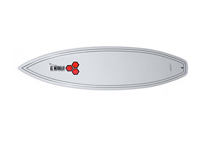
Where else can you find a new Channel Islands shred stick, Pro-Lite bag to carry it in, Creatures of Leisure tail pad, and Xcel fullsuit for $700?! The North County Surf blog, that's where. Check out the blog to buy something for yourself this Xmas. Also got a clip of Julian Wilson of former Quiksilver fame, err Nike fame, umm Hurley, not sure anymore, ripping in Indo. And of course a mid-week Surf Check and an in-depth THE Surf Report - all of that and more in the blog below!

PIC OF THE WEEK:

One of North America's least understood and frustrating surfing locations is the north east. And I mean the north north east. Like Nova Scotia. Unlimited potential with countless points, bays, sandbars, rivermouths- it's just missing consistent surf to make it world class. Like maddening inconsistency- and add in the winter is brutally cold with snow measured in feet, not inches and extreme tide swings- it's unbelievable anyone wants to surf up there. I actually knew a guy back in the day from San Diego who bought a house up there and waited out the summer months for surf. Did nothing bat sat and waited in his house. Literally. Weeks on end would go by with not even a wave to longboard. Then everything would light up like a Christmas tree and it was worth the wait. Don't know what happened to the guy, probably living out his own version of The Shining, but man was he dedicated. For more great shots of the Canuck line ups, check out TransWorld Surf's pics here.

Keep Surfing,

Michael W. Glenn
Auspicious
Harboring McAfee
Selling a Line of Ginja Ninja Action Figures at Walmart