
All tricks, no treats.
SURF:
Unbelievable offshores this week (and no fires to speak of fortunately) but not much swell.

If you were lucky (or smart), you could have picked off a chest high set here and there. But for the rest of us, we were left with perfect little waist high rollers the past few days. The Pacific seems to be in a funk right now and we're left with small surf again this weekend. Look for waist high surf from the SW/NW the next few days and nice weather- with maybe a return of low clouds/fog in the nights/mornings on Sunday. Water temps are a comfortable 65 degrees and here's tide and sun information this weekend:
- Friday/Saturday:
- Sunrise: 7:07 AM
- Sunset: 5:58 PM
- AND DON'T FORGET TO SET YOUR CLOCK'S BACK ON SATURDAY NIGHT FOR THE END OF DAYLIGHT SAVING TIME!!! (Did I get your attention?)
- Sunday:
- 6:08 AM (Dawn patrol anyone)?
- 4:56 PM (Forget about surfing after work now.)

- And tides this weekend are:
- 3’ at sunrise
- 4.5’ after lunch
- 2' at sunset
FORECAST:
Still no real storms on the forecast charts.

We might get a little waist high bump from NW windswell around Tuesday and waist high+ NW wind/ground swell on Thursday (oh boy) but nothing to make you break out the step up yet.
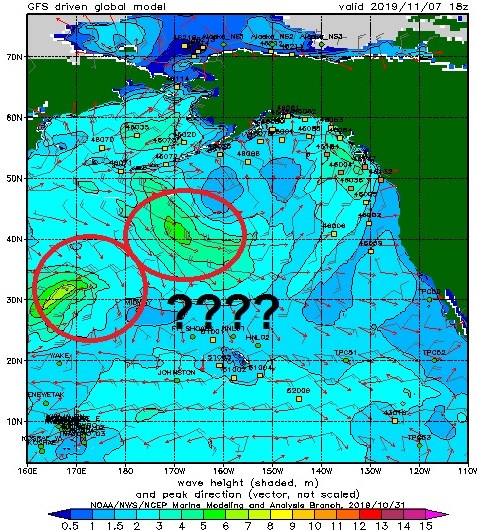

Further out, models don't look that promising but we may get waist high NW groundswell around the 11th (better in SD) and hopefully some waist to chest high SW around the 13th (better towards the OC). Long story short, the storms in the North Pacific haven't kicked into gear yet for us here and the southern hemisphere is in hibernation until March. Make sure to check out Twitter/North County Surf if anything changes between now and then.
BEST BET:
Hopefully Thursday with waist high+ NW or longer term (if you can wait that long).
WEATHER:

Thank our lucky stars we didn't have any major fires down here in San Diego County the past few days. The offshores went to waste anyway with the small surf. The winds are switching today and we're back to our normal sea breeze. As mentioned above, look for low clouds to return by Sunday and into next week. Temps will be a pleasant 70 during the day and 50 at night. And no rain in sight unfortunately. Good news for all you snowsurfers out there though; Montana's already got a few feet of the fluffy white stuff which means the Rockies and Northern California can't be that far behind.
NEWS OF THE WEEK:

With the absence of a strong El Nino or La Nina this winter, I've almost forgotten what an average winter feels like here in Southern California. Either we've had big surf/lots of rain or small surf/lots of sun the past decade. So what's on tap for the coming winter? The National Oceanic and Atmospheric Administration (NOAA) put out their seasonal forecast recently and had this to say about CA and the rest of the U.S.:
Warmer-than-average temperatures are forecast for much of the U.S. this winter according to NOAA’s Climate Prediction Center. Although below-average temperatures are not favored, cold weather is anticipated and some areas could still experience a colder-than-average winter. Wetter-than-average weather is most likely across the Northern Tier of the U.S. during winter, which extends from December through February.
While the El Nino Southern Oscillation (ENSO) climate pattern often influences the winter, neutral conditions are in place this year and expected to persist into the spring. In the absence of El Nino or La Nina, long-term trends become a key predictor for the outlook, while other climate patterns, such as the Madden-Julian Oscillation and Arctic Oscillation (AO), will likely play a larger role in determining winter weather. For example, the AO influences the number of arctic air masses that intrude into the U.S., but its predictability is limited to a couple weeks.
While the El Nino Southern Oscillation (ENSO) climate pattern often influences the winter, neutral conditions are in place this year and expected to persist into the spring. In the absence of El Nino or La Nina, long-term trends become a key predictor for the outlook, while other climate patterns, such as the Madden-Julian Oscillation and Arctic Oscillation (AO), will likely play a larger role in determining winter weather. For example, the AO influences the number of arctic air masses that intrude into the U.S., but its predictability is limited to a couple weeks.
“Without either El Nino or La Nina conditions, short-term climate patterns like the Arctic Oscillation will drive winter weather and could result in large swings in temperature and precipitation,” said Mike Halpert, deputy director of NOAA’s Climate Prediction Center.
This spring saw significant and historic flooding across the central U.S. that impacted nearly 17 million people. However, during the summer and early fall, drought rapidly developed across much of the South, with drought conditions now present across approximately 20% of the country.
This spring saw significant and historic flooding across the central U.S. that impacted nearly 17 million people. However, during the summer and early fall, drought rapidly developed across much of the South, with drought conditions now present across approximately 20% of the country.

Temperature:
- The greatest likelihood for warmer-than-normal conditions are in Alaska and Hawaii, with more modest probabilities for above-average temperatures spanning large parts of the remaining lower 48 from the West (California) across the South and up the eastern seaboard.
- The Northern Plains, Upper Mississippi Valley, and the western Great Lakes have equal chances for below-, near- or above-average temperatures.
- No part of the U.S. is favored to have below-average temperatures this winter.

Precipitation:
- Wetter-than-average conditions are most likely in Alaska and Hawaii this winter, along with portions of the Northern Plains, Upper Mississippi Valley, the Great Lakes and parts of the Mid-Atlantic and Northeast.
- Drier-than-average conditions are most likely for Louisiana, parts of Texas, Mississippi, Arkansas and Oklahoma as well areas of northern and central California.
- Southern California looks to be average for precipitation
- The remainder of the U.S. falls into the category of equal chances for below-, near-, or above-average precipitation.
Drought:
- Abnormally dry conditions are present across much of the Southern U.S., with areas of the most severe drought in the Four Corners region of the Southwest, central Texas and parts of the Southeast.
- Drought is expected to improve in portions of the Southeast, Mid-Atlantic, Alaska and Hawaii, while persisting in central Texas and the Southwest.
- Drought development is expected to occur in parts of central California.
In summary for Southern California, look for roughly 11" of rain, slightly above temperatures, and average surf.
PIC OF THE WEEK:

Trick or Treat? Trick: it's not today but if you're good, maybe Santa will bring this treat by Xmas. But hopefully before then. For more amazing winter time pics, make sure to check out Mark McInnis' work here.
Keep Surfing,
Michael W. Glenn
Scary Good
Wife Wants Me To Dress Up As Ryan Gosling For Halloween
Surfing Boneyards At Midnight On A Pyzel Ghost with Richie 'Skeletor' Collins