Tuesday, October 15, 2013

Surf Check

 
What a fantastic day outside! Too bad I'm stuck in a cubicle at work. Regardless- what a fantastic day outside! Not missing much though; the surf is pretty small...
We've got knee high+ NW/SW combo swell with the best spots in the OC getting inconsistent waist high sets from the SW. Water temps are still holding at 67 and the air temp is in the mid-70's at the beaches. Could almost trunk it right now if there were waves to ride.
Tides the next few days are 3' at sunrise, up to 6' mid-morning, down to 0' mid-afternoon, and back up to 3' at sunset.
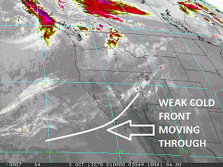
If you like the weather today, then you're going to love the next week. High pressure has set up shop and we've got clear skies, light winds, and temps in the mid to high 70's at the beaches. There's a weak low pressure system making it's way up north later in the week that may give us a couple clouds towards Thursday but it's going to be minor. Then high pressure sets back up again for more great weather this weekend.
As far as the surf goes, we haven't had any major storms the past few days in the southern or northern hemisphere aimed at us so we're left with begging a couple small tropical storms to send us surf. Octave peaked yesterday with 60 mph winds and has since slammed into Baja. Priscilla on the other hand is still spinning in the ocean but peaked earlier at 50 mph. Not the biggest swell makers. Northern OC though MIGHT see a chest high set tomorrow and into Thursday. Down here in SD we'll be lucky to get some waist high waves from them.
Going further out, high pressure is keeping the storms in the north Pacific at bay so we're left with pretty flat conditions this weekend. Did I tell you the weather is going to be nice though? So we got that going for us.

For next week, we have a couple storms on the charts today, that if everything holds, we should get some fun SW towards Tuesday and a good WNW around the same time. Look for chest high waves in the OC from the SW, chest high combo WNW/SW in north county SD, and shoulder high sets from the WNW in southern SD.
 
So until then, enjoy the good weather, fix those dings, and get some surf next week. 


Thursday, October 10, 2013

THE Surf Report- Early Edition


Back to normal.

SURF:

A little bit of everything this past week: Small clean combo surf, big stormy NW swell, and tonight clean new SW swell with a touch of dying NW. Tomorrow we'll have building SW swell, clean conditions and some tiny NW windswell mixed in. Look for shoulder high sets in north county SD Friday from the SW with head high waves in the OC. Just tiny NW again also. Then for Saturday it's peaking SW and not much NW to break up the lines so it may be a little walled.
By Sunday the SW is on it's way down and the NW windswell creeps back up again; most spots should be chest high. All in all some fun SW this weekend and clean conditions.
Water temps have dropped to 66 and tides are 3' at sunrise, up to 5' at 3pm, and down to 3' again at sunset. Make sure to keep up to date on the waves/weather at Twitter/North County Surf.

FORECAST:
Fun swell this weekend will lead to pretty flat conditions next week. Lack of storms = lack of surf.
Charts show a storm trying to take shape tomorrow in the southern hemisphere which may give the OC some chest high sets late next weekend but that's about it.
Hopefully the northern hemisphere will come to life next week and we'll get some NW again.

WEATHER:

Kind of cool to see the wind and rain again around here. Even a stray thunderstorm rolled through Wednesday night. The storm has since departed and weak high pressure is setting up this weekend. Look for sunny skies and temps near 70 at the beaches. High pressure builds slightly further towards the middle of next week and we may be back to the high 70's around here.

BEST BET:
All weekend: Some leftover NW windswell tomorrow with building SW. Or on Saturday better SW but no NW. OR... dying SW on Sunday but building small NW. Place your bets.

NEWS OF THE WEEK:
Now that was a good storm. Considering it's early October AND we didn't get much rain last year, it did a good job of getting us in the mood for the holidays (only 75 more shopping days 'til Xmas)! Now granted, it wasn't a heavy rain producer like an El Nino storm (i.e. 1"+) but it did give us decent totals. Here's some stats from yesterday's storm:

RAIN:
Lake Cuyamaca: 2.58"
Laguna Beach: 0.51"
Carlsbad: 0.27"
Dana Point: 0.27"
Del Mar: 0.25"
Newport Beach: 0.20"
Oceanside: 0.17"
Huntington Beach: 0.15"
San Diego: 0.07"

WIND:
Sky Valley, Coachella Valley: 78mph
Local mountains 45-60mph
Most coastal locations were 20-25mph

It always seems like mid-October when we get our first shot of showers of the season, so we're about a week ahead of schedule. Normal is about 10" for the year and we got less than half of that last year.

BEST OF THE BLOG:

Notice the new radar at Ponto? It reads the ocean conditions and sends out a high pitched siren when a set is approaching. Seriously. And I have some swamp land in Florida I want to sell you. Read the story on the North County Surf blog. And of course a mid-week Surf Check and an in-depth THE Surf Report. All of that and more in the blog below!

PIC OF THE WEEK:

Ever heard the expression 'Corduroy to the horizon'? This is what they mean. Times 10. How many lines can you count in this photo? Correct answer wins a free bar of wax.

Keep Surfing,

Michael W. Glenn
Model. Citizen.
Secretly Miss Baywatch
The Last Wave Warrior

Wednesday, October 9, 2013

Big Brother is Watching Your Every Maneuver


You've probably noticed the search for unintelligent life going on at Ponto beach in south Carlsbad lately. Or maybe saw the radar and figured it was a surf forecasting tool for the North County Surf blog. Or maybe you were like me and didn't know what the heck it was until you read the following story from the San Diego Union Tribune:
 
CARLSBAD — A large radar device recently installed at Carlsbad’s Ponto Beach is part of a federal crackdown on drug and immigrant smuggling along the California coast.

The device, which can track any vessel within 20 miles, could help law enforcement agencies spot and apprehend smuggling boats or terrorists before they get to shore. It is the first of its kind in the country.

Federal officials have begun to focus more on securing the coastline after sharply reducing smuggling by air during the past 25 years, said Keith Jones of the Air and Marine Operations Center in Riverside, which is run by U.S. Customs and Border Protection.

“We have a very good handle on the air game and now we’re trying to respond to this new threat,” said Jones, noting that smuggling along the coast has been on the rise. “We’re targeting small vessels, which have been challenging for us.”

That’s where the Ponto Beach radar device, which sits atop a cliff high above the ocean, can make a difference, Jones said. It expands the government’s surveillance reach roughly five-fold, because most shoreline radar devices can only track vessels within four miles of the coast.

Since the radar device was installed in early August, data from Ponto Beach has been flowing into the operations center in Riverside, which has a large surveillance room similar to NASA’s Mission Control in Houston.

New software allows officials in Riverside to combine that data with smaller radar detectors, footage from police and Coast Guard cameras along the shore, and data from government planes flying over the coastline.

The goal is launching a coastal surveillance system later this year that integrates all available data in one place, while also adding new information from devices like the one in Carlsbad, Jones said.

“We’d love to have them up and down the coast, but we’re not sure how many we’ll have,” he said, noting that the devices are expensive. “It could be dozens or it could be hundreds.”

The radar device was installed on a 60-day trial basis to determine whether the data it gathered would be useful. Jones said officials have been pleased with the results so far.

He said Carlsbad was chosen because it’s in the government’s geographic “threat vector.”

Several small boats smuggling both immigrants and drugs have landed on the shore near Ponto Beach in recent years. Police and Coast Guard officials have made some arrests, but they also concede that some boats are probably landing undetected late at night or before sunrise.

Jones said the increase in smuggling by boat is because of heightened security at the international border and government efforts to eliminate smuggling by air.

“Back in the late ‘80s and early ‘90s, air smuggling was a huge problem,” he said. “We hope to slowly and steadily make the same progress with maritime smuggling.”

Thomas Tomaiko, a program manager for the borders and maritime division of the U.S. Department of Homeland Security, stressed that law-abiding boat operators wouldn’t be harassed.

“The overwhelming majority of small vessels operating in and around the United States coasts and in our ports and inland waterways are engaged in legitimate activities,” he said. “However, a small number are platforms for illegal or illicit activities, such as human and drug trafficking, and may be used for waterborne attacks on our maritime infrastructure.”
 
 
At Ponto Beach on Wednesday, swimmers and sunbathers criticized the gray radar device as unattractive. But they also said smuggling was a large enough problem that such efforts were warranted.

“It’s a little distracting,” said Gina Eckert, referring to the constantly spinning 12-foot bar atop the device. “But we’re looking this way, at the ocean, not up there. And they need things like that so they can see who’s out there.”

The device, which is along the western edge of Carlsbad Boulevard just south of Avenida Encinas, has raised a lot of eyebrows since it was installed, lifeguard Erik Burgan said.

Jones, the Customs and Border Protection official, praised the state Parks Department, which oversees Ponto Beach, for allowing the radar device to be installed on short notice without any hassle.

Tuesday, October 8, 2013

Surf Check

 
Bad news: It's tiny today. Good news: It's picking up tomorrow! Bad news: There's a storm comin'.
 
That's basically it in a nutshell. Just small knee high+ NW/SW today. We've got 10mph SW winds on it from the approaching cold front tonight (more on that below). So we've got small waves, blown out conditions, and showers coming tomorrow. Where's the good news again?
Well... we've got a building NW windswell off our coast today that will arrive Wednesday afternoon. That should be good for chest high waves around here and shoulder high in SD. Windswell of course is created by wind- and in this case the approaching cold front- so we should also have 20mph+ winds from the W tomorrow. Think of the bright side- lots of peaky consistent surf with no one out.
Once the front blows through, we've got some small SW swell created last week that will show on Thursday. About chest high towards the OC. Unfortunately the departing cold front may leave in it's wake strong NW winds that will shred any kind of swell out there. Hoping conditions clean up by Friday and we'll have small leftover SW by then.
Looking further out, it will be pretty small next week. There's no real NW or SW swells to speak of. Hopefully by next weekend (around the 20th) we start to get more SW and NW swells by then from the storms shown on the models above. If we can just keep the cold fronts at bay...
Speaking of cold fronts, the aforementioned 'storm' coming tomorrow is pretty weak but it's our first showers since... well maybe last March it seems like. Look for winds about 20mph tomorrow, showers leaving up to 1/4" of rain by Thursday morning, and hopefully clean conditions by Friday. The weekend should be sunny and mild. The charts maybe show another small cold front early next week but it doesn't look that impressive so don't hold your breath.
Water temps are still a pleasant 68 degrees and tides are all over the place the next few days: about 2' at dawn, up to 6' at noon, and down to 0' at sunset.

Have a good week and enjoy the first storm surf of the season!


Friday, October 4, 2013

THE Surf Report


Not a fan of Santa Ana. But I love Santa Ana winds.

SURF:
It's on! The stars are starting to align today- we've got leftover chest high sets from the NW, new chest high sets from the SW, and the offshore 'Santa Anas' are moving down the state to OC and SD.
Look for the combination of sets to give shoulder high waves most everywhere today and the offshores to be strongest in the OC today and SD on Saturday. Saturday has leftover chest high SW and Sunday is another great beach day as high pressure continues the offshore winds- albeit lighter- and we'll have leftover waist-chest high SW- best in the OC.
Water temps are high 60's and tides the next few days are 4' at sunrise, 6' at 10am, down to 0' at 4pm, and back up to 2' at sunset. Make sure to keep up to date on the waves/weather at Twitter/North County Surf. 

FORECAST:

Both swells should be gone by Monday and it looks pretty small to start the school and work week. Charts show another late season storm in Antarctica spinning today which should give us waist high SSW swell towards the middle of next week in SD and chest high sets in the OC.
Models also show another shot of NW taking shape for next week that will give us waist high swell in north county SD and chest high sets in southern SD. BUT... conditions may be dicey as we may have our first shot of showers the middle of next week?! More on that below...

WEATHER:

The advertised offshore 'Santa Ana' winds are taking shape this morning in LA/OC and will hit San Diego later in the day. Look for sunny skies, low humidities, offshore winds, and temps in the low 80's today. High pressure will position itself a little better on Saturday where offshore winds will be a little stronger on Saturday for SD. Beach temps will also climb to the mid-80's and almost to 90. Winds start to back off by Sunday and temps get back to near 80. Models then show a cold front coming through southern California mid-week for maybe our first shot of showers. Until then- enjoy the great weather this weekend.

BEST BET:
TODAY! Leftover NW windswell, new fun SW swell, and offshore winds. Oh- did I mention the water temps are still nice and trunks are in order?! Doesn't get better than this.

NEWS OF THE WEEK:

The BBC reported today that the health of the world’s oceans is deteriorating even faster than had previously been thought. A review from the International Programme on the State of the Ocean (IPSO), warns that the oceans are facing multiple threats. They are being heated by climate change, turned slowly less alkaline by absorbing CO2, and suffering from overfishing and pollution. The report warns that dead zones formed by fertilizer run-off are a problem.  It says conditions are ripe for the sort of mass extinction event that has afflicted the oceans in the past. It says: “We have been taking the ocean for granted. It has been shielding us from the worst effects of accelerating climate change by absorbing excess CO2 from the atmosphere. “Whilst terrestrial temperature increases may be experiencing a pause, the ocean continues to warm regardless. For the most part, however, the public and policymakers are failing to recognize - or choosing to ignore - the severity of the situation.” It says the cocktail of threats facing the ocean is more powerful than the individual problems themselves. Coral reefs, for instance, are suffering from the higher temperatures and the effects of acidification whilst also being weakened by bad fishing practices, pollution, siltation and toxic algal blooms. IPSO, funded by charitable foundations, is publishing a set of five papers based on workshops in 2011 and 2012 in partnership with the International Union for Conservation of Nature (IUCN’s) World Commission on Protected Areas. The reports call for world governments to halt CO2 increase at 450ppm. Any higher, they say, will cause massive acidification later in the century as the CO2 is absorbed into the sea. It urges much more focused fisheries management, and a priority list for tackling the key groups of chemicals that cause most harm. It wants the governments to negotiate a new agreement for the sustainable fishing in the high oceans to be policed by a new global high seas enforcement agency. The IUCN’s Prof Dan Laffoley said: "What these latest reports make absolutely clear is that deferring action will increase costs in the future and lead to even greater, perhaps irreversible, losses.  "The UN climate report confirmed that the ocean is bearing the brunt of human-induced changes to our planet. These findings give us more cause for alarm – but also a roadmap for action. We must use it." The co-coordinator, Prof Alex Rogers from Oxford University has been asked to advise the UN's own oceans assessment but he told BBC News he had led the IPSO initiative because: "It’s important to have something which is completely independent in any way from state influence and to say things which experts in the field felt was really needed to be said." He said concern had grown over the past year thanks to papers signaling that past extinctions had involved warming seas, acidification and low oxygen levels. All are on the rise today. He agreed there was debate on whether fisheries are recovering by better management following examples in the US and Europe, but said it seemed clear that globally they were not. He also admitted a debate about whether overall climate change would increase the amount of fish produced in the sea. Melting sea ice would increase fisheries near the poles whilst stratification of warmer waters in the tropics would reduce mixing of nutrients and lead to lower production, he said. He said dead zones globally appeared to be increasing although this may reflect increased reporting. "On ocean acidification, we are seeing effects that no-one predicted like the inability of fish to detect their environments properly. It’s clear that it will affect many species. We really do have to get a grip on what’s going on in the oceans," he said.

BEST OF THE BLOG:

Yet another clip has hit the web this week of another new wavepool. Confused of all the different types of man-made waves out there? Technology got you down? Afraid of the planet being overrun by robots?! Fear not- the North County Surf blog has sorted it out all for you. Check out the full story on the blog. And of course a mid-week Surf Check and an in-depth THE Surf Report. All of that and more in the blog below!

PIC OF THE WEEK:

Know what's great about this spot? Beside it being uncrowded? Beside it being throaty? Beside it being the perfect size? It's that it's completely unknown, it's got a full channel, and it's breaking a few feet from shore meaning the paddle is easy cheesy lemon squeezy.

Keep Surfing,

Michael W. Glenn
Worldwide Phenomenon
Gruncle Stan
Shootin' the Curl With an Unlicensed 7'6" Gun

Thursday, October 3, 2013

Wavepool Battle! Take 4! Who's the best?!


Man there's been a lot of talk lately about wavepools. From Kelly Slater vs. Greg Webber's competing technologies, to clips of pros in wavepools coming out weekly, to the Surf Park Summit last month; it's making me seasick. Basically we're at a tipping point where surfers want to surf a real one, the surf industry wants them built so can they sell more clothes, and investors actually see a slight return on investment. So the question is now, who has the best technology? I thought you should decide with today's post on the North County Surf blog.

 
First up is the original wavepool- and still the worst- Big Surf in Tempe, AZ. A knee high gutless wave that is more like riding a mini tsunami then actually surfing. On that note, I didn't want to show you a video of it. I know you have better things to do right now and your time is valuable. Same goes for the Mandalay Bay wavepool. What a complete waste of money. In a town that wastes a lot of money, that says a lot.
 

 As we continue to move up the wavepool hierarchy, we head to Mission Beach and Waveloch's Flowrider. This is definitely one of the more, let's say interesting, entries. Jets of water shoot into a curved bottom and a 6' wave makes a continuous barrel. The dilemma here is that the jets don't shoot a deep stream of water so the bottom is only about 6" deep- not deep enough for a real board with fins. And if you go over the falls, you dislocate your shoulder. I think I'll pass.
 

Just a few weeks ago, a new pool was unveiled by a company called Surf Lagoon. It's actually portable and they had a demonstration in the Munich airport in Germany. Shane Beschen surfed it (i.e. Kelly's kryptonite before Andy), Kalani Robb, and some German river monster (trust me- watch the video- look for the hairy balding guy wearing boardshorts and booties. So sick). Basically they improved on Flowrider's water depth- but made the wave mushier in the process. So no winner yet on this one.


The Rip Curl team (i.e. Mick Fanning, Owen Wright, and Matt Wilkinson) headed to Malaysia's Sunway Lagoon a few years ago and tested out the waters. Seems as though the pool doesn't make much of a peak- more of a wall- and the boys had to be towed in. The pool's pretty to look at- but the surf isn't. So this isn't making the top of my list.
 

Ok- now we're getting somewhere. Next up is Disney's Typhoon Lagoon. From the company that gave us Space Mountain, Thunder Mountain, and the Matterhorn, leave it to Walt to make an actual wavepool you can surf. Granted it's only chest high at best, and not a lot of power, but the Florida guys like Evan Geiselman, Kelly Slater, and Cory Lopez make it look like Lowers.  I went to a pseudo contest there years ago and watched Beschen, Machado, and Kalani tear the place apart. It was 9 o'clock at night, I had a beer in my hand, music was blaring, and humid as heck in the warm September night. Pretty rad actually. I want to go back.


Now we're getting somewhere- except they closed down this place about 10 years ago in Japan so it's nowhere now. Make sense? Anyway, it was the Miyazaki Ocean Dome which incredibly was one of the better wave pools ever built. And considering how surf crazy the Japanese are AND how technologically savvy they are AND having one of the higher household incomes in the world, I don't know why this thing didn't survive. Maybe it just wasn't energy efficient and cost an arm and a leg to run.


By now you've probably seen Dion Agius' shred sesh a hundred times in the Dubai desert. Built by Surf Park Central, the wave is pretty legit. I think we have a winner here: a shoulder high wedge pushes you into an oncoming corner and you LAUNCH. Not me of course- I'm talking Dion here. But you get the idea. Supposedly it takes a lot of energy to run this thing- but when you're full of cash and oil in Dubai- money's not a problem. Lack of surfers are of course the problem in the Middle East so I'm not sure how long this place will stick around. As far as wavepools go- this is pretty much a tie with the wave below...

 
And the wave that's on par with the Dubai wedge is Spain's Wavegarden. The Dubai wave is slightly bigger and more powerful- but it pales in comparison to the length of the Wavegarden's ride. Check out the clip of Dane Reynolds above. Only a stomach high wall- but he gets like 10 turns in. And there's a mirror left on the other side of his wave- dual waves in 1 pool. Killer. Just make it 6' and I'll pay the country club membership.

So we've moved up to the top of the food chain and it's gotten us here: A good short wedge in Dubai and a smaller longer wave in the Basque country. Doesn't do me much good here in the states though. Well the Surf Park Summit that happened last month is trying to make the surf engineers listed in the story above, create a bigger and longer wave, like the picture shown above from the Kelly Slater Wave Company and Greg Webber's similar wave with Surf Park Central. So we're just thiiiiiiiis close finally to getting a real wave pool here in the states. I'm guessing 5 years from now? Maybe those Vegas guys can take another gamble and thrown down some money for a real wave and put the Mandalay out of it's misery.

Tuesday, October 1, 2013

Surf Check

Fall is officially here! Cooler air temps, water temps are under 70 finally, clouds are lingering, breezy conditions and plenty of NW swell. And I'm also guessing we'll see our first true cold front and shot at showers mid-October- always seems to happen a week or so before Halloween.
But let's talk about the near term first- plenty of NW windswell/groundswell in the water today from a weak storm passing by to the north. Most spots around town had shoulder high+ waves and down in SD it was head high plus. There was even a little SW swell underneath the solid NW and wind bump today.
Luckily the NW windswell/groundswell combo will last a couple more days for us.

As the tail end of the weak cold front makes it way through here tomorrow, look for more breezy SW winds and a shot at drizzle. That should be gone by Friday and the weekend is looking similar to last weekend- high pressure sets up, we have weak offshore winds in the mornings, and air temps at the beaches near 80.

Last week I saw a storm forming off Antarctica that I thought was going to send some chest high SW our way for late today. It took longer to form then expected and it looks like it will start filling in late Wednesday and peak on Thursday. Sorry about that.
Once high pressure sets up this weekend, it will effectively kill any storms close to us so it looks pretty small around here towards Sunday and early next week.
The only other swell on our radar right now is another storm in Antarctica taking shape in a few days that is mostly going E to W so we may get some waist high sideband SW energy around here about the 10th and chest high for the OC.
Tides the next few days are 4' at sunrise (6:45), peaking at 5.5' at 9am, down to 1' at 3pm, and back up to 4' at sunset (6:45). Water temps are hovering around 67.

In a nutshell, some more NW the next few days and breezy conditions and a little bit of SW swell on Thursday. Once the weather cleans up this weekend, the swells will diminish unfortunately!