
Goodbye Summer and hello Fall!
SURF:
Pretty average week around here. Not that I'm complaining or anything.


FORECAST:
The NW peaks on Sunday and we'll have leftover waist high+ surf on Monday with chest high sets still in south SD.


WEATHER:

We've got pleasant weather on tap for tomorrow and Saturday morning as weak high pressure is in control. Just night and morning low clouds and temps in the low 70's. Then a cold front moves through northern CA late Saturday and our low clouds/fog thicken up on Sunday for a chance of drizzle and temps in the high 60's around here- right on schedule again for the 1st day of fall. We get a quick break early in the week for a little more sunshine then the clouds thicken up again the 2nd half of the week.
BEST BET:
Sunday with the new fun NW swell- but a little more clouds unfortunately. Or Wednesday with a slightly bigger NNW swell- and more clouds again.
NEWS OF THE WEEK:

I don’t think I’ve ever seen autumn ever come so quickly around here. It’s literally like someone turned off the ‘summer’ switch and fall arrived: cooler air temps next week along with low clouds/drizzle and NW swells marching down the coast. To add to my bewilderment, the autumnal equinox arrives this Sunday- right on time to greet the fall weather/waves. To be precise, it’s at 1:45 PM in north county San Diego. There are of course two equinoxes every year – in September and March – when the sun shines directly on the equator and the length of day and night is nearly equal. Seasons are opposite on either side of the equator, so the equinox in September is also known as the "autumnal (fall) equinox" in the northern hemisphere. However, in the southern hemisphere, it's known as the "spring (vernal) equinox". On the equinox, night and day are nearly exactly the same length – 12 hours – all over the world. And if you’re wondering, the sun comes up at 6:40 AM in north county San Diego and sets at- you guessed it- 6:40 PM. This is the reason it's called an "equinox", derived from Latin, meaning "equal night". However, even if this is widely accepted, it isn't entirely true. In reality equinoxes don't have exactly 12 hours of daylight The September equinox occurs the moment the sun crosses the celestial equator – the imaginary line in the sky above the Earth’s equator – from north to south. This happens either on September 22, 23, or 24 every year. On any other day of the year, the Earth's axis tilts a little away from or towards the Sun. But on the two equinoxes, the Earth's axis tilts neither away from nor towards the Sun, like the illustration shows. After Sunday the 22nd, the days grow shorter as we head towards December 21st and the Winter Solstice- in which we only receive around 10 hours of sunlight.
BEST OF THE BLOG:
Really don't want to wait for Friday's THE Surf Report? Then check out the condensed mid-week 'Surf Check' every Tuesday on the North County Surf Blog. Or if you can wait until Friday, then check out the in-depth 'THE Surf Report' with more maps, tide charts, surf shots, and satellite images than you can shake a stick at. All of that and more in the blog below!
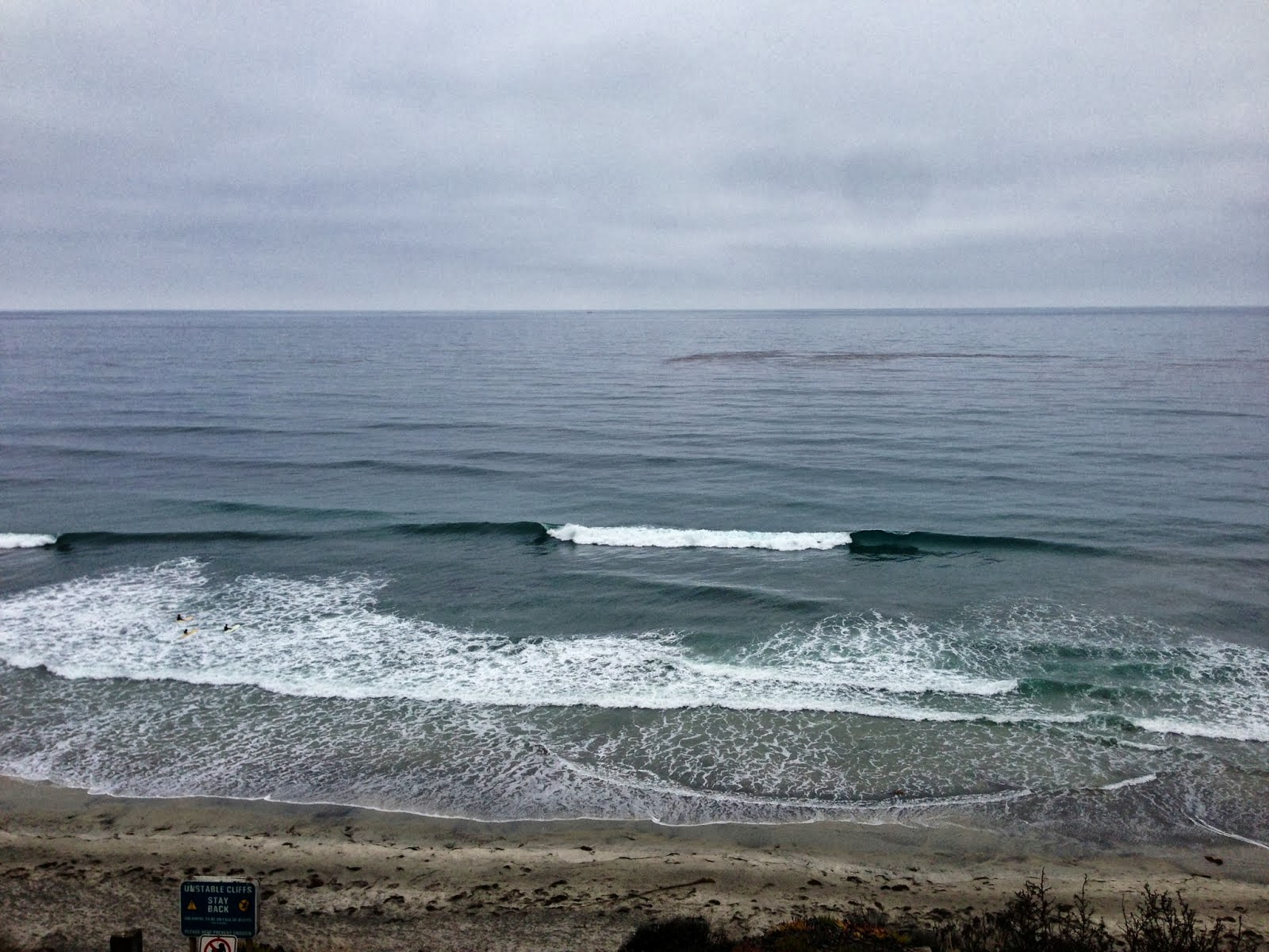
PIC OF THE WEEK:

Dig the 'double point' in this pic- lots of overhead rights rolling through the outside point for the dads and little dribblers on the inside for the groms. Now if there was an Anthropologie on the point for my wife, I'd never have to leave the beach!
Keep Surfing,
Michael W. Glenn
Universally Loved
PG-13
Surfing All-Star if we had Surfing All-Stars