
May Gray. La Nina. And no invite to Kelly's wave pool. Yet.
SURF:

Not much excitement around here lately. Had some fun SW swell the past week but May Gray's SW winds early in the AM made a mess of it.


FORECAST:


WEATHER:
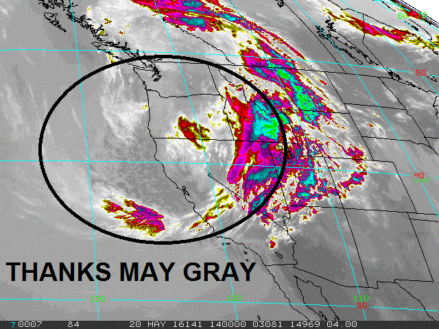
As mentioned above, we're stuck in a May Gray holding pattern (which will most likely blend into June Gloom). We have a weak cold front passing by the N today which will thicken up our clouds and keep the sun away for the foreseeable future at the beach (wish I owned property in Palm Springs). We could even see drizzle or light rain Friday and Saturday nights. Next week is more of the same but the sun may peak out in the afternoons at the beaches. Temps though will be lucky to hit 70. I'll be honest- you might as well keep the jacket handy until at least the July 4th weekend.
BEST BET:
Fun leftover SW today with a touch of NW but cloudy. Or hope the clouds clear for the Memorial Day weekend as new good SW swell fills in.
NEWS OF THE WEEK:

If we dig a little deeper, the ‘official’ eastern Pacific season began last Sunday, May 15, which is about a half a month earlier than the Atlantic season. The earlier start date is due to warmer waters and typically weaker wind shear earlier in the season compared to the Atlantic. While the Atlantic hurricane season receives much of the attention and publicity in the United States, the hurricanes and tropical storms that form in the eastern Pacific can occasionally be a concern for the southwestern United States and Hawaii. Although the majority of the hurricanes and tropical storms that form in the eastern Pacific move away from land and are only a concern to shipping interests, the weather patterns at the beginning and end of the season are more conducive to these systems potentially affecting Mexico and the southwestern United States.

Arizona is the southwestern state with the history of the most tropical storm encounters. According to the National Weather Service in Tucson, Arizona, a total of eight tropical storms or depressions have remained intact and affected Arizona directly since 1965. Five of these actually made it as tropical storms with sustained winds of 39 mph or higher. Flooding rains are typically the greatest concern from any tropical systems that survive the journey into the southwestern United States. This means that the actual number of systems that have affected the Southwest throughout history is much higher since many of them dissipate before actually reaching the United States. Why is this? While the storm may no longer be intact, the remnant tropical moisture can fuel drenching rains as it moves into the region. The 2015 eastern Pacific hurricane season proved this with above average rainfall this past summer in Southern California and plenty of tropical weather days. Southern California is the only portion of the Pacific coastline in the Lower 48 that could see a tropical storm or hurricane landfall from the eastern Pacific. Although very rare, we have some examples from past history which show us that this can happen.

On October 2, 1858, the only known hurricane to hit Southern California slammed into San Diego. Sustained hurricane-force winds resulted in extensive property damage.
Since 1858, a tropical storm has made landfall in Southern California. In September of 1939, a tropical storm with winds of 50 mph hit Long Beach. According to the National Weather Service in Oxnard, flooding caused moderate crop and structural damage. High winds surprised the shipping industry in the area, which resulted in 45 deaths.
Why are tropical storm and hurricane landfalls such a rare event in Southern California? The primary reason is the very cool ocean temperatures in the path of a tropical system trying to make the journey to the Pacific coast of the United States. As in 1858, the hurricane must be moving fast enough, over waters just warm enough, to maintain its intensity on the way north to California.
As far as in our friends in Hawaii go, they’re usually protected from tropical storms and hurricanes approaching from the east due to cooler waters and strong winds aloft, which contribute to weakening. Many other tropical storms and hurricanes have passed safely to the south of Hawaii thanks high pressure north of the islands.
PIC OF THE WEEK:

In case the WSL can't get a permit for Trestles, I bet this spot in England is available. For like 40 pounds. Or a pint of Smithwick's.
Keep Surfing,
Michael W. Glenn
Future Hall Of Famer
Saved a Damsel In Distress
World Record Holder Highest Pulled Air At 12' 7"