
Thanksgiving In June.
SURF:
You've probably heard the term 'Christmas in July' which loosely means an unexpected gift. Well, I propose 'Thanksgiving in June'. Why?

Because I'm thankful the water has warmed up, May Gray hasn't been as bad as predicted, and we've had a ton of surf. Something to be thankful for!

For today, we have yet another SW swell filling in for head high waves and overhead sets in he OC. That swell will peak tomorrow with overhead sets for us and lasting into Saturday- time to turn on the Emergency Boardriding System!

We also have a small NW filling in on Saturday (along with breezy conditions from the WSW) so it may help peak up the swell- but add some bump. For Sunday, the SW fades but the NW holds and we've got chest high+ surf on tap. All in all a fun weekend. And here's the tides, sun, and water temps for the next few days:
- Sunrise and sunset:
- 5:41 AM sunrise
- 7:54 PM sunset
- Let's just call it as we see it- 5:30 AM sunrise and 8 PM sunset!

- Water temps are mid 60's with some spots in SD hitting 67 close to shore.
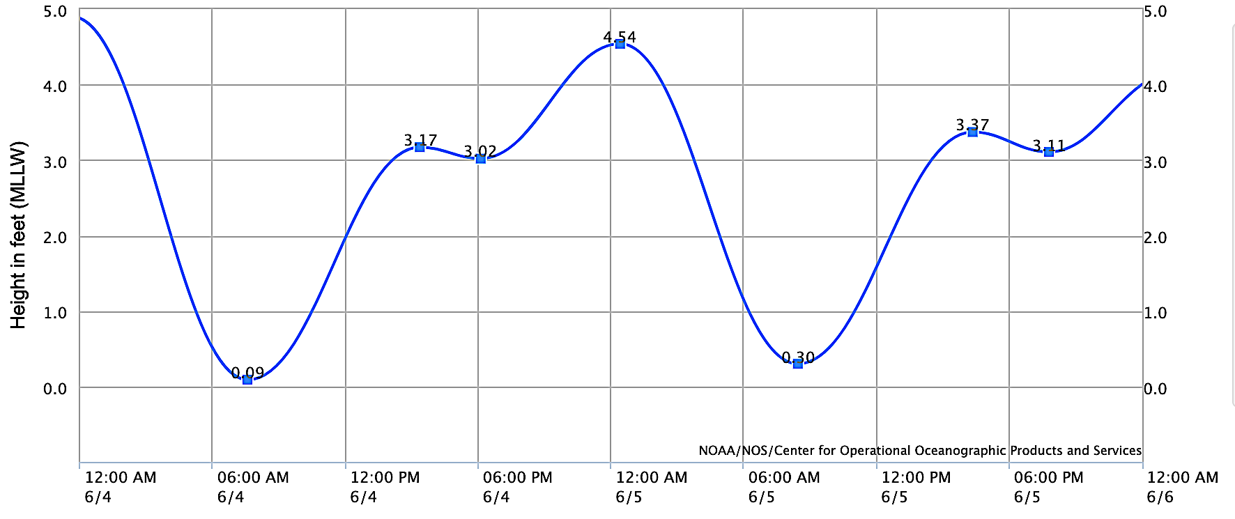
- And tides are simple this weekend:
- 0' at sunrise
- 3' late afternoon
- that was easy
FORECAST:
The southern hemisphere starts to die down early next week to the waist-chest high range but the NW will pick up slightly to keep us in rideable conditions for the time being.

First up though is a small SW mid week for chest high sets towards the OC.
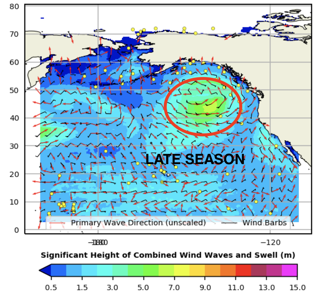
Right behind it is a late season NW around the 10th for more chest high surf in northern SD and shoulder high waves in southern SD. And after that? Looks like a holding pattern with not much on tap from either the southern or northern Pacific.
WEATHER:

May Gray turned out to be better than expected this past Memorial Day weekend- and for most of the past week. For Friday, we've got mostly sunny skies again mid-day with night/morning low clouds. A weak cold front moves by to the N this weekend for more stubborn low clouds and breezy conditions. As the week progresses, we'll see less clouds and more sun, with temps in the low 70's by mid-week. Couldn't ask for much more during spring. If anything changes between now and then, make sure to follow North County Surf on Twitter!
BEST BET:
Friday with firing SW swell! EBS! EBS! EBS!
NEWS OF THE WEEK:

Even though we're in the midst of our 3rd straight La Nina, this past week has been nice with less than average May Gray/June Gloom and water temps in the mid-60's. In the long term though, La Nina conditions tend to push storms to the N during winter, we feel colder water temps, and less rain in Southern CA. Plus... the chance of less hurricane surf in the summer. The National Hurricane Center just released their summer '22 forecast and just take a guess on what they said...
The 2022 Eastern Pacific Hurricane Season outlook indicates a 60% chance of a below-normal season. (Ouch)! There is a 30% chance of a near-normal season and only a 10% chance of an above-normal season (So basically a 90% chance of a below average to average season- weighted towards below average). The eastern Pacific hurricane region covers the eastern North Pacific Ocean east of 140°W and north of the equator.
The 2022 outlook calls for a 70% probability for each of the following ranges of activity:
- 10-17 Named Storms
- 4-8 Hurricanes
- 0-3 Major Hurricanes
A couple things to note: 4-8 hurricanes and up to 3 major hurricanes means we could see close to 10 storms over the summer. But that doesn't mean surf though. A couple things have to go our way unfortunately. Storms have to be big enough (major hurricane status is ideal) and storms have to move N into our swell window (cold water La Nina conditions prevent that). With that said, I'm guessing we'll see 1 swell a month at best from July to September in SD and maybe 1 or 2 more towards the OC which faces towards the S.
The activity is expected to fall within these ranges in 70% of seasons with similar climate conditions and uncertainties to those expected this year. These ranges do not represent the total possible ranges of activity seen in past similar years. These predicted ranges are centered below the 1991-2020 averages of 15 named storms, 8 hurricanes, and 4 major hurricanes. The eastern Pacific hurricane season officially runs from May 15th through November 30th. The peak months of the season are July-September.

Of note though is Hurricane Agatha, the first named storm of the season. Agatha made landfall along the southern Mexico coast Monday afternoon. The hurricane dumped heavy rain and triggered mudslides as it moved inland, leaving a death toll in its wake. As of Wednesday morning, at least 11 people have been killed as result of Agatha's passing, with 20 more missing, according to the Associated Press (AP).
Agatha became the strongest storm to make landfall in Mexico this early in the season, crashing ashore just west of the town of Puerto Angel with maximum sustained winds of around 105 mph (169 km/h). On Monday, the storm was on the precipice of reaching major hurricane status, its sustained wind speeds falling just 1 mph shy of that intensity (111 mph or higher).

Agatha's landfall marked just the third such occurrence during the month of May in the eastern Pacific Ocean. Only two prior hurricanes in recorded history made landfall in Mexico in May -- Barbara on May 29, 2013, and another storm named Agatha on May 24, 1971 -- both of which were Category 1 hurricane strength. Agatha also became the earliest-forming hurricane in the basin since Andres on May 29, 2015. Although the storm dissipated late Tuesday, residents and local officials were left to clean up the hurricane's destruction.
Footage from Oaxaca showed intense downpours and fierce winds limiting visibility for anyone who dared to venture out during the height of the storm. Chainsaws were buzzing in Huatulco, a popular coastal resort region, as trees littered the ground.

On Monday, municipal authorities in Huatulco ordered “the absolute closure” of all the resort’s beaches and its famous seven bays, many of which are reachable only by boat, The Associated Press (AP) reported. They also closed local schools and set up emergency storm shelters.
Tropical downpours triggered mudslides in the rugged terrain of southern Mexico. Transportation authorities worked through Monday night to clear mud and rocks from roadways, including two highways in Oaxaca. Strong winds knocked down power and communication lines and caused one transformer to explode in Oaxaca, forcing authorities to use radio as the primary means of communication.
Even though it looks like a weak season for us in Southern California, Mainland Mexico has already started with a bang unfortunately.
PIC OF THE WEEK:

I don't like surprises, but I wouldn't mind walking around the corner and seeing this.
Keep Surfing,
Michael W. Glenn
Brainy
The Real Maverick
Did A Floater At Nazaré And My Board Shattered Into 100 Pieces Upon Landing
Michael W. Glenn
Brainy
The Real Maverick
Did A Floater At Nazaré And My Board Shattered Into 100 Pieces Upon Landing