Seriously, what are you waiting for?!
SURF:
After a rough start with Fabio yesterday (i.e. building
swell, warm water, sunny skies BUT… howling N winds), he’s finally hitting our
beaches today with light winds and fun surf. Unfortunately Fabio peaked last
night but we still have chest high waves with shoulder high sets in far north
county and head high+ in the OC. There’s also a little bit of NW windswell in
the water to cross up the Fabio swell, so I guess all that wind yesterday wasn’t
for nothing.
As Fabio backs off today, we have a small southern hemi swell filling
in for more chest high surf. Lucky us. That will last into Sunday morning.
Along with water temps around 70 and air temps in the mid-80’s, it’s shaping up
to be a fun weekend. Get on it!
Tides the next few days are about 3’ at
sunrise, down to 1.5’ mid-morning, and up to 5’ at sunset.
FORECAST:
Monday through Wednesday next week should be on the small
side with just background waist high SW well but then it picks up slightly on
Thursday with chest high sets from another southern hemisphere swell. That
lasts into Saturday.
Early the week of the 16th looks small again
with just (you guessed it) background SW swell then we could get a better SW swell
for head high waves the weekend of the 19th if the forecast charts hold true.
And in-between all of that- I wouldn’t rule out another hurricane.
WEATHER:
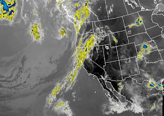
If the Hurricane Fabio swell and warm water didn’t get your
heart racing, then the weather might. As high pressure set up shop yesterday
(thanks N winds) our temperatures started to increase too. Today we’ve got
lighter winds thankfully and warmer air temps. Look for the beaches today to be
in the high 80’s and just a few miles inland, in the mid-90’s. Tomorrow we may
have a weak coastal eddy that could spin up some fog early on, but by
mid-morning, it’s back to sunny skies and temps in the mid-80’s. Sunday may
cool off slightly to the low 80’s/high 70’s but models show increasing tropical
moisture from our S so it may feel more humid. That moisture may increase some
more on Monday/Tuesday and we have s light chance of thunderstorms along our coast.
Coolio. Even if we don’t get a stray shower, we’ll have those awesome tropical
clouds overhead. By late next week, we should be back to the low clouds/fog in
the nights/mornings and temps in the mid-70’s. Make sure to keep up to date on
the latest conditions at Twitter/North County Surf.
BEST BET:
Today with great weather, warm water, and a visit from Fabio.
Or late next week with an increase in SW swell again.
NEWS OF THE WEEK:
This weekend in weather history!
- · 2001: Strong monsoon thunderstorms hit our deserts. In Coachella Valley, Highway 86 was washed out and the American Canal overflowed causing $1 million in damage. Borrego Springs reported 3/4” of rain in just 20 minutes and blowing dust with near zero visibility.
- · 2011: Monsoonal moisture interacted with an old low pressure system to produce intense thunderstorms. Severe downburst winds of 50-60 mph affected the cities of Perris and Phelan, damaging trees, powerlines, and several homes.
- · 2014: A large southerly swell generated by a powerful storm in the southern hemisphere that first arrived at local beaches over the 4th of July weekend peaked on this weekend. Surf heights exceeded 15’ at The Wedge, and reached 10’ at Huntington Beach with widespread 6-8’ sets along other south facing beaches. Two people drowned including a lifeguard during a rescue attempt.
- · 1991: Light rain spread over most of the L.A. Basin, a rare event for July. The L.A. Civic Center reported 0.13 inch of rain, a paltry amount for winter, but the third highest single day rainfall in July since records began in 1877
- · 1998: Monsoon thunderstorms dropped one-inch hail in Agua Caliente (in the Anza Borrego Desert).
- · 1984: Highest minimum temperature records were set each day in San Diego for 15 consecutive days, starting on this day and ending on 7/24.
- · 1918: It was 40° in Victorville, the lowest temperature on record for July.
PIC OF THE WEEK:
Not the biggest surf but offshore, long lines, and no one
out. Trust me- you’ve surfed worse.
Keep Surfing,
Michael W. Glenn
Titan
Interviewing For The EPA Gig
Just Made A Film About Knee High Blown Out Crowded Surf
Called The Endless Bummer


