
Everyone Knows It's Windy.
SURF:

With apologies to The Association, everyone, and I mean EVERYONE knows it's windy. And rainy. And snowy. What a wild winter- and there's more in store. But let's get back to the lecture at hand- the surf this weekend.

We're in-between storms, so just expect some waist high SW groundswell/NW windswell Friday/Saturday and only waist high semi-bumpy NW windswell Sunday from a weak front passing by to the N. And here are tides, sunrise/sunset, and water temps for the next few days:
- Sunrise and sunset:
- 6:12 AM sunrise
- 5:49 PM sunset

- Water temps are 55/56 in SD, 54/55 in the OC, and 52-54 in LA. And San Fran is STILL high 40's.

- Tides are starting to move again this weekend:
- about 5' at sunset
- about -0.5' around 2 pm
- and up to 3' at sunset
FORECAST:
High pressure is still in control over the eastern Pacific, so storms are:
- forming off Japan
- then riding over the high pressure above Hawaii
- hitting British Columbia
- then dropping like a rock into California
What does that mean for us? Similar to our storm pattern in December- a lot of NW windswell and no groundswell to speak of. Next up?

Another storm headed into northern California late Sunday and more head high windswell for us building late Monday, peaking Tuesday, and dropping Wednesday.

After that, things go quiet until late next weekend when we may actually see a head high W groundswell. Be on your best behavior! Don't want to blow our chances...
WEATHER:

No real rain for the foreseeable future, so let's enjoy the sun while we can. Nice weekend ahead with cool temps, then a weak cold front will move by to the N on Sunday/Monday. Maybe a chance of light showers but NOTHING like we've seen recently. Tuesday should be cool and breezy, then we're back to mild weather. Here's a quick summary of the week ahead:
- Friday: sunny and temps in the high 50's, mid-40's
- Saturday: same as above
- Sunday: a little more clouds and high 50's/mid-40's again
- Monday: chance of showers, high 50's/mid-40's
- Tuesday: clearing and breezy, high 50's/mid-40's
- Mild the 2nd half of next week.
If anything changes between now and then, make sure to follow North County Surf on Twitter!
BEST BET:
Tough to say- small but clean this weekend. Or bigger but windy on Tuesday. OR.. dropping swell on Wednesday BUT cleaner. My choice is Wednesday!
NEWS OF THE WEEK:

There's been so much weather this winter that I have whiplash. (I thought for sure it was from my Tom Curren head snaps, but doctor confirmed it wasn't). Whatever the final verdict is, there's been a ton to digest. In particular:
- Mammoth Mountain averages 400" of snowfall a year and it's already at 525" (that's almost 44')
- Snow Valley Resort above LA averages 80" of snow per year and is sitting at 180" so far...
- San Diego is at 9.86" of rain this year (La Nina might I add) and the SEASONAL total is 9.79"- with more storms coming.
- Peak wind gusts from this last storm were 65-80 mph in the So-Cal mountains and up to 50 mph along the coast.
All of this wild weather should be ending soon, right? I mean, we're less than 3 weeks from spring and our rainiest months are January and February. Well... the long range outlook is showing more storms headed our way for mid-March. That's good for our drought, but it could lead to some unexpected problems. Here's the LA Times to explain:
Soggy, snow-capped California faces the likelihood of yet another month of wet weather, but what remains uncertain is whether this late winter precipitation will augment weeks of record-setting snowpack, or cause it to vanish should warmer rains arrive.
Last week, a frigid storm transformed portions of the state into a white landscape while toppling trees, prompting power outages, spurring water rescues and leaving some residents trapped by heavy snow.
Now, with forecasts calling for more rain and snow in March — including the potential for at least one more atmospheric river system — California is girding for what comes next.
"If we were to get heavy rain with a warm system and a lot of tropical moisture feeding into it, that would melt all of the snow that just fell in the mountains," said David Sweet, a meteorologist with the National Weather Service in Oxnard.
Typically, California's snowpack provides about one-third of the state’s water supply and has long been relied upon for its steady, slow melting during the hot, dry months of summer. A deluge of warm rain, however, could cause melting snow to fill rivers too quickly and trigger widespread flooding. "We need to stick that in the back of our mind and think, 'Boy, I sure hope that doesn't happen,'" Sweet said.

Forecasters say it's still too early to say precisely how the rest of winter will play out, but the latest 30-day outlook from the National Oceanic and Atmospheric Administration's Climate Prediction Center, issued Tuesday, shows above-normal chances of precipitation in all of California through March, as well as a higher likelihood of cold temperatures. That could bode well for the state's ample snowpack.
"We have considerable confidence that wet weather is likely for the next two weeks and an active pattern [of wet weather] could very well remain for the rest of the month," Jon Gottschalck, chief of the climate center's operational prediction branch, said in an email.
In the coming days, the western United States is expected to be "dominated by upper-level low pressure," Gottschalck said, which will probably deliver more low temperatures and low-elevation snow to California. That means "much of the precipitation, at least in the next week, will add to the snowpack. But the arrival of more precipitation in the weeks that follow could be some cause for concern.
UCLA climate scientist Daniel Swain said about 20% of forecast models are currently depicting a very strong and warm atmospheric river storm in California around mid-March. A series of nine atmospheric river storms hammered California in early January, breaching levees and contributing to nearly two dozen deaths.
Should such an event occur in the wake of extensive snow, "that could indeed pose [a] significant flood threat," Swain said on Twitter. However, he said that is "speculation at this early juncture" because the present odds of such a warm storm are about 1 in 5.
The recent winter storm already dropped heaps of cold rain and snow in parts of California. Many Southland peaks received more than 50 inches of fresh powder, with the Mountain High ski resort in Wrightwood recording 93 inches, according to the National Weather Service. Daily rainfall records were set at Los Angeles International Airport and in Burbank, downtown Los Angeles and several other parts of the region.

If similar conditions continue, the season has the chance to become one of California's snowiest on record, Swain said. Across the state, snowpack remains incredibly healthy — 186% of normal for the date as of Tuesday, according to state data. In the southern Sierra, it's 224% of normal. Reservoirs are notably healthier too, with Lake Shasta nearly doubling its volume from two months ago.
The immediate forecast in the Sierra is continued icy conditions, including "a very cold pattern with multiple feet of snow this weekend," said Wendell Hohmann, a meteorologist with the National Weather Service in Reno.
"The atmospheric river signals are pretty far out there, so predictability is pretty low and confidence is therefore pretty low on that," Hohmann said, "but it does kind of open the door for us to keep an eye on it at this point, see how it evolves."
In addition to flooding, a warm rain-on-snow event could pose challenges from a water supply perspective. Earlier-than-usual snowmelt, especially in the Sierra, can make it harder for the state's water managers to plan ahead, and can have negative effects on hydropower and ecology, experts say.
Sweet, of the weather service, said he primarily focuses on short-term forecasts but has also been keeping an eye on the longer-range models, which are "starting to hint" at the possibility of such a system.
As it stands, the forecast for more precipitation of any kind comes amid a winter that has already defied expectations in California. In October, seasonal outlooks pointed to a drier-than-normal season driven by a rare third appearance of La Niña. The fact that conditions ended up so wet speaks to the challenges of long-term forecasting, Sweet said "We still don't have an absolute razor-sharp focus, or way of looking at the extended forecast, and being really sure of it," he said.
Despite its hazards, the wet weather has had many upsides in California. Improved snowpack and reservoir levels have allowed the state's water managers to tentatively increase State Water Project allocations to 35%. In December, they said they would be able to give only about 5% to 29 agencies, which together serve about 27 million Californians.
The U.S. Drought Monitor also moved nearly all of California out of its worst two categories — exceptional and extreme drought — this year for the first time since 2020.
As of this week, about 33% of the state remains in severe drought, the third-worst category, according to the Drought Monitor. About 52% of the state is categorized in moderate drought and 15% as "abnormally dry." One small county — Del Norte, in the state's far northwest corner — has moved out of drought completely.
BEST OF THE BLOG:
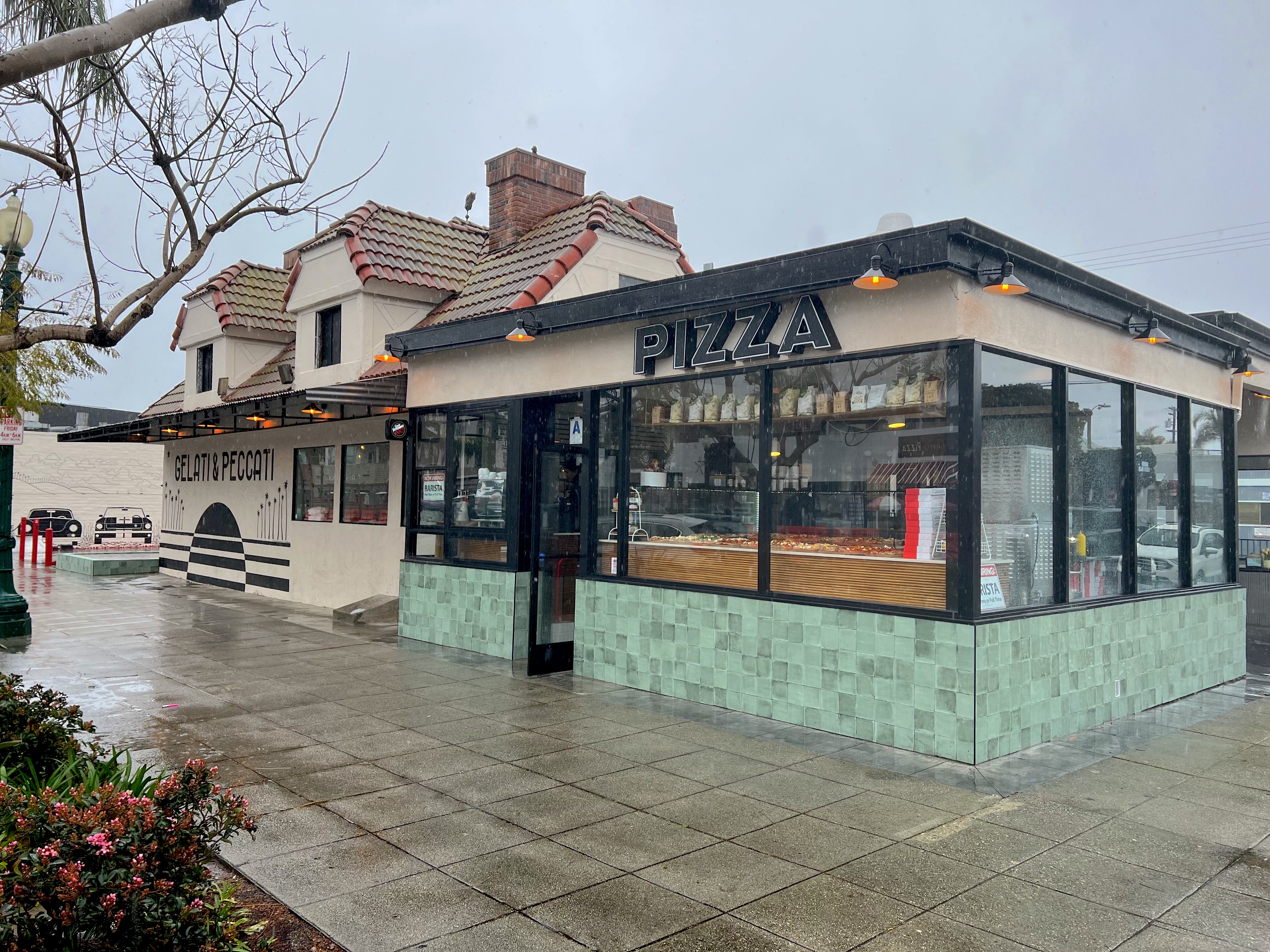
Encinitas has quietly turned into a foodie's heaven. Whether it's Italian, American, Asian, Peruvian, Mexican, coffee shops, delis, high end, dive bars, you name it- Encinitas probably has it. Add to the list Gelati & Peccati- a place to get a little bit of everything at breakfast, lunch, AND dinner. Get the scoop at The North County Surf Blog!

Now that we're done with the 'sketchiest' waves of California series, let's have a look at something a little tamer. Ladies and gents, I give you 'Awe'strailia. Why 'Awe'?' Because I'm awestruck on how awesome this break is.
Keep Surfing,
Michael W. Glenn
Stupefying
Already Busted My March Madness Bracket
Can Talk To Seals. And Dolphins. And Some Pelicans.
Michael W. Glenn
Stupefying
Already Busted My March Madness Bracket
Can Talk To Seals. And Dolphins. And Some Pelicans.