Back on track.
SURF:
Nothing much these past few days. Just some small NW windswell with average beach weather. Water was still warm though at 70. Fortunately a new small SW started to show last night and beaches in far north SD and the OC had some chest high sets by sundown. Today it’s filled in a bit further and we have inconsistent shoulder high sets around town with head high+ sets the closer you get to the OC. Nothing firing but lots of fun waves and good weather is on tap later. We also have some small knee high NW windswell trying to peak up the beach breaks a tad. Those swells peak today and drop slightly Saturday. We actually get another boost from the SW on Sunday for shoulder high waves in north county SD and overhead sets in the OC. Low clouds should burn off mid-morning and the water is still a summer-like 70 degrees. Looks like a fun weekend for surf. Tides the next few days are 1’ at sunrise, 4.5’ at 10am, down slightly to 2’ at 3pm, and back up to 6’ at sunset. Make sure to keep up to date on the swells and conditions at Twitter/North County Surf.
FORECAST:
WEATHER:
BEST BET:
I’m calling Sunday. As the weather kicks into high gear and that new fun SW shows up, that looks to be the day. So take the kids to soccer Saturday and mow the lawn ASAP because you have a date with some rippable wedges. Break out the boardies! NEWS OF THE WEEK:
1. Adrian around the 2nd week of June. A category 4 hurricane with winds in the 130-155 mph range
2. Beatriz around the 3rd week of June. A category 1 hurricane with winds in the 75-95 mph range. 3. Calvin around the 2nd week of July. A category 1 hurricane with winds in the 75-95 mph range.
4. And Dora a couple weeks ago. A category 4 hurricane with winds in the 130-155 mph range.
And as you know- all of them unfortunately died out before they came around the corner of the Baja peninsula and didn’t send any waves our way. But not is all lost. Seems like we’ve had a little more action this season compared to last year. If you look at the first 4 storms of 2010:
1. Agatha at the end of May. Only a tropical storm with winds about 45 mph.
2. Blas around the 2nd week of June. Only a tropical storm again with winds about 45 mph.3. Celia at the end of June. A strong category 5 hurricane with winds over 155 mph.
4. Darby at the end of June also. A category 3 hurricane with winds in the 110-130 range.
So what am I getting at you ask? Well last year was all over the map- we had a storm forming at the end of May (really early) and a strong category 5 hurricane in Celia in June. This year it’s been consistent- all 4 storms we’ve had have been hurricanes and they’ve been chugging along on a set timeline- 2 in June and 2 in July. Even though we haven’t had surf from them, I’m hoping the consistency keeps up as we head into the peak of the season in August so we get more predictable surf- if there is such a thing. If everything goes according to the 2011 plan, those little clusters of clouds should at keast form into 1 hurricane the 1st week of August. Keep your fingers crossed!
BEST OF THE BLOG:
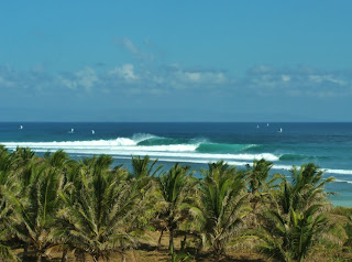
In case you haven’t seen what all the fuss was about, check out Kelly and the boys owning massive Cloudbreak a couple weeks ago. Or wondering what’s taking so long to get the massive 44 acre Encinitas Community Park (i.e. the Hall Property) up and running? Or how about a mid-week surf check? Then mosey on over to the blow below!PIC OF THE WEEK:
Keep Surfing,
Michael W. Glenn
AwesomeScraping Popcorn Off The Debt Ceiling
IPS Top 16 Three Straight Years


