Similar to last week's report. And the one before that. And the one before that...
SURF:
Had some fun NW windswell this week for shoulder high sets in south SD. There was some little SW groundswell underneath too but it wasn't much of a factor. And the weather tried to cooperate with partial afternoon sunshine.

Today the NW has backed off slightly with waist high waves but there is new SW groundswell filling in. Spots around town have shoulder high sets and there are some head high sets at the best OC spots and far north SD county. Sun has come out early too. Look for the SW to hang around tomorrow and the NW windswell to increase a touch. The clouds unfortunately will hang around at the beaches though a little longer this weekend as we have yet ANOTHER weak cold front moving through nor-Cal and it's kicking up our low clouds. Surfwise on Sunday, the SW and NW windswells will be backing off slightly but there should be some chest high sets still. All in all nothing spectacular this weekend but it will be fun. And I'm hoping the clouds break up for at least some sun from noon to 4 at the beaches both days.
Water temps are mid-60's and tides the next few
days are around -1' at 7am, 4' mid-day, and 2' in the evening. Make sure to keep up to date on the waves and weather at
Twitter/North County Surf.FORECAST:
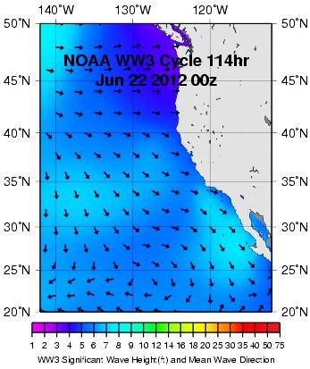
After a weekend of fun surf, there's no real SW swells headed our way or major NW windswell activity OR hurricanes happening.
Models show a slight bump from the NW windswell on Tuesday but that's only going to be waist high+ in SD.
The southern hemisphere is trying to become active (again) but charts don't show that happening until the 29th of June- which would give us surf late in the 4th of July weekend. Until then, get it this weekend!
WEATHER:
After the little cold front moves through nor-Cal this weekend and kicks up our clouds with temps in the mid to high 60's here, we should have weak high pressure build in behind it by mid-week. No real warm up but the clouds should burn off by mid-morning and leave us with sunny skies and temps at the beaches in the low 70's. One interesting note; there's a low pressure system trying to form in the Gulf of Mexico this weekend. When high pressure forms over the southwest next week (for our nice temps advertised above) that low may break apart and the humidity/clouds may get sucked into our region. That's a long shot but still an interesting scenario- tropical weather in so-Cal.
BEST BET:
Even though the low clouds increase tomorrow for only partial afternoon sunshine at the beaches, we do have a holding SW groundswell and building NW windswell for shoulder high combo peaks. Get your honey-do's done and get on it!
NEWS OF THE WEEK:

NOAA's Climate Prediction Center came out with their 3 month forecast recently. Now I know 3 months is a long way off to predict the weather- considering it's almost impossible to get the weather right a week out. But some factors come into play to make the forecast that far out somewhat believable- namely the slight El Nino forecasted for the 4th quarter this year. If our water temps warm up slightly by the end of summer, we should have a few things happen. 1. Land temps won't be cooled off by the cold ocean so we'll have above normal temperatures in the southwest. Most likely an 'Indian Summer' with warm temps and a little more humidity. Sure beats the foggy days we had the past few Augusts. 2. The warmer water temps will mean we can keep those 3/2 fullsuits at bay hopefully through October. I remember the strong El Nino we had back in '97/'98 (I sound like an old man- which I'm not of course)- I trunked it during a dawn patrol session on November 4th. I'm not claiming the same, but we should have mild temps through October and maybe use a springsuit at worst. 3. Warmer water will fuel more monsoon type weather in the desert southwest (with some of those clouds and humidity drifting our way). And 4. More fuel to grow those Aleutian storms and subsequently bigger surf/more rain this winter. In a nutshell, look for warmer air temps late summer, more humidity, and a chance of a good soaking this winter. But don't quote me on that!
BEST OF THE BLOG:
Still waiting for the Kelly Slater and Greg Webber wave pools to come to fruition. Until then, we're left with our dreams of Dubai, Orlando, and the now defunct Miyazaki barrel (R.I.P.). The blog this week has some clips of these chlorine compounds in action that you'll want to see. And as usual the North County Surf blog's got the mid-week Surf Check and a more detailed THE Surf Report. All of that and more at in the blog below!
PIC OF THE WEEK:
Thought you deserved a treat this week with 3 pics. Now granted, don't expect dreamy shots of Rincon, Pipe, or Ulu. But rather some of the obscure waves of the world; in this case, an island off Europe, the Gulf Coast during hurricane season, and man playing God. All beautiful in their own rights (or lefts for that matter).
Keep Surfing,
Michael W. Glenn
Jack of All Tirades
Outbid For Lanai
Rather Go Over The Falls In A Barrel At Nias Than In A Barrel Going Over The Falls At Niagra