
Back on track.
SURF:
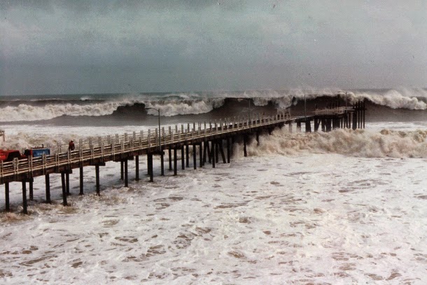
After all the heat and bombing SW swell at the beginning of the month, we're starting to look a lot more like April around here.


FORECAST:

Nothing of significance to start the week except for small NW windswell and background SW swells. We then have a weak cold front coming through the 2nd half of next week and the NW windswell comes along with it.


WEATHER:

Just when you think summer's getting an early start- the forecast calls for cool conditions this weekend with low clouds in the nights and mornings. Not that big of a deal... but models then hint at showers the 2nd half of next week. Basically what you'd expect from April. By Friday the showers should end and we get cool conditions with NW winds behind the cold front.
BEST BET:
Even though Thursday will be the biggest day in the next week, the weak storm mentioned above will mess things up. Tomorrow is the call with new NW groundswell, nice weather, and background SW.
NEWS OF THE WEEK:
As we all know by now, the long-forecasted El Niño event of 2014/15 did not live up to the hype. Heck- it was non-existent. On March 5, 2015, the National Weather Service finally declared a "weak" event arriving several months later than expected, formally dashing predictions that we would see a major event on par with the monster El Niño of 1997/98 that would bring much-needed rain to California, large surf, and stormy conditions. Now, a team of researchers believes that they know why this year's event, and others like it, didn't live up to the hype.
A new study published online April 13, 2015, in the journal Nature Geoscience finds that prolonged wind bursts originating in the western Pacific can have a strong effect on whether an El Niño event will occur and how severe it is likely to be. In addition, the paper identifies three distinct varieties or "flavors" of El Niño, and explains how these westerly wind bursts (WWBs) can determine which of these flavors will take shape. The findings should help refine future predictions of these global-scale climate events.
"These westerly wind bursts are intra-seasonal; they're not weather, they're not climate, but somewhere in between," said Raghu Murtugudde, a professor of atmospheric and oceanic science at the University of Maryland who is a coauthor on the study. "Our study shows that the wind bursts are definitely having an effect. We better learn to predict them if we are going to have skillful El Niño predictions."
The researchers analyzed 50 years of tropical Pacific sea surface temperature and westerly wind burst data. They found differences, especially when comparing the data from this year's weak El Niño event with the record-breaking event of 1997/98.
"The most notable difference was the existence of strong westerly winds extending from the western to central equatorial Pacific in May 1997, which were not seen in 2014," said Murtugudde, who also has an appointment in the university's Earth System Science Interdisciplinary Center (ESSIC). "The development of strong westerly winds in the central equatorial Pacific in association with the warming to its east appears to be an essential element of large El Niño events."
After adding westerly wind bursts to their intermediate ocean-atmosphere coupled model, the researchers consistently found three "flavors" of El Niño (rather than one, which was the model's output without the winds). The three warm patterns included extremely strong events with the largest warming near the South American coast, a cluster of weak warm events centered near the dateline, or moderate warming in the central-eastern equatorial Pacific. For strong El Niño events, the westerly wind bursts grew strong and extended east of the dateline.
According to the research team, the wind bursts affect ocean dynamics by exciting Kelvin waves that produce surface warming in the eastern equatorial Pacific and by generating strong equatorial surface currents that extend the eastern edge of the warm pool.
"We hope this study helps other climate modeling researchers realize the importance of westerly wind bursts on El Niño severity and diversity, and the importance of extending our weather forecasting capabilities from two to four weeks to capture WWB variability. Fortunately, the latter is now a focus at the National Atmospheric and Oceanic Administration, which develops our weather forecasts," said Murtugudde.
PIC OF THE WEEK:

Keep Surfing,
Michael W. Glenn
Anchor
Goat Hill Course Record 32 Under Par
Duke's Great Grandson