
Tropic Thunder II.
SURF:
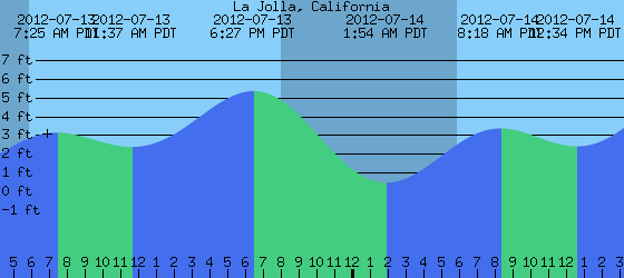
Nothing too exciting this week- mainly small NW windswell, a little background SW swell, and some pulses of S swells from Hurricanes Daniel and Emelia.

Today we have continued S swell from Emelia and the OC is getting the best shot of this straight S swell with shoulder high sets. Far north county SD sees some chest high sets peaking today and south SD is pretty small. The real excitement is the weather above with the tropical clouds and humid conditions. It's the poor man's version of Hawaii around here! Emelia's swell peaks this afternoon and we've got some leftovers on Saturday morning. Sunday unfortunately is looking pretty small. So head to the OC and get it while you can!
FORECAST:
Nothing really happening in the northern hemisphere so any NW windswell over waist high is out of the question through at least the upcoming week.


WEATHER:

Gotta love this tropical weather we're having. Since we don't get rain around here in the winter and our summers are relegated to low clouds and fog, this humid tropical airmass is pretty exciting for us weather nerds. There's a chance of thunderstorms overhead today and it looks like it sticks around tomorrow. Then a weak front moves through northern CA early next week and we get a return of low clouds/fog down here and beach temps in the low 70's. Boring. BUT... since soon to be Hurricane Fabio may move in a northerly direction, his clouds may get sucked up into that low pressure system here and we may get more tropical clouds towards the end of the week. Cool.
BEST BET:
This afternoon. Not the greatest surf in SD- but it is rideable as you get closer to the OC. And the tropical clouds make it feel like your surfing in Bali. Not really, but a guy can dream, can't he?
NEWS OF THE WEEK:

This week NOAA came out with their 2011 State of the Climate report. The lead character of the 2011 climate story was a double dip La Niña, which chilled the Pacific at the start and end of the year. Many of the 2011 seasonal climate patterns around the world were consistent with common side effects of La Niña. Worldwide, 2011 was the coolest year on record since 2008, yet temperatures remained above the 30 year average. The peer-reviewed report, issued in coordination with the American Meteorological Society (AMS), was compiled by 378 scientists from 48 countries around the world. It provides a detailed update on global climate indicators, notable weather events and other data collected by environmental monitoring stations and instruments on land, sea, ice and sky.
“2011 will be remembered as a year of extreme events, both in the United States and around the world,” said Deputy NOAA Administrator Kathryn D. Sullivan, Ph.D. “Every weather event that happens now takes place in the context of a changing global environment. This annual report provides scientists and citizens alike with an analysis of what has happened so we can all prepare for what is to come.”
Two back-to-back La Niñas, each characterized by cooler-than-average water temperatures in the eastern equatorial Pacific, affected regional climates and influenced many of the world’s significant weather events throughout the year. These included historic droughts in East Africa, the southern United States and northern Mexico. La Niña conditions contributed to an above-average tropical cyclone season in the North Atlantic hurricane basin and a below-average season in the Eastern North Pacific. It was also associated with the wettest two-year period (2010–2011) on record in Australia, which was particularly remarkable as the wet conditions followed a decade-long dry spell.
The Arctic continued to show more rapid changes than the rest of the planet. Sea ice shrank to its second smallest “summer minimum” extent on record during 2011, as older ice (four to five years old) reached a new record minimum at more than 80 percent below average. Overall, glaciers around the world continued to lose mass. Loss from Canadian Arctic glaciers and ice caps were the greatest since measurements began in 2002.
Highlights:
•Warm temperature trends continue: Four independent datasets show 2011 among the 15 warmest since records began in the late 19th century, with annually-averaged temperatures above the 1981–2010 average, but coolest on record since 2008. The Arctic continued to warm at about twice the rate compared with lower latitudes. On the opposite pole, the South Pole station recorded its all-time highest temperature of 9.9°F on December 25, breaking the previous record by more than 2 degrees.
•Greenhouse gases climb: Major greenhouse gas concentrations, including carbon dioxide, methane, and nitrous oxide, continued to rise. Carbon dioxide steadily increased in 2011 and the yearly global average exceeded 390 parts per million (ppm) for the first time since instrumental records began. This represents an increase of 2.10 ppm compared with the previous year. There is no evidence that natural emissions of methane in the Arctic have increased significantly during the last decade.
•Arctic sea ice extent decreases: Arctic sea ice extent was below average for all of 2011 and has been since June 2001, a span of 127 consecutive months through December 2011. Both the maximum ice extent (5.65 million square miles, March 7) and minimum extent (1.67 million square miles, September 9) were the second smallest of the satellite era.
•Ozone levels in Arctic drop: In the upper atmosphere, temperatures in the tropical stratosphere were higher than average while temperatures in the polar stratosphere were lower than average during the early 2011 winter months. This led to the lowest ozone concentrations in the lower Arctic stratosphere since records began in 1979 with more than 80 percent of the ozone between 11 and 12 miles altitude destroyed by late March, increasing UV radiation levels at the surface.
BEST OF THE BLOG:

an in depth THE Surf Report. All of that and more in the blog below!
PIC OF THE WEEK:

It's amazing how quickly surf spots go in and out of fashion in the mags. One week Todos is king, next week it's Teahupoo. Remember when Ulu was the darling? Now it's Kerama's?! Anyway, today's Pic of the Week is a forgotten little island off Mex. Probably better that way as it seemed every mag and video that came out in the late 80's had some sort of shot or video of this place. And now it's been passed over by Emma Wood. Actually, that's Dane's doing. But regardless, the wave still exists and it's lonely. Just the way it likes it. Make sure to check out more forgotten line ups at Rob Keith Photography.
Keep Surfing,
Michael W. Glenn
Intangible
Mourning the Loss of My TomKat
Getting Clips in Performers 4 and Wave Warriors 5