Had some fun surf this morning from the NW- if you could see it through the fog. Luckily the fog burned off mid-morning and we were left with chest high sets and clean conditions.
This evening we've got just a little NW left and that holds into tomorrow morning. As luck would have it, we've got another similar sized NW showing Thursday into Friday. South SD county should have head high sets.
Looks like the fog will stick around the next few days and the low clouds may increase too for a little drizzle. High pressure builds on Saturday and Sunday looks warm again with temps in the high 70's at the beaches.
Tides the next few days are 4' at sunrise, 6' at 9am, down to 0' at 4pm, and up slightly to 1' at sunset. And water temps are hovering around 66 degrees.
The north Pacific is starting to become consistently active- with our without El Nino. The chart above shows a storm forming this weekend and we should get a shoulder high NW towards next Tuesday and south SD getting some head high+ waves.
And just when I thought the southern hemisphere was shutting down for the season, it started up it's engine again. Looks like a form is trying to form later this week with a chance of SW swell for us next weekend. Hoping to see chest high waves here with bigger sets towards the OC.
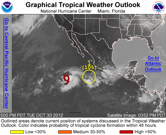
And the tropics won't die either. We've got little tropical storm Rosa with 45 mph winds tonight and not much else. Don't expect much surf from her due to the weak wind speeds AND she's moving away from us. There's also a little group of clouds behind Rosa too trying to form but it's still a few days off from amounting to anything.
Long story short- look for fun NW swell the next 7 days and better weather this weekend!