1 – 1 = 1
SURF:
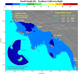
What do you get when you have great weather but no surf? Well I guess you still have good weather. That’s what we have on tap this weekend. But don’t let me get ahead of myself; today we still have some fun leftover SW swell. South SD is waist high, there’s a couple inconsistent chest high sets in north SD, and the best OC spots have shoulder high sets. By tomorrow only the OC will have small rideable SW swell. Models show a weak wind blowing off Pt. Conception this afternoon which may give a slight bump to SD out of the NW on Saturday. Most likely waist high towards south SD. Nothing to write home about. Sunday looks pretty flat most everywhere. But conditions will be great! So we got that going for us.
And beware the tides; we’ve got massive swings this weekend- almost 9’- that will wreak havoc on the small swell at your local break. It will look rideable one hour and flat the next. Tides the next few days are 4’ at sunrise, just over 7’ at 11am, and -1.5’ at sunset. Water temps are low 60’s. Sunrise is 7am and sunset is 6pm. Make sure to keep up to date on the waves and weather at Twitter/North County Surf.
FORECAST:
Looks like the north Pacific is trying to get a little more organized early next week and we should get a small bump from NW windswell- this time toward Monday for chest high waves in south SD and waist high waves in north SD and north OC. Monday the winds off Central California are forecasted to kick into gear for a bigger windswell/groundswell combo for late Tuesday and into Wednesday. Hopefully we’ll get some chest high waves in north SD/north OC while south SD will be the call with head high sets.
Down south a small storm is forecasted to organize around Halloween and if everything pans out, we should have a SW swell around next Sunday- similar in size to the one we just had. Nothing too exciting out there but at least some rideable waves from the NW and SW every 3 or 4 days.
WEATHER:
BEST BET:
If you’re in the OC, today is the best bet with the great weather and little leftover SW swell. For the SD crew, best bet is to wait for the new NW on Wednesday- especially if that cold offshore wind event shows up. Or if you’ve got a car, hit Huntington Beach today then make your way to Blacks on Wednesday and get the best of both worlds.
NEWS OF THE WEEK:
After the Japanese earthquake and resulting tsunami in March, there’s been a lot of research on what the ocean dragged back into the sea when the waters receded. One would think that all the junk that got sucked out into the sea would float off the coast of Japan. But we need to take into account the massive currents in the ocean and how they travel across the Pacific. The L.A. Times did a story this week that up to 20 million tons of trash (yes, I said that correctly- 20 million tons- a.k.a. 40 billion pounds) are floating around the Pacific and are headed to the west coast. The University of Hawaii researchers say that pieces of homes, a refrigerator, cars, soda cans, you name it, are headed to your local spot. I’ve got enough problems with the goons littering the line up at Swami’s, now I have to worry about a potential Prius in the impact zone. According to UH senior researcher Nikolai Maximenko, the debris should show up around the beginning of 2014 towards Oregon and Washington. Luckily for southern California, we’ll be partially blocked by Point Conception so a majority of trash may go right past our coastline- kind of like how big NW swells pass by our area. So I guess there’s a benefit to getting skunked around here once in a while. The North Pacific Gyre will also suck some of the junk into its vortex while storms in the north Pacific will grind some garbage into small ‘confetti’ type matter. Regardless, there’s going to be a lot of weird stuff washing up on the shores in the coming years. BEST OF THE BLOG:
Speaking of weird stuff floating around, the web is full of it. Like the North County Surf blog. This week’s features include the Double Latte Duel between the new coffee joints popping up around town, the battle for Nor-Cal supremacy this week between the O’Neill and Rip Curl contests, your weekly dose of a Tuesday surf check, Greg Webber and Kelly Slater’s wavepool battle, and Forum Snowboards for free! (well actually not free but pretty darn close). All of that and more in the blog below! PIC OF THE WEEK:
Keep Surfing,
Michael W. Glenn
BombasticOrganizing ‘Occupy Off The Wall’
Guinness Record Holder For Throwing The Biggest Spray


